Oslo to Amsterdam
August 30 to September 18, 2025
Mike and Judy Henderson
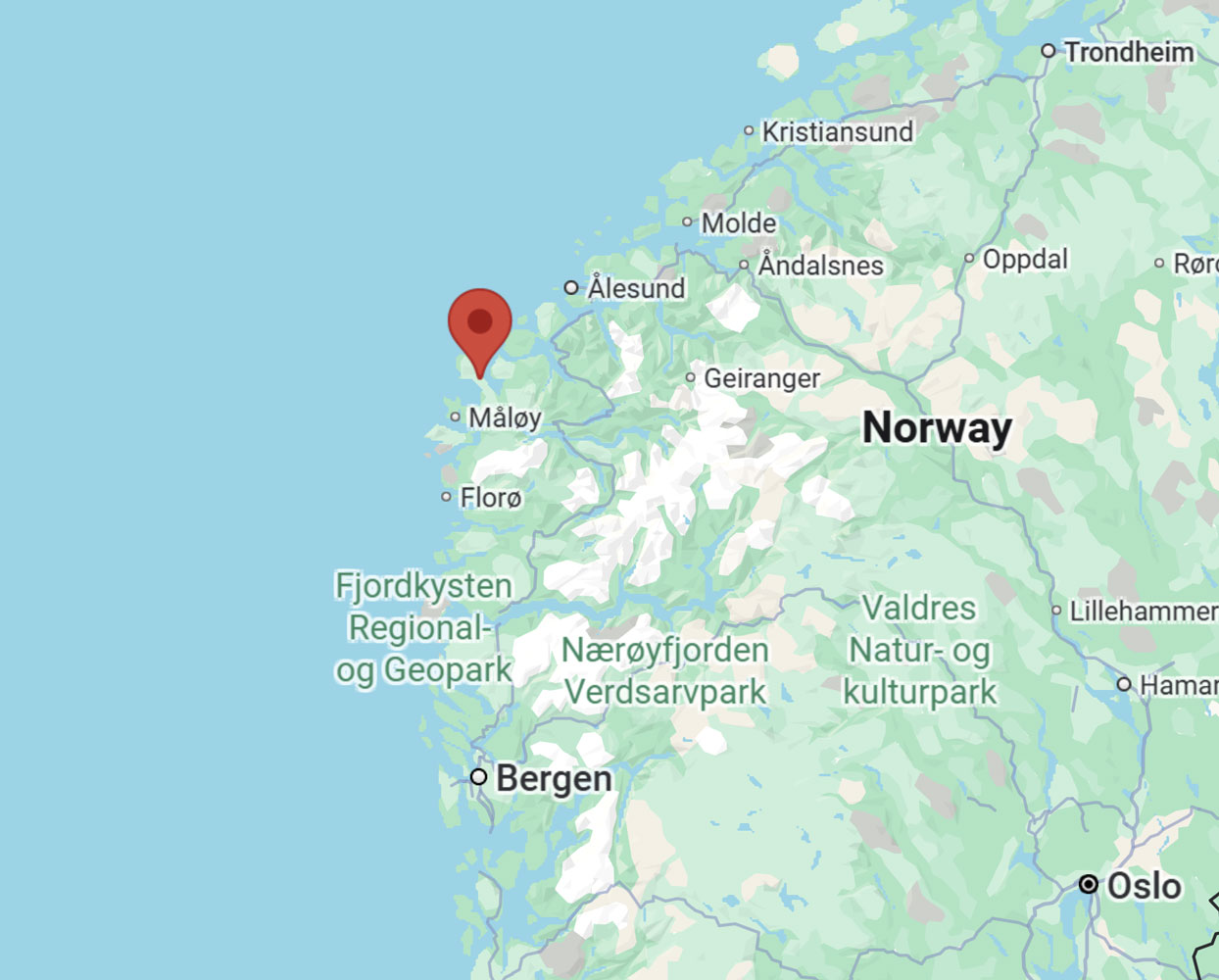
I'll leave this map up for reference. This cruise is just one segment of the Regent Grand Arctic Cruise. I think the whole cruise is about 160 nights. The description of the whole cruise is no longer available on the Regent website.
++++++++++++++++++++++++++++++++++++++++++++++++++++++++++++++++++++
Update: On September 12th the Internet manager gave me the upgraded Internet Package which supports FTP. The basic package normally does not support FTP, but it worked for me from August 30 to September 5 so I thought something was wrong with the system. I'm glad to be able to update the blog from my room now.
+++++++++++++++++++++++++++++++++++++++++++++++++++++++++++++++++++++++
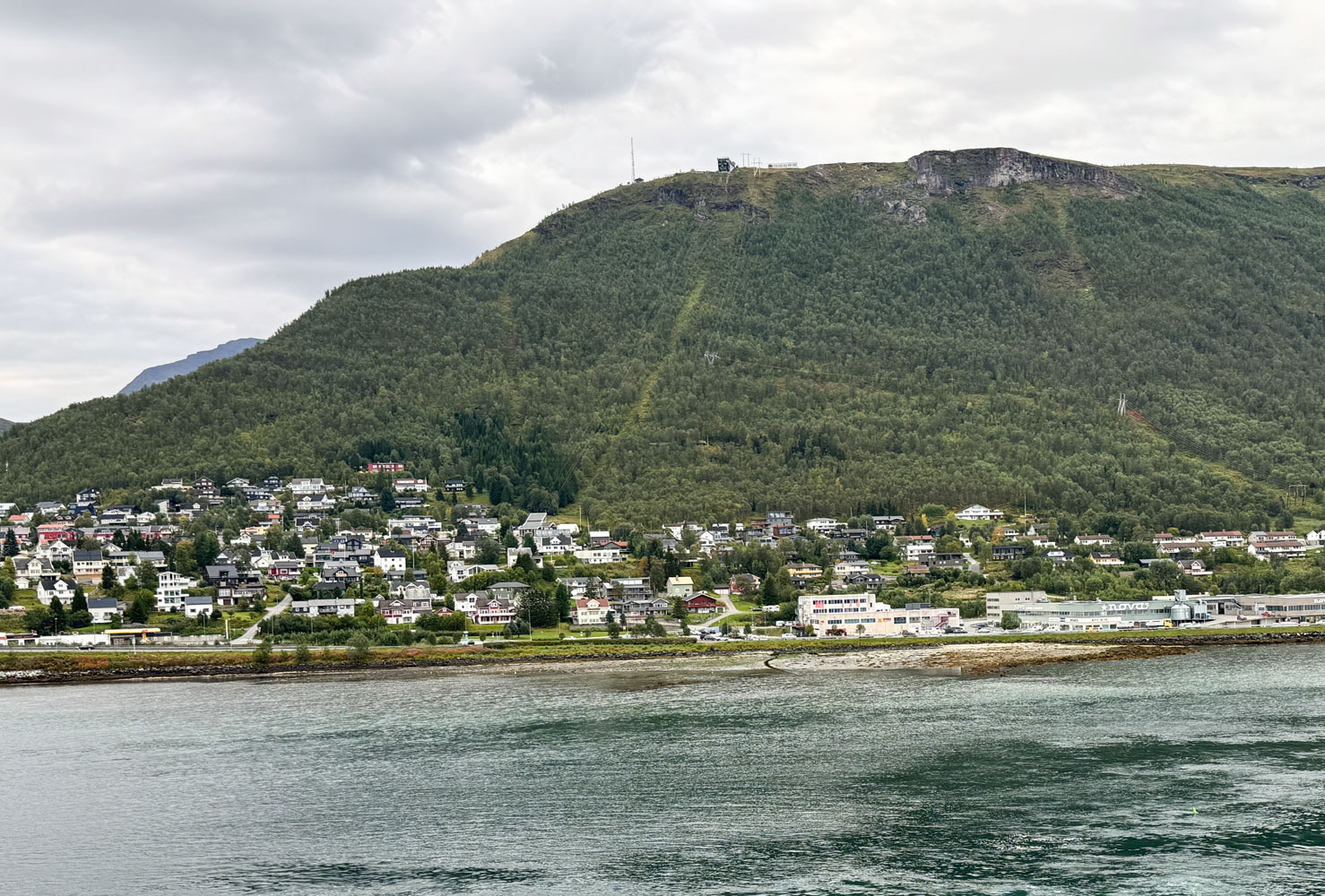
9/10/2025 (Wednesday) We arrived in Tromsø this morning. Our excursion is scheduled for this afternoon, but we're going to do a "standby" for the same tour in the morning. Originally, the afternoon tour was all that was available.
We went to breakfast and got in line early to get our name on the standby list. And it did work out - we were the last couple to get on the morning excursion.
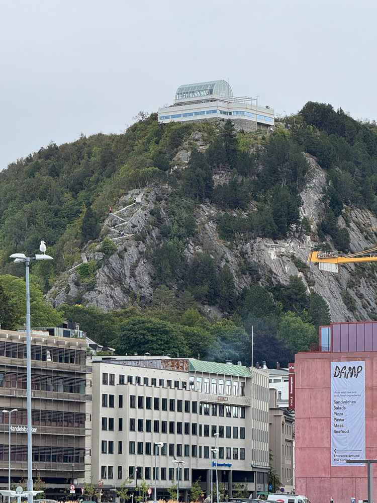
We're going to visit a museum, the very modern church, and then take a cable car to the top of the mountain overlooking the town.
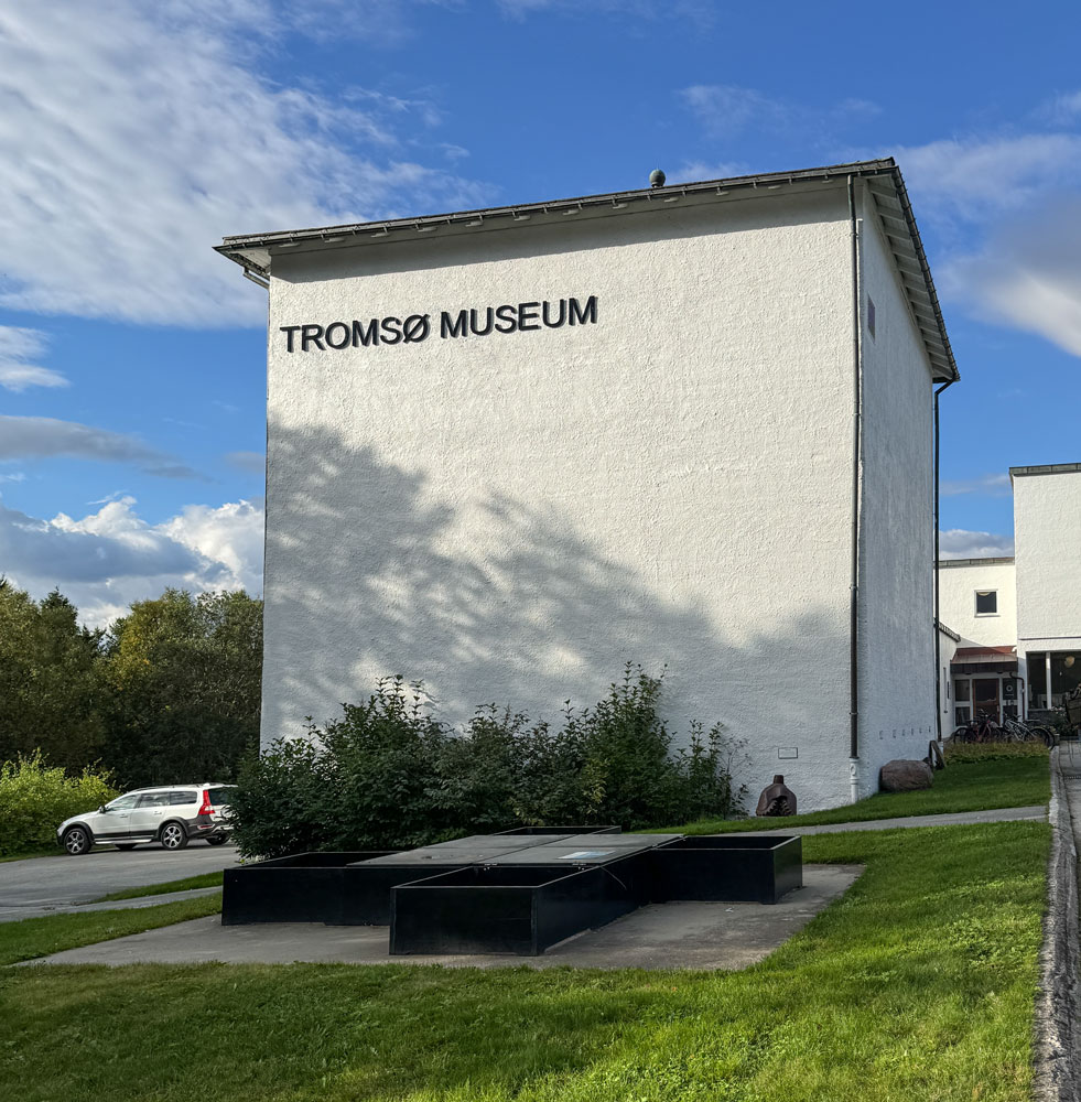
The bus took us first to the Tromsø Museum, founded in 1872.
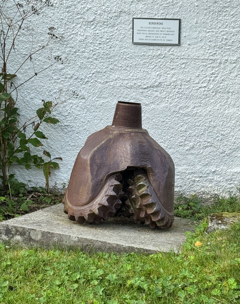
At the lower right of the above picture is an oil well drill bit. Years ago, when I worked on boats in the Gulf of Mexico doing seismograph work, I encountered used drill bits. But this one is huge.
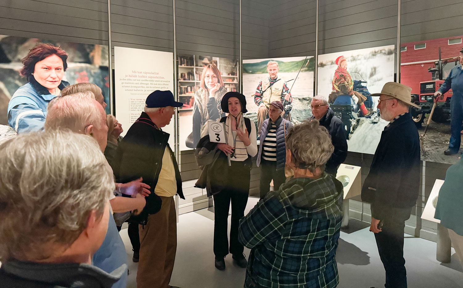
Inside, they had a major exhibition on Sámi culture. Our guide gave some background information.
There were other exhibits in the museum as well, and we wandered through the museum for about an hour.
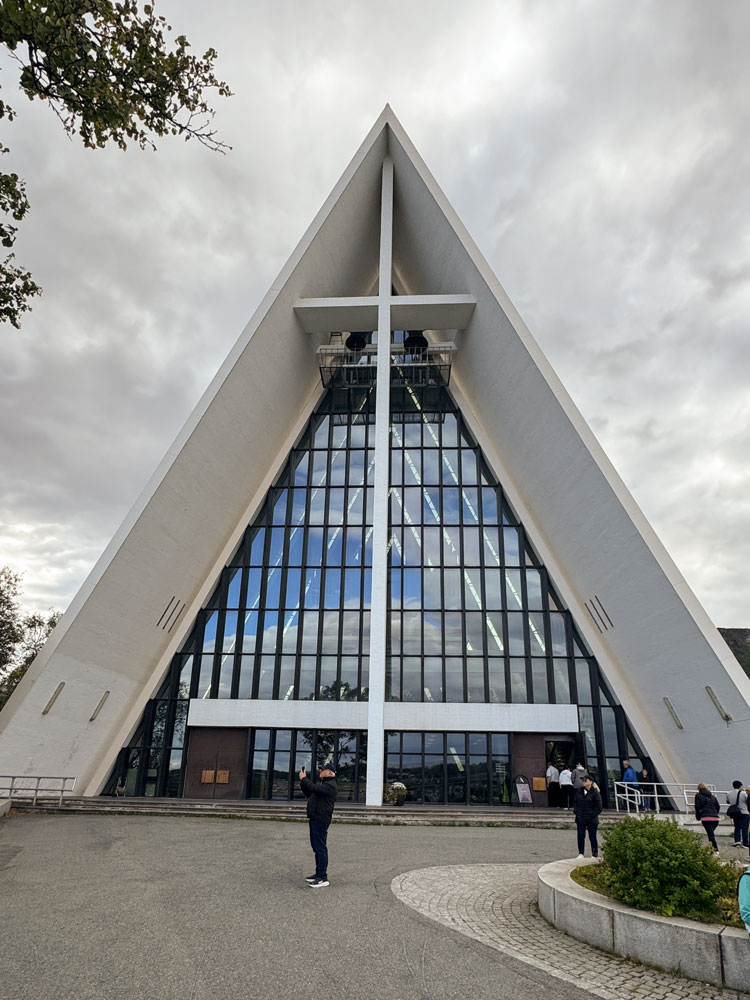
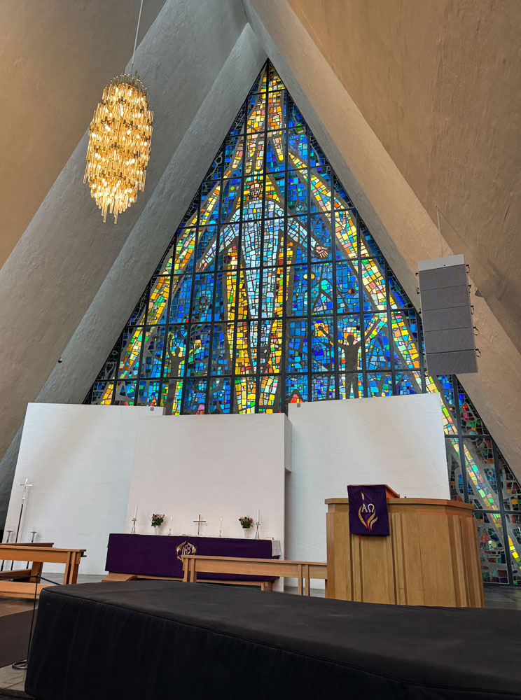
Next, we went to the Arctic Cathedral, built in 1965 based on plans by Jan Inge Hovig. He designed it to be very open to the light, but our guide said that it was so open that parishioners started wearing sunglasses during the services. To reduce the light somewhat, a large stained glass wall was installed in 1972 behind the altar.
Here's a view of the front of the church.
The stained glass panel behind the altar. Some of it is blocked by the panels behind the altar. The panels may be required to keep the area behind the minister from being too bright.
The pipe organ at the back of the church.
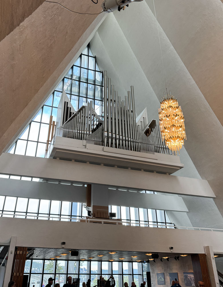
The church is quite a tourist attraction and there's a souvenir shop below the organ.
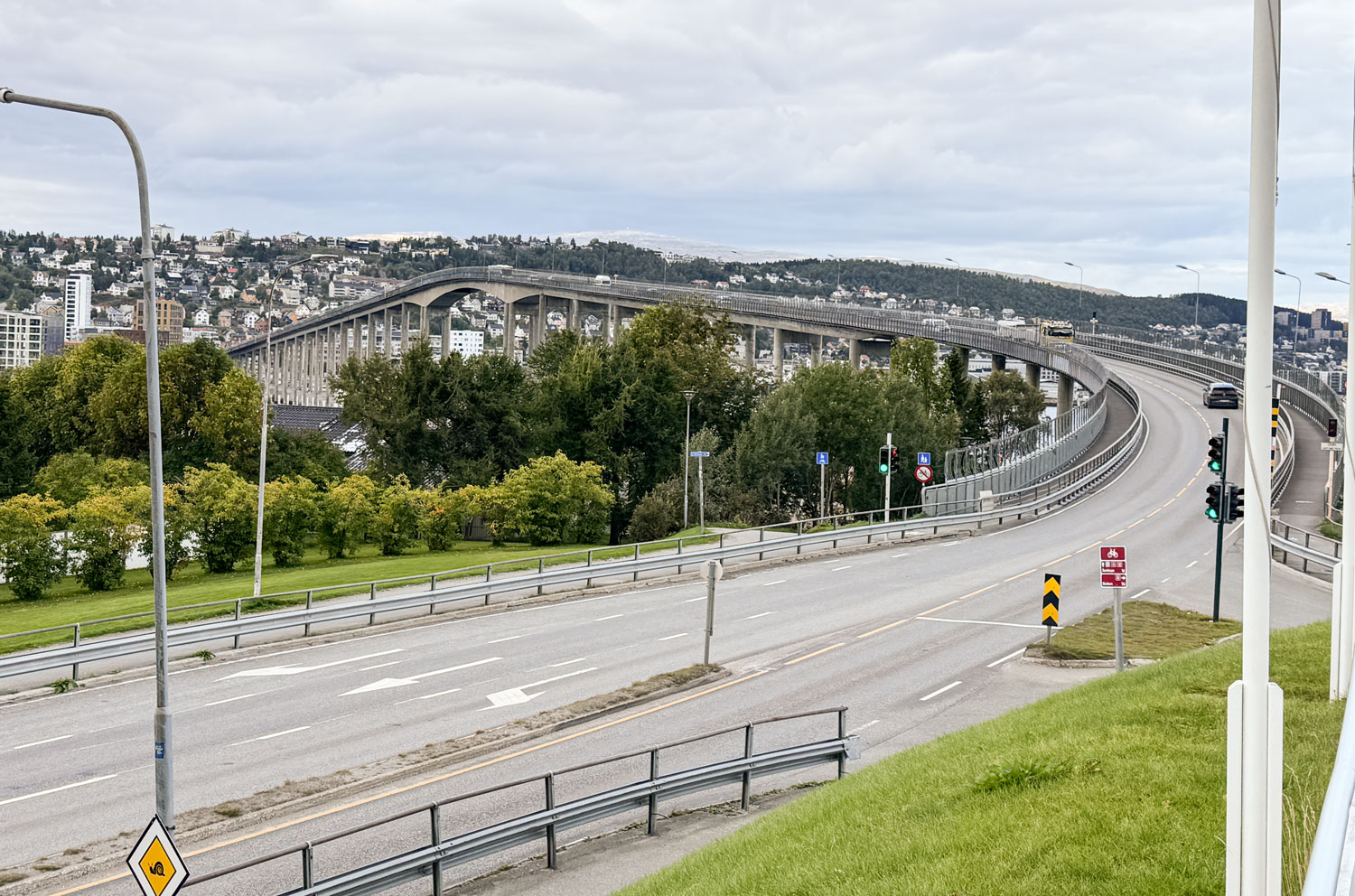
Directly in front of the Cathedral is the Tromsø Bridge. We had crossed it to come to the cathedral.
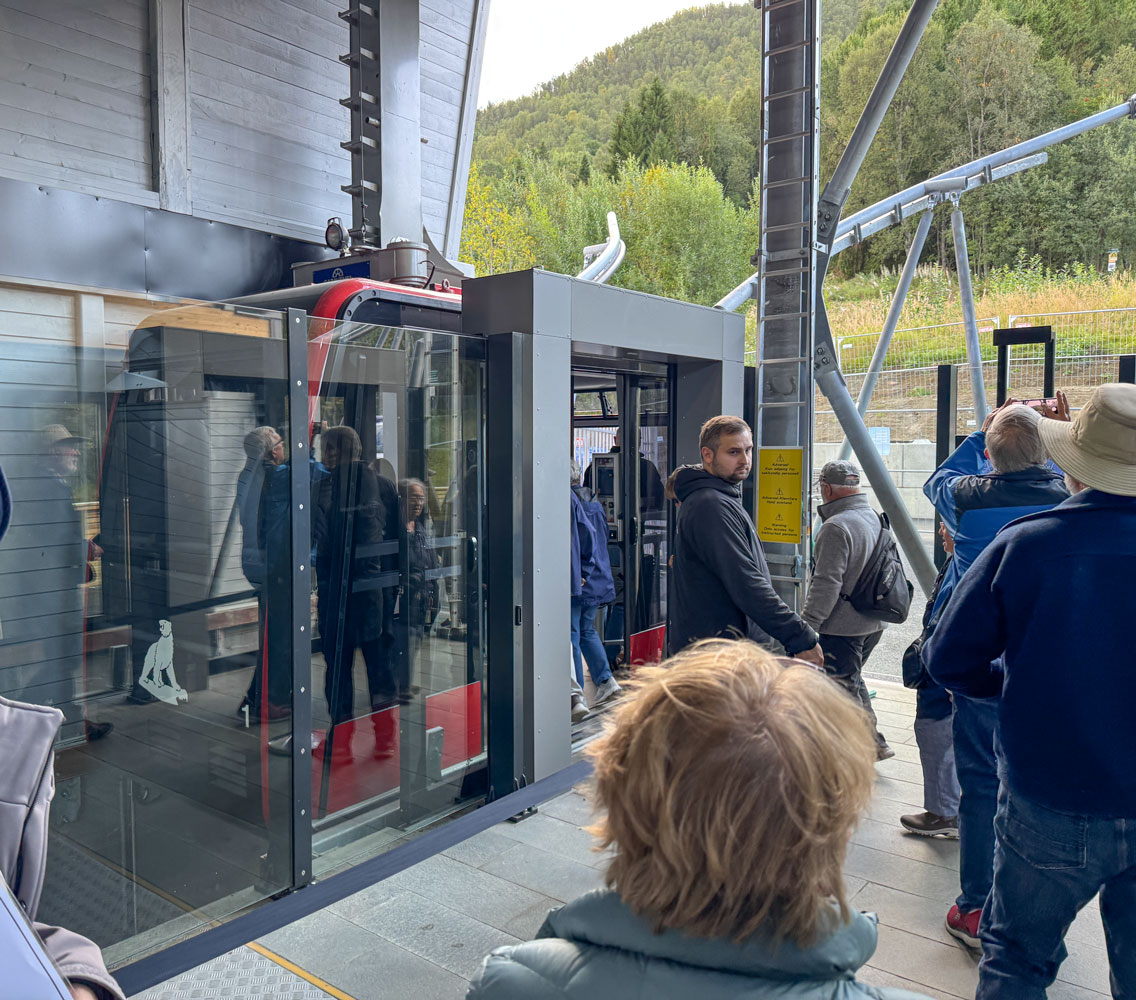
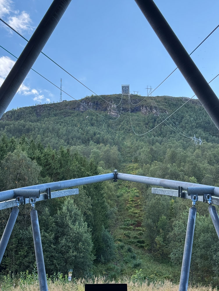
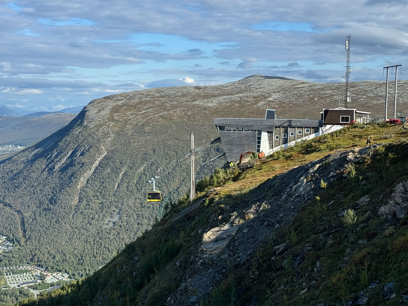
The final activity on our excursion was to take the Fjellheisen, the cable car to the top of the mountain. You can see the upper station in this picture.
Boarding the cable car.
The view up toward the upper station.
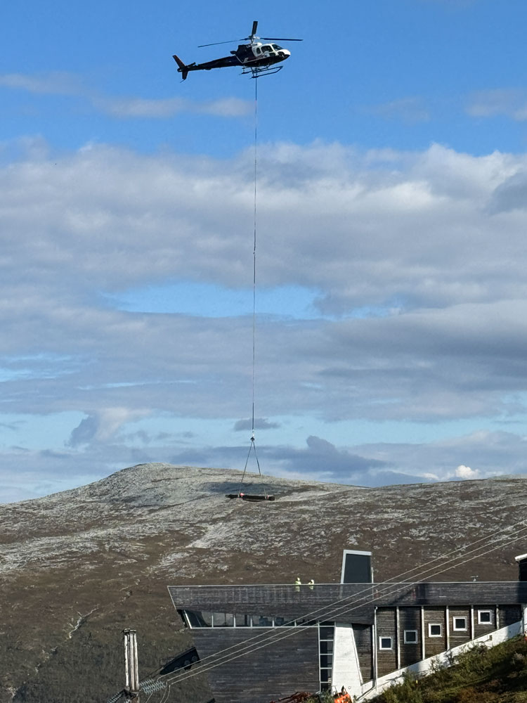
When we got to the top we saw some major construction going on there. I didn't get any pictures that really show it, but they were bringing construction materials to the site by helicopter.
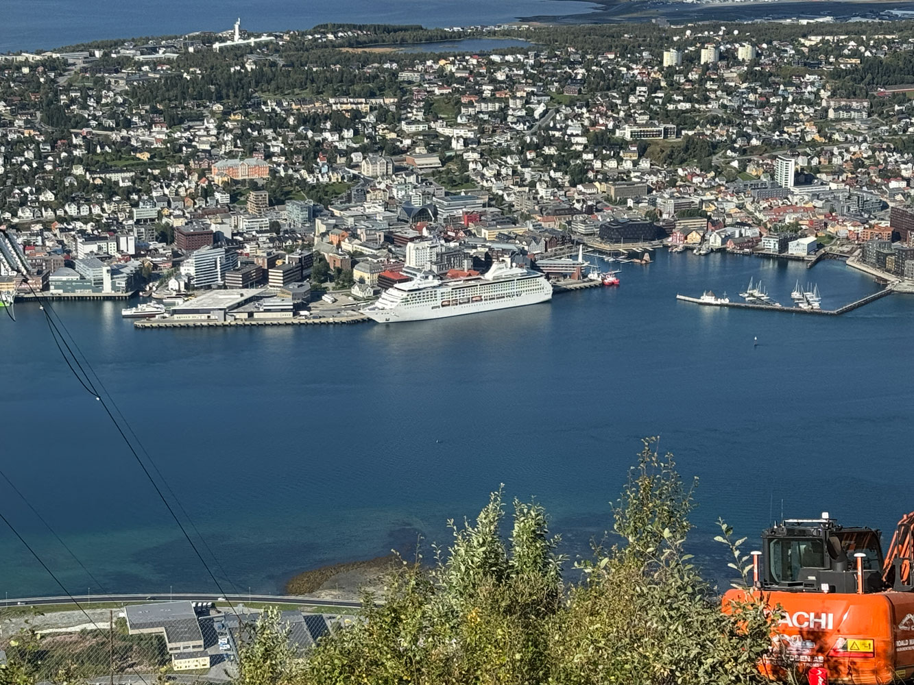
We could see the ship from the mountain.
The upper station with a cable car arriving.
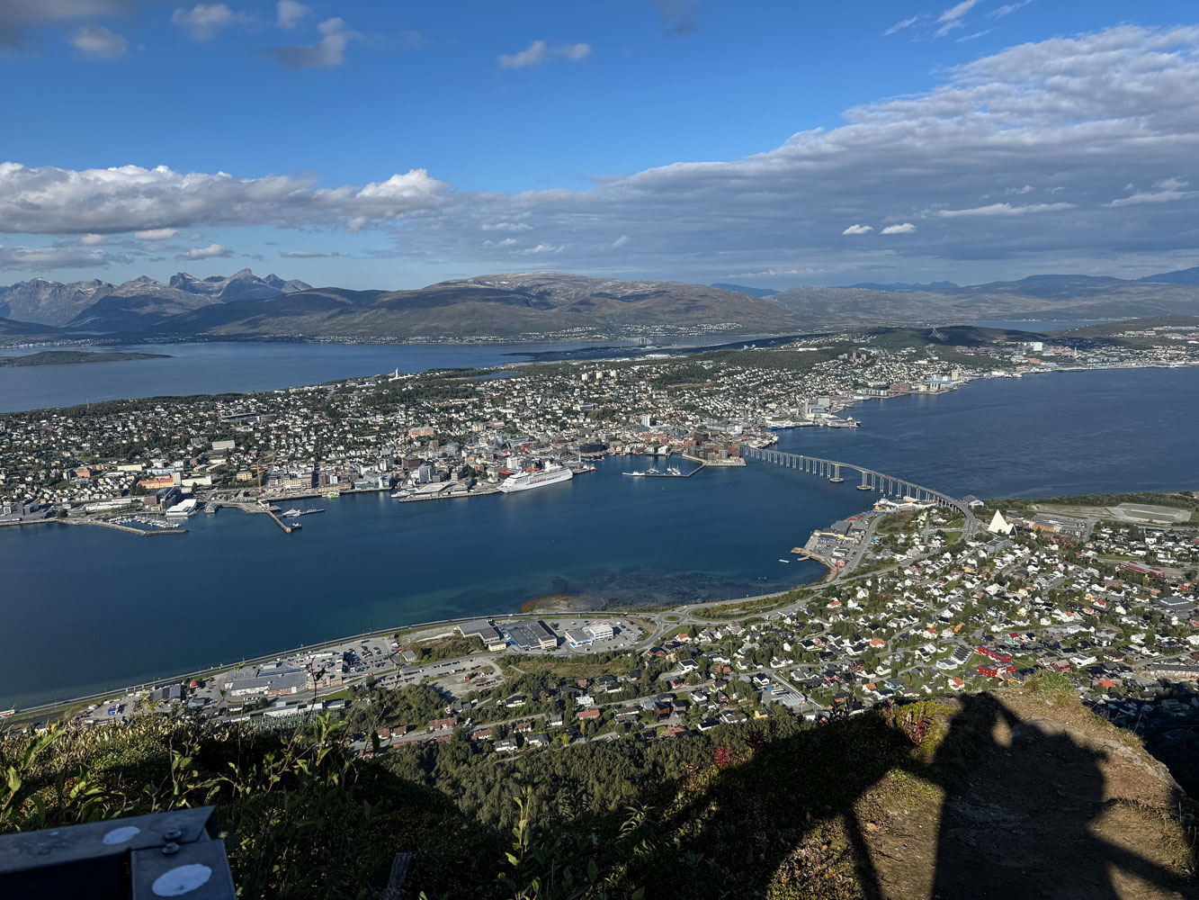
A view of Tromsø from the mountain.
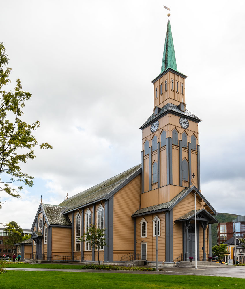
Judy and I wandered around a bit and eventually it was time to go back down. Returning to the ship we passed the Tromsø Cathedral, built in 1861.
The rest of the day was ordinary for us. We played Trivia at 4:30 and lost - just didn't know many of the answers.
We had dinner with Eva and Richard and then to bed.
+++++++++++++++++++++++++++++++++++++++++++++++++++++++++++++++++++++++
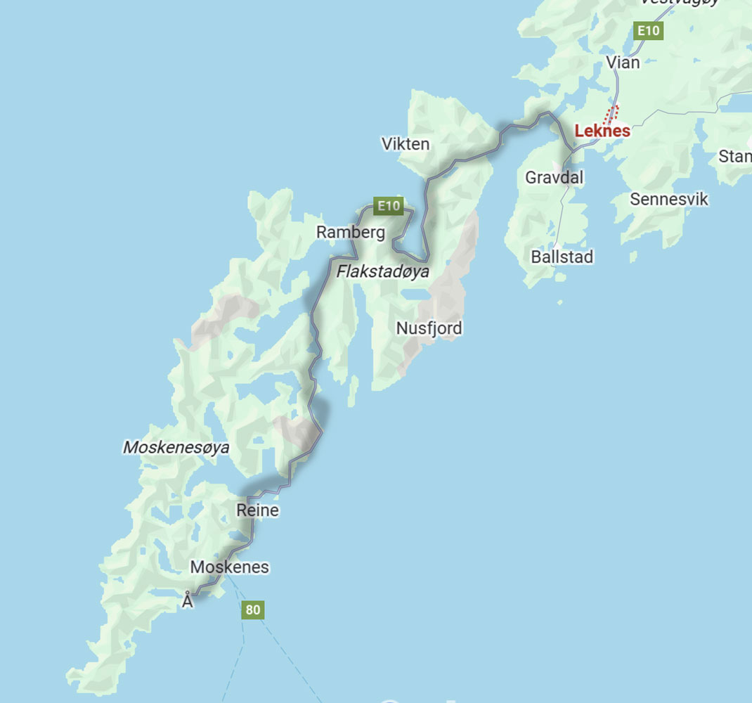
9/11/2025 (Thursday) The itinerary says that we'll arrive in Leknes today about 1pm. But we actually docked at Gravdal which is a bit south of Leknes.
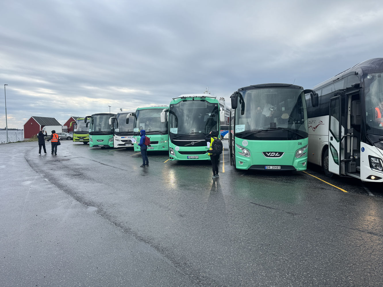
We have a long - 7 hour - excursion today. We'll go from Gravdal to the town of Å (pronounced oh-ah) at end of the E10 road at the bottom of the peninsula. The distance is about 64km and it will take about an hour and a half to get to the end. That means we'll get back to the ship around 8pm, or maybe even a bit later.
The excursion will be mostly sight seeing.
The morning started off with some drizzle, but soon cleared.
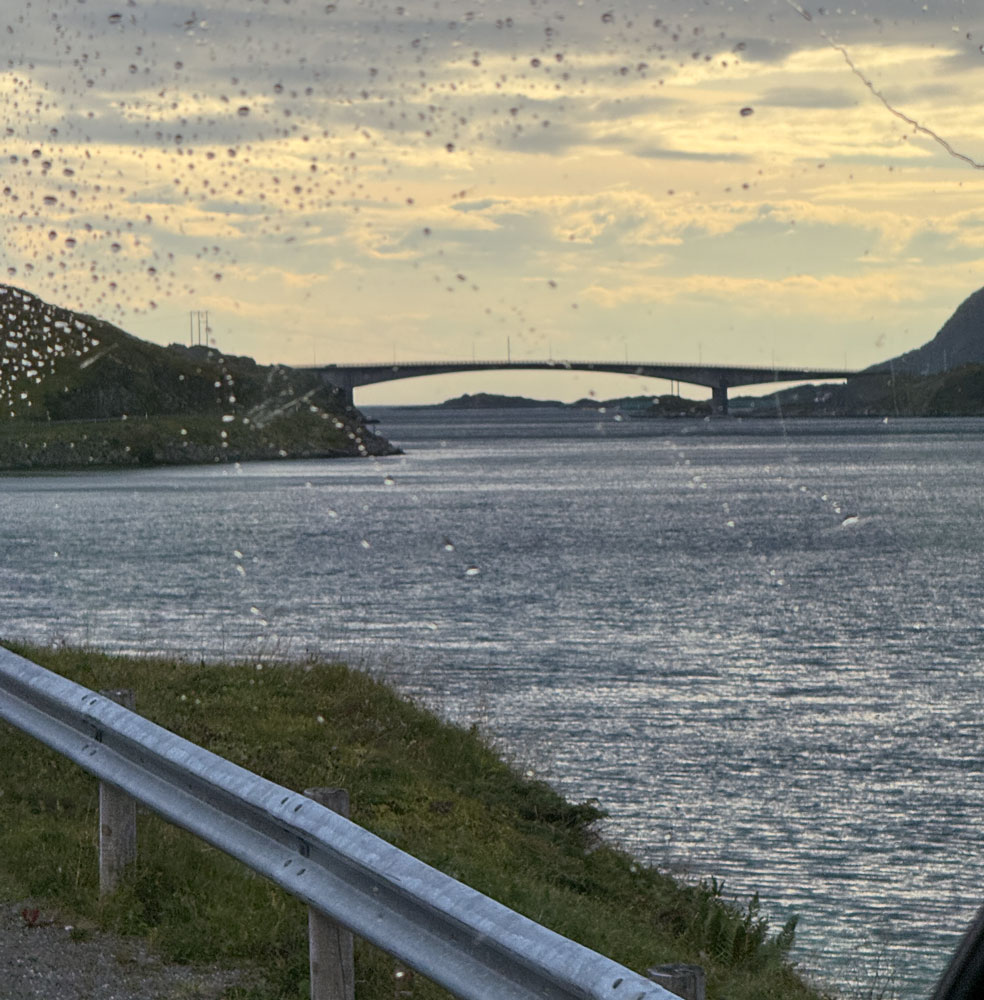
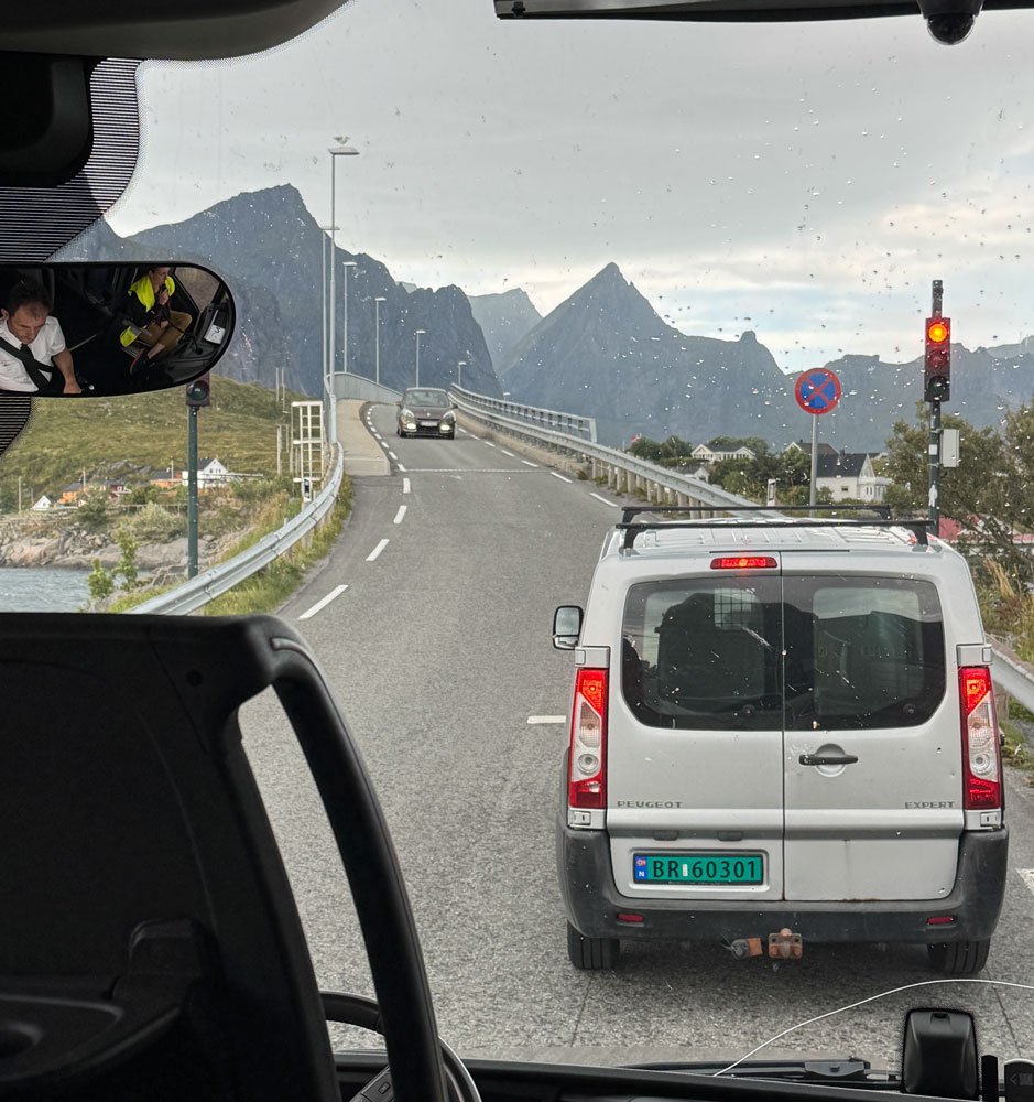
The peninsula is made up of islands, and we went through several tunnels and over a few bridges. Here's a bridge between two islands. I was shooting through the front window of the bus, and you can see the water droplets on the window.
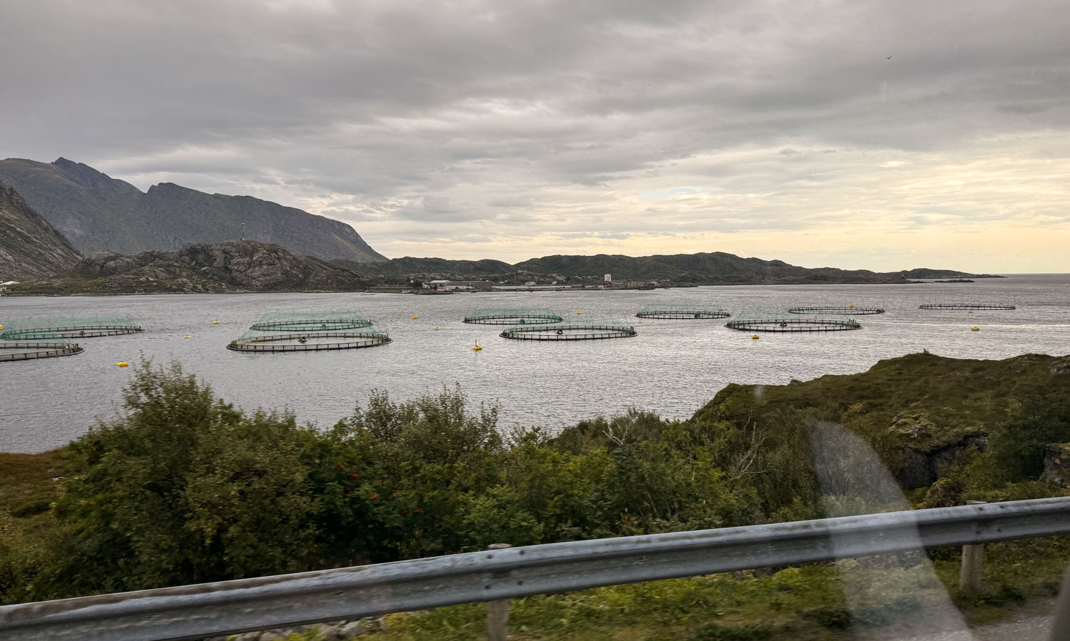
We passed a fairly large salmon fish farm.
We came to a one-lane bridge. The stop lights on each end prevent two vehicles from meeting head-on in the middle of the bridge.
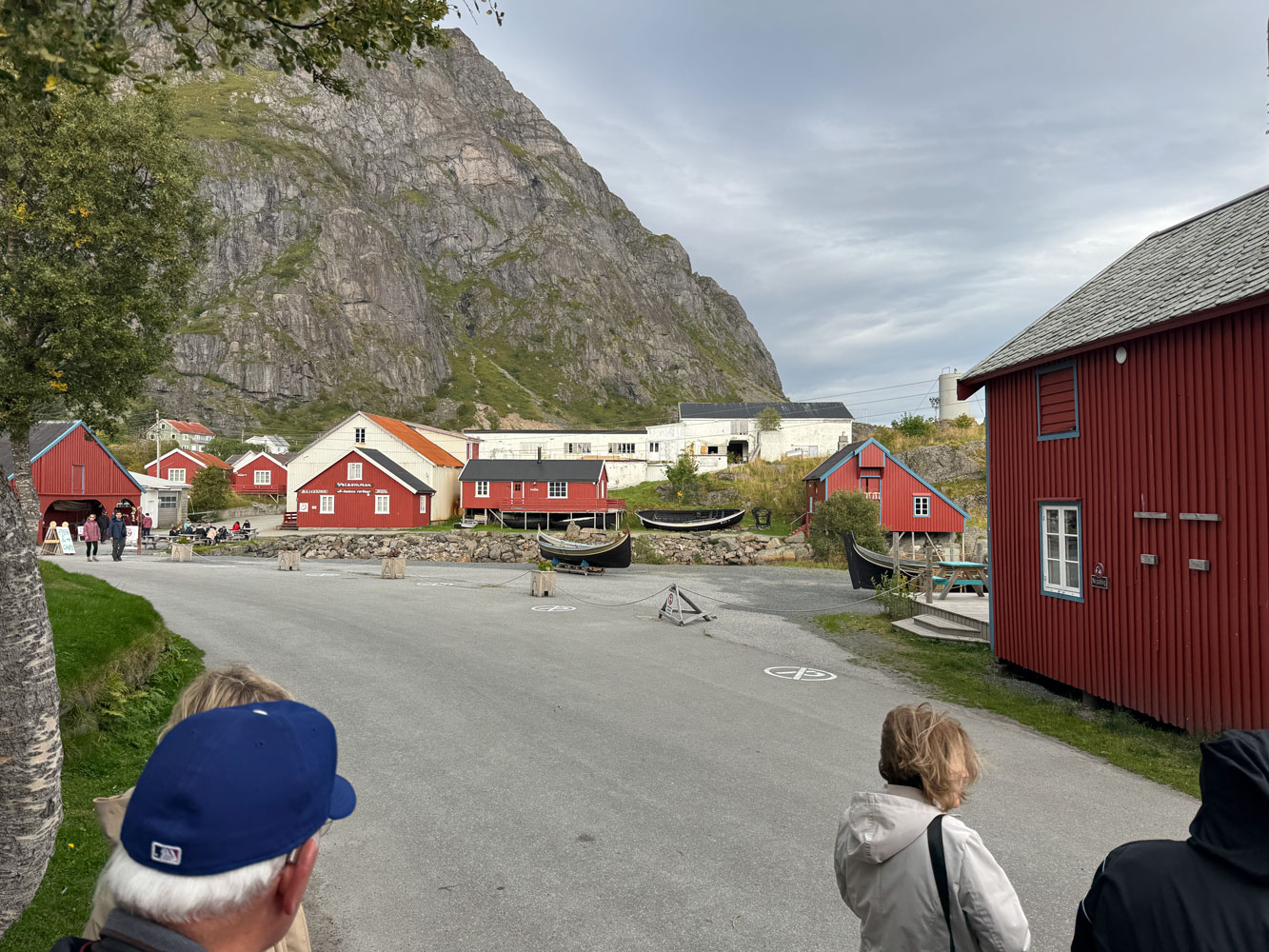
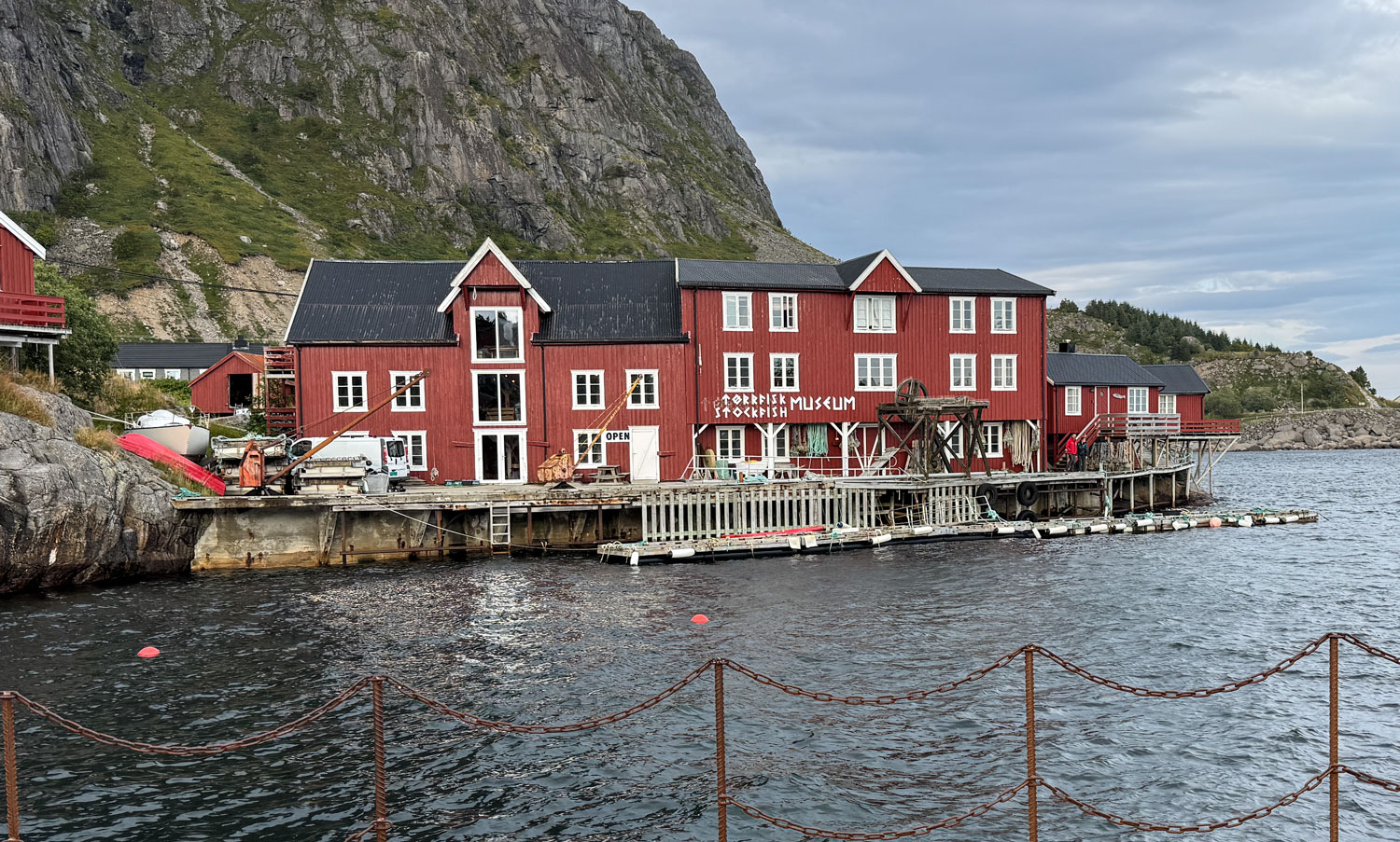
We eventually arrived at Å at the end of the road where there is the Norwegian Fishing Village Museum and the Lofoten Stockfish Museum.
We will visit the Fishing Village Museum first. It consists of a number of buildings that purport to show what a fishing village was like over the past 200 years.
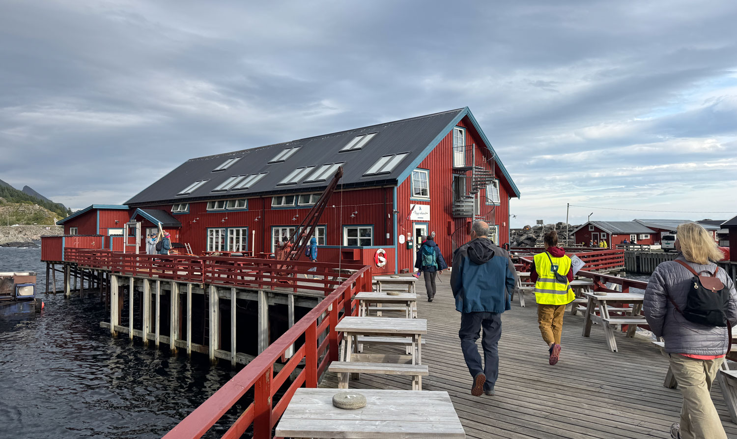
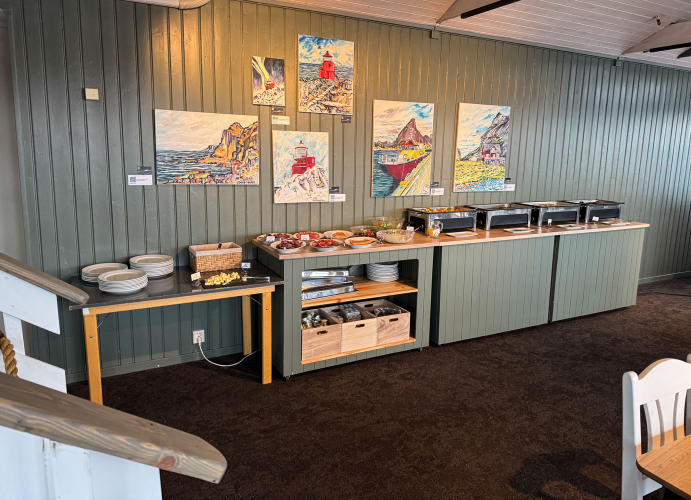
But first, the guide took us to the Brygga restaurant for lunch.
A look inside the restaurant.
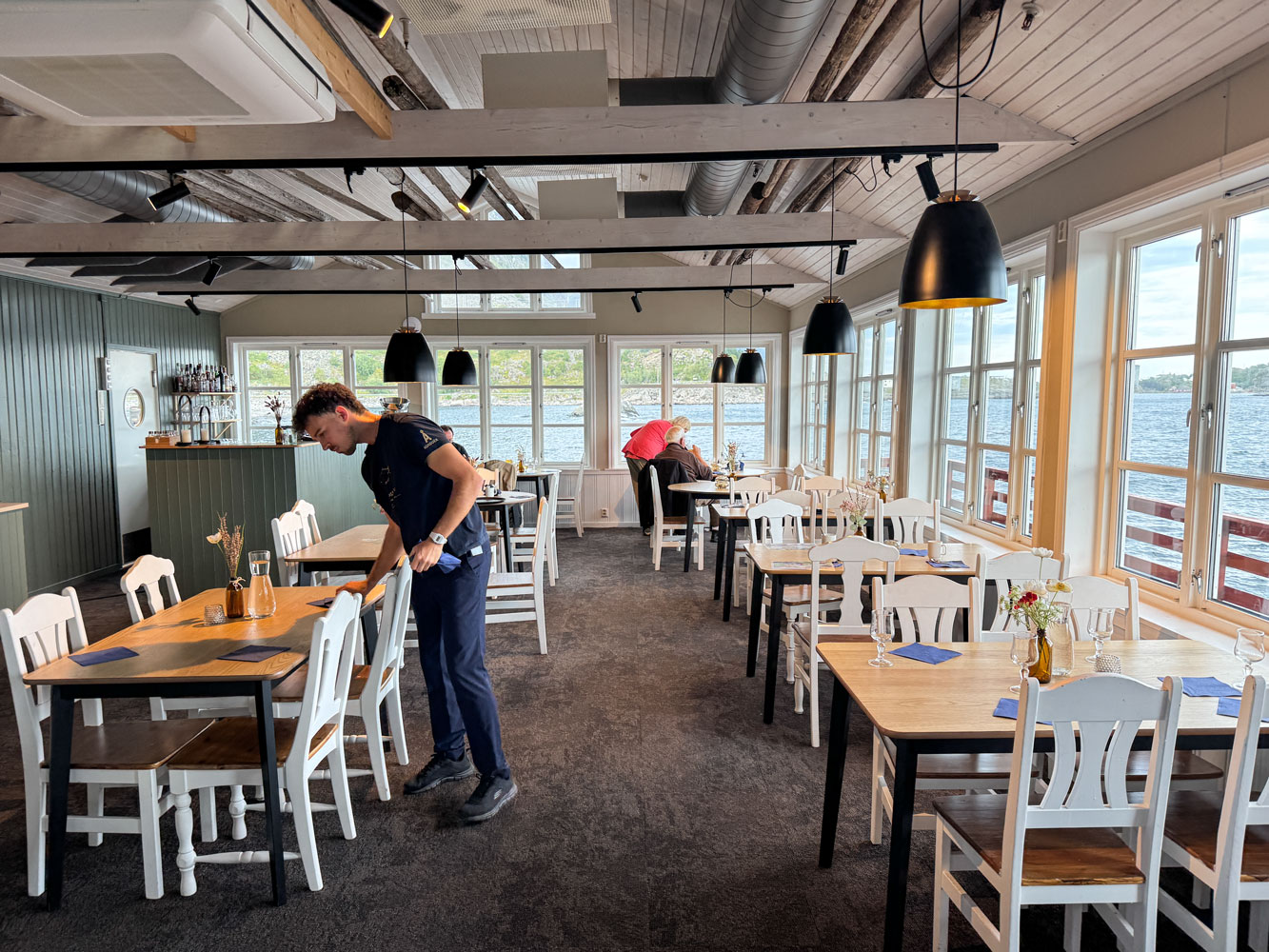
Lunch was buffet style serving salmon and potato salad, with a light fluffy dessert.
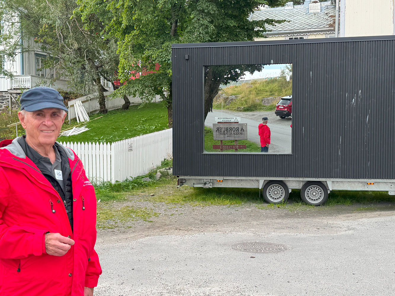
After we left the restaurant we came upon a big mirror, probably 6 feet high. So we took a picture of ourselves taking a picture of ourselves.
Here's that mirror.
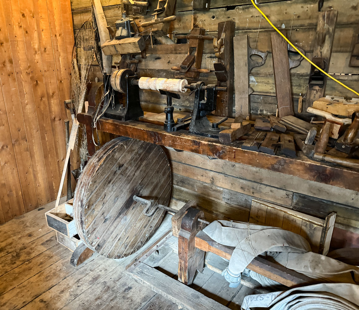
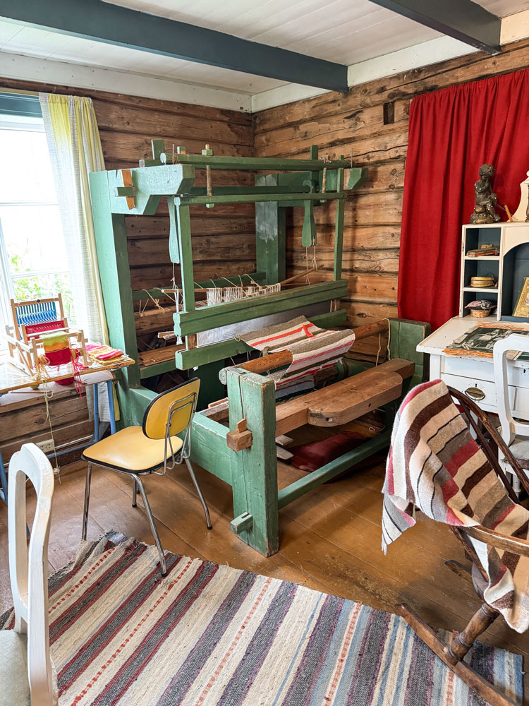
We visited several of the buildings, including a boat house.
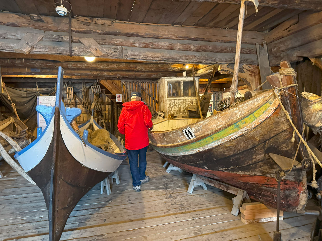
They had two treadle lathes in the boathouse. This one is not in working condition but it looks like it could be restored.
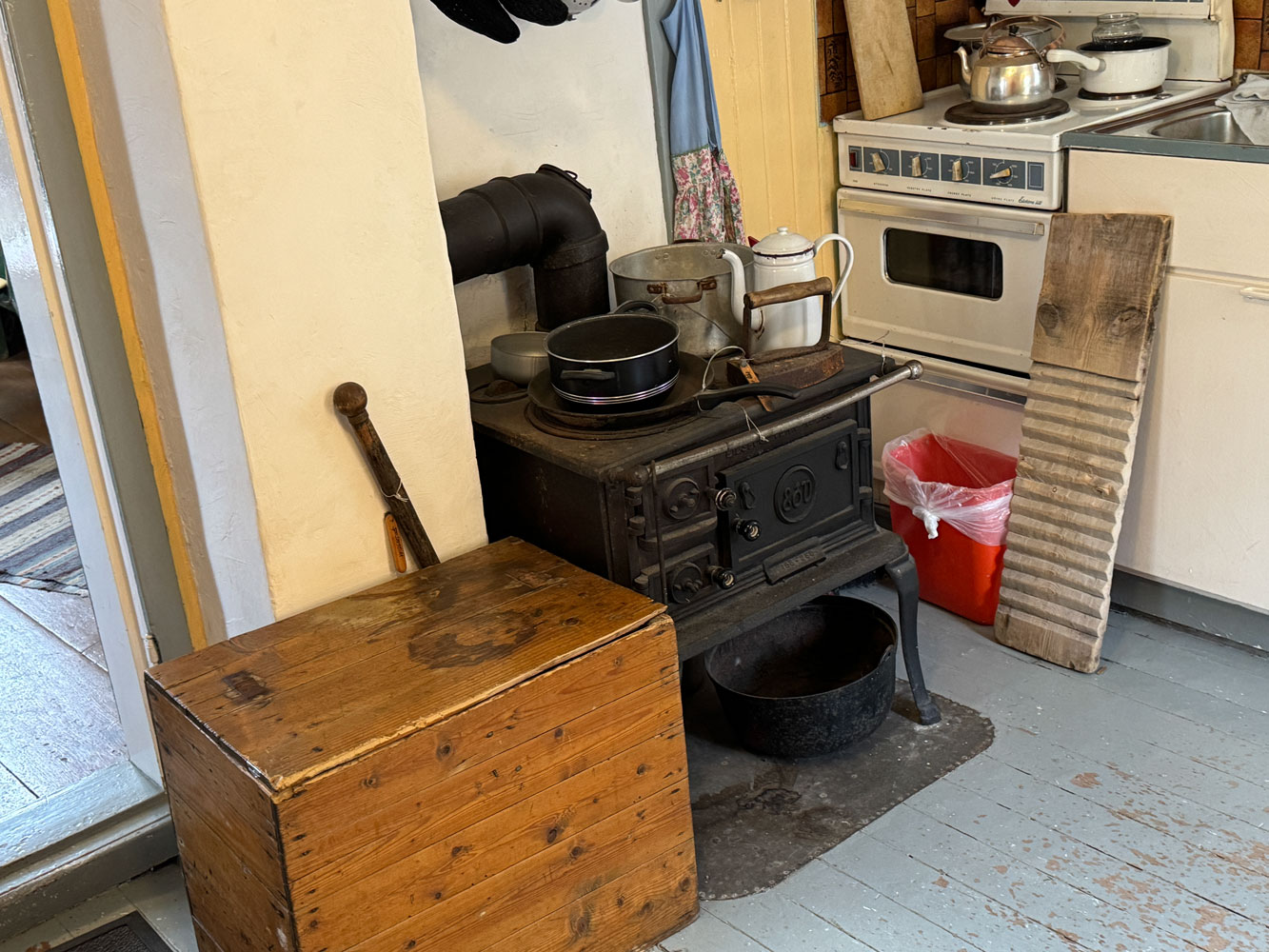
We also visited a building that was once a home to a family. Here's a view of the kitchen.
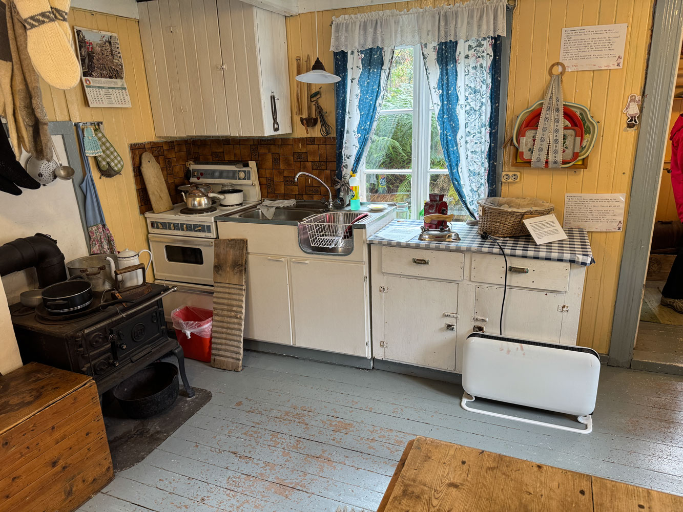
But it's a mix of modern and old. There's an electric stove, and right nearby is a wood stove.
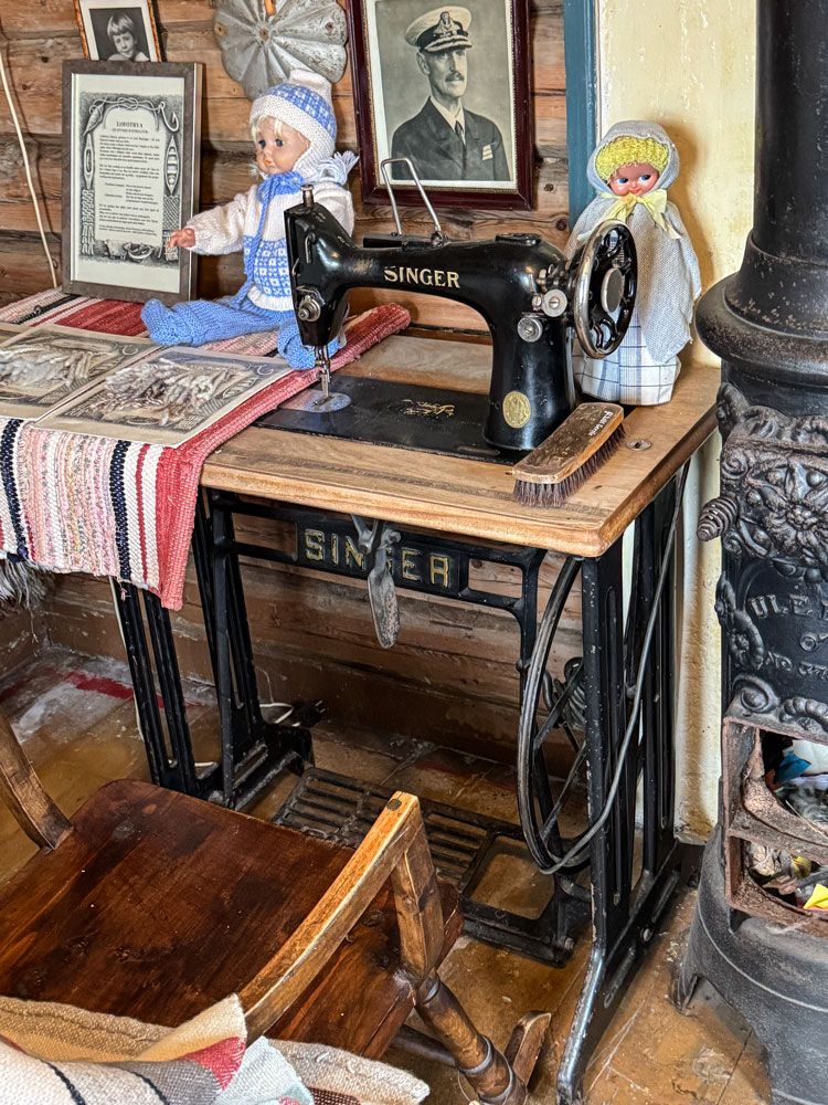
A treadle sewing machine. I learned to sew on one similar to this one.
A loom.
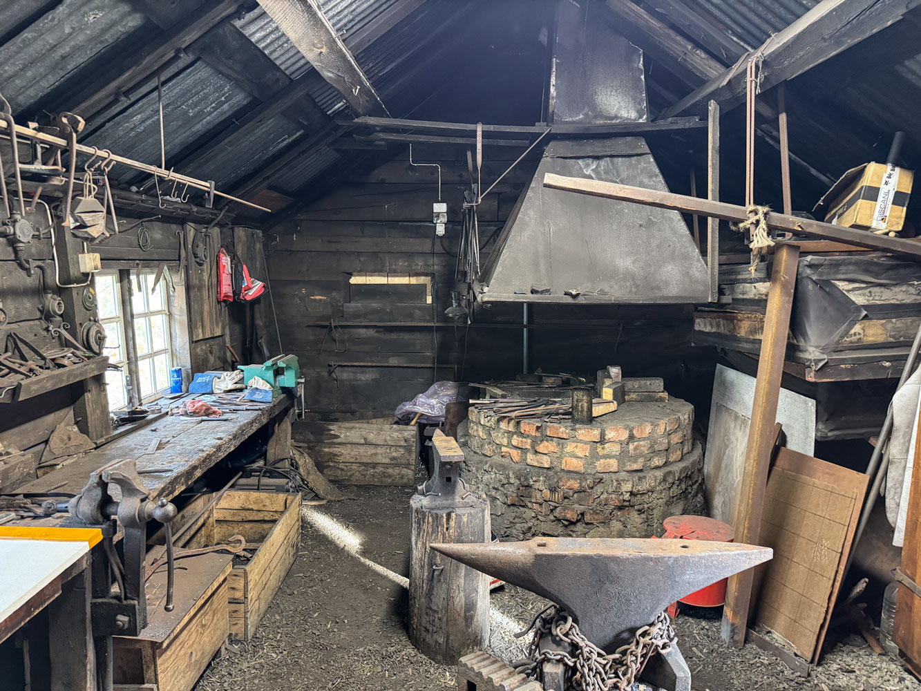
I stuck my head into the blacksmiths shop. It was also of mixed heritage. It has a modern electric grinder, but an old forge.
We met the guide again at 5pm and we went to the Lofoten Stockfish Museum.
We heard an experienced fisherman talk about the cod and how it is processed into stockfish.
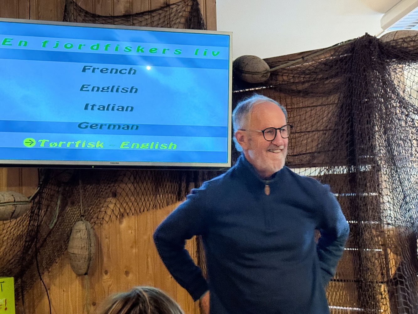
He said that this year's catch of cod has been very small and he blamed it on climate change, but in listening to him talk about how many fish they caught, I suspect overfishing was also a major contributor.
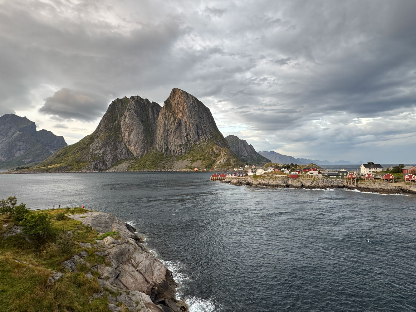
After his talk we left Å and headed back toward the ship. Along the way, we stopped at the village of Reine for pictures.
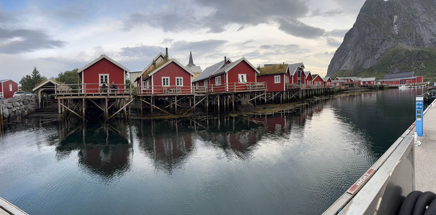
After a bit of time in Reine, we continued on, but stopped at the one-lane bridge and took some more pictures.
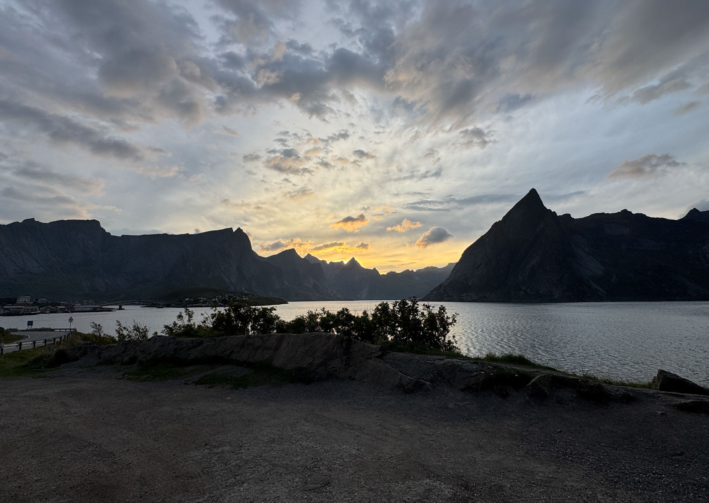
The sun was setting.
We continued, but stopped for a final time at Ramberg to see the white sand beach. It was 7:30pm and it was getting dark. Summer twilights are long in the north, until after September 21, when they become shorter as the long winter nights come on.
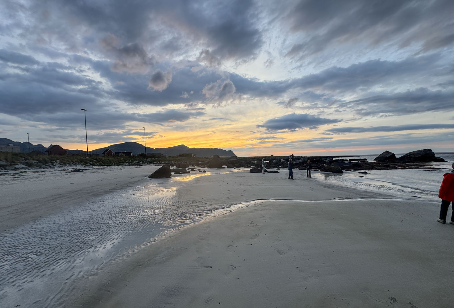
Everyone had sand on their shoes, and the bus driver down put a foot brush for people to wipe the sand off their shoes before getting back on the bus, but I think a lot of sand still got into the bus.
The driver took a short side road through Flakstad to show us the Flakstad Church. He said he had been baptized in that church as a baby. Back then it had been a smaller church. A larger church was needed, but the congregation didn't want to tear it down, so they built the new one over and around it. Then they dismantled the small one and carried it out piece by piece through the front door. Practical Norwegians.
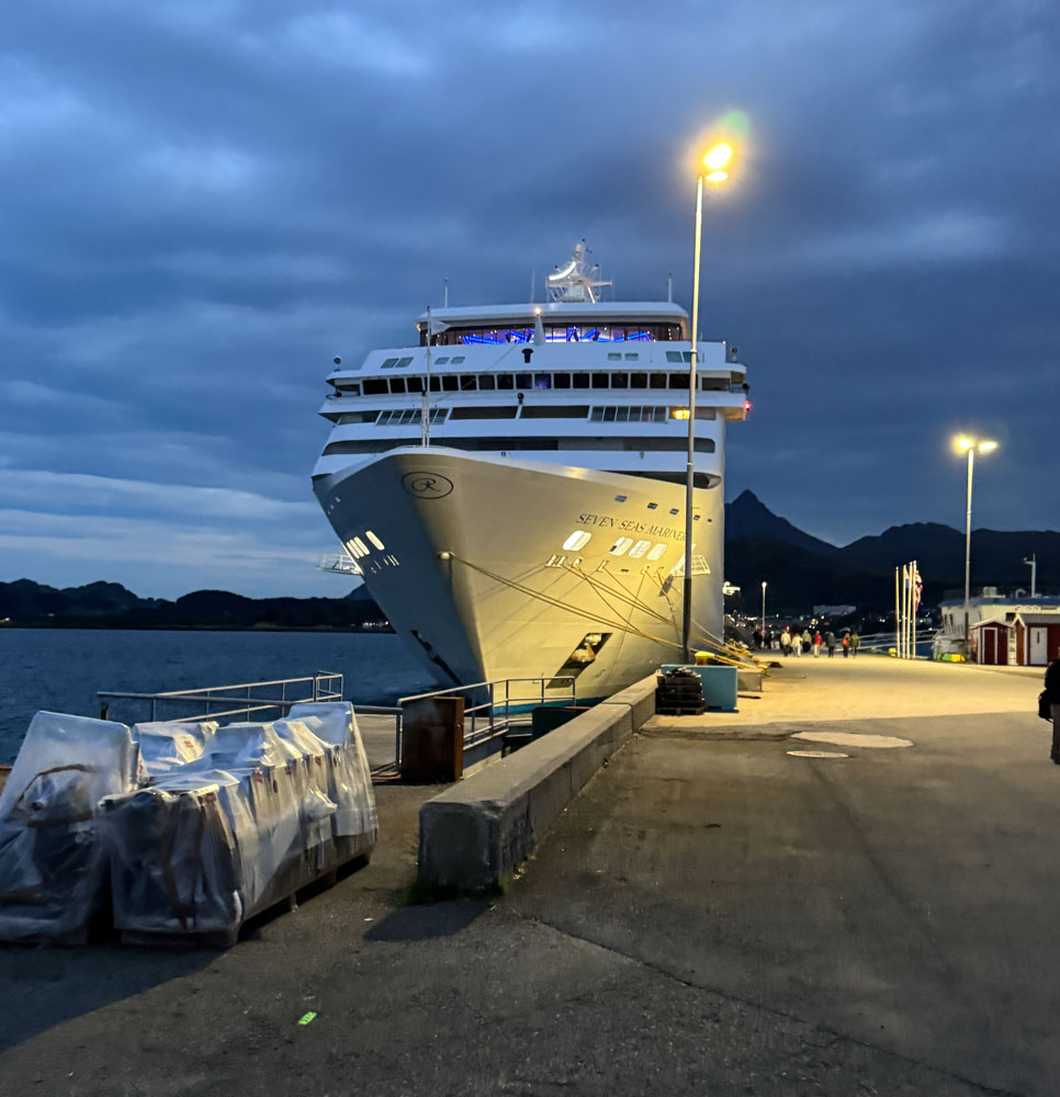
With that, we went back to the ship, arriving about 8:30pm. The good ship Mariner was waiting for us.
Judy and I had a small dinner in the Compass Rose and then it was to bed. Tomorrow is a sea day.
+++++++++++++++++++++++++++++++++++++++++++++++++++++++++++++++++++++++
9/12/2025 (Friday) We have an easy sea day today. The ship Internet people finally figured out what the problem was and gave me the upgraded Internet package which allows me to update the blog.
Otherwise, it was a quiet day. We played one of the ship's games and went to Trivia at 4:30, where we came in second. Then to dinner in the Prime 7 restaurant with Eva and Richard.
+++++++++++++++++++++++++++++++++++++++++++++++++++++++++++++++++++++++
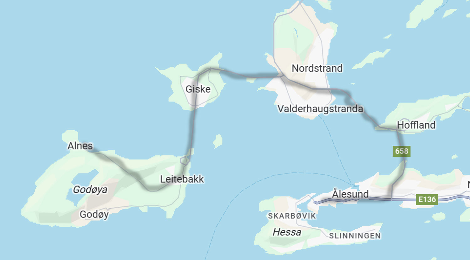
9/13/2025 (Saturday) We docked in Ålesund today and our excursion started about 9am. We're going to the islands of Giske and Godøya via the Vigra Fixed Link, which consists of the Ellingsøy Tunnel which connects the islands of Nørve (where Ålesund is located) and the island of Ellingsøya. This tunnel is about 3.5km and the maximum depth is 144 meters.
Then, the Valderøy Tunnel between the islands of Ellingsøya and Valderøya. This tunnel is about 4.2km long and the deepest part is 137 meters.
Then, there's the Giske Bridge, which connects the islands of Valderøya and Giske.
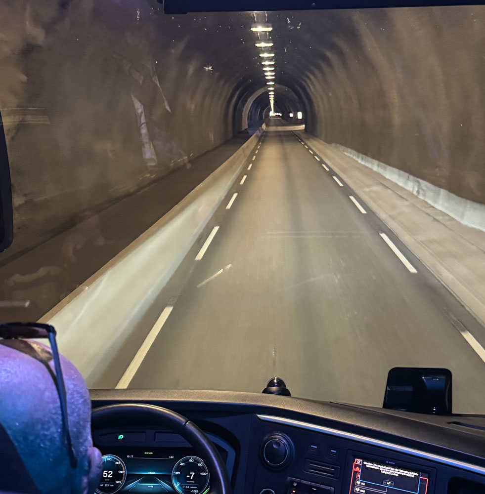
The last connection is the Godøy Tunnel from the islands of Giske and Godøya. The tunnel is about 3.8km and the deepest part is 153 meters. This last tunnel was interesting - it's only one lane wide. That's a K-rail on the left side of the picture, and a walkway between it and the tunnel wall, allowing pedestrians and bicyclists to use it.
There are "pull off" places every so often and you can see the lights of an approaching car for a fairly long distance. Since we were a bus, cars pulled over, but I wonder how they work it out when two cars approach.
Here's a map of our excursion.
When we came out of the Godøy Tunnel there was a viewpoint and the bus stopped there, giving us a view across the island towards the Alnes Lighthouse (which barely shows in the picture, toward the right side).
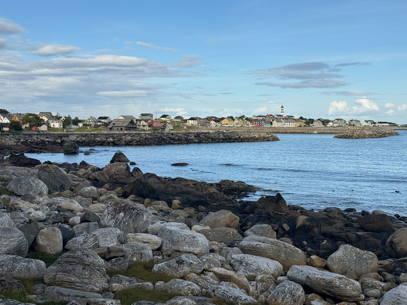
Here's a bit more telephoto shot of the lighthouse.
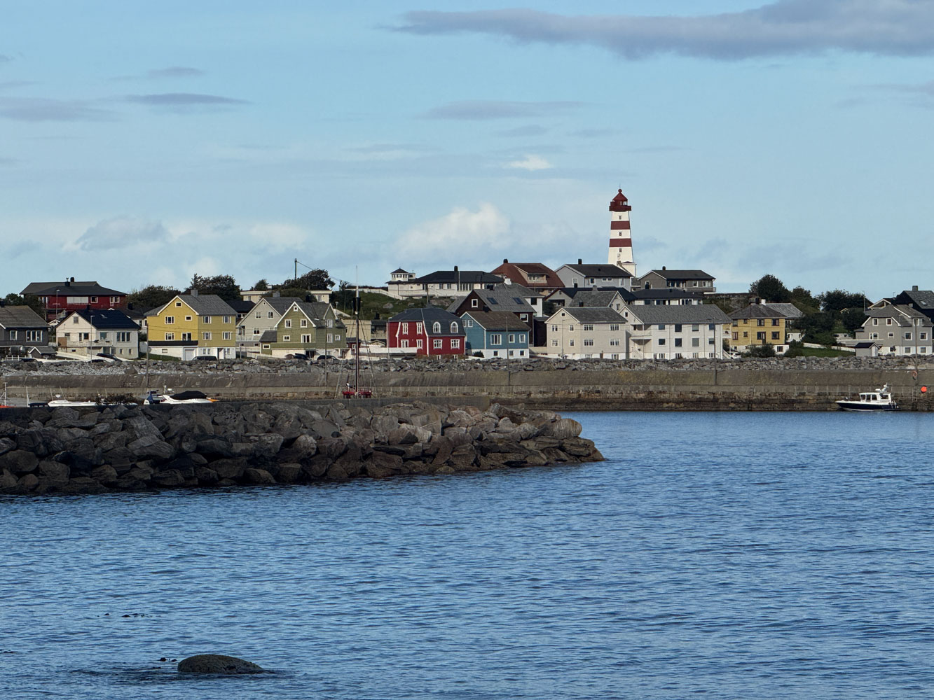
Then we drove to the lighthouse. We didn't recognize it immediately but we had visited the lighthouse when we took an earlier cruise in this area in 2022.
Here's a bit better picture of the lighthouse.
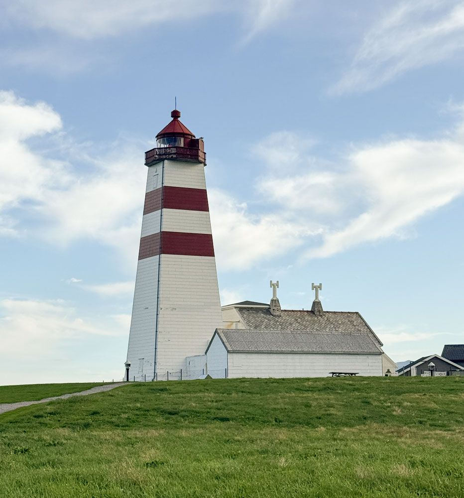
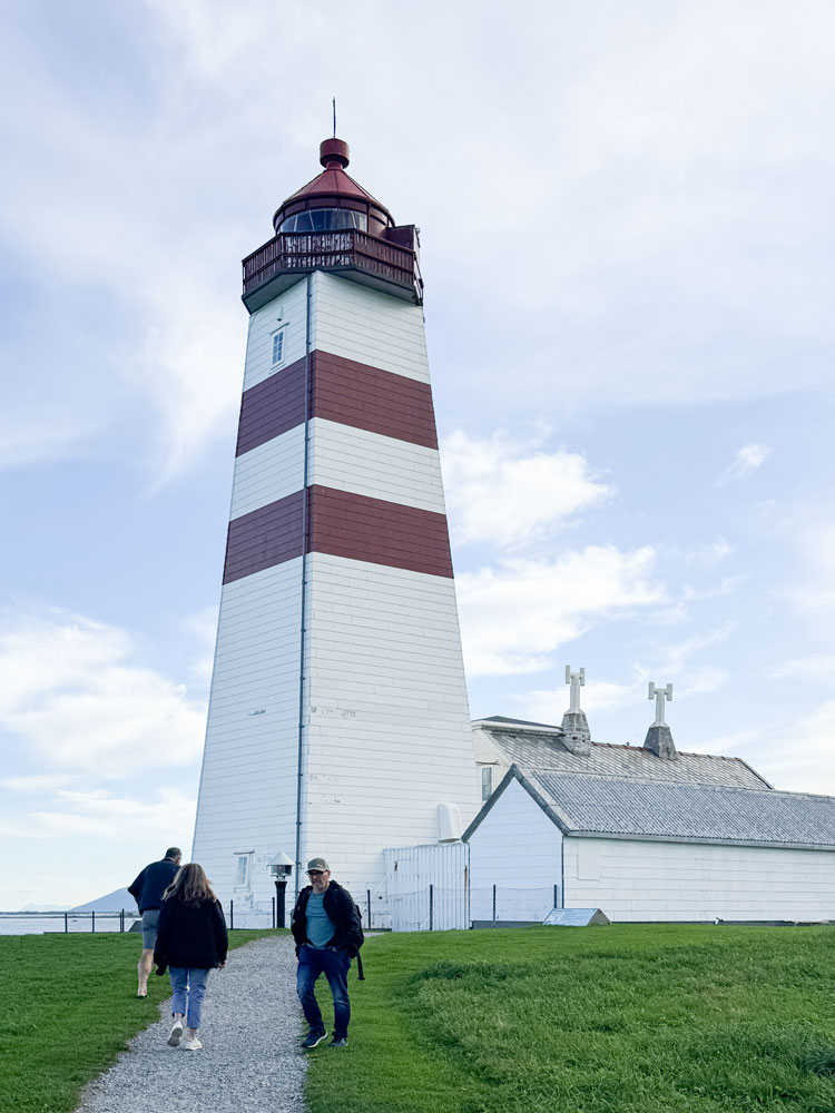
We went into the lighthouse but didn't go up to the top this time - I had done so last time. The stairs are very steep. Click on the "earlier cruise" link above for more pictures of the lighthouse.
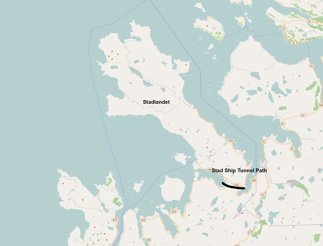
While we were at the welcome center, I saw a poster about the Stad Ship Tunnel. Norway is going to put a tunnel across the Stadlandet peninsula for (smaller) ships to go through.
It will be 1.7km long, 37 meters high and 36 meters wide. Here are some maps of where it will be located. I suppose there's too much mountain there to cut a canal.
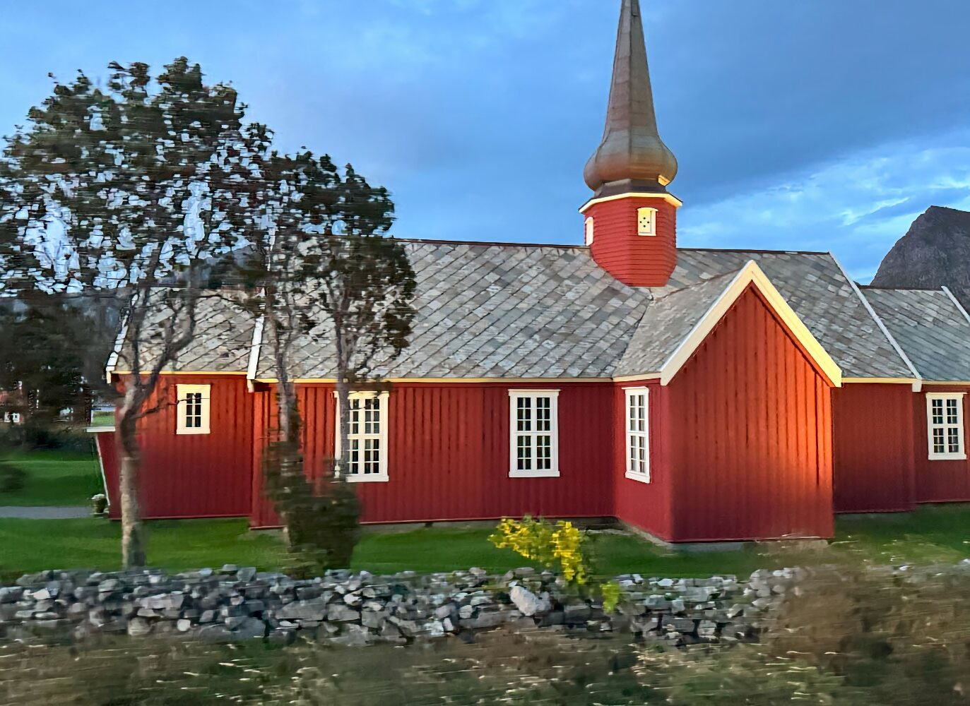
We left the island of Godøya and went to the island of Giske to visit the Giske Church. The church was probably build in the 1100's (12th Century).
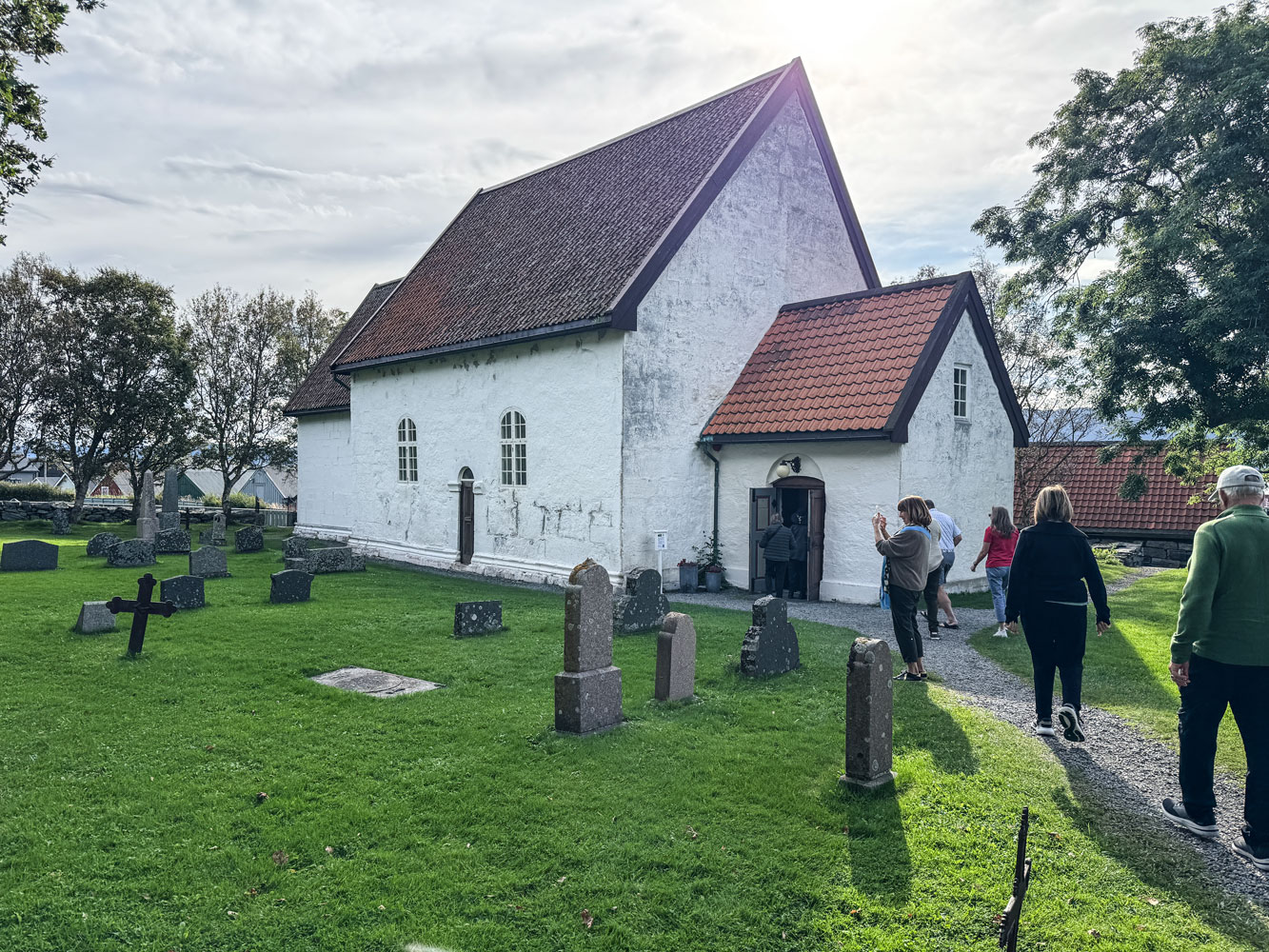
Turns out, we had visited the church on the same previous cruise.
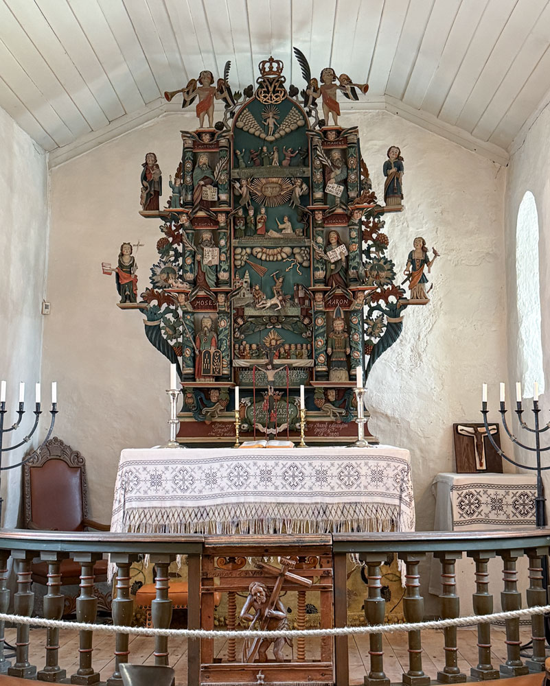
Here's a view of the elaborately carved altar area. It was carved by Jakob Sørensøn Giskegaard (1734–1827), also known as Tavle-Jacob.
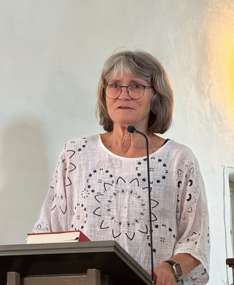
A woman from the congregation gave us a talk about the church. It was the same woman who had made the presentation to us back in 2022.
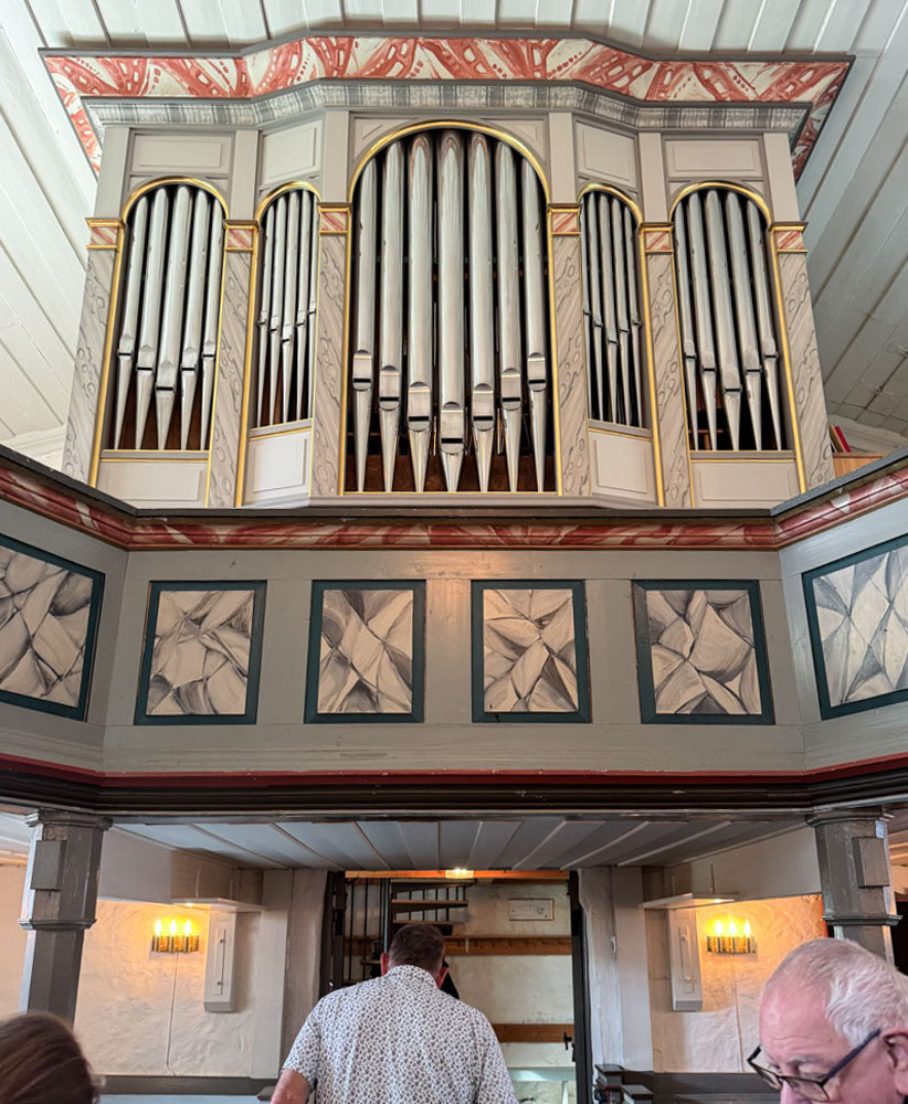
The pipe organ at the back of the church.
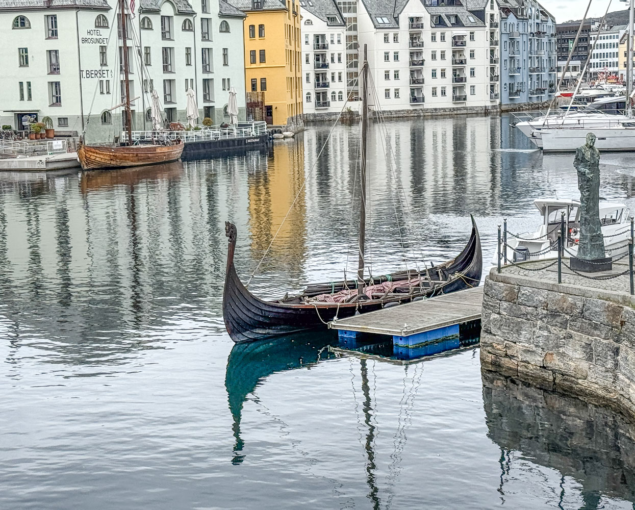
Then we went back to the ship. Judy and I went for a quick walk, and took this picture in the center of town. Note the Viking Longship in the center of the picture.
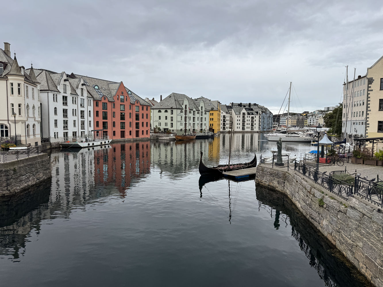
A better picture of the longship.
But it started raining so we went back to the ship. I took this picture of Mount Aksla Viewpoint, which we had visited on the previous cruise.
Note the switchback walkway to the Viewpoint - there are 418 steps. We did not walk that last time:-)
That was basically the end of our day. We did Trivia and bombed out, then went to dinner and finally to bed.
+++++++++++++++++++++++++++++++++++++++++++++++++++++++++++++++++++++++
9/14/2025 (Sunday) We arrived in Lerwick, Shetland Islands this morning. Our clocks moved back one hour for the Shetland Islands and we got a bit confused about the time this morning. I thought our iPhones would not change time until we connected to cellular, but that was not true. Apparently, the phone monitors our location, and recognizes when we move into a different time zone - and automatically changes the time. Just had us confused.
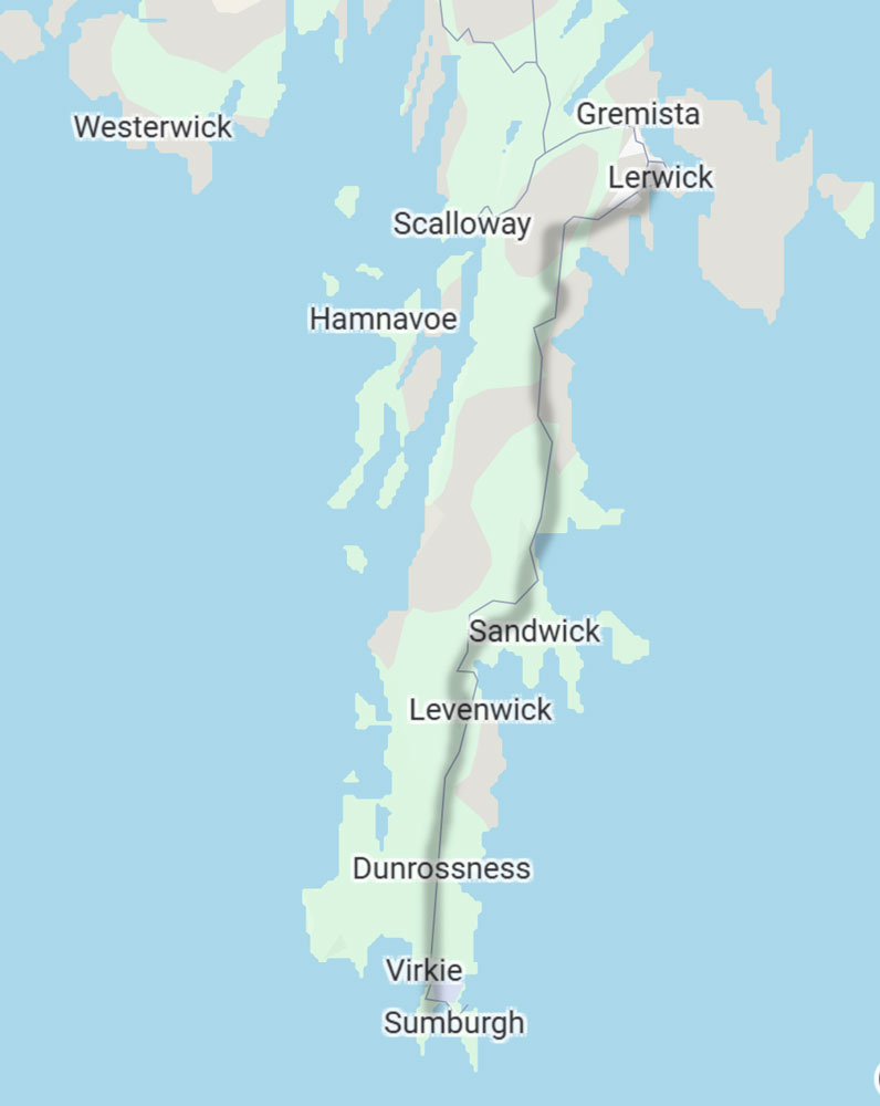
This morning's excursion is a bus drive down the Shetland Islands, from Lerwick all the way to the end of the island at Sumburgh. We actually did a couple of diversions from the path I indicated, but the route is close to what we did.
We had to go through a face-to-face passport control before leaving the ship, but it went quickly and we were on the bus by 9:10am.
I'm at a bit of a disadvantage in describing this excursion. Our tour guide had a very thick Scottish accent and I could only understand a few words now and then - but I'll do what I can.
It's been said that the while Scots speak English they just don't pronounce it very well:-) They also have a full vocabulary of words unique to the region.
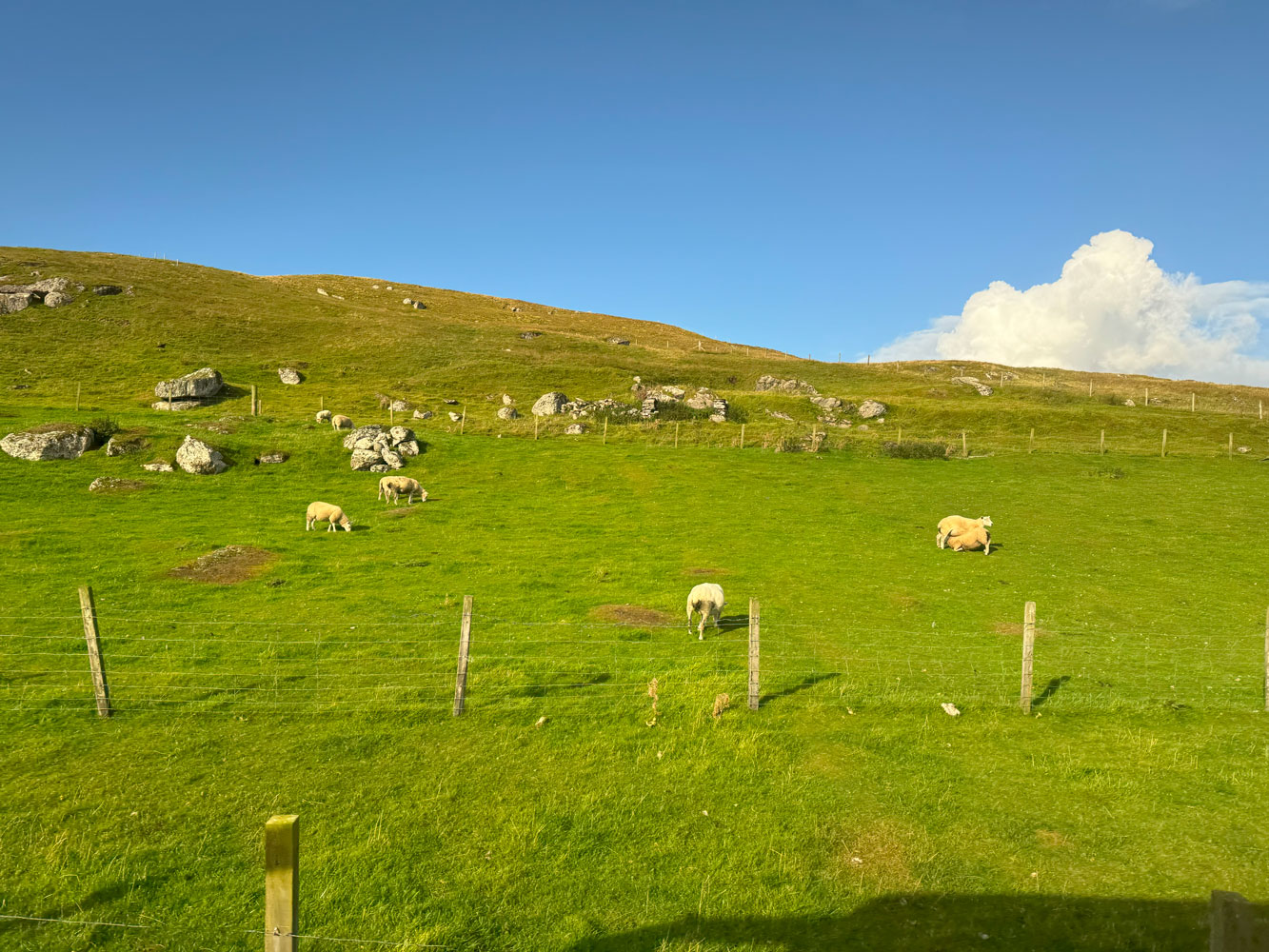
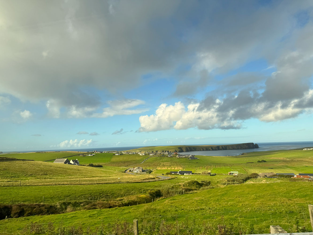
We drove through the countryside, mostly through grazing lands for sheep, a few cows, and a few Shetland horses. Here are a couple of pictures of the area.
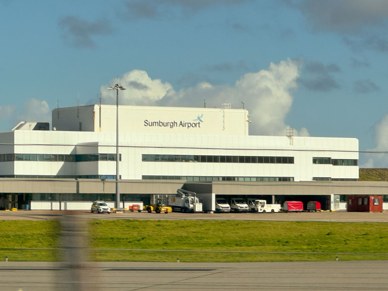
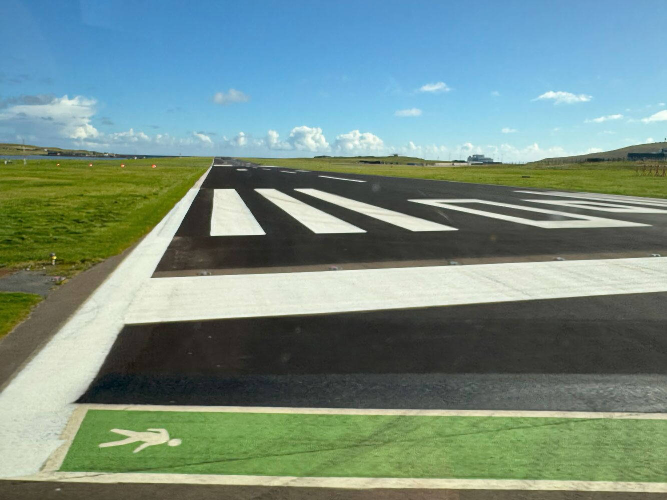
The Sumburgh Airport is located at the end of the road and the Jarlshof archeological site is just past the airport. The airport was originated in 1936, and was used by the RAF during World War II. There were three runways during that time, the longest being only 730 meters. The main runway today is 1,500 meters, barely enough for a 737.
Here's a satellite view of the airport. You can see that the primary runway runs completely across the island - in fact, it looks like they extended the runway on the east side with fill. On the left side of the picture you can see the public roadway crossing the primary runway.
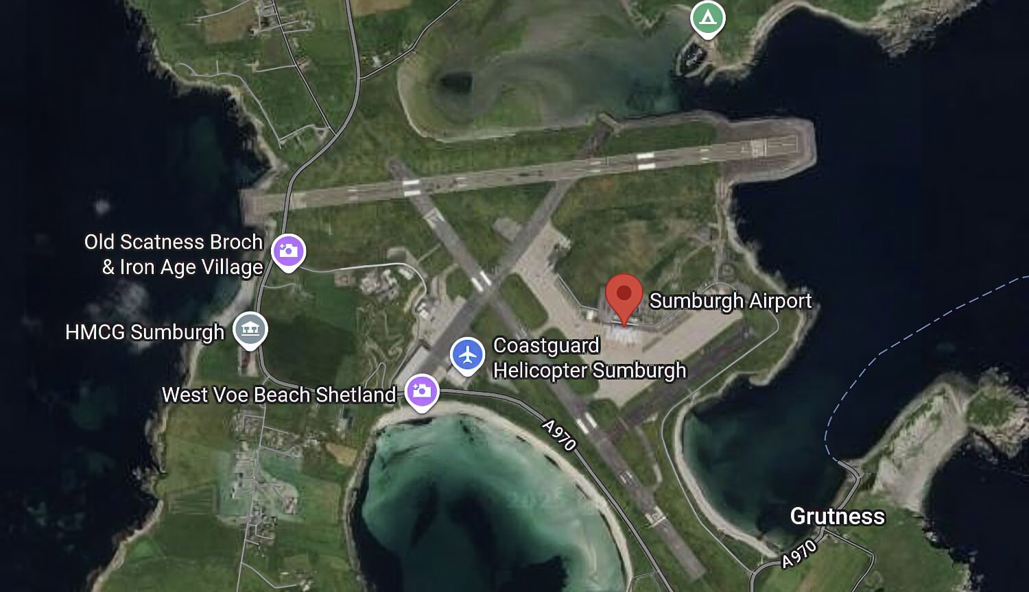
To get to Jarlshof, you have to cross the airport runway. There's a gate station on either side of the runway and they stop traffic when a takeoff or landing is going on.
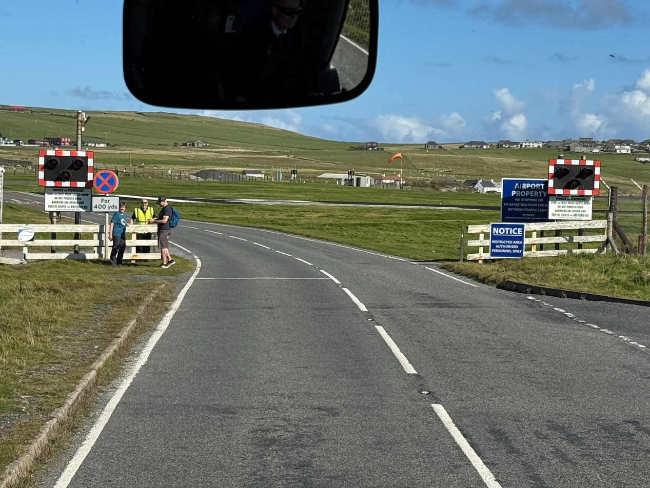
Here we are approaching the runway. They want to make sure you don't turn left or right.
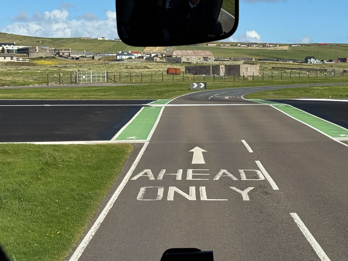
Here's a look down the runway as we crossed over it.
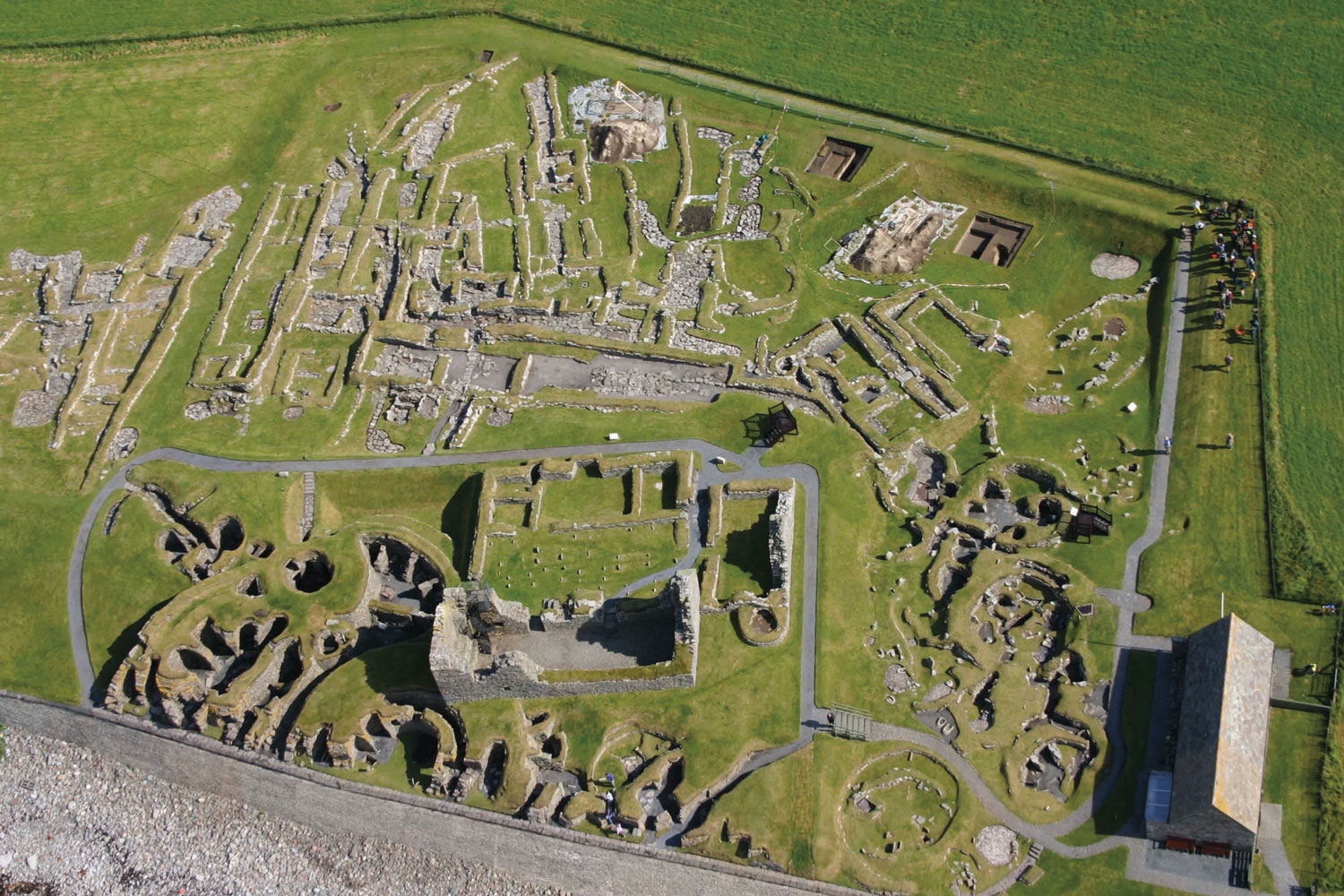
We proceeded to Jarlshof. There's a broch there, which is an iron age fort. The area has been inhabited since 2500 BC and up to the 17th Century. Here's a good article about Jarlshof.
An overhead view of the site. The broch is the semicircular structure at the bottom of the picture. The shore has been eroded and only half of the broch is left.
The large structure in the lower center of the picture is from the 17th Century.
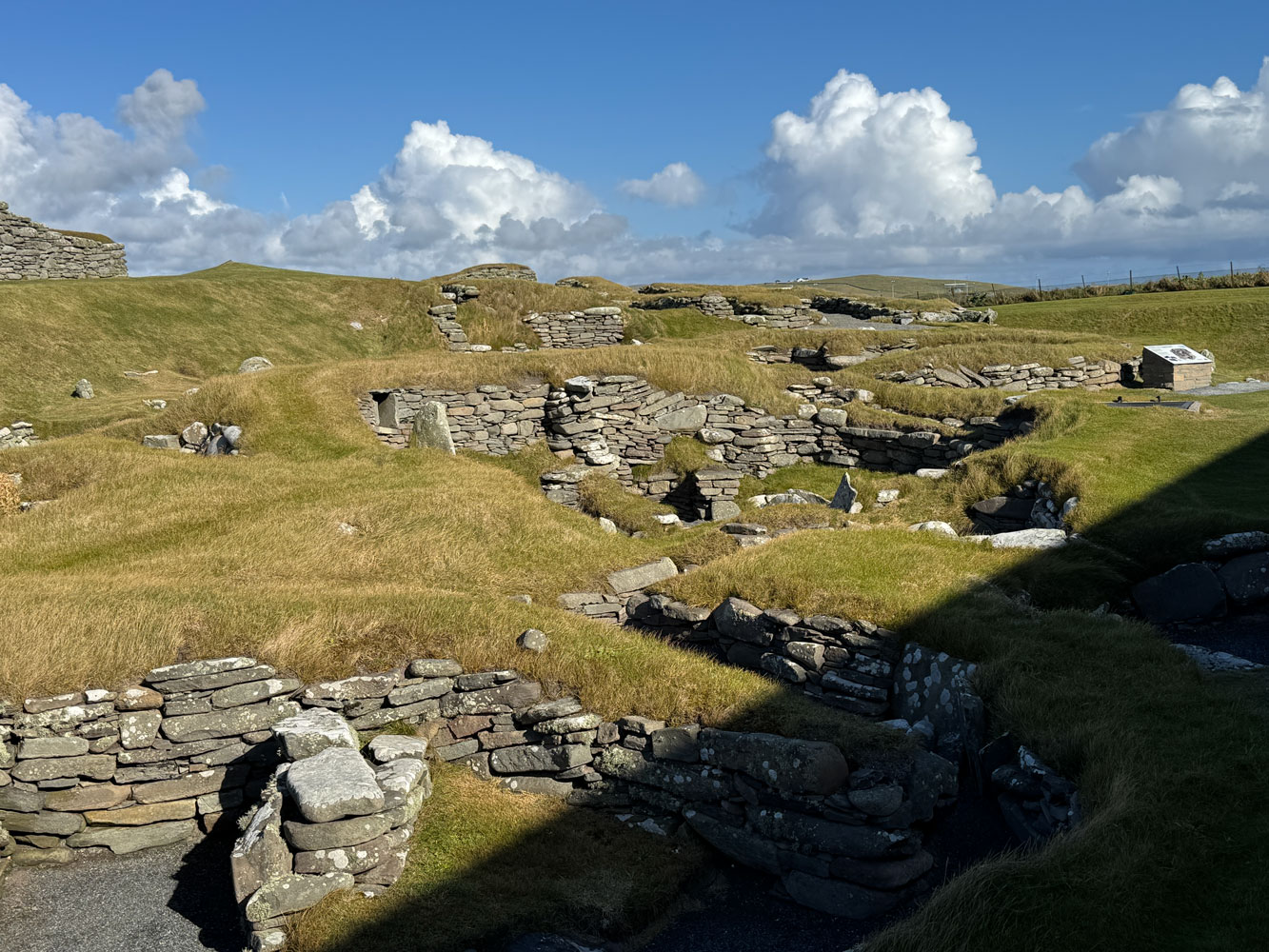
A view of some of the archeological area from the ground. The earliest portions are thought to be from Neolithic times.
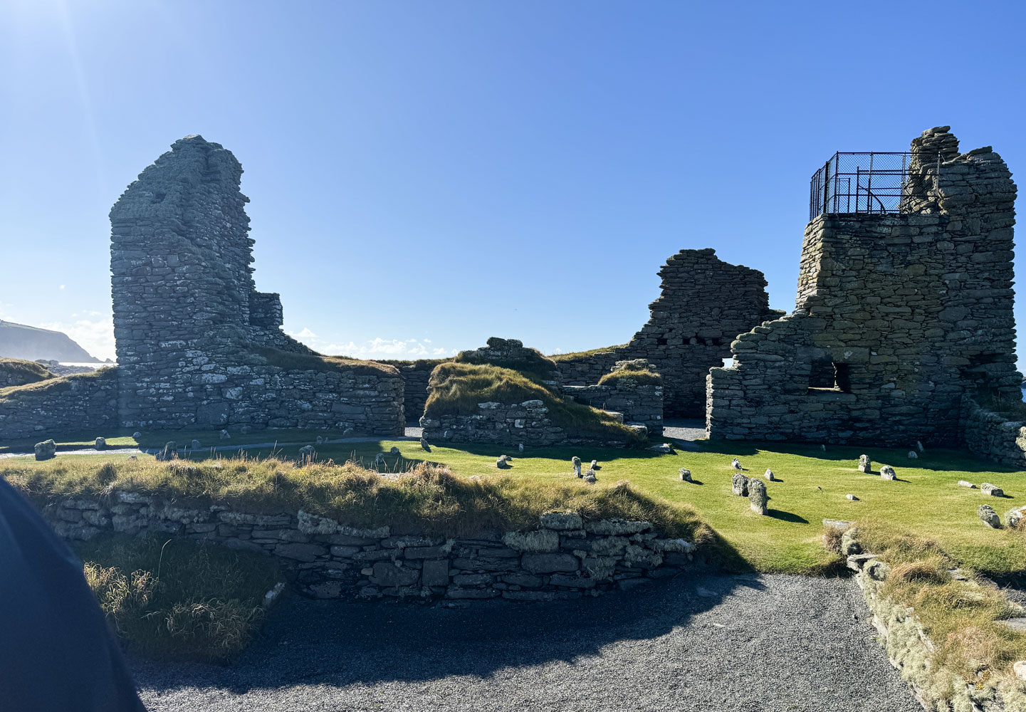
This remaining structure is from the 17th Century.
I took a bunch of pictures but they all just look like a pile of rocks. Best to read the links if you're interested in the site.
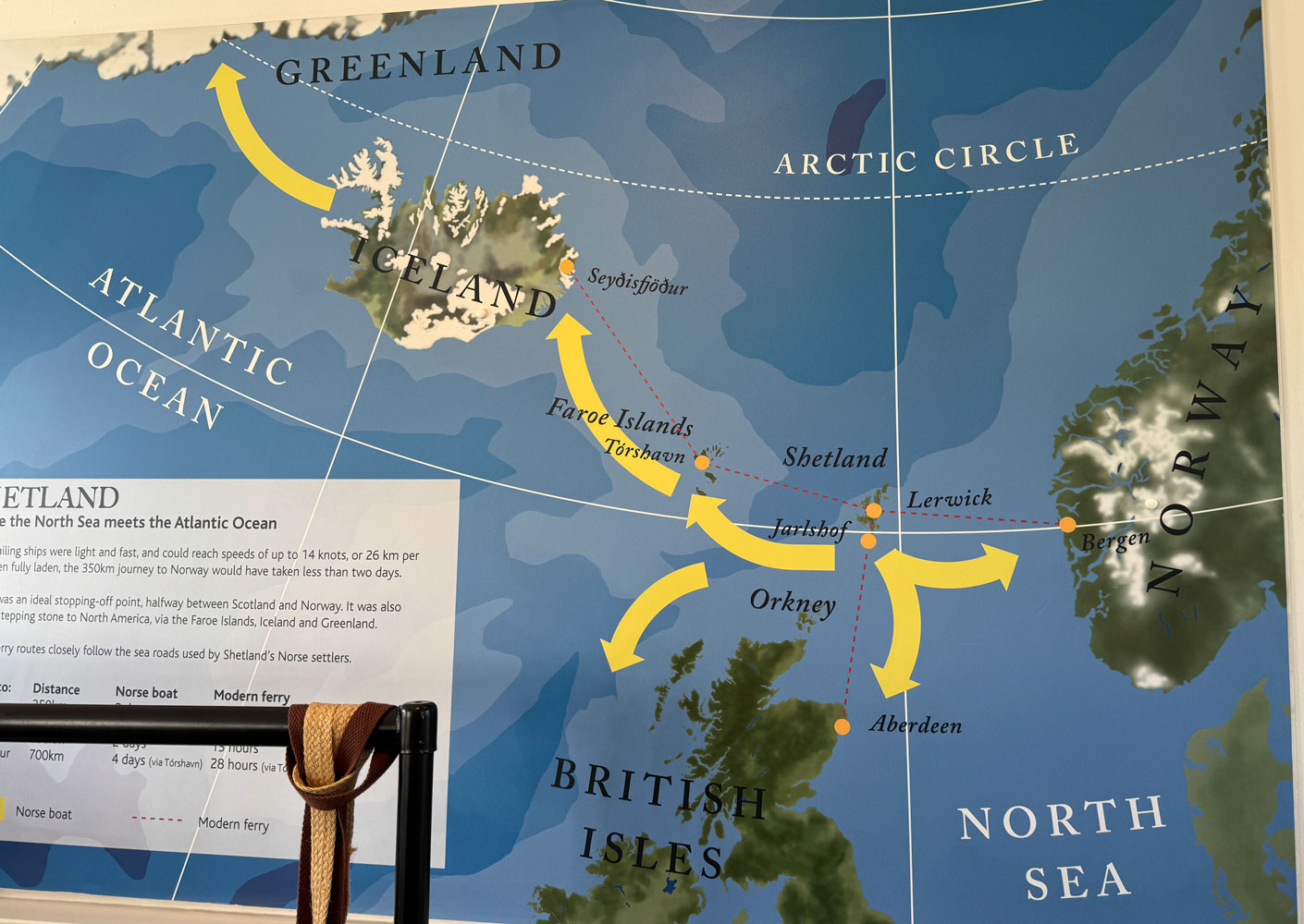
I took this picture in the Gift Shop because I thought it showed how the Shetland and Faroe Islands were stepping stones for the Vikings to get to Iceland, Greenland, and Scotland.
Along the ride, both to Sumburgh and back, I noticed the silage bales were wrapped in black plastic rather than in white, as in Norway. I asked the tour guide but she guessed that it was simply the most available.
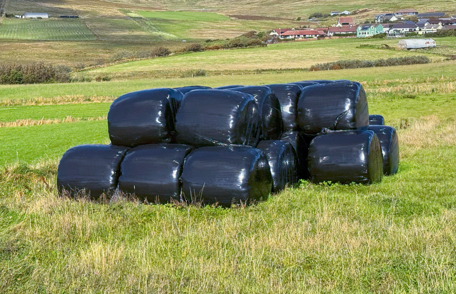
In doing some research on the web, the general opinion is that white is better because the black plastic causes higher temperature in the bales, which negatively affects the silage process. However, the black plastic is lower cost and the loss of silage may be less than the cost difference of the plastic.
Our final stop was the village of Hoswick for the Hoswick Shopping Experience.
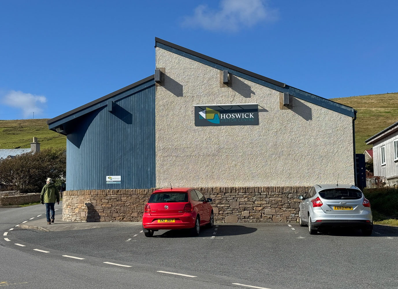
However, there were only two stores in Hoswick other than the Visitor Centre - a jewelry store and a woolen goods store. We learned that the village of Hoswick is where the tour guide had been born.
Eventually, we continued on to Lerwick, arriving at the ship about 1:30pm.
We had lunch, played one of the Regent games, then Trivia where we bombed, and dinner.
That was the end of our day. Tomorrow we go to Invergordon in Scotland.
+++++++++++++++++++++++++++++++++++++++++++++++++++++++++++++++++++++++
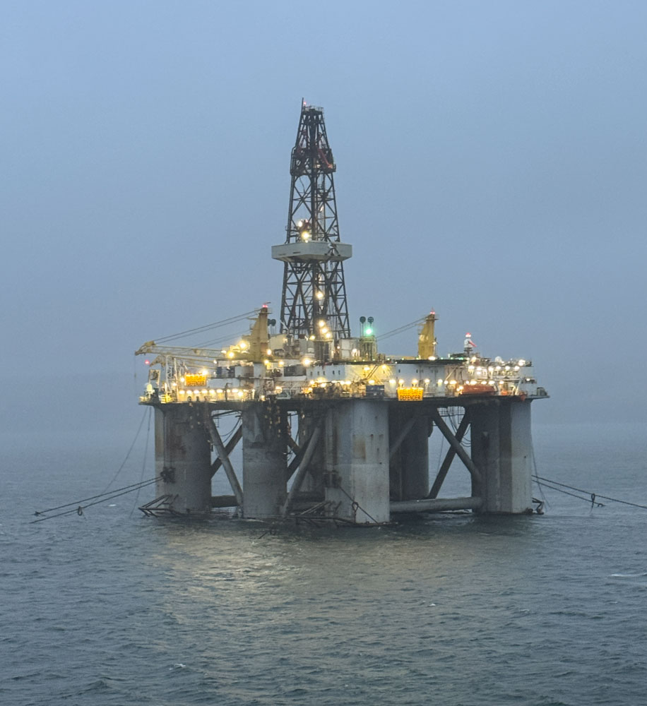
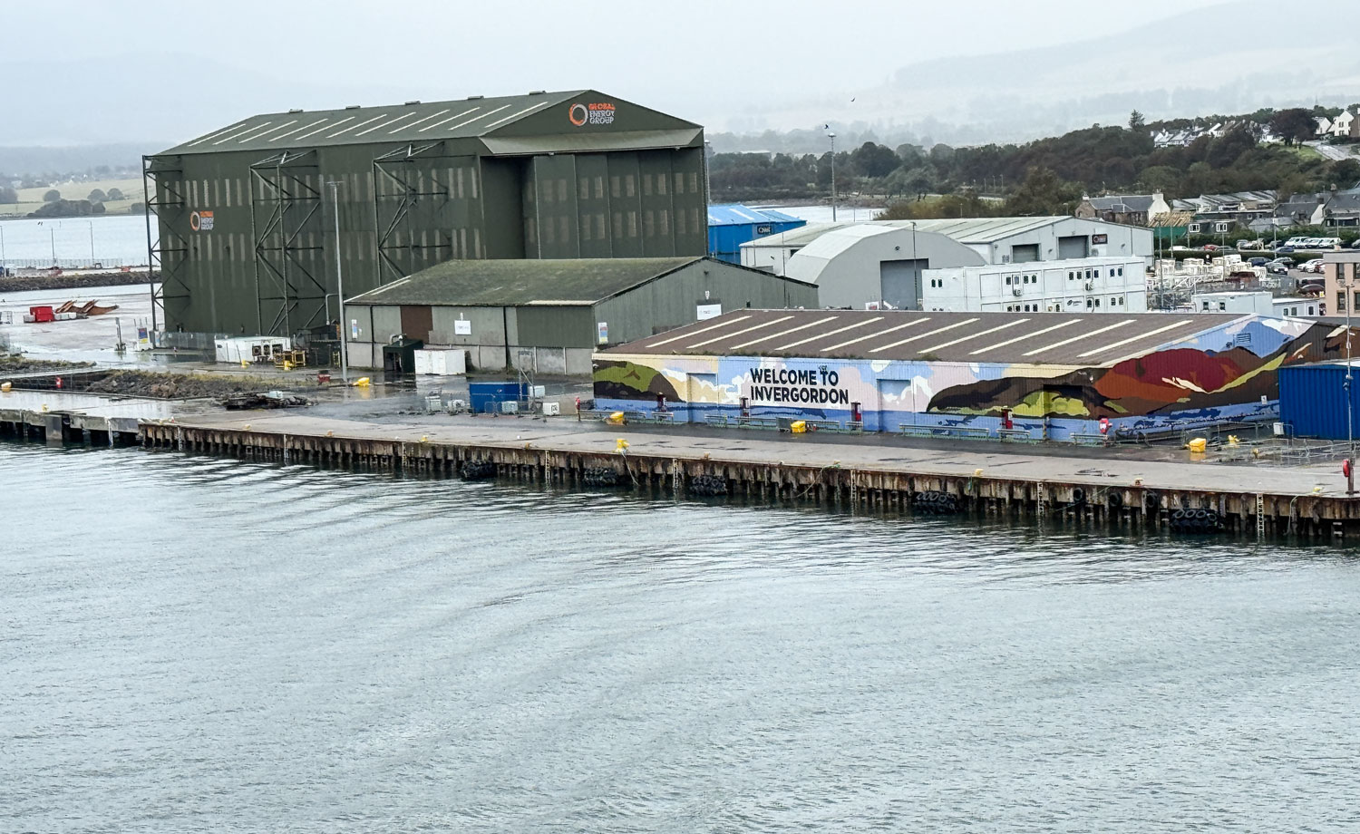
9/15/2025 (Monday) We docked in Invergordon this morning about 7am. As we were coming in to Invergordon we passed an oil drilling rig.
Here's the dockage area of Invergordon. We didn't dock there, but to the left in the picture.
Our excursion was to have been to Inverness which is about 25 miles from Invergordon.
We had chosen the "Inverness on your own" tour because almost all the other tours were to various castles, and we had seen enough castles in our travels.
It was cold and raining when we arrived so we decided to just stay on the ship. Although you can't see the rain, here's what it looked like when we arrived.
The "tour" would have put us in Inverness for 4 to 5 hours, on our own, in the cold and rain, 25 miles from the ship. I suppose we could have caught a taxi back to the ship if we wanted to return early, but we were not that curious about Inverness.
We just took it easy on the ship, played the Regent games, and did Trivia in the afternoon (we came out second).
Then dinner and to bed. Tomorrow is Edinburgh which we visited in May 2018.
+++++++++++++++++++++++++++++++++++++++++++++++++++++++++++++++++++++++
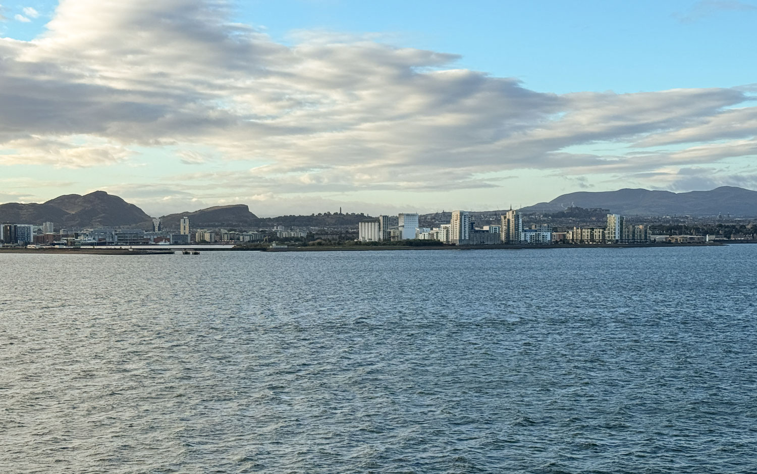
9/16/2025 (Tuesday) We arrived in Edinburgh this morning about 7:30 but did not dock. We're going to have to tender in to the city. The temperature is a bit cool, low 50's, but it's a bright, sunny day.
Our excursion is not until the afternoon, so we're able to take it easy this morning.
A view of Edinburgh from the ship.
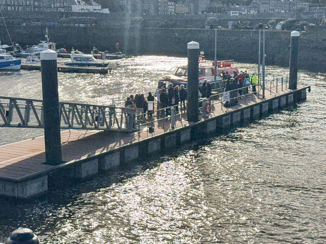
The crew was preparing the tenders to take us ashore.
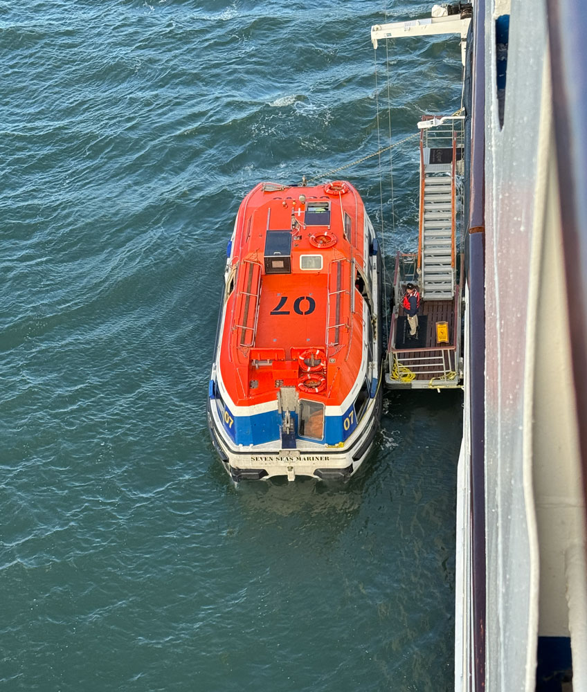
We relaxed until about 11:15 when we went down to the fourth deck to board the tender.
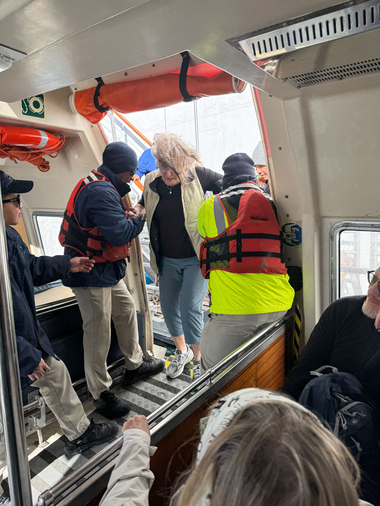
It took about 20 minutes for the tender to get to shore. When we got there the buses were not ready so everyone just stood around until things were sorted out.
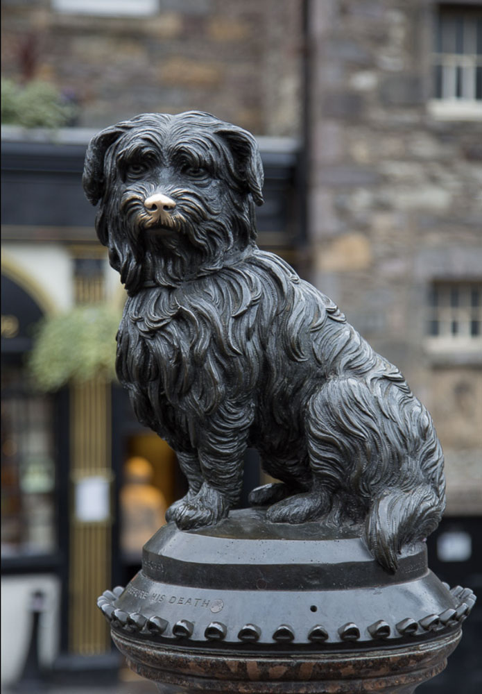
Eventually, we were able to board the buses and we started off for the Edinburgh Castle. Along the way, we passed the statue of Greyfriers Bobby. The dog, Bobby, is reputed to have gone daily to his master's grave for 14 years, until his death in 1872. People rub his nose and that's why it's so shiny. The accuracy of the story is questioned, but its a sweet statue.
Eventually, we reached the castle. Judy and I had visited the castle during a previous trip in 2018.
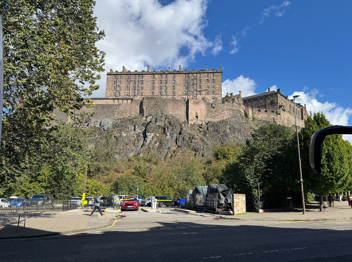
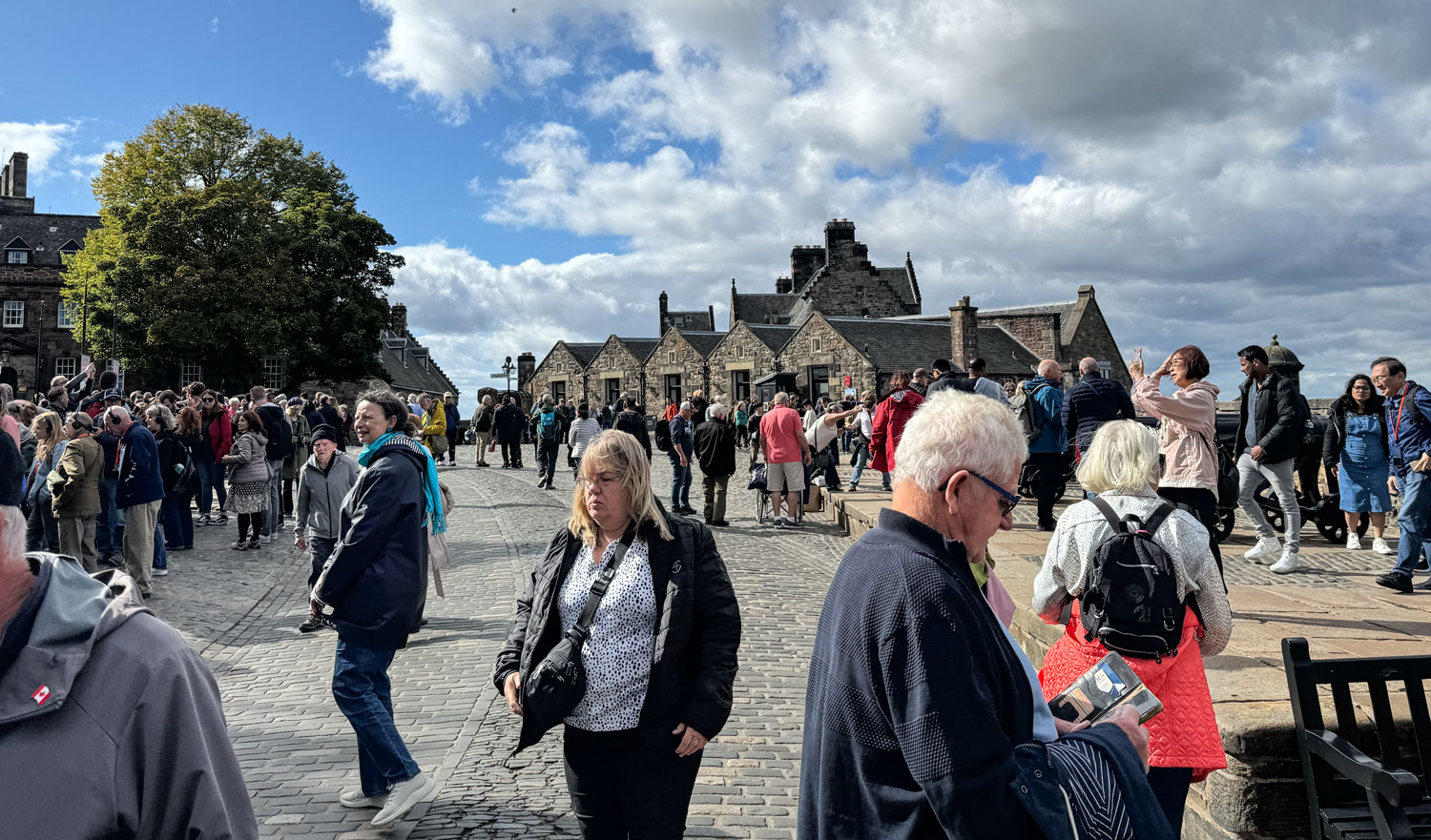
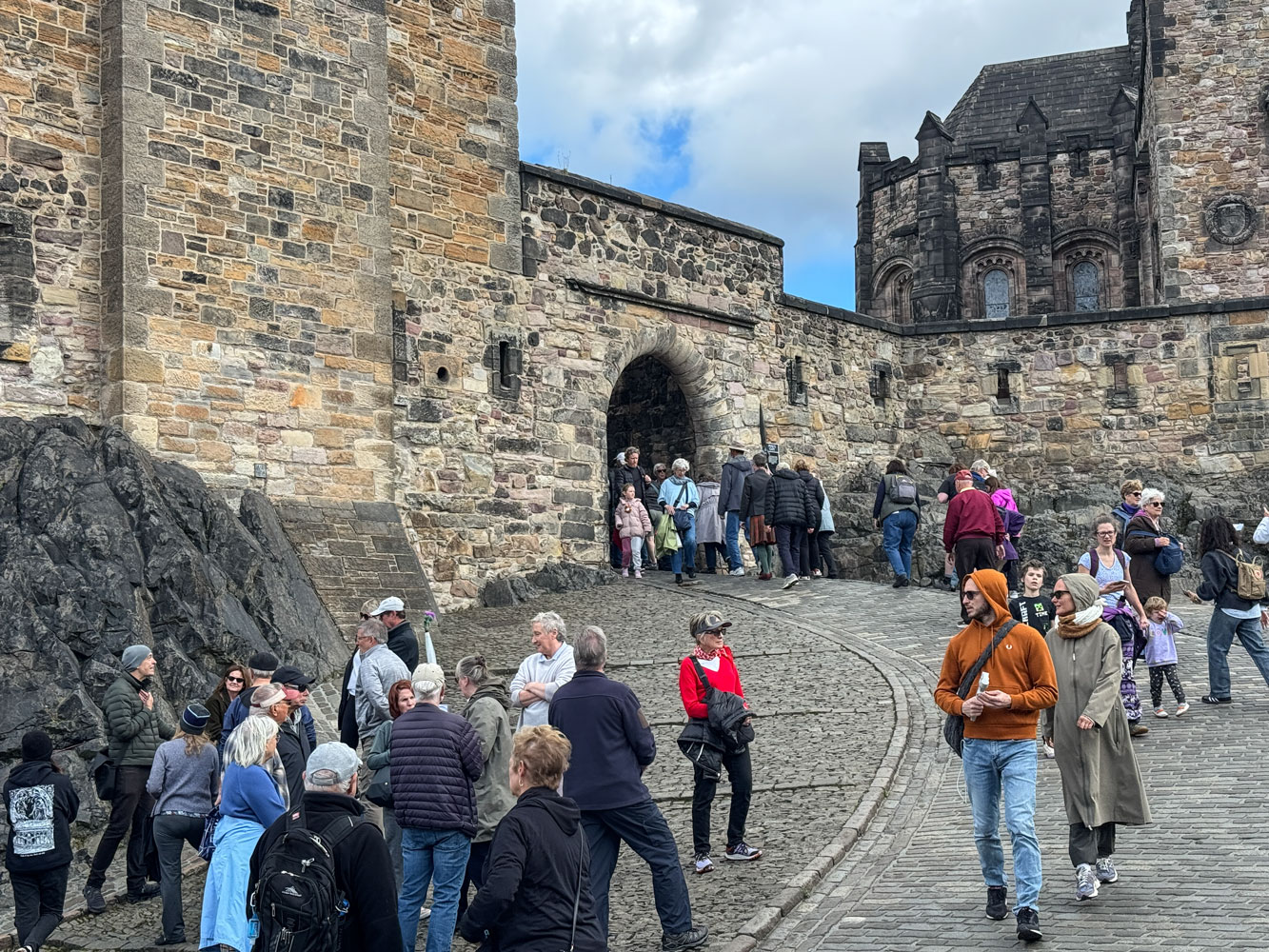
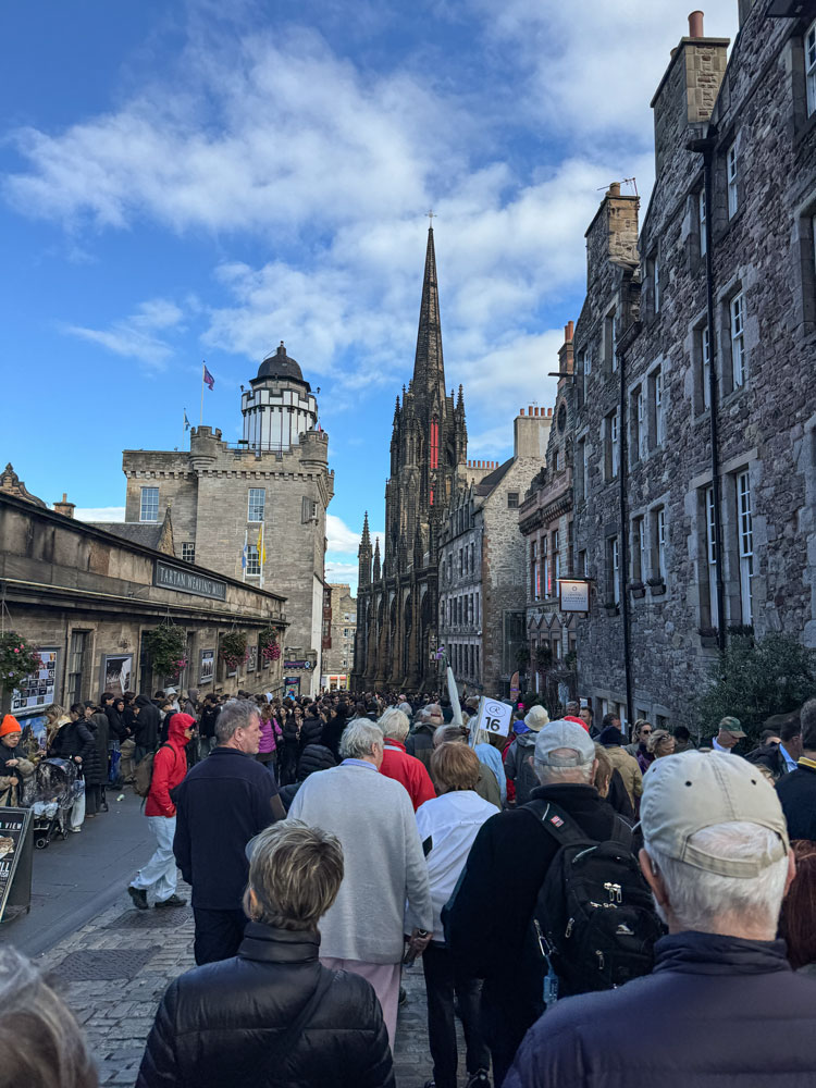
We had an uphill walk to get to the entrance. Unfortunately, when we got there, it was a real zoo - there were many, many people waiting to get into the castle.
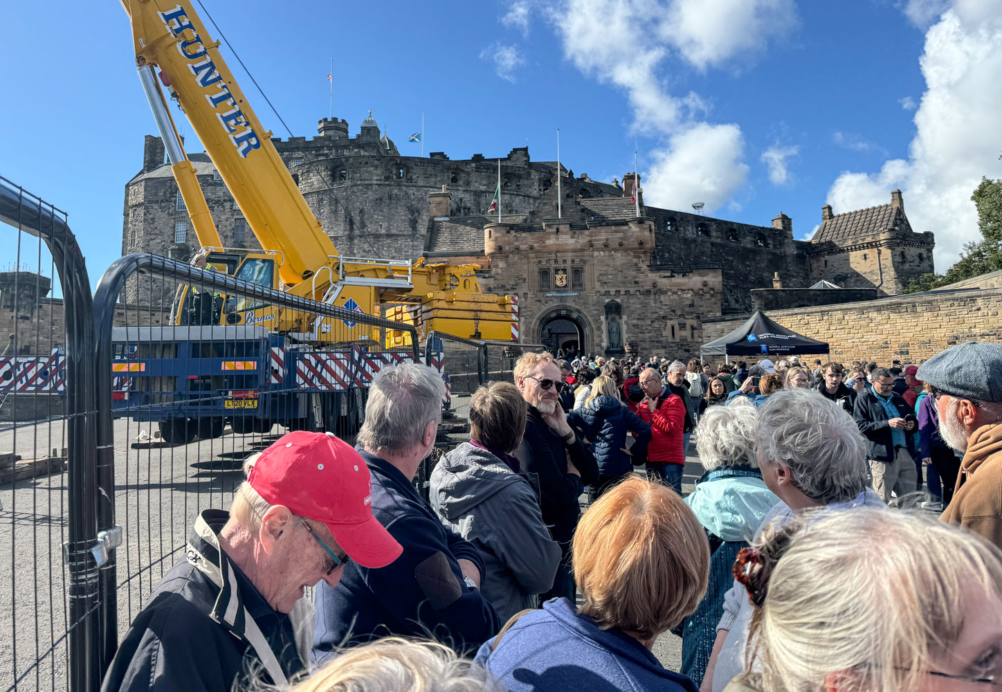
Part of the forecourt was taken by stadium stands that had been set up for the Military tattoo which was held back in August. I'm told that they set up the stands several months before the show and then tear them down after the show. It looks like a lot of work.
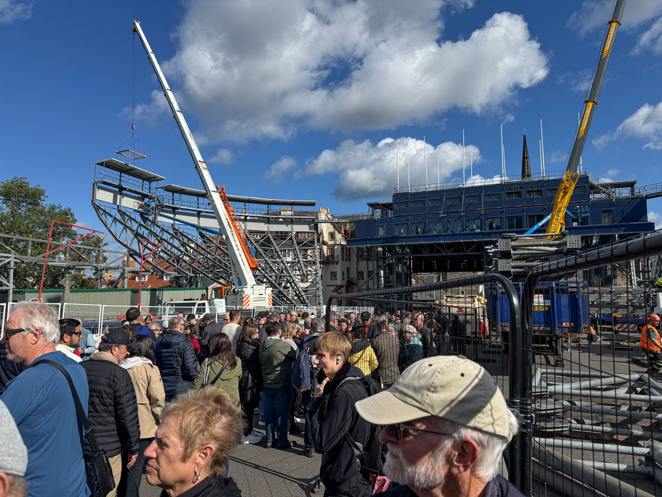
We had to wait about 40 minutes before the tour director got tickets for us and then we worked our way up to the entrance. No lines, just everyone pushing to get to that tent where our tickets would be scanned.
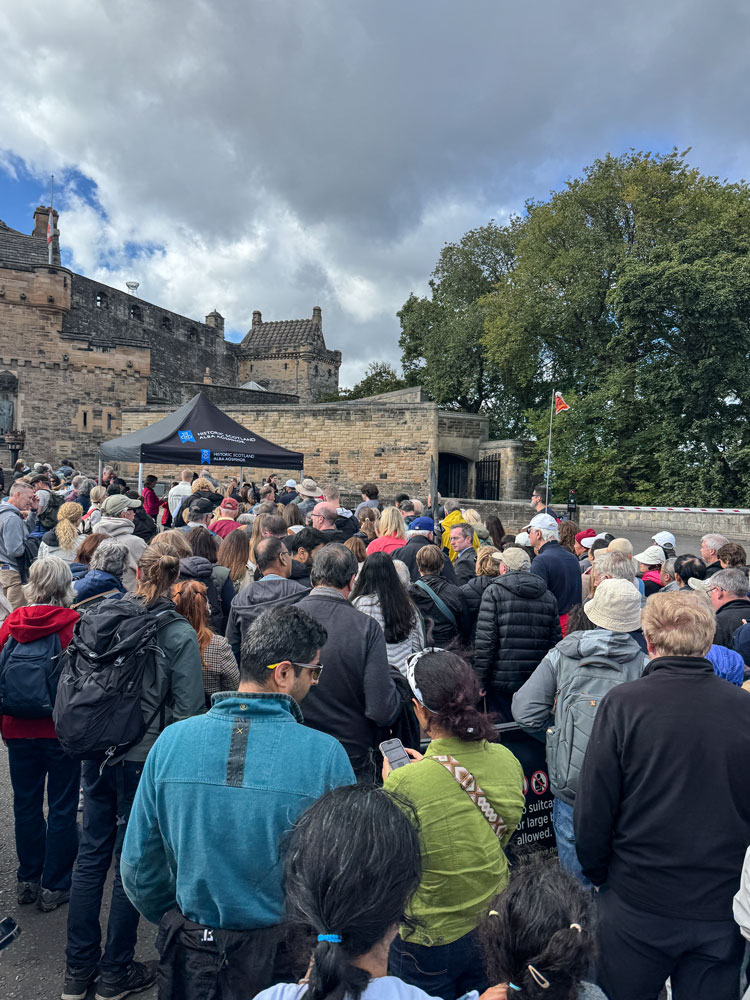
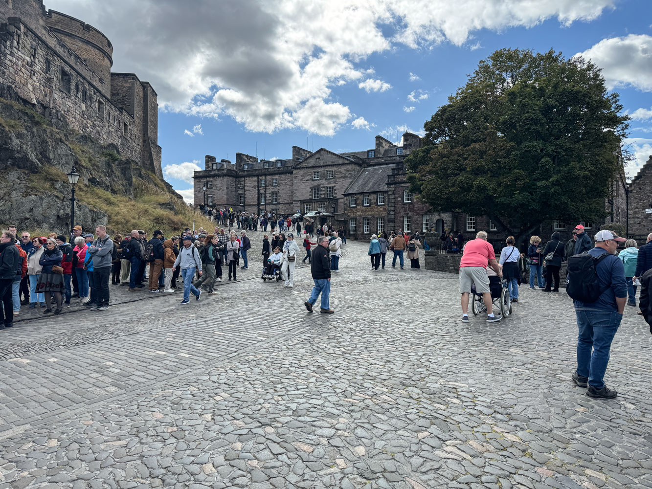
Eventually we made it through the ticket tent and were at the entrance.
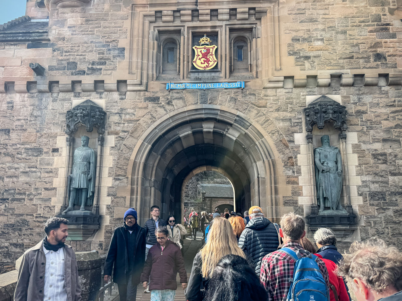
We walked uphill to the main gate.
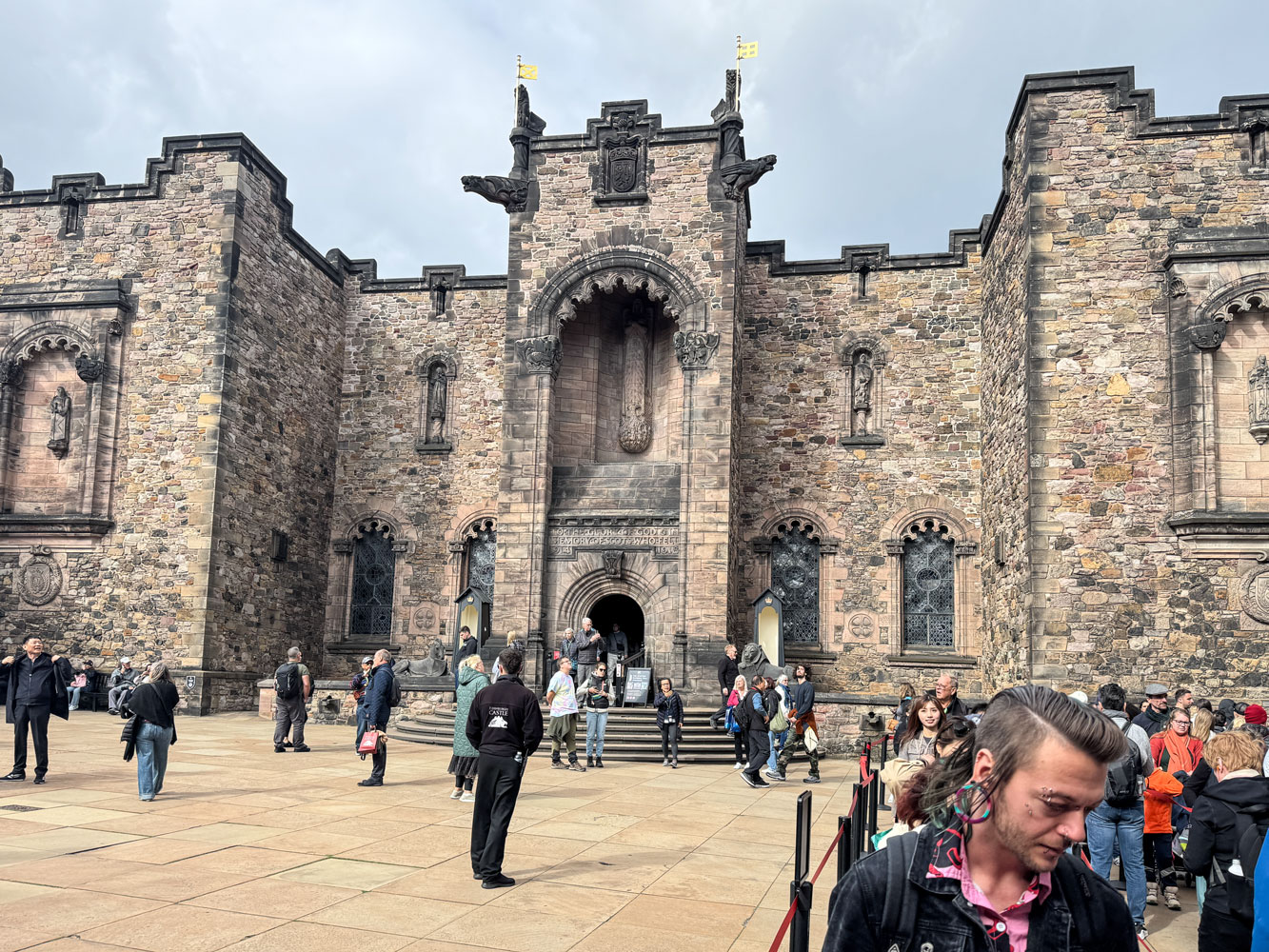
A view of the area beyond the main gate.
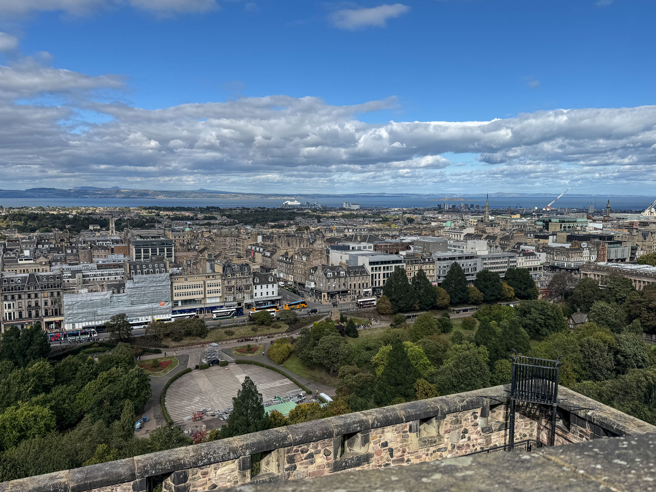
From here we could look down on the city. You can see the Mariner in the far distance.
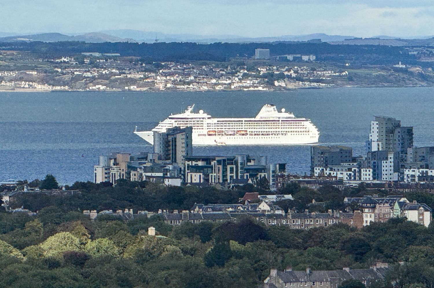
A telephoto shot of the Mariner.
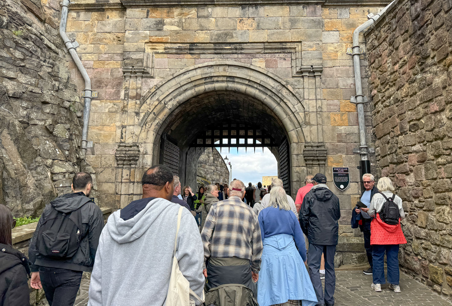
A view a bit further into the castle.
We went up one level.
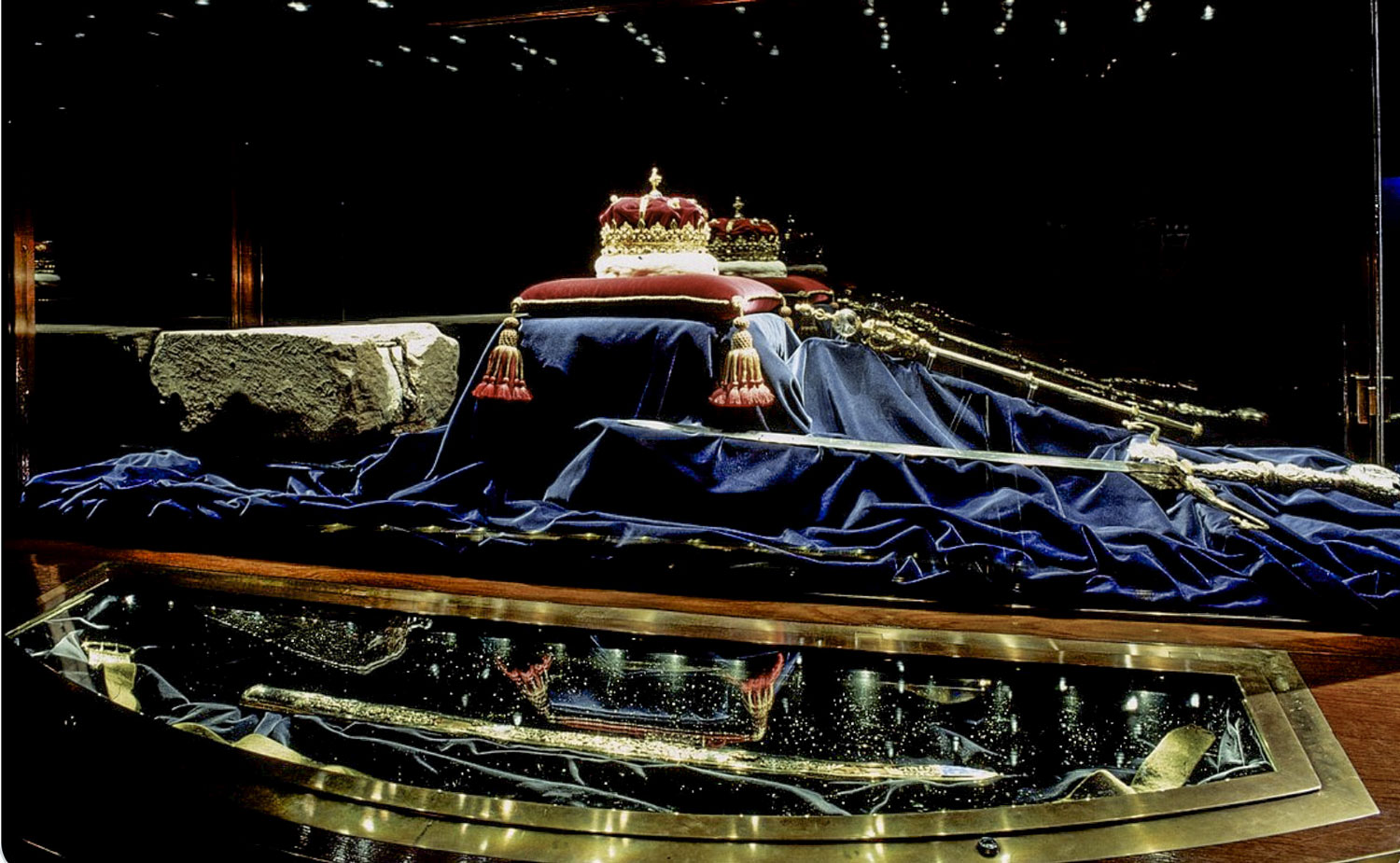
We went up to Crown Square where the memorial to the Scottish soldiers killed in World War I is located. Wen went in, but photography is not allowed, so no pictures.
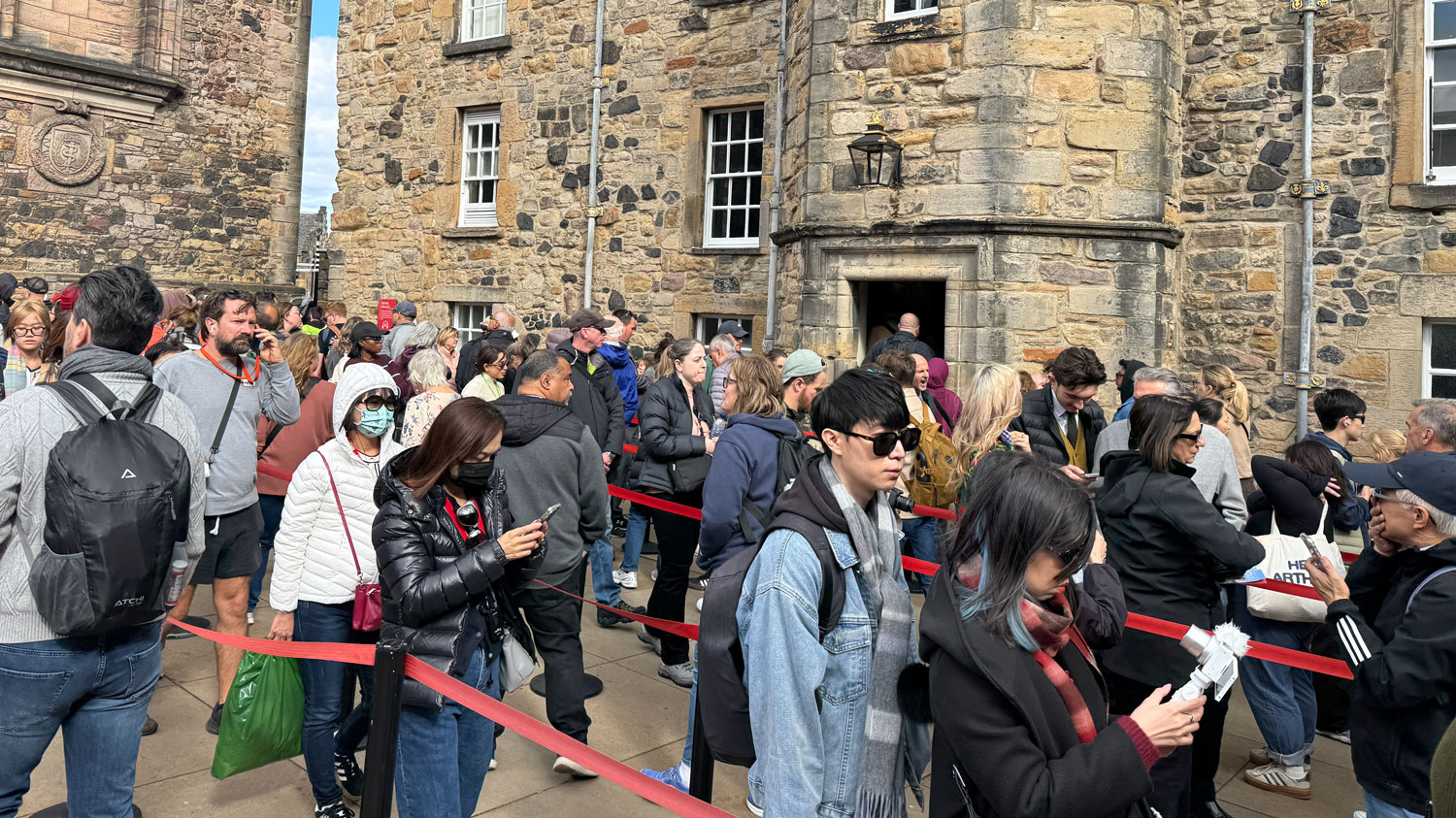
Then we stood in line to see the Scottish crown jewels. The line moved quickly.
Photography was not allowed but through the magic of the Internet, here's a picture of the jewels.
The crowds were just a bit too much for us and we eventually went down to the cafe and had a cup of coffee. Then we met the tour guide and walked back to the bus.
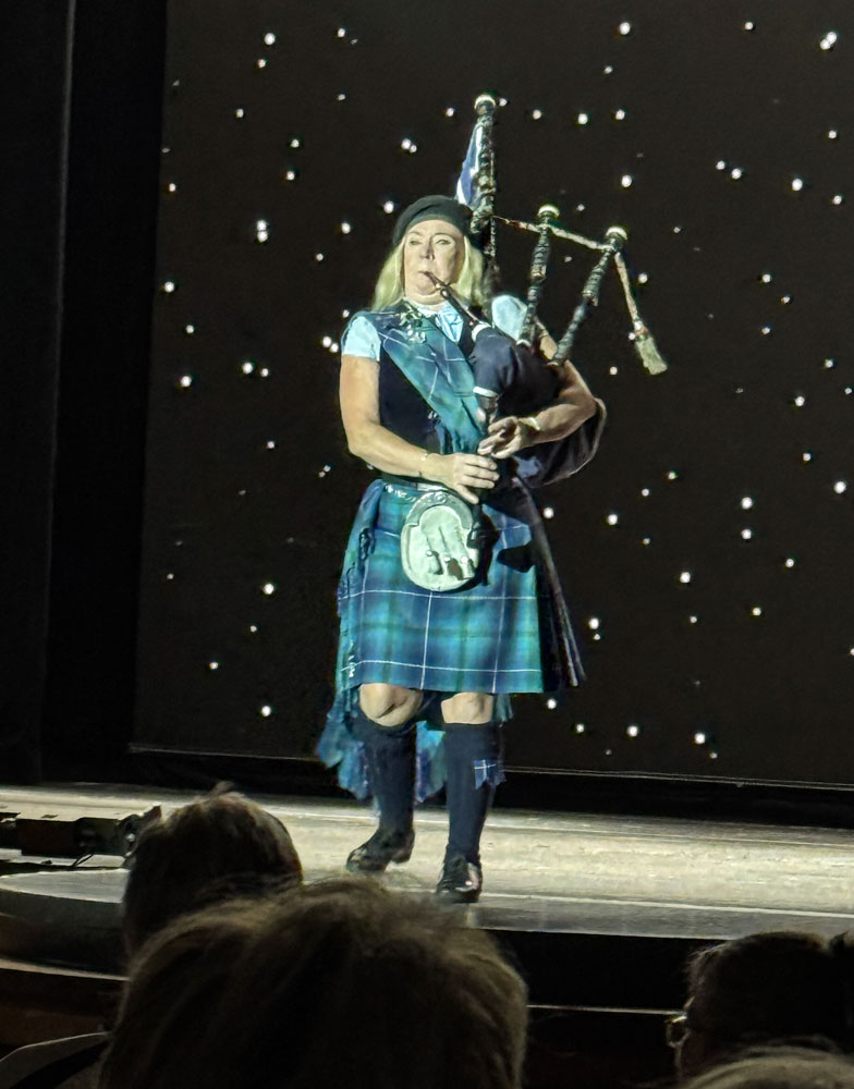
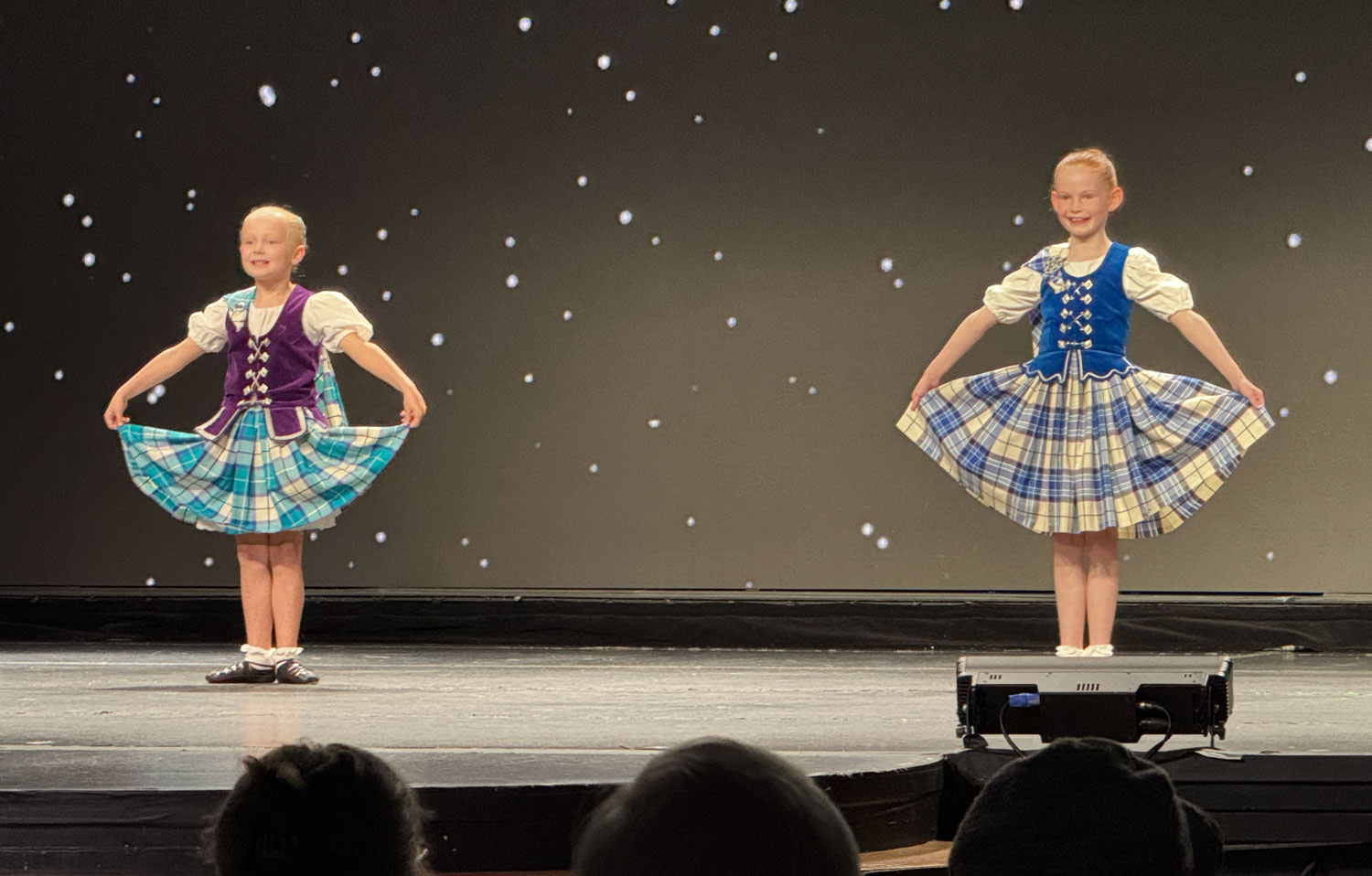
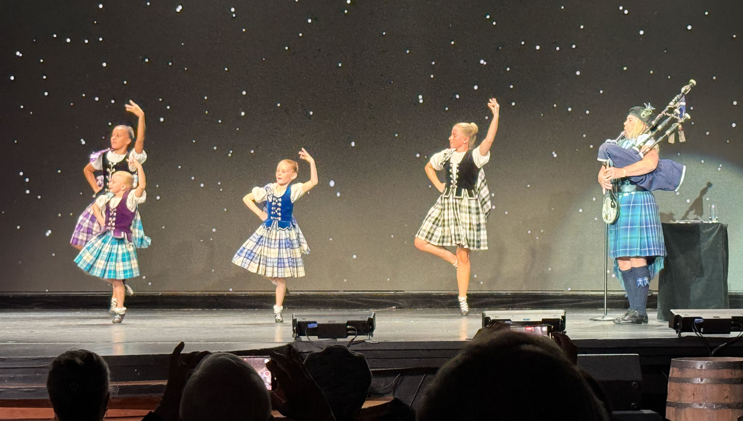
When we got back to the port, another bus had arrived shortly before we did and was loading on the tender. We had to wait. Waiting with us was the group of entertainers for the evening, a group of Scottish dancers and a woman bagpiper. They were National Scottish Champion performers.
We went down to the theater at 5:30 for the show and the theater was full.
Here's the bagpiper.
There were four dancers. Here are the two older girls.
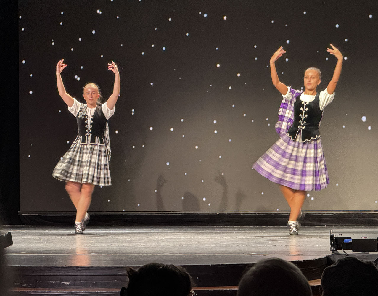
And the two younger girls. They were adorable.
The whole troupe performing.
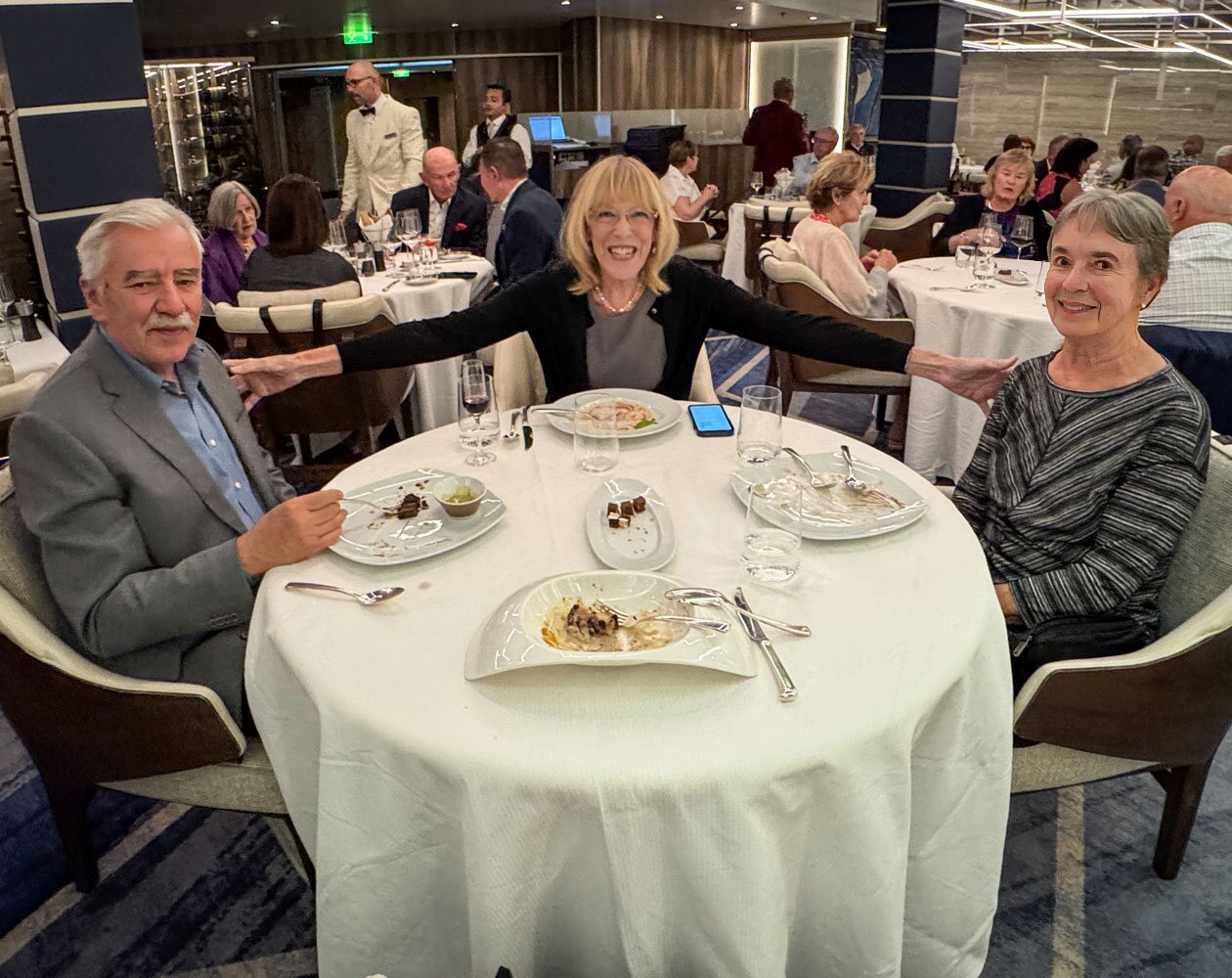
Then it was to dinner at Prime 7 with Eva and Richard.
That was the end of our day.
Tomorrow we arrive at the Port of Tyne which is the entry port for Newcastle. We'll visit the Durham Cathedral.