Oslo to Amsterdam
August 30 to September 18, 2025
Mike and Judy Henderson
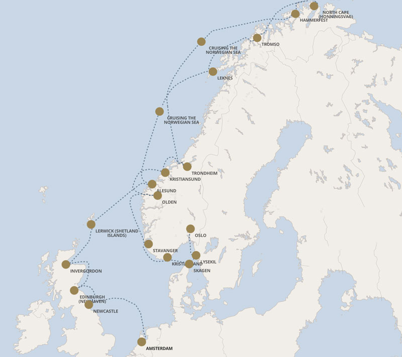
I'll leave this map up for reference.
++++++++++++++++++++++++++++++++++++++++++++++++++++++++++++++++++++
9/3/2025 (Wednesday) We arrived in Stavanger this morning.
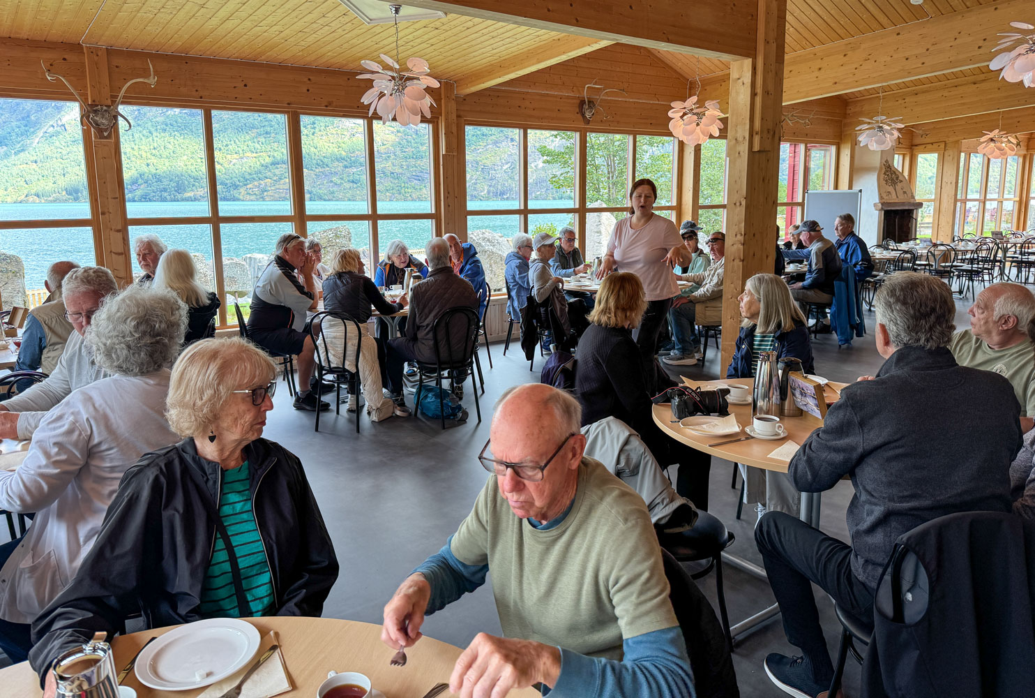
Our 9:30 excursion meant we didn't have to rush this morning. This excursion is mostly viewing the scenery from the bus, but we will also stop for some Norwegian waffles.
We left Stavanger and proceeded along Norwegian route 13, which takes us through two notable tunnels: the Hundvåg Tunnel which is 5.5km long, and the Ryfylke Tunnel, which is 14.4km long and 292 meters below sea level at its deepest part. It is the deepest and longest traffic tunnel in Norway. The two tunnels are part of the Ryfast Project. One of them went almost directly under our ship, according to our guide.
The Ryfylke Tunnel will lose its title to the Boknafjord Tunnel, part of the Rogfast Project, when it is completed in 2033. The Boknafjord Tunnel will be 26.7km long and 392 meters below sea level at its deepest part and will carry traffic for Norwegian route 39.
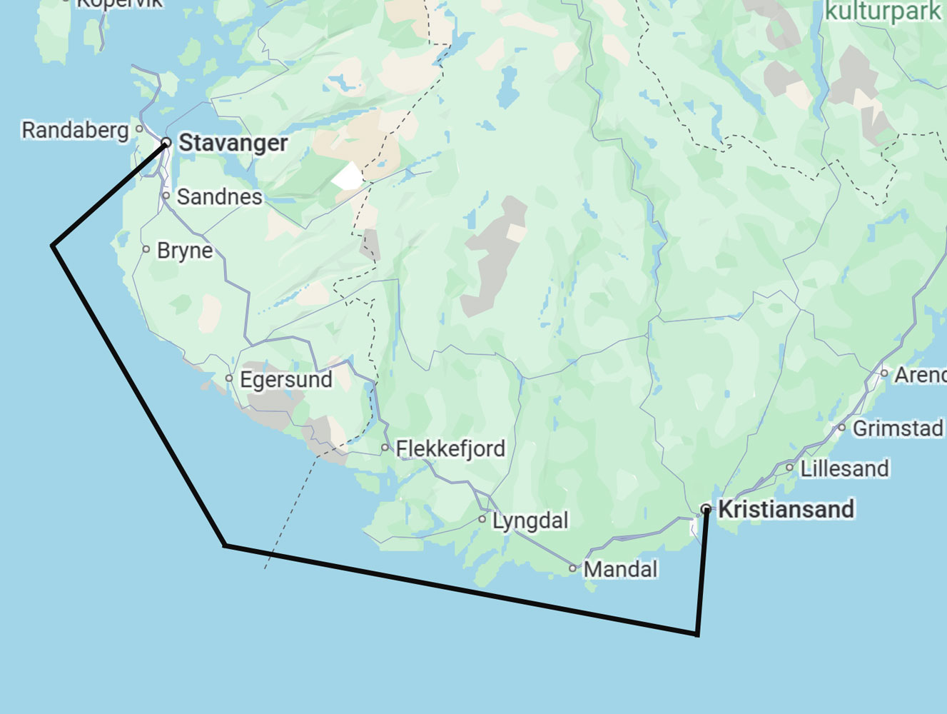
Finally, here's a map of our excursion. We start in Stavanger, take route 13 to route 523 all the way to Oanes. We will stop in Jørpeland for waffles.
It was interesting to hear about the tunnels, but pretty boring to go through them - not much to see.
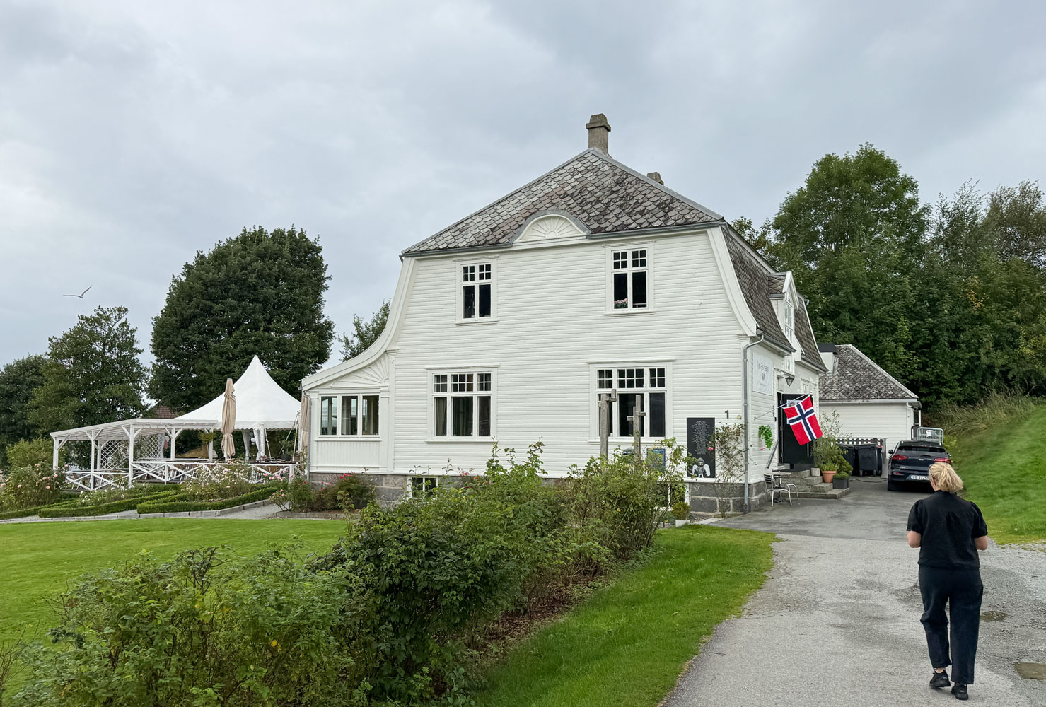
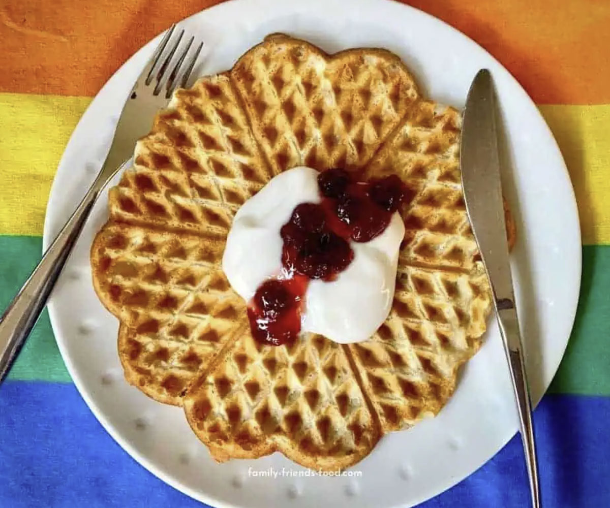
We stopped in Jørpeland at the Villa Rosehagen for Norwegian heart waffles.
I forgot to take a picture of the waffles, but here's one from the web. They were served with sour cream and strawberry jam, just as shown in the picture. They were slightly sweet and very tasty.
Incidentally, Norway celebrates Waffle Day, on March 25th. They are a favorite food, and often used as a dessert.
After the meal, we walked through the town and visited a couple of shops. We each bought a neck gaiter for our upcoming trip to Antarctica.
When we left Jørpeland we headed down towards Oanes, but turned around just before going into the town.
The Lysefjord Suspension Bridge crosses the Lysefjord just before Oanes, but we did not cross it.
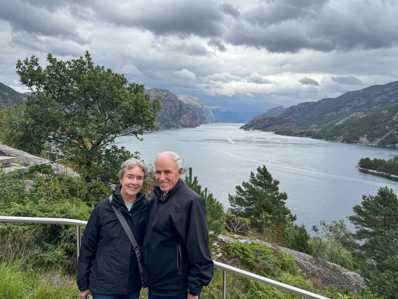
On the way back we stopped at a viewpoint for some pictures of the fjord. Lyse means light, and it is a well-named fjord.
When we reached Stavanger we stopped at the Sverd i fjell monument (Swords in the rock).
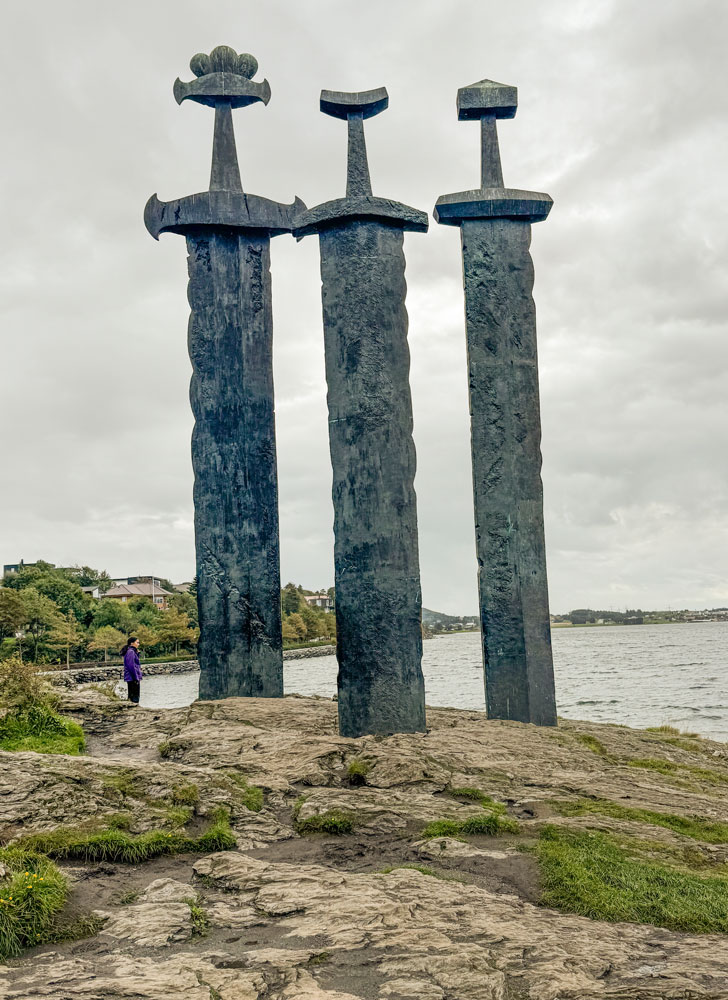
The sculpture celebrates the Battle of Hafrsfjord which occurred sometime between 872 and 900 and resulted in the unification of Norway. After the battle, the Viking king, Harald Fairhair, declared himself King of Norway.
Then it was back to the ship. We arrived about 1:30 and just made it to the restaurant for lunch - it closes at 2pm.
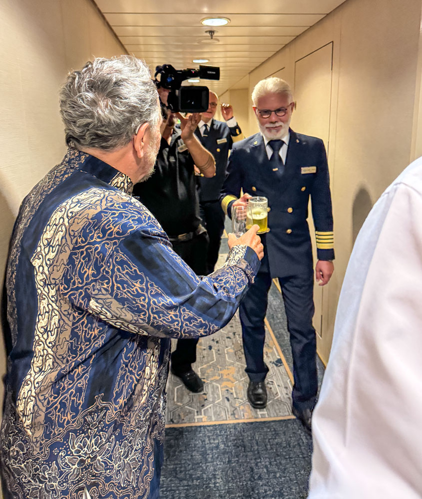
Later it was Trivia time. Then at 6pm we had the "Block Party" where everyone comes out into the hallways and meets their neighbors.
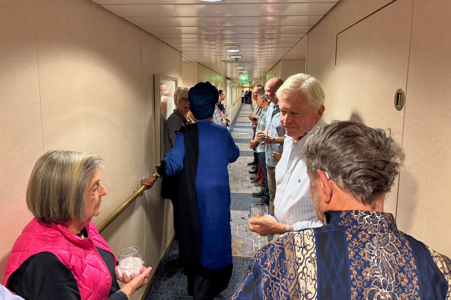
The Captain, Rosario Vasta, and a few other members of the crew came by quickly, along with a cameraman. The video will go into a video of the trip, shown to the guests at the end of the cruise.
We met Eva and Richard at 6:30 for dinner and then to bed.
++++++++++++++++++++++++++++++++++++++++++++++++++++++++++++++++++++
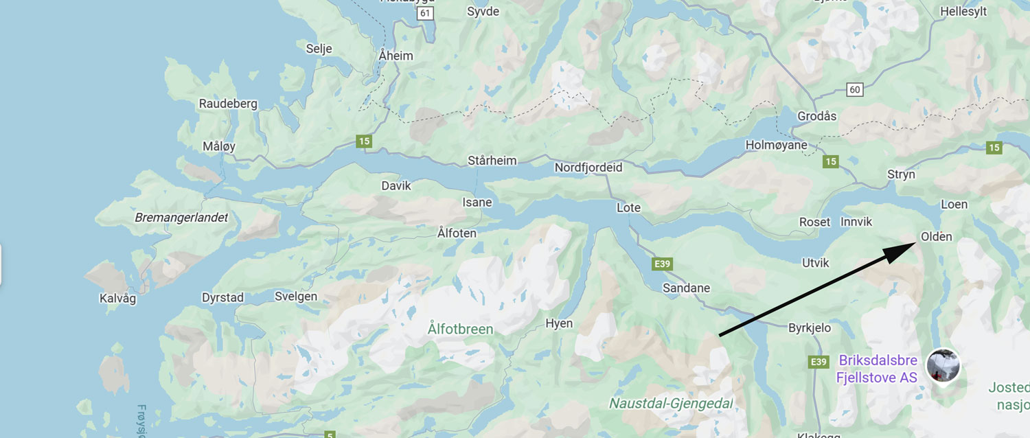
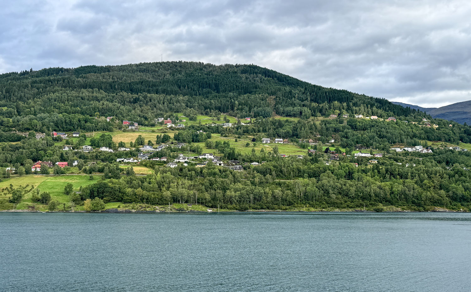
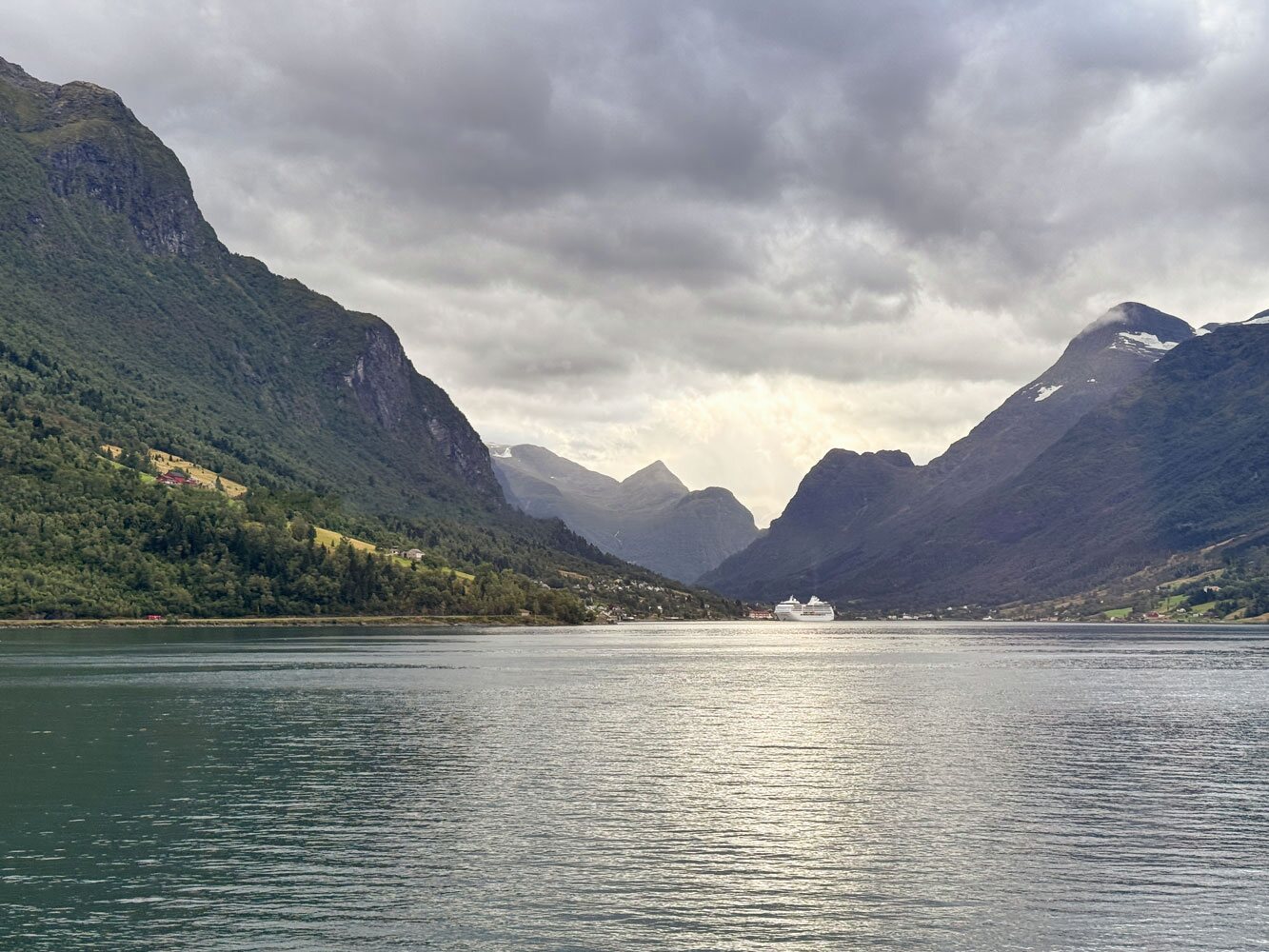
9/4/2025 (Thursday) We are heading to Olden this morning (it's at the end of the arrow in the map, below). The ship accessed Olden by first sailing the Nordfjord, then the Innvikforden. Olden is at the end of Innvikforden (about 127km from the North Sea), so it took quite a while for the ship to sail to it. The ship has to go fairly slowly in the fjord. A surprising number of farms and small villages line the steep lands of the rocky, forested mountainous sides of the fjord.
Here's one group of farms along the Innvikforden.
Eventually we reached Olden and docked. Olden is a very small town, but it's part of a larger municipality of Stryn. While the official population of Olden is only 666, I was told that the population of the municipal area is about 5,000.
Our tour today is mostly just bus riding and sightseeing, so I won't have a lot of pictures. The tour started about 11:30 so Judy and I made a sandwich, each, in the restaurant to take with us.
A view from the bus looking back toward the ship.
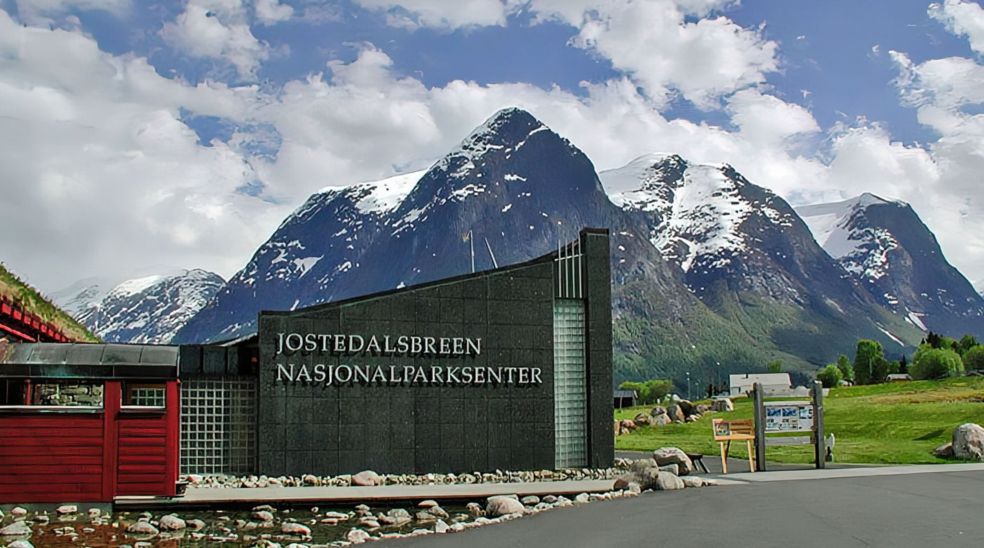
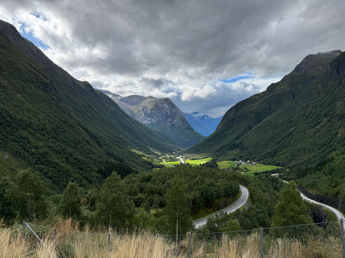
We proceeded along route 60 through Stryn, to the Jostedalsbreen National Park Center.
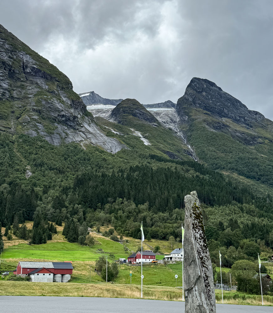
From the parking lot we could see the glaciers at the top of the mountains.
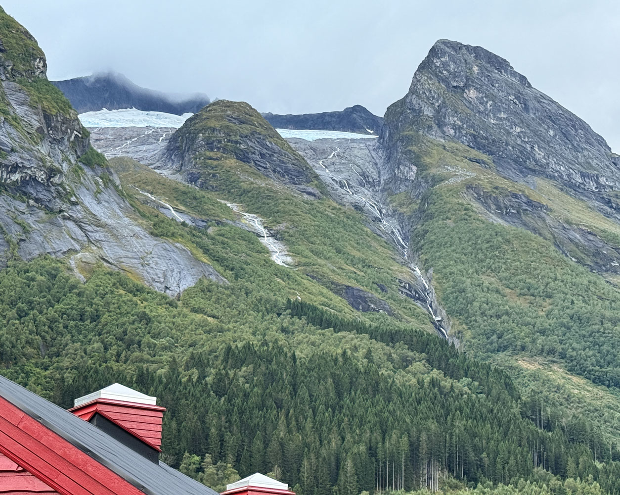
A closer view of the glaciers.
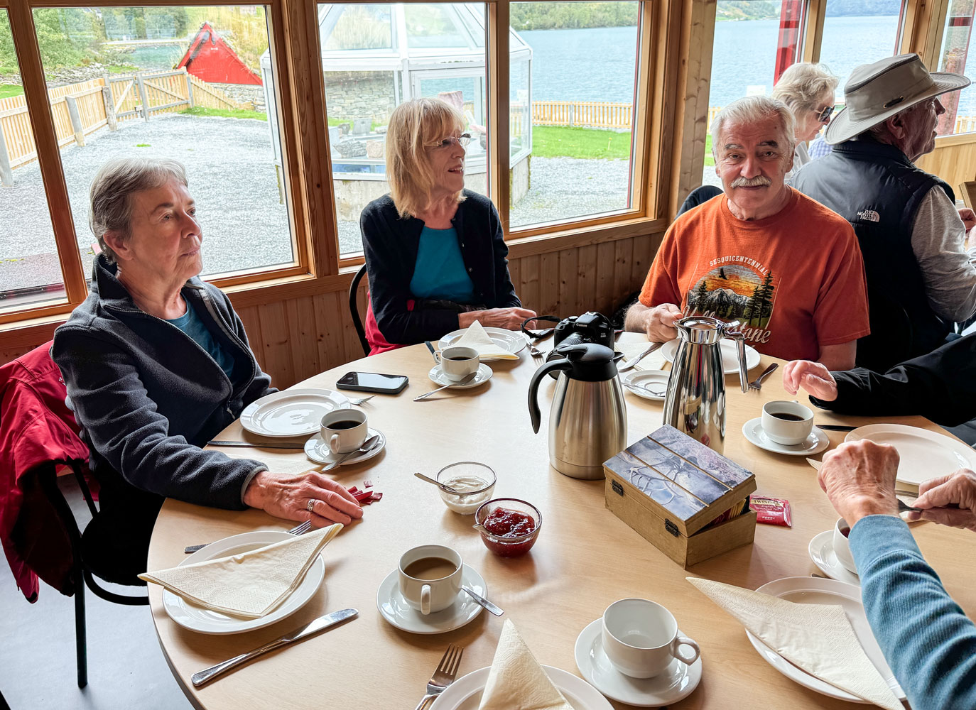
We gathered in the restaurant and had coffee and pancakes. The pancakes were regular (thick) pancakes, served cold. Nothing like the thin Norwegian heart pancakes we had yesterday. We did have sour cream and strawberry jam with them.
Judy, Eva and Richard waiting for the pancakes. Norwegians love their coffee, and this pot was a good example.
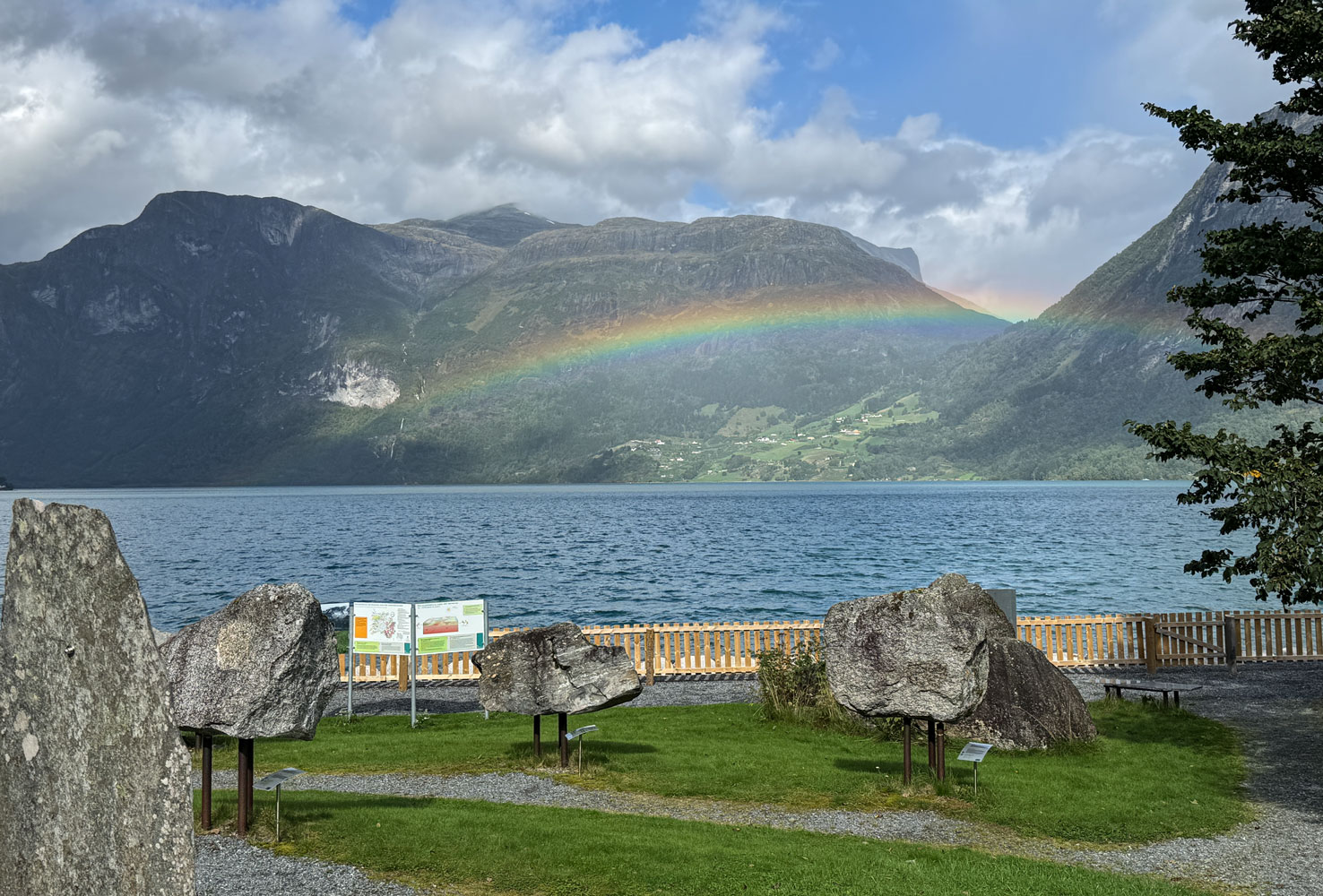
We spent some time in the park building and watched a video about the area and the park. It had been drizzling and when we looked outside, there was a rainbow.
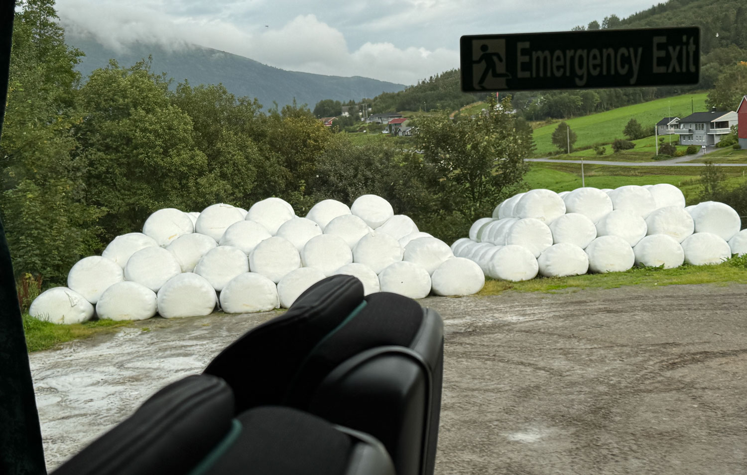
After we left the National Park building, we headed further into the park. There are farms in the park area and along the way, we saw a lot of these "Giant Marshmallows," as the guide called them. Actually, they're bales of silage which will be fed to the farm animals during the winter. Plant fodder can be stored as hay or silage. Hay has to be dried fairly well (15% to 18% moisture content) before it's baled or it will mildew. Silage, on the other hand, is baled wet (50% to 60% moisture content) and allowed to ferment, much in the same way that sauerkraut is processed. It's important that the plastic covering is airtight. If air gets into the bale, the contents will mildew and it will spoil the fodder. Norway uses silage, instead of hay, because it rains so much in the country that it would be very difficult to dry the plant material sufficiently to make hay.
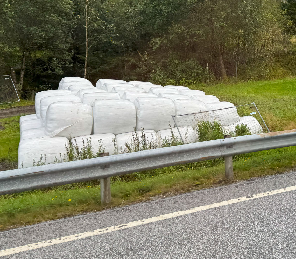
Here's a picture of another stack of silage bales.
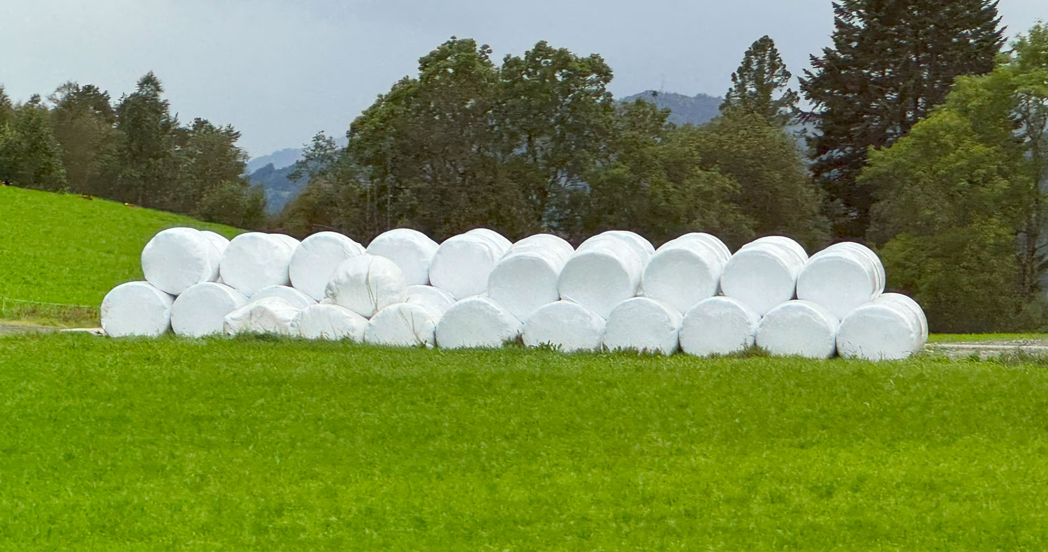
Since the bales contain plant material with a high moisture content, a bale will be very heavy - usually more than 250kg (550 lbs.) so the bales must be handled with mechanical equipment, often tractors with special attachments to handle a bale without penetrating the plastic covering.
The rest of the excursion was just looking at scenery so I'll just post some of the pictures. Norway specializes in beautiful scenery.
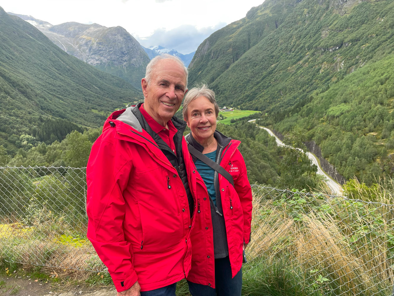
We stopped at an overlook and captured a few memories.
Judy and me at that overlook.
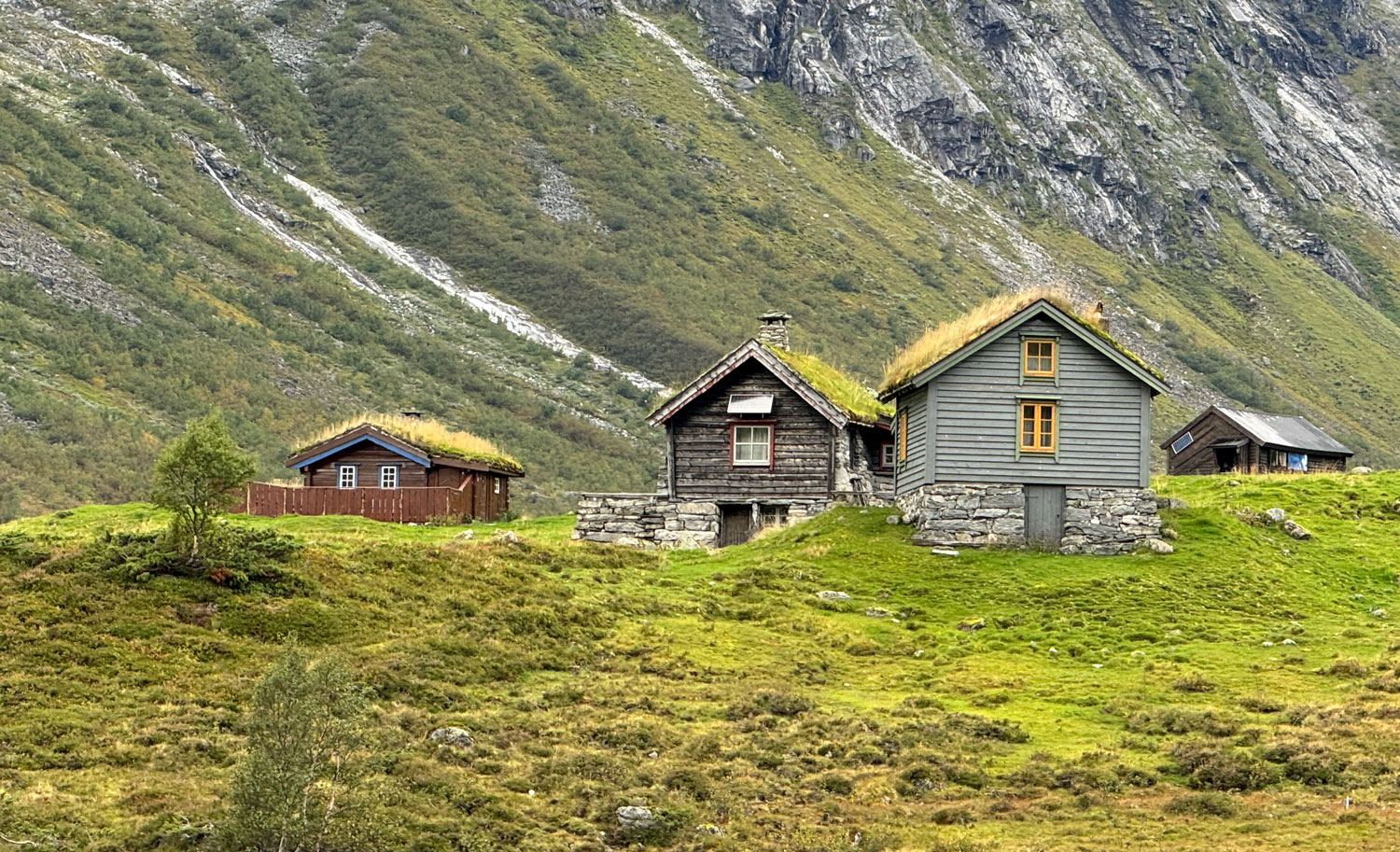
We continued on to a location where they had some houses to represent what early settlers lived in.
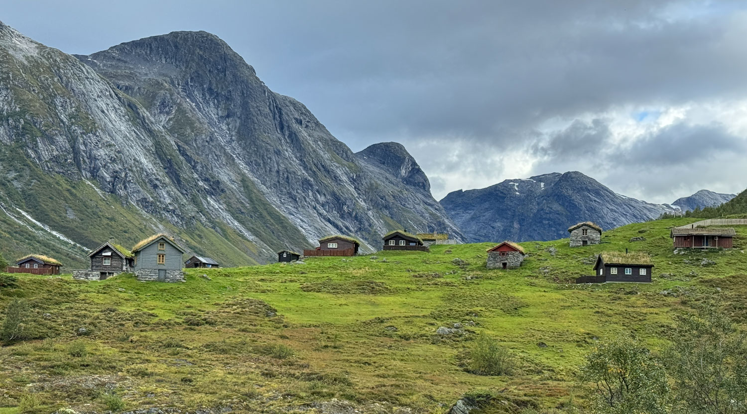
A closer look at a few of the houses. Sod roofs were used, because those materials were available. A layer of birch bark was laid down, and sod placed on top. Seeds and plants grew, and absorbed the rain. Sometimes a sheep or goat was put on top to graze, to control the growth.
Then we headed back to the ship. We had lunch, played trivia and went to dinner. That was the end of our day.
++++++++++++++++++++++++++++++++++++++++++++++++++++++++++++++++++++
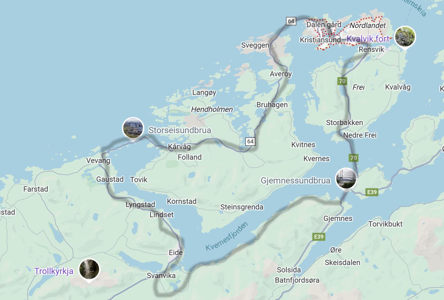
9/5/2025 (Friday) We go to Kristiansund today. We will drive on the Atlantic Ocean Road excursion today. Here's a rough map of the route of our bus ride today.
We drove out of Kristiansund and eventually came to the Gjemnessund Bridge, a 1,257 meter suspension bridge. It's the second longest suspension bridge in Norway (the Hardanger Bridge is the longest at 1,380 meters).
We passed some fish farms.

And lots of bales of silage.
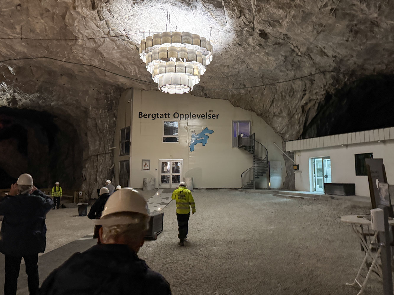
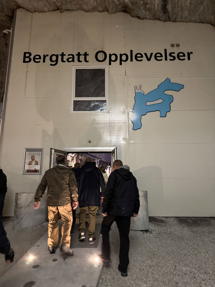
We eventually reached the Bergtatt marble mine. It's located near the town of Eide, which you can see on the map, above. The mine is no longer in operation but has been converted to a tourist attraction.
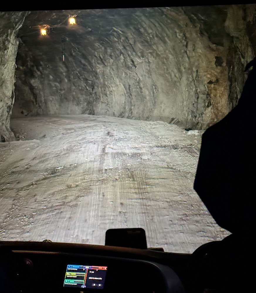
The bus drove directly into the mine. The mine shaft was made large enough for the big dump trucks used in the mine, so the bus fit easily.
Whenever I go into a mine, I try not to think about the Crandall Canyon Mine Collapse. In that disaster, the miners took too much coal, over too wide an area, and the mountain collapsed on them.
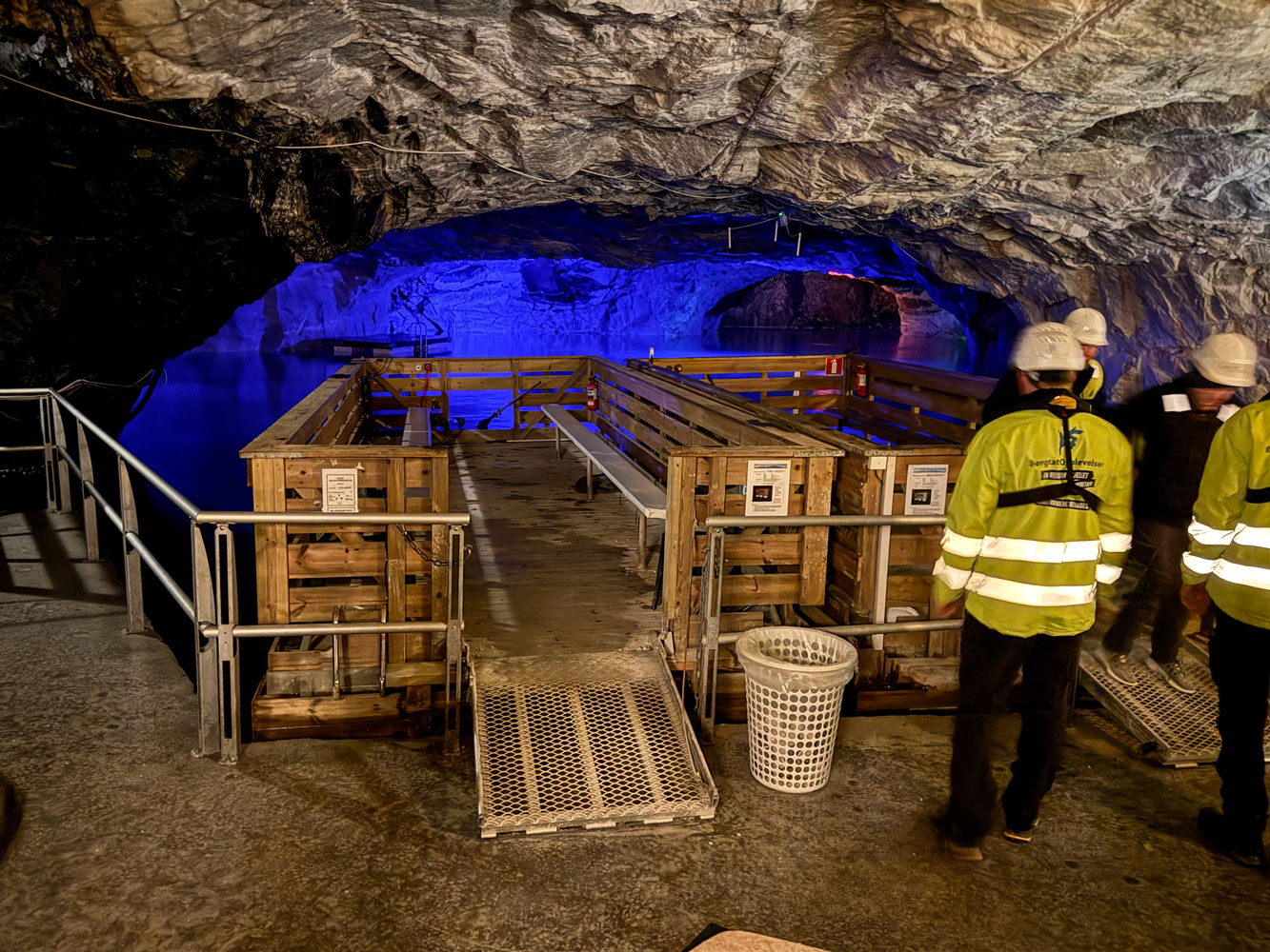
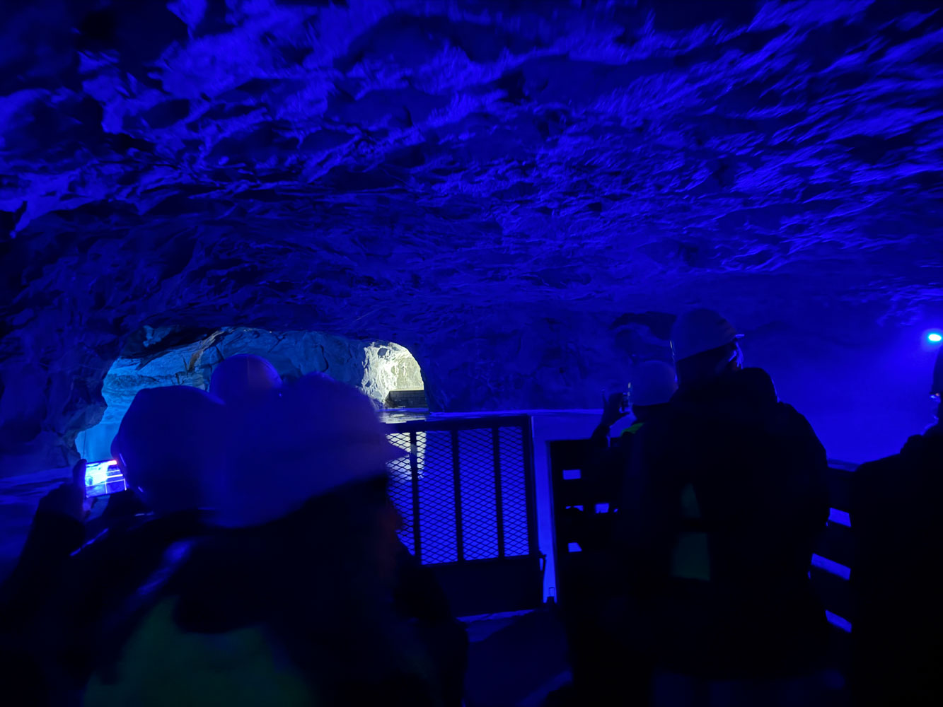
We came to a broad area where the bus parked and we gathered in the area close to the lake.
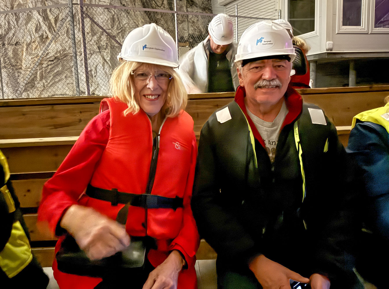
We put on hard hats, and life preserver jackets and boarded a small boat.
Eva and Richard on the boat.
Almost all mines have problems with water and have to pump it out continuously. One of the first uses of the steam engine was to drive pumps in mines. Once this mine was decommissioned, they allowed the water to collect and now have a "lake" in the mine.
Some bright person came up with the idea of turning the mine into a tourist attraction, and that's what it is today.
Just a side note, in Greek mythology souls had to cross Lake Acherusian in a boat with ferryman Charon to reach Hades. In the Roman version of the myth, Charon crosses the rivers Styx and Acheron to reach Hades. As part of Roman funeral rites, the dead were provided with coins to pay Charon for the crossing to Hades.
That's somewhat how I felt as we sailed in this boat.
In Greek and Roman mythology, Orpheus went to Hades to rescue his wife, Eurydice, but was not successful in bringing her back. Aeneas went to Hades to speak with his deceased father, and Odysseus is also reported to have visited Hades.
The ceiling was quite close for most of the trip.
Soon we could see a lighted area. Is it Hades?
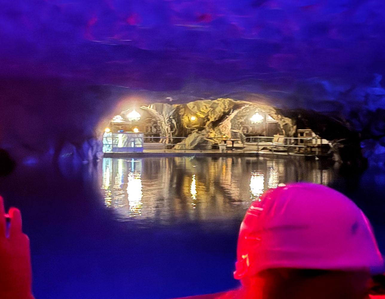
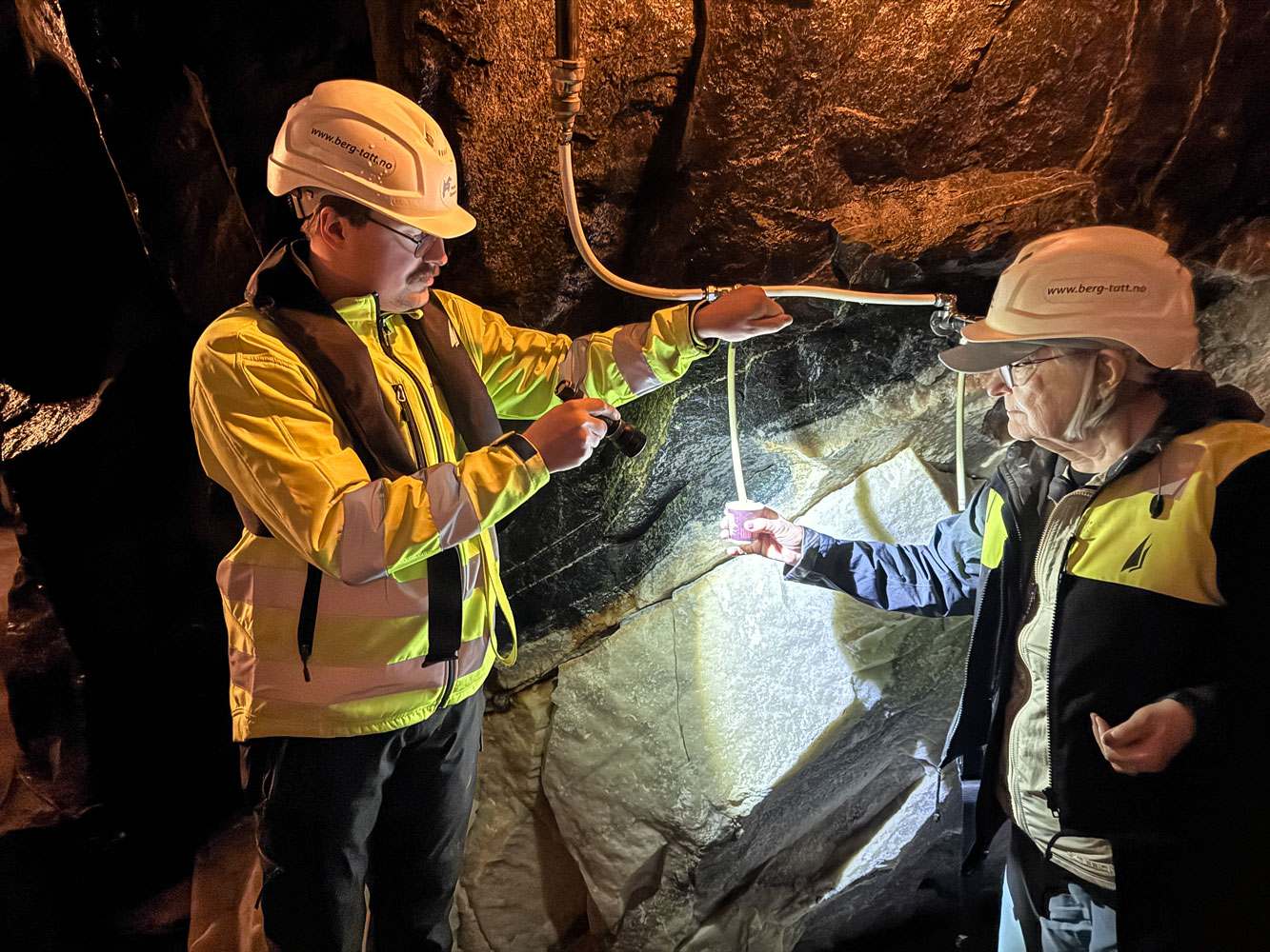
No such luck. We watched a video and then they gave us some cups so we could sample the water that comes through the mountain.
That was the extent of our visit to Hades. We re-boarded the boat and went back to our starting point.
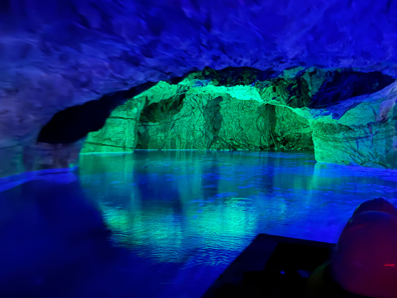
Another view of the lake.
When we got back to the starting point we were shown a video about the mine. What this mine did was produce marble dust for use in the paper industry.
We re-boarded the bus and continued our trip toward the Atlantic Ocean Road.
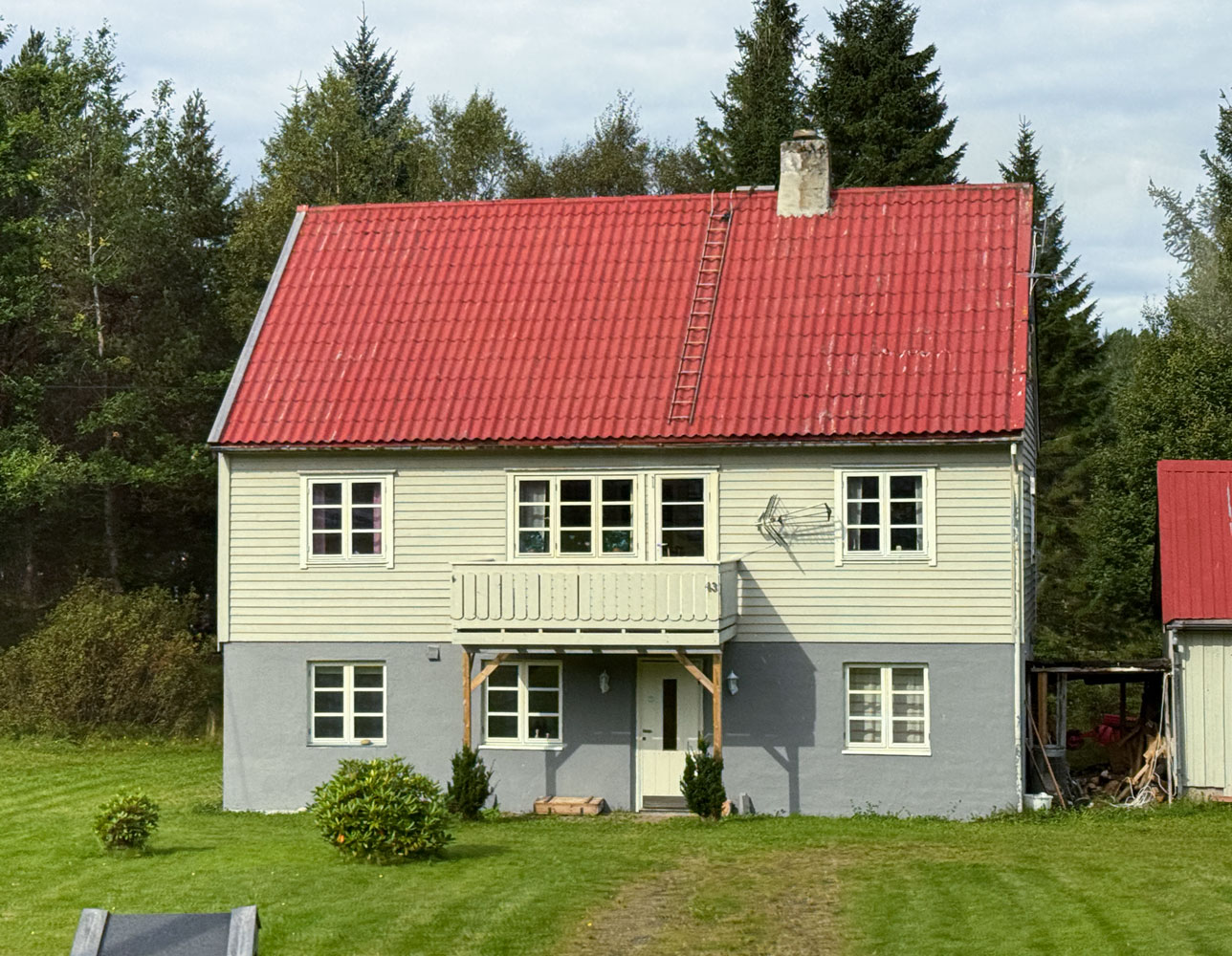
As we were heading that way, the guide pointed out the "ladders" on the roof of almost all the houses. She explained that people still build wood fires in their fireplaces and that causes creosote to build up in the chimney, and that requires a chimney sweep to come clean the chimney. Those "ladders" are there for the chimney sweep to use. Here's a picture of a house with a ladder on the roof, next to the chimney.
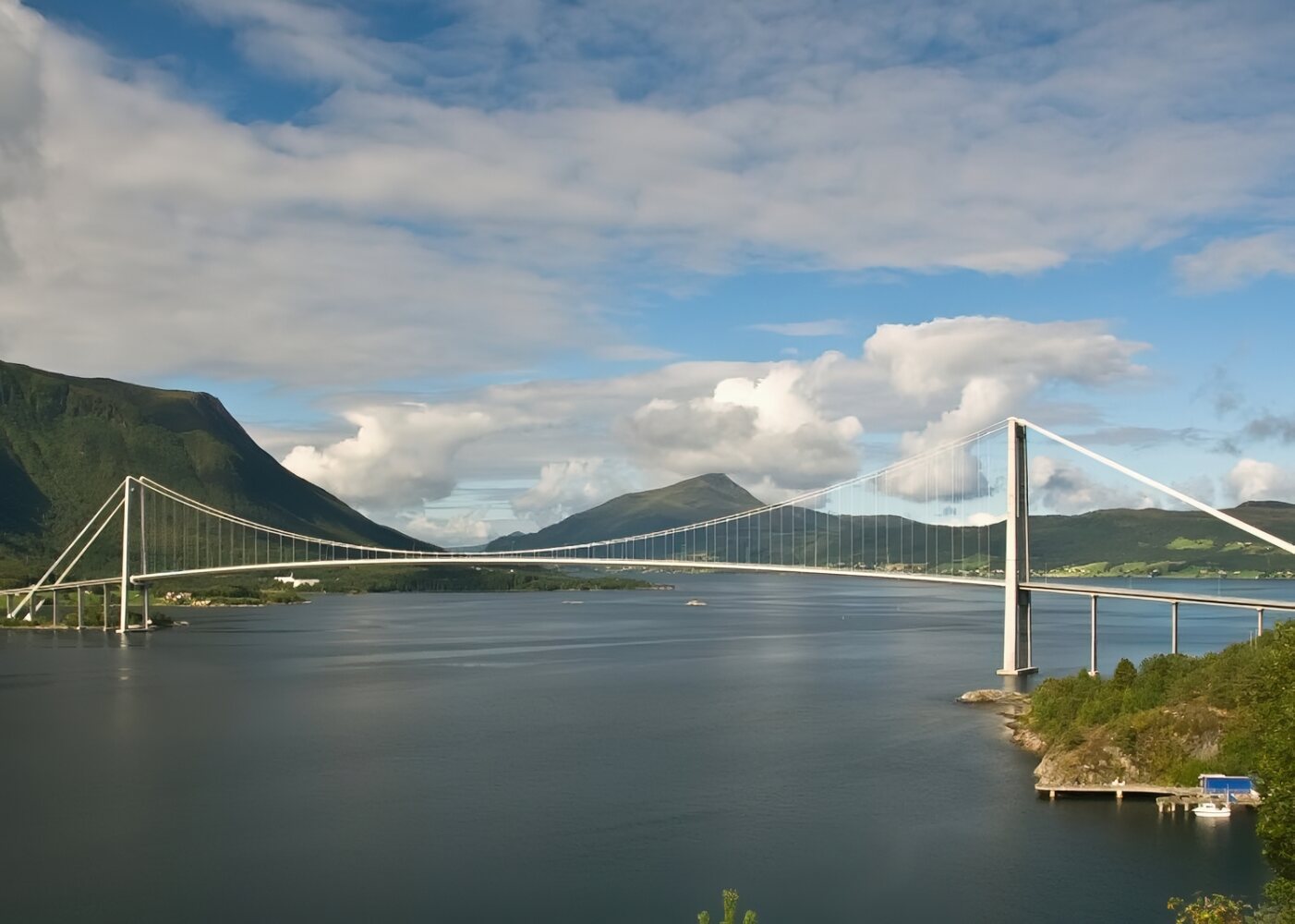
The Atlantic Ocean Road runs over eight bridges. It was opened in 1989 and was originally a toll road, but the construction cost has been paid by the tolls (as of 1999) and the road is now free. It was awarded the title "Norwegian Construction of the Century". It is also a "National Tourist Route".
When you're on the road, you can't take a picture of it, so here's a picture from the web.
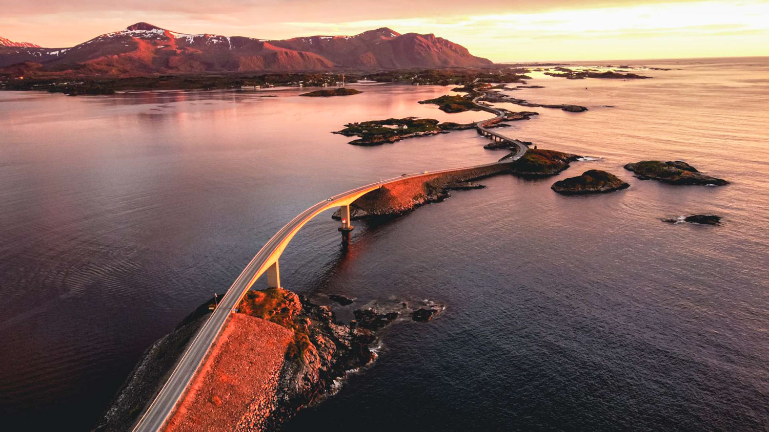
A view of the famous Storseisundet Bridge on the Atlantic Ocean Road.
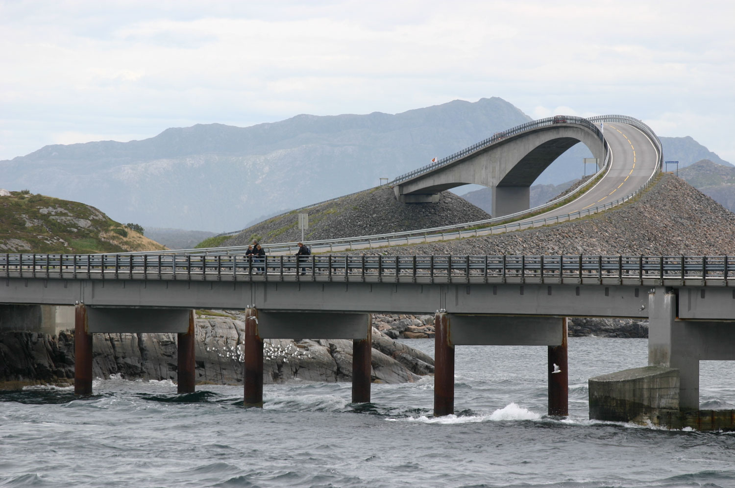
We stopped at a lookout point on Flatskjæret Island, just past the bridge. There was a walkway around the island, and this is our view of the bridge. Not nearly as dramatic as the picture from the web (which was taken from the other side of the bridge).
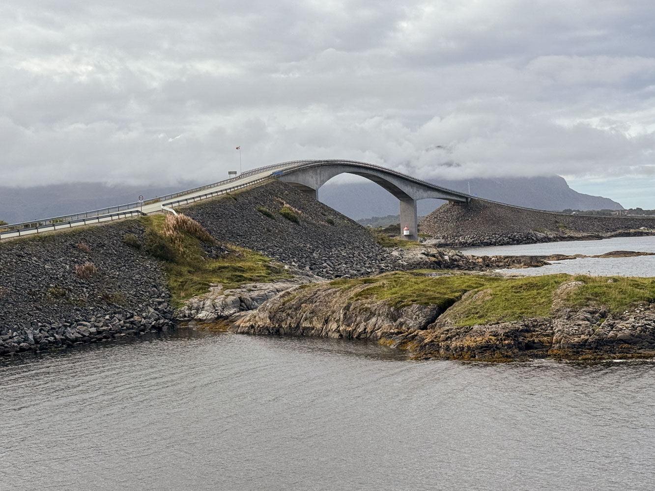
Then we continued along our route and took the Atlantic Ocean Tunnel back to our ship. The tunnel is 5.7km and reaches a depth of 250 meters.
When we got back to the ship, we had lunch and then Judy did some shopping at the mall just across from the ship. Then we played Trivia and won (for a change).
We had dinner and then to bed. Tomorrow we go to Trondheim.
++++++++++++++++++++++++++++++++++++++++++++++++++++++++++++++++++++
9/6/2025 (Saturday) We arrived in Trondheim during the night and were docked when we woke up about 6am. Our tour doesn't start until 1:15pm so we just took it easy on the ship, and I worked on this blog.
++++++++++++++++++++++++++++++++++
I encountered an Internet problem yesterday and brought it to the attention of the ship's staff today. I can't upload the blog to the server using the ship's Internet access. I set up my cell phone as a hotspot and was able to upload everything. But we really need to figure out what the problem is with the ship's access.
Everything was working fine until yesterday.
[As of 9/9/25 the problem has not been fixed, nor have I received any updates on my problem report. I think they're going to try to ignore me.]
+++++++++++++++++++++++++++++++++++++
Today is the running of the Trondheim marathon, which blocked off some of the streets. There were about 14,300 participants, but only 1,127 were doing the full marathon. Most were doing the half-marathon but they also had some who did a team marathon (each team runner runs a part of the marathon). [Note: In my youth I ran six marathons, including the Boston Marathon. My best time was 3:26 at the Marine Corps Marathon in Washington DC.]
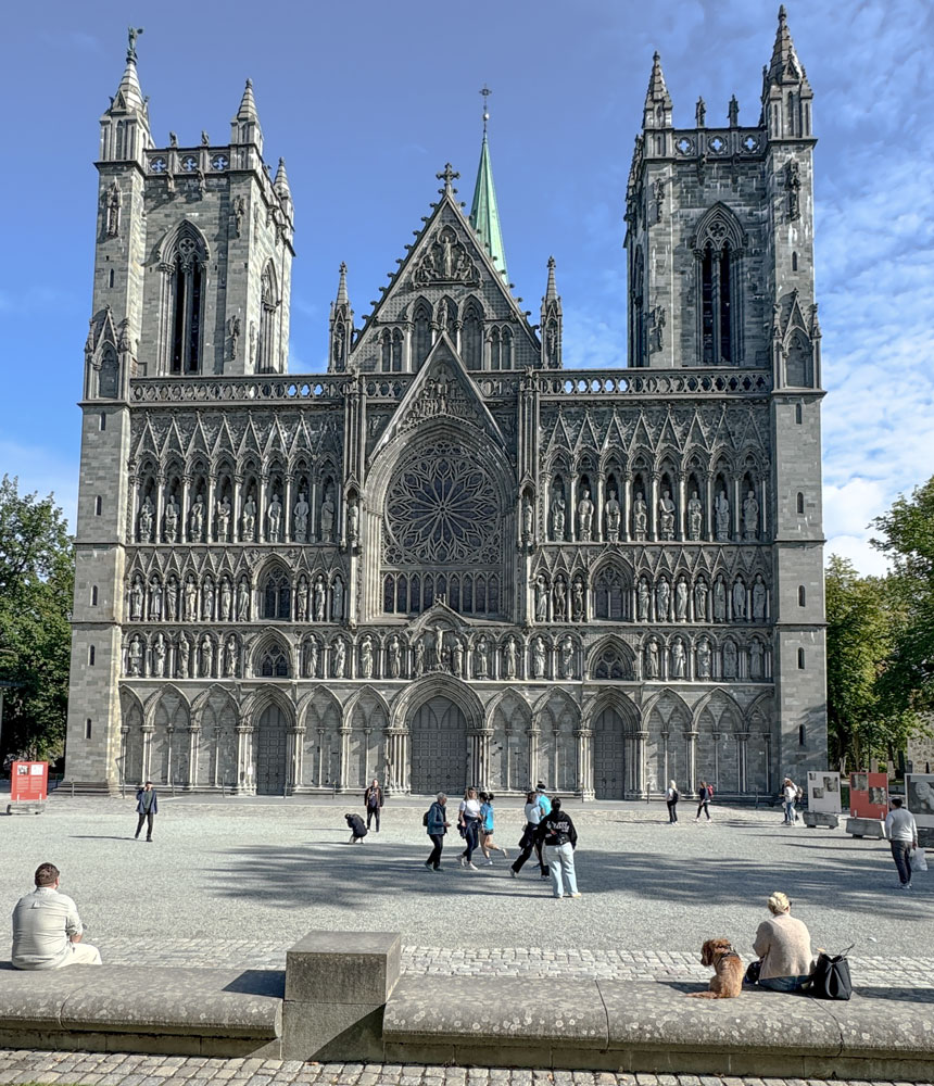
We met the bus on the dock about 1pm and went first to the Trondheim Cathedral. We couldn't go into the cathedral but did take some pictures of the outside, and watched some of the race finishers walk by.
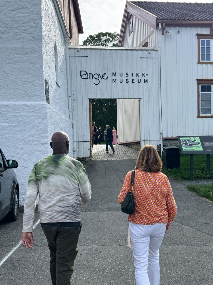
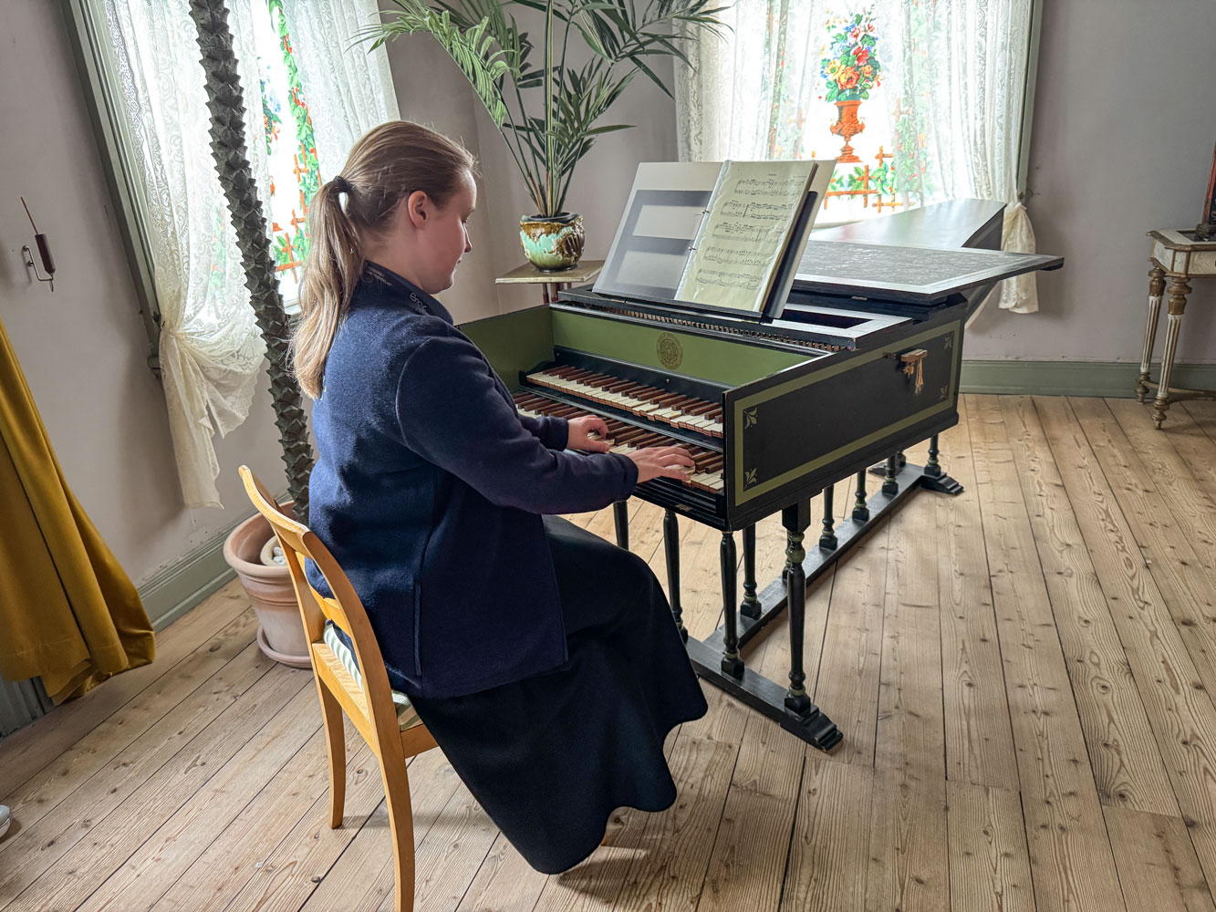
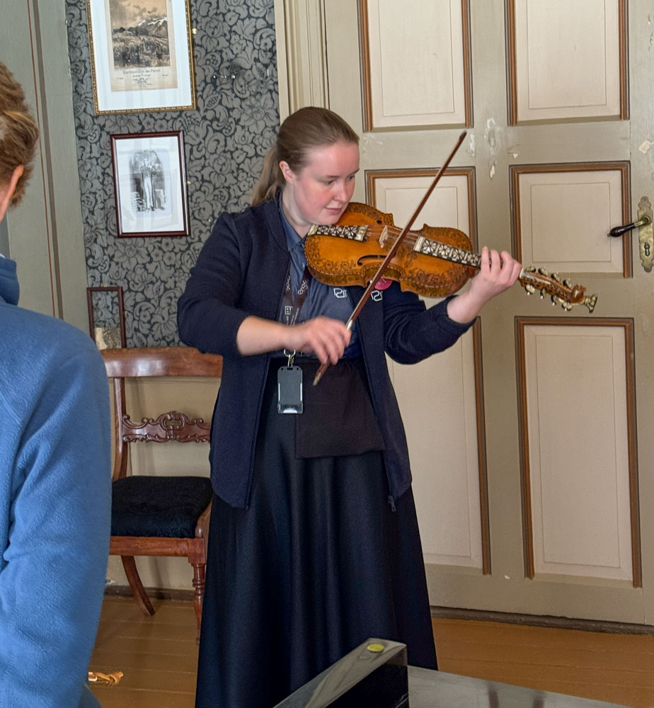
Then we went to the Ringve Music Museum. It is Norway's national museum for music and musical instruments.
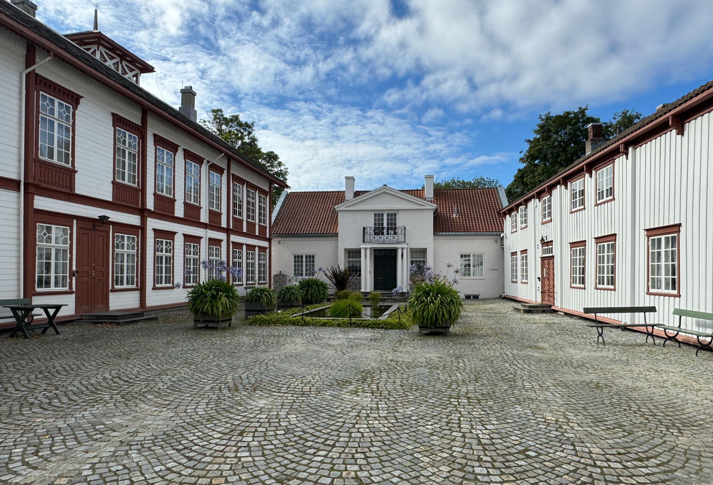
A view of the interior courtyard.
Our guide demonstrated several of the instruments.
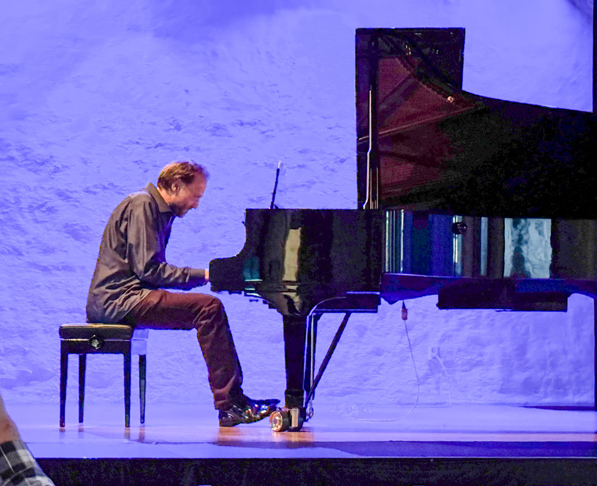
After the guided tour we went to the hall for a piano concert, but the pianist was not very good, so we left.
With that, we had some time on our own to wander around the museum, and then returned to the ship - just in time for the Trivia game, which we won first place (tied with another team).
Then, to dinner and bed. We won't be in port tomorrow.
++++++++++++++++++++++++++++++++++++++++++++++++++++++++++++++++++++
9/7/2025 (Sunday) We have a "sea day" today and it's a welcome rest. About 7am this morning we crossed the Arctic circle, 66° 33' North.
The ship will celebrate the crossing at 3pm today.
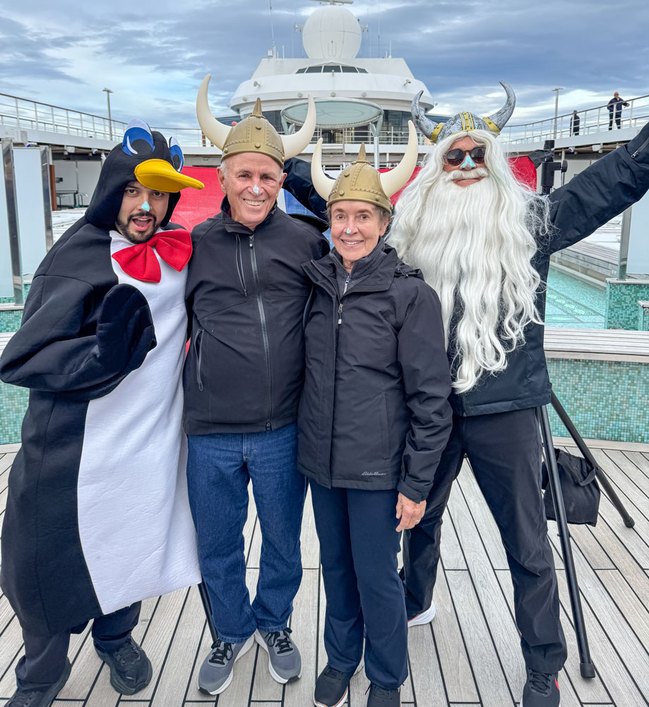
At 3pm we went up to the pool deck and the party was already in progress. Here's the cruise director, Andy Heath, in costume.
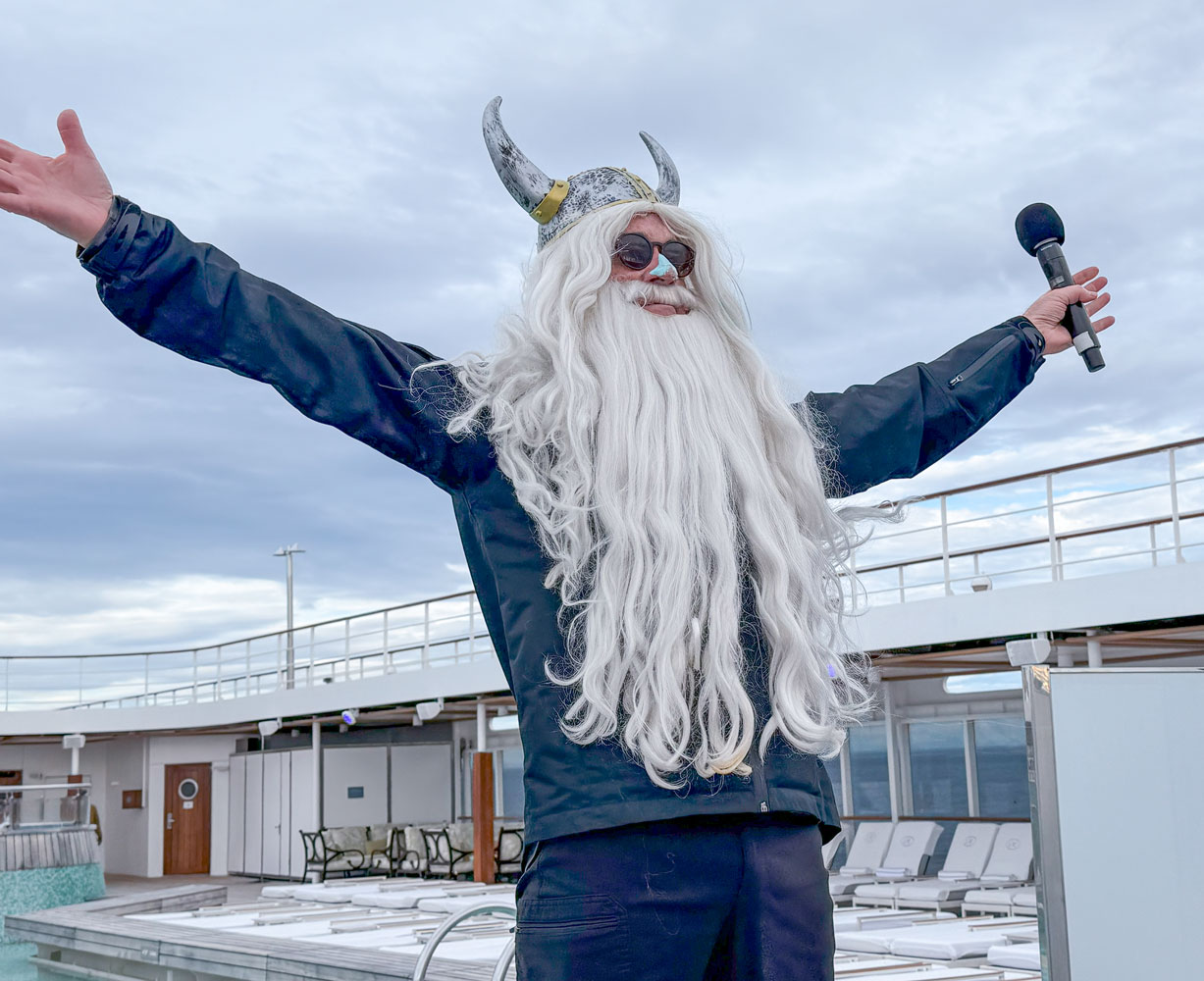
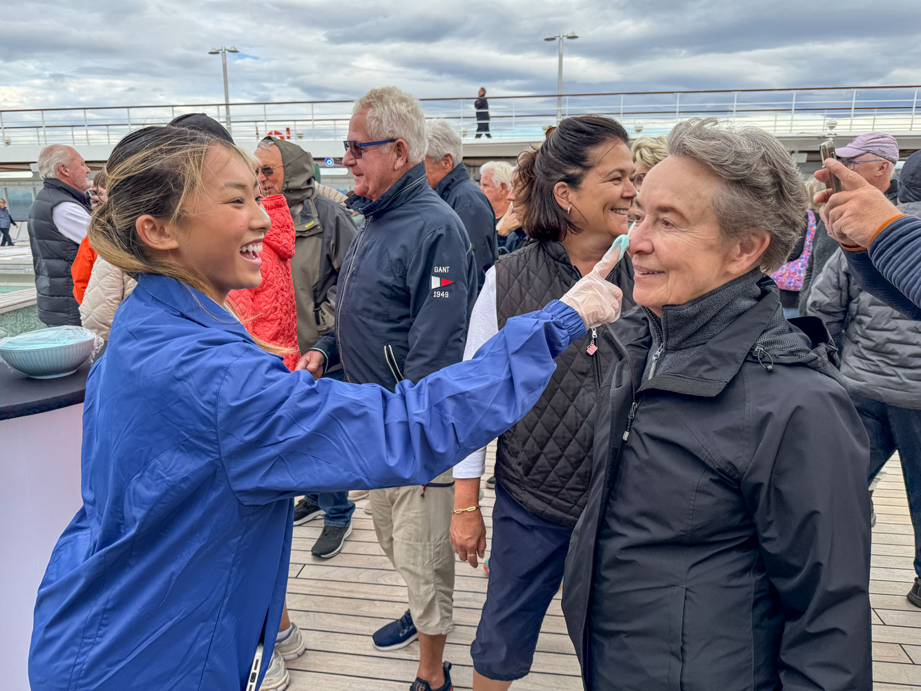
Note the blue on his nose. I don't know what it symbolized but they offered everyone some blue paint (it turned out that the blue paint was blue cake frosting).
Here's Judy getting her nose "painted".
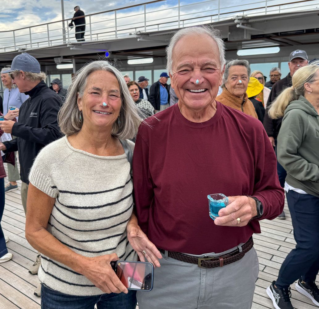
They also had blue vodka shots. Here's a picture of two of our trivia partners, Julie and Bruce, both with blue noses. Bruce has one of the blue vodka shots.
Judy and I had our picture taken with the cruise director and the assistant cruise director.
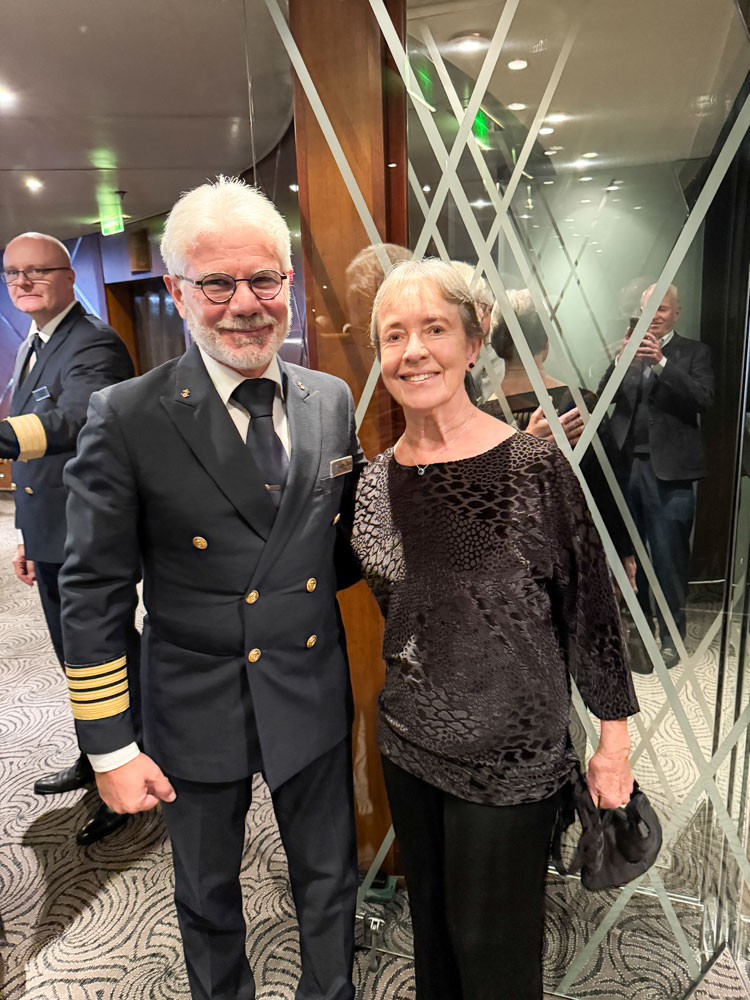
At 6pm we had a Seven Seas Society gathering. As we entered I took this picture of Judy with the captain, Rosario Vasta.
A presentation was made about future cruises, and then a group entertained us with ABBA songs. I realized there was a reason I never paid much attention to ABBA's music.
We had a reservation at Chartreuse restaurant for 8pm this evening, but I wasn't feeling up to par and skipped it. Judy, Eva, and Richard went and enjoyed the dinner.
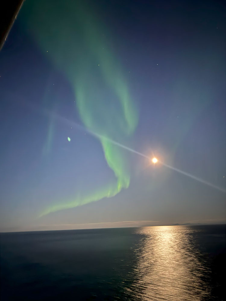
That night, about 11pm, the cruise director alerted us to the appearance of the Northern Lights (aurora borealis). Judy and I went up on the top deck to see the lights and Judy got some pictures. It was cold and windy and I left a few minutes before they appeared.
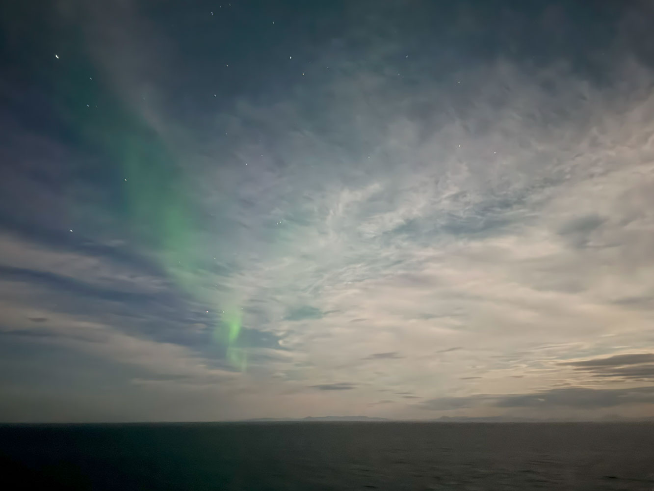
The display was not as spectacular as some of the pictures you often see, but it was the Northern Lights.
By the time Judy got back to the room, I was fast asleep.
++++++++++++++++++++++++++++++++++++++++++++++++++++++++++++++++++++
9/8/2025 (Monday) We arrived at Hammerfest this morning about 9am and the weather was wonderful and warm, about 65 degrees.
I was talking to a resident about life in Hammerfest and asked him what they did in the summer there. He thought for a while and then said, "We usually have a picnic that day!"
Our next port is Honningsvåg, north of Hammerfest, and there's a rivalry between Hammerfest and Honningsvåg concerning which is the most northerly town in Norway.
In 1997 Norway passed a law requiring a municipality to have 5,000 residents to be called a town. However, Honningsvåg had been granted town status in 1996, and the law did not apply to towns designated before the law. So they're both "towns" but Hammerfest (population 7,882) is quite a bit larger than Honningsvåg (population 2,245).
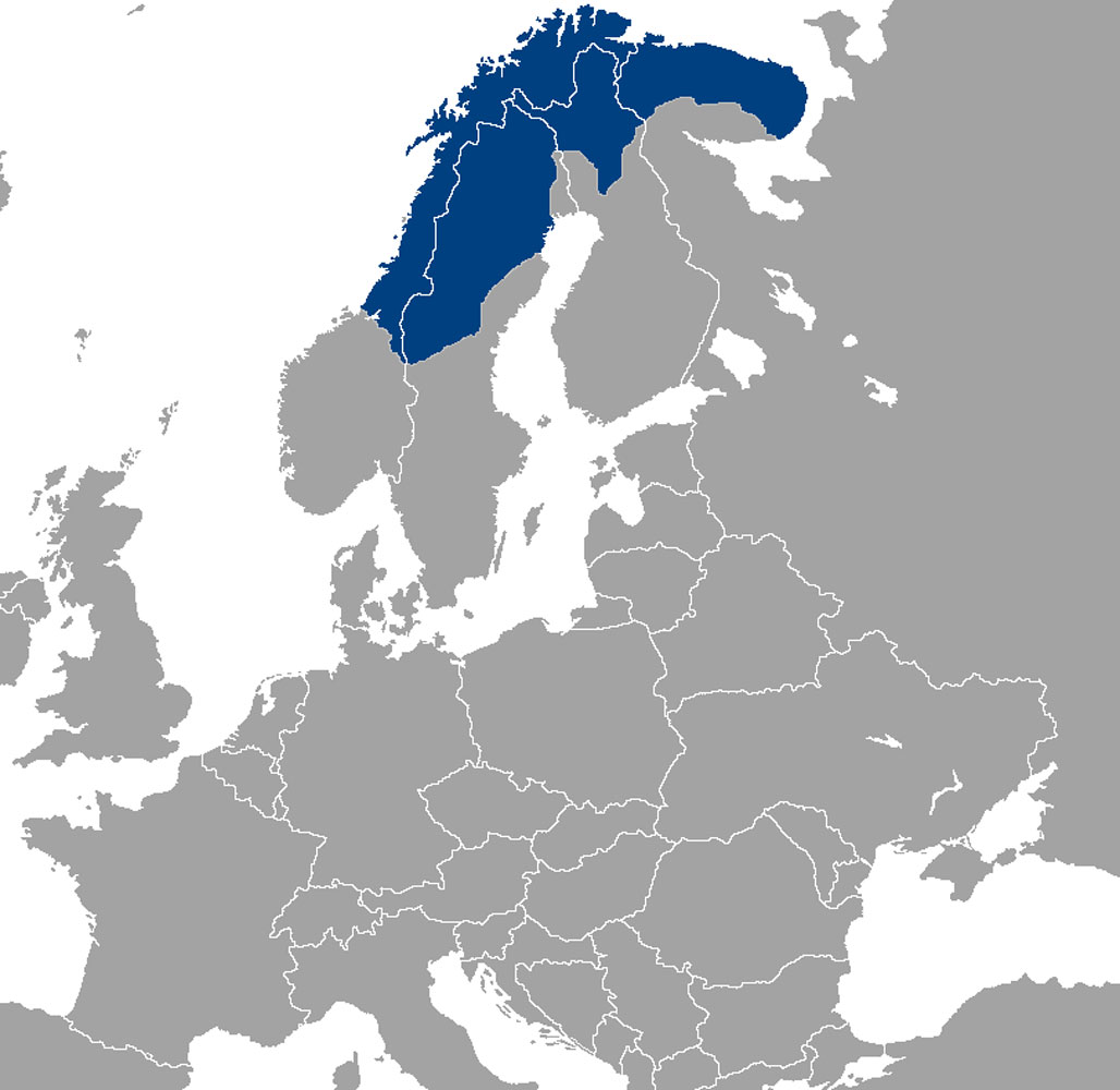
Today, we're going to visit a Sámi camp just outside the town of Hammerfest. The Sámi people used to be called "Laplanders" but that name is no longer considered appropriate. They live in the northern part of Norway, Sweden, and Finland, as shown in the following map.
Our excursion departed the ship about 10am. One thing we noticed was the lack of trees this far north.
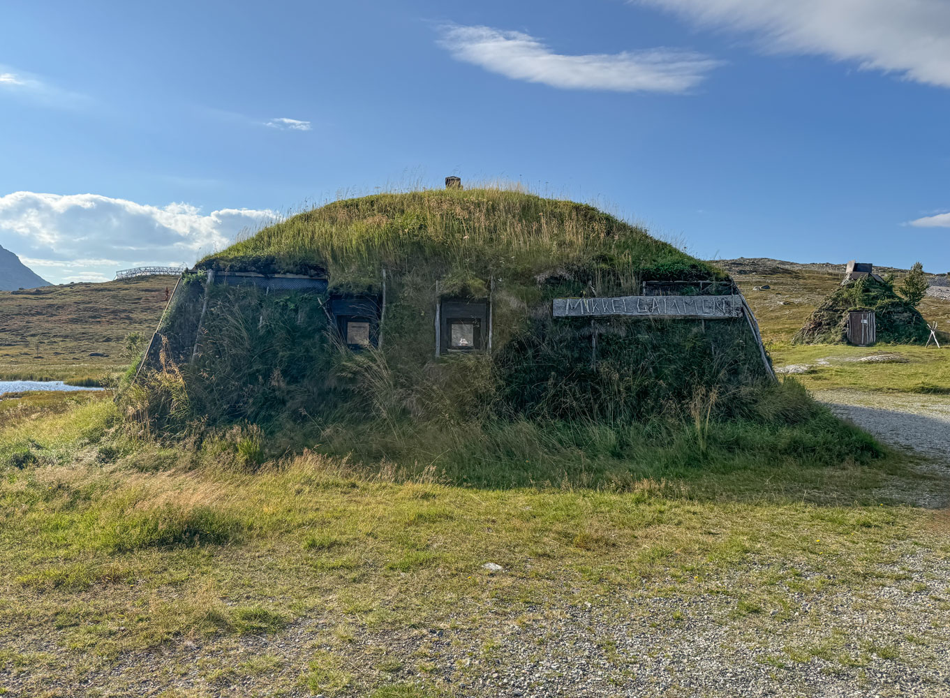
When we arrived at the camp, we were directed to a round structure that was covered with soil and plants
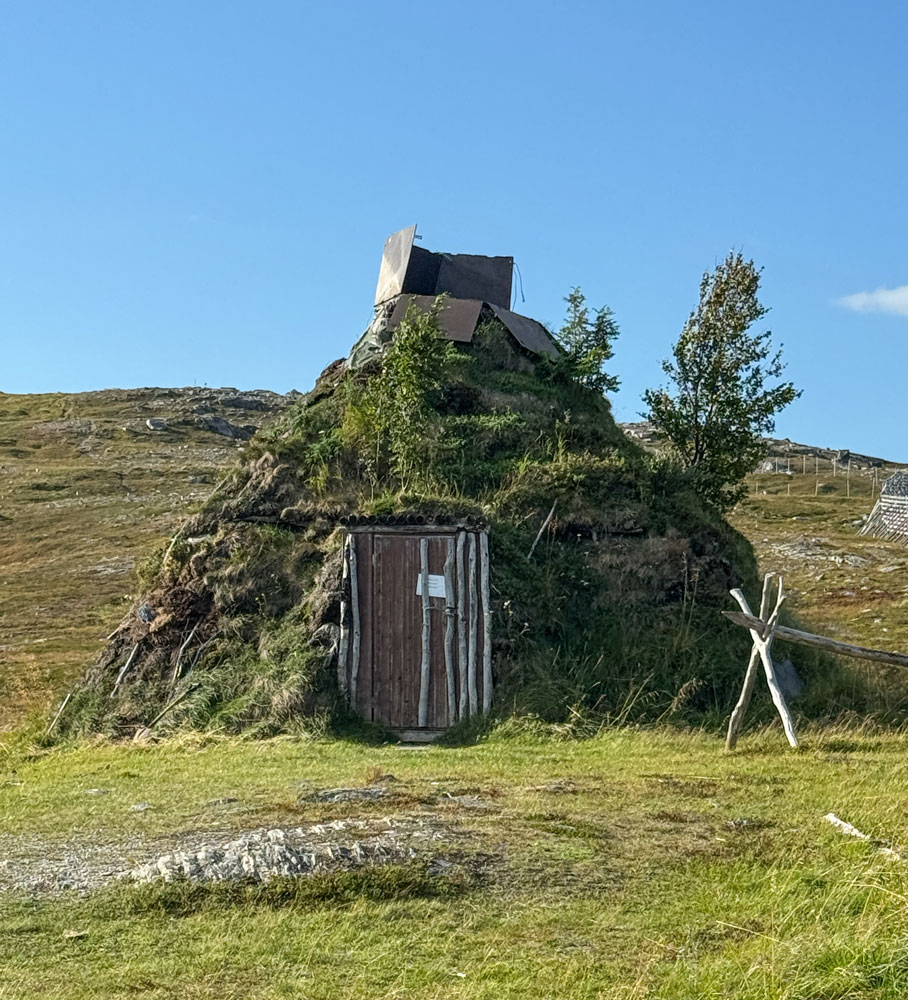
Inside there was a fire going in the center, and a Sámi man kneeling just outside the fire pit. The floor was covered by reindeer hides laid over small dried branches.
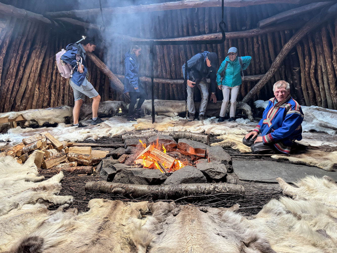
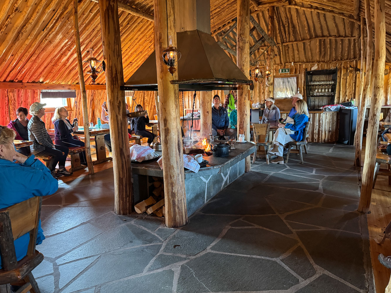
The Sámi man talked to us, but he spoke so quietly that it was almost impossible to hear. He spoke for perhaps an half hour, and he sang samples of three joiks, the Sámi chant-like melodies that relate their heritage. Then we went to a much larger structure, and much more modern. This view is of the end of the structure. It was much longer down the sides.
A view inside. We had coffee and a Sámi sample of reindeer and cloudberries.
We were excursion group four, and when we arrived at the Sámi camp, group three was just departing. As we were leaving, group five arrived. So the Sámi camp had a lot of visitors today.
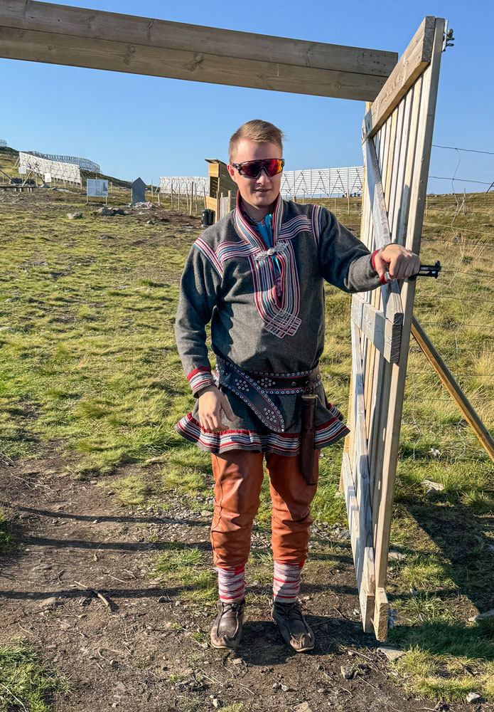
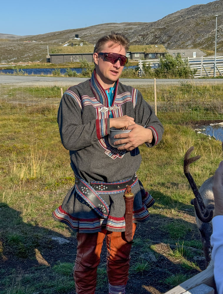
After this, we went to see some reindeer and hear from a herder. Here he is in traditional dress. He spoke perfect English.
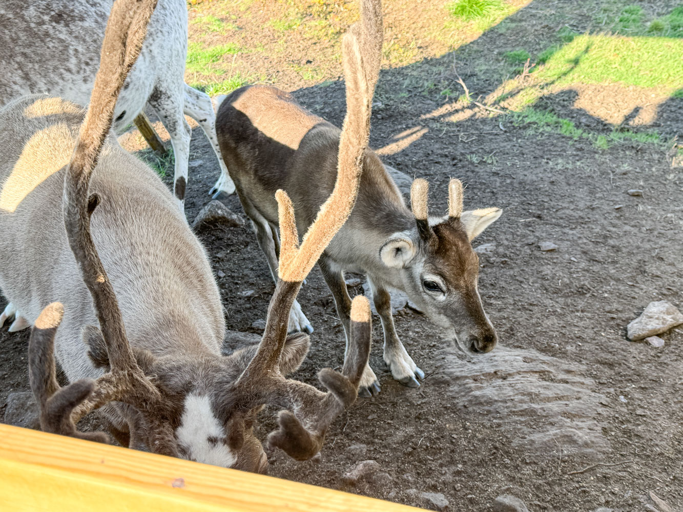
Here are a couple of the reindeer.
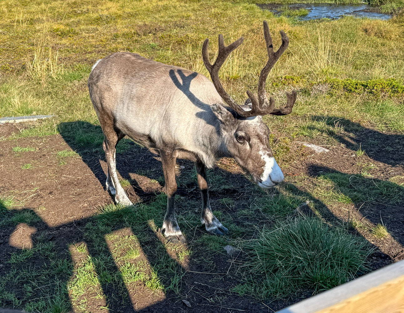
They still have the velvet on their antlers. The herder said they would shed the velvet in a month or so, and then their antlers could be removed, if necessary.
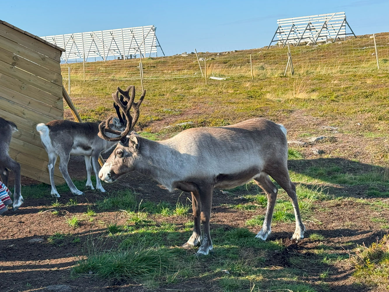
One of the calves.
Reindeer herding is highly regulated now. His group is limited to 2,000 head, and he has a permit to herd reindeer.
Here's another picture of the herder. He's holding a container of "reindeer pellets", which the reindeer gently nibbled out of our hands.. His talk was very interesting.
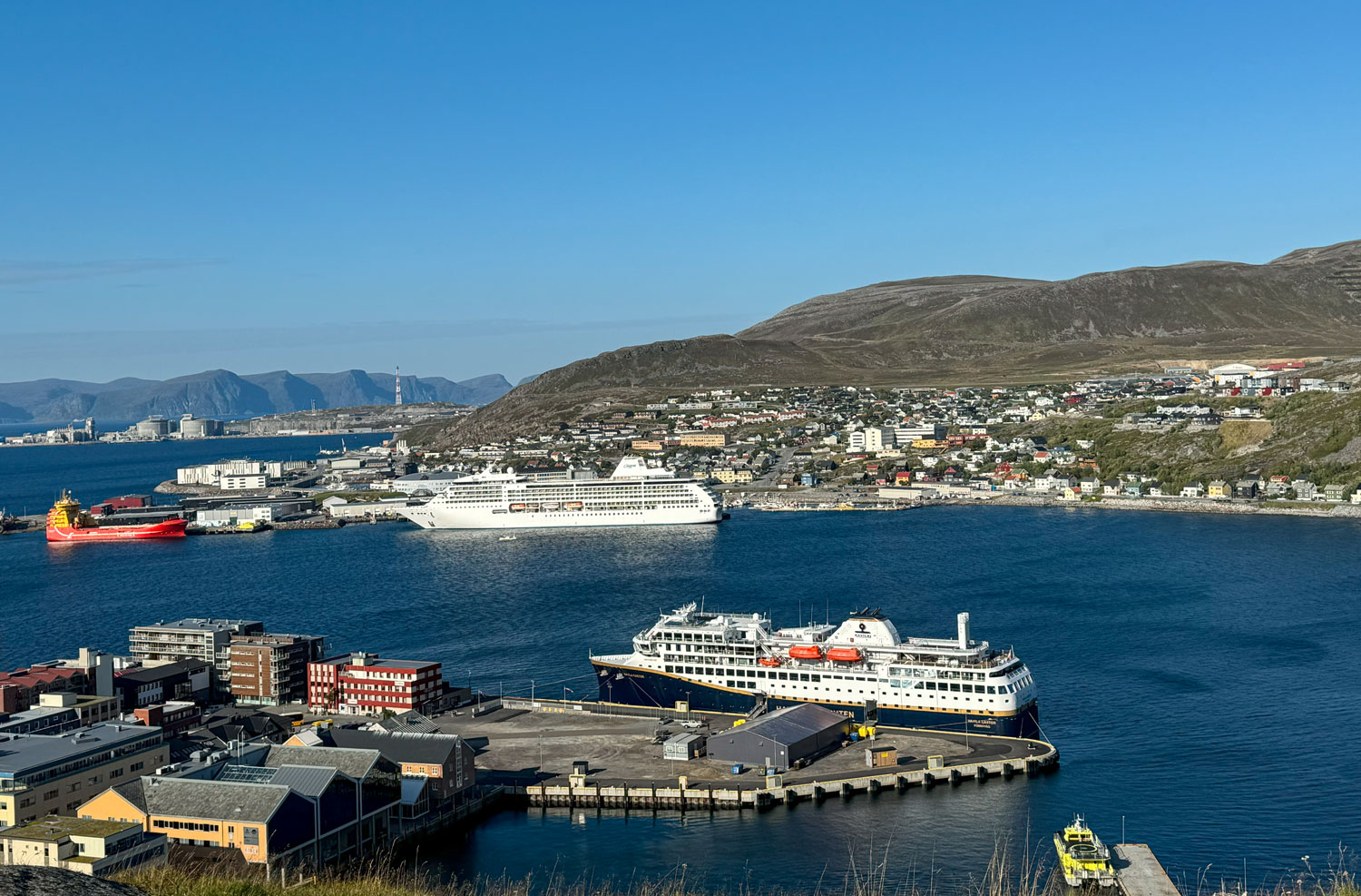
The Sámi camp is on Salen Hill, 86 meters (282 feet) above the town, and we walked to the edge of it to take some pictures of the town. We could see the Mariner as well as one of the Hurtigruten ships that carry supplies, mail and people to the towns along the Norwegian coast. There are eleven Hurtigruten ships that ply the route from Bergen to Kirjenes, stopping at 34 ports, winter and summer. It has operated since 1893.
The hill is 86 meters above the town, and there's a switchback path to go up or down. The path is loose rock and was tough to navigate, especially for the age group of our excursion.
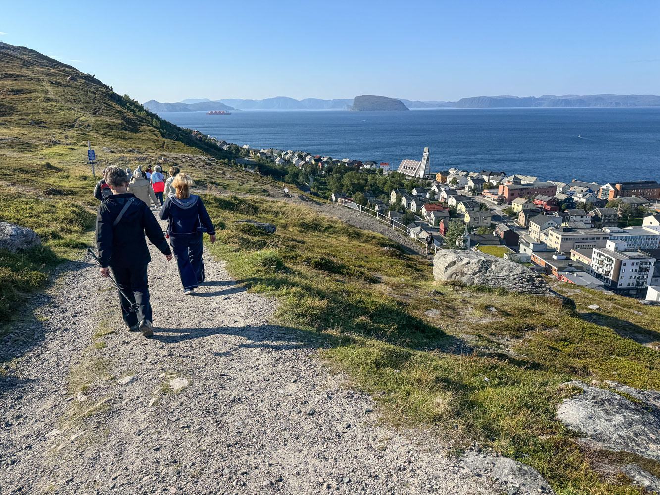
But everyone did get down the path safely. When we got to the bottom the tour guide asked if anyone wanted to stay in town rather than go directly to the ship. Judy and I decided to stay and visit the Royal and Ancient Polar Bear Society.
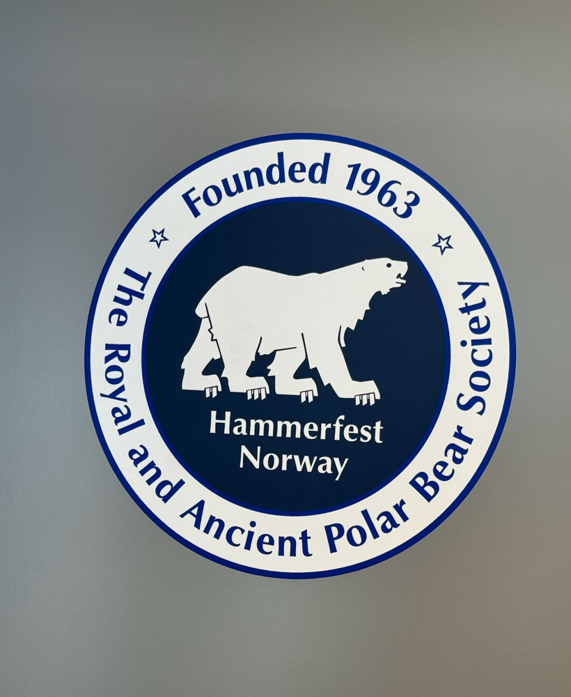
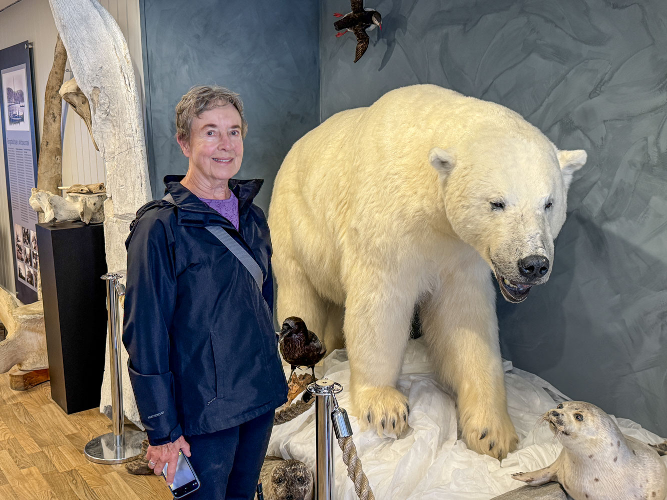
There's a small museum associated with the business office. Here's Judy with the Society mascot.
The society is not really a serious endeavor - it's just a tourist thing. You can join the society for $46 and application has to be made in person - so it proves that you were there in Hammerfest. Since the cost was fairly high, we decided that only one of us would join and Judy is now a member.
From there, we walked through the town, stopping at a couple of stores. Eventually we got back to where the shuttle bus stop was, and while there were a couple of buses there, neither one was the shuttle bus. There was a taxi stand across the street so we shared a taxi with another couple to get back to the ship. The taxi was an electric Mercedes. We were back to the ship about 2pm.
++++++++++++++++++++++++++++++++++++++++++++++++++++++++++++++++++++
9/9/2025 (Tuesday) The ship arrived at Honningsvåg this morning before we got up.
After breakfast, we were down in the theater at 8am for our excursion to the North Cape, the northern most place in Norway.
The bus ride was about 30 minutes and the road was excellent. There's a building at the cape and we needed a pass with a QR code to enter the building. However, I discovered that the QR code was the same on every ticket.
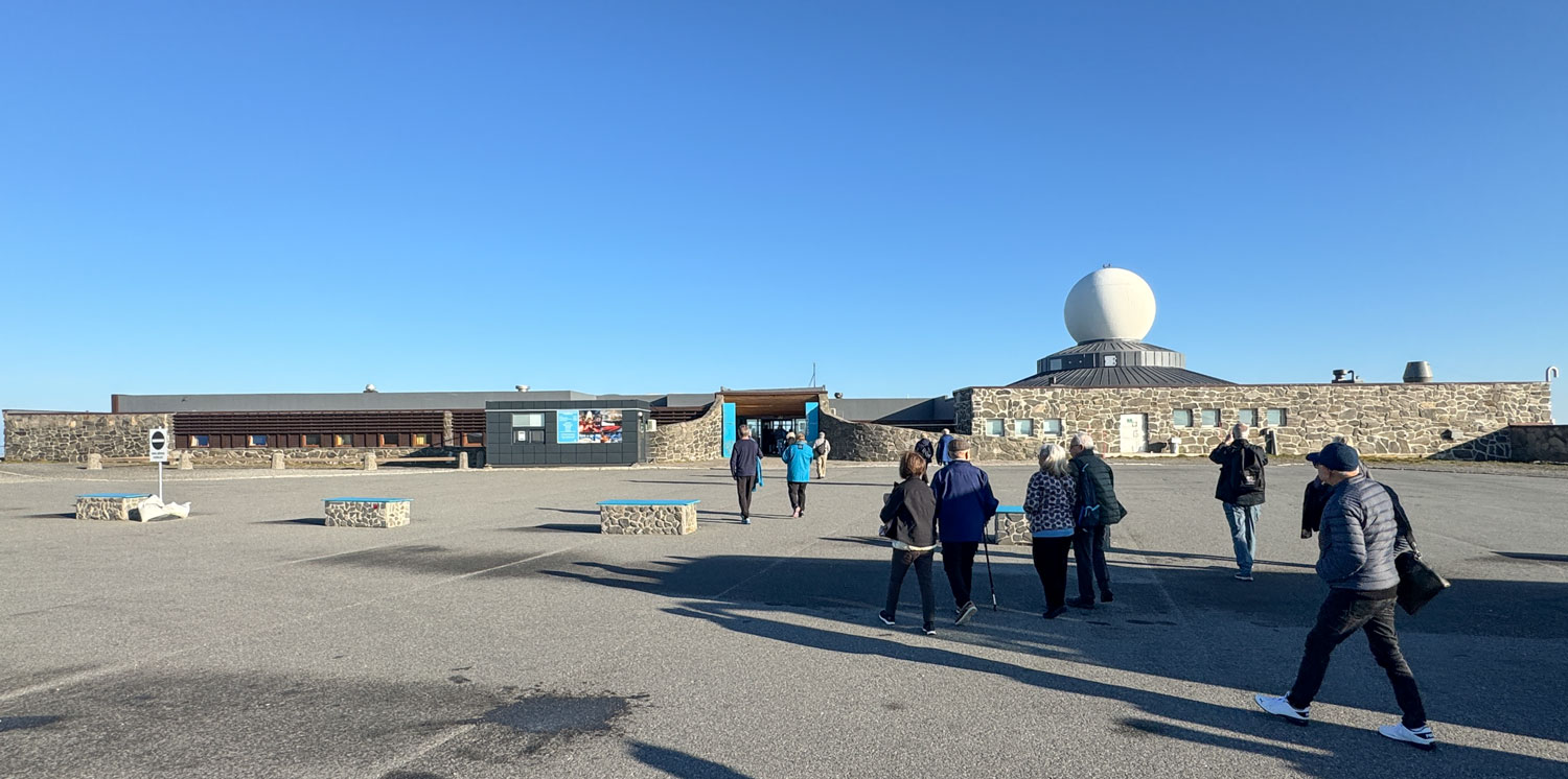
In the building there is a souvenir shop, a restaurant, and rest rooms.
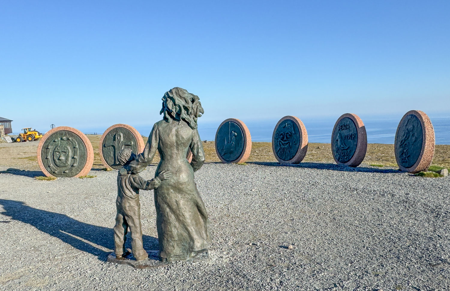
Off to the side of the building is a display of seven disks and a statue. A few years ago, seven children were selected at random from different countries and they spent a week at the cape. They produced some art which was reproduced into the disks, and displayed here.
Behind the building is the cape, looking out on the Norwegian Sea and the Barents Sea.
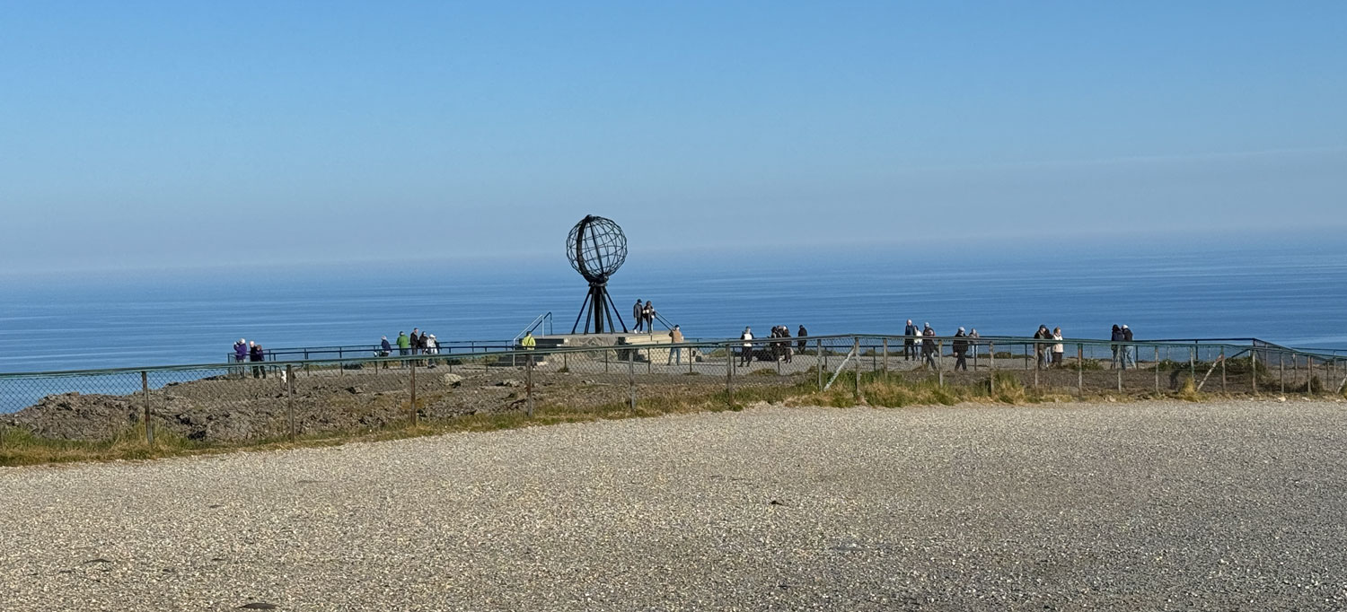
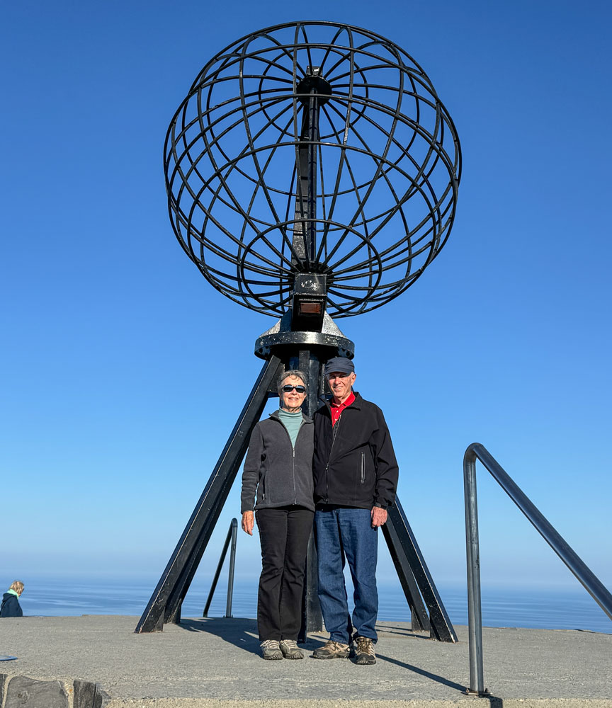
Judy and me at the globe.
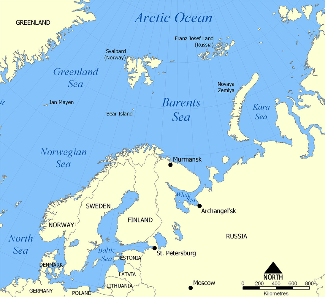
During World War II, this was a hot area. After the Soviet Union was invaded on June 22, 1941 Britain and the United States (through lend-lease, signed March 11, 1941) began providing supplies to the Soviet Union. The problem was how to get the supplies there.
Some of the supplies (about 22% to 23%) were sent via ship convoy around this cape to Murmansk and Archangel in Russia. Germany attacked the convoys and many ships and men were lost. The allies ran 78 convoys, a total of 1,400 ships. 85 merchant vessels and 16 warships were lost, along with about 3,500 men. In addition to the Germans, the sailors had to fight the weather, including temperatures that went down to -30°C.
The majority of the supplies were sent via the Pacific Route to Vladivostok (about 45%) and a lesser amount went through the Persian Corridor (about 23%).
A good book about one of the Arctic conveys is "Arctic Convey PQ18".
After wandering around the area, Judy and I went into the restaurant and had a cup of coffee until time to return to the ship.
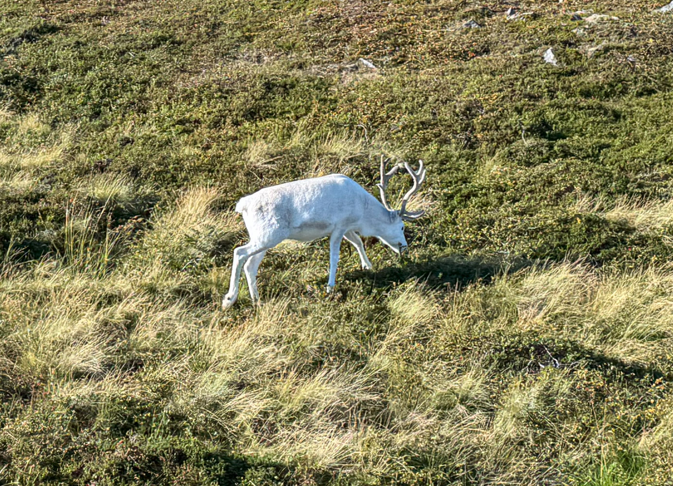
On the ride back to the ship, we saw some reindeer along the road, including this unusual white one.
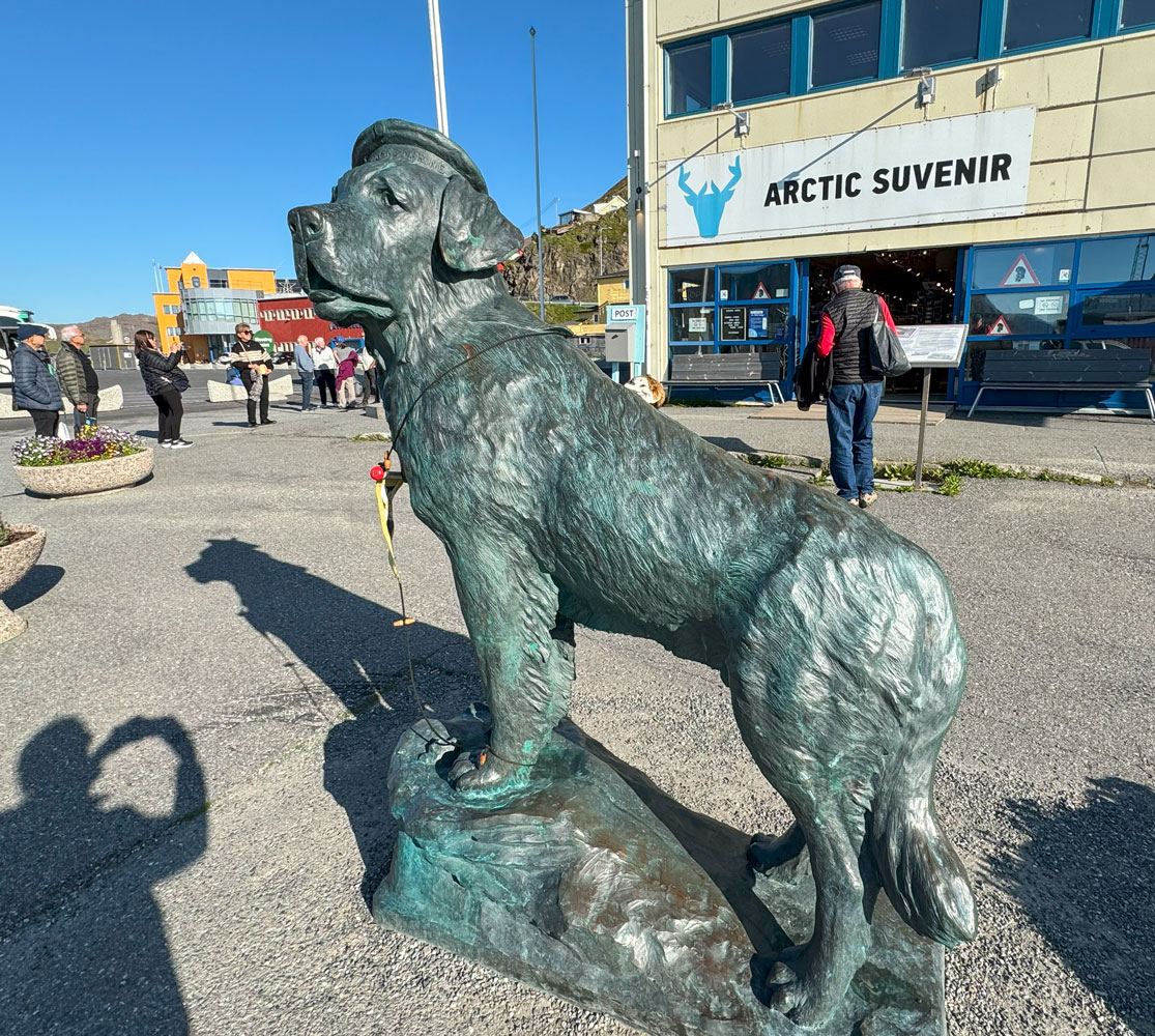
When we got back to the dock we found this statue of the Saint Bernard, Bamse, in front of the souvenir shop. You can see his full story at the link above. He became a symbol of Norwegian freedom during the war. He was beloved by the country.
[Note: There's a book about Bamse - see here.]
We did some shopping in the souvenir shop and then went back to the ship where we played "Roller Ball" and then Trivia at 4:30 (we won at trivia!).
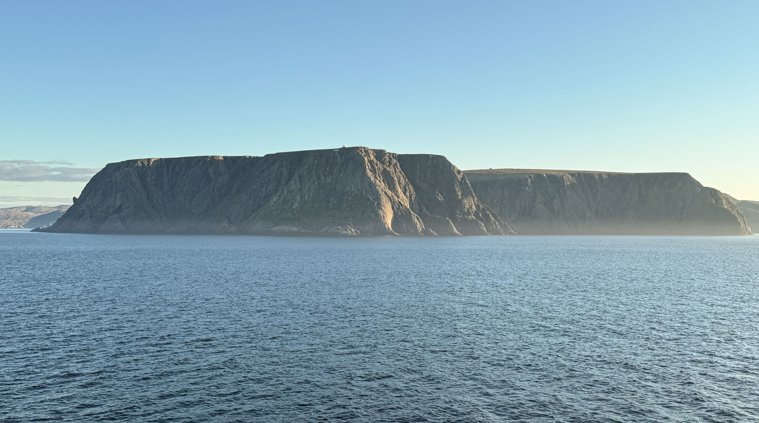
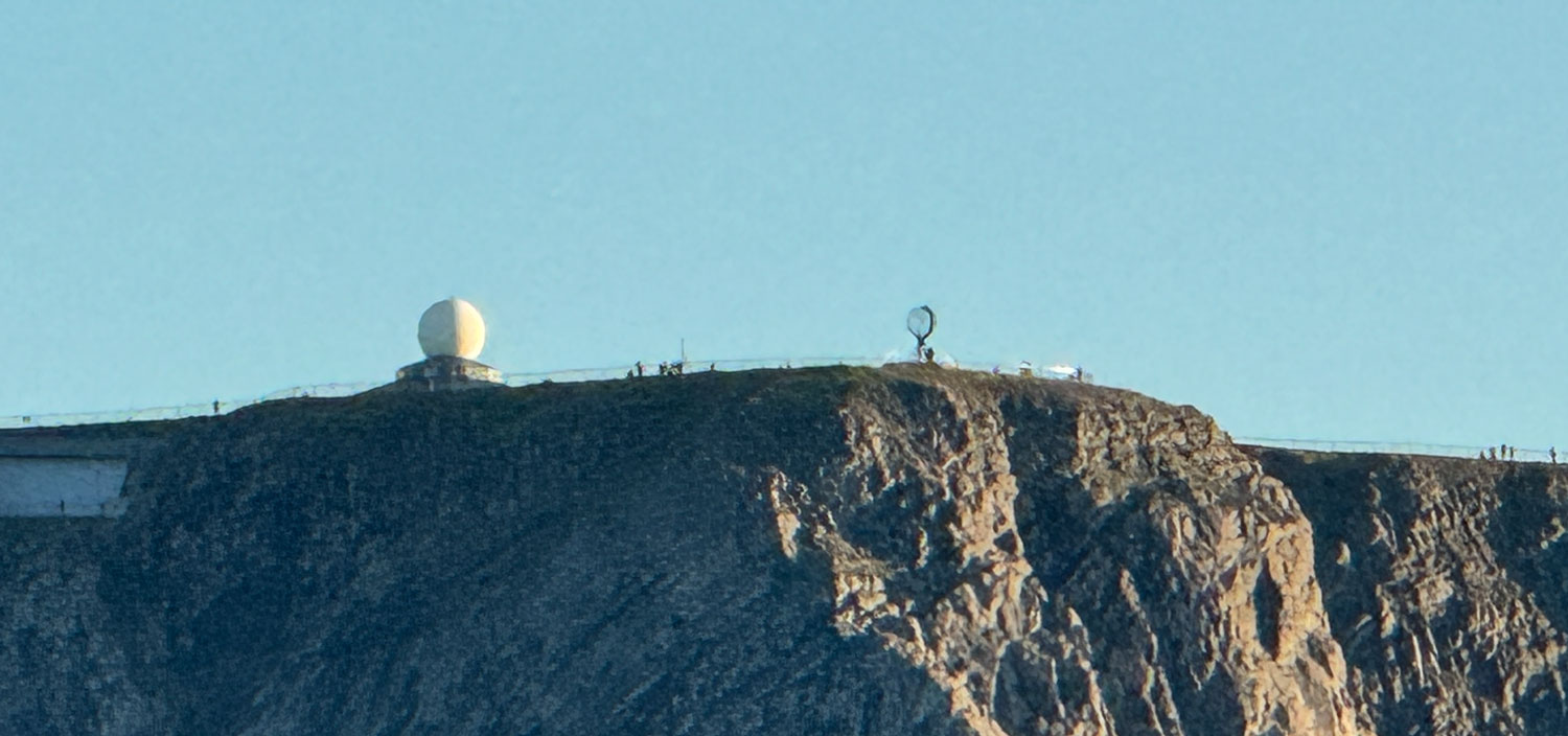
The captain departed Honningsvåg and headed north to go around the North Cape. As we were directly north of the cape, I took the following pictures.
Here, at maximum telephoto, you can see the building and "globe" that we were visiting earlier in the day.
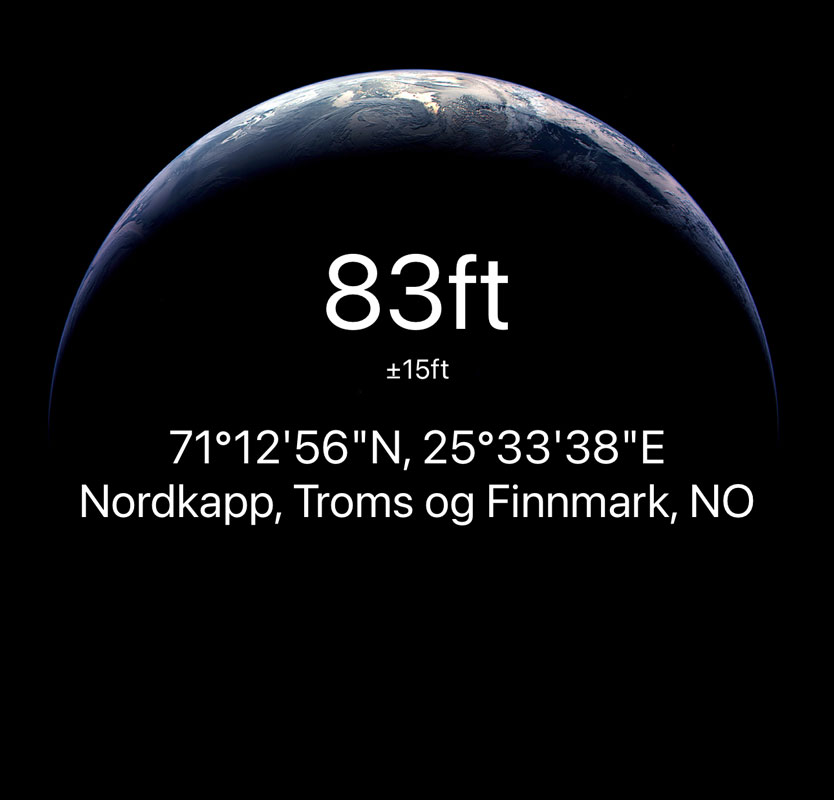
This was our location as we were off the cape, and the furthest north we went.
We skipped dinner and headed to bed. That was the end of our day, and the end of this installment.
We've reached the top of Norway and will now head back down the coast.
[Added note: The Northern Lights were out during the night. Judy and I missed them, but I got a few pictures from the Cruise Manager, Norbert Tesar. Here's a nice one.]