Antarctica
December 21, 2025 to January 8, 2026
Mike and Judy Henderson
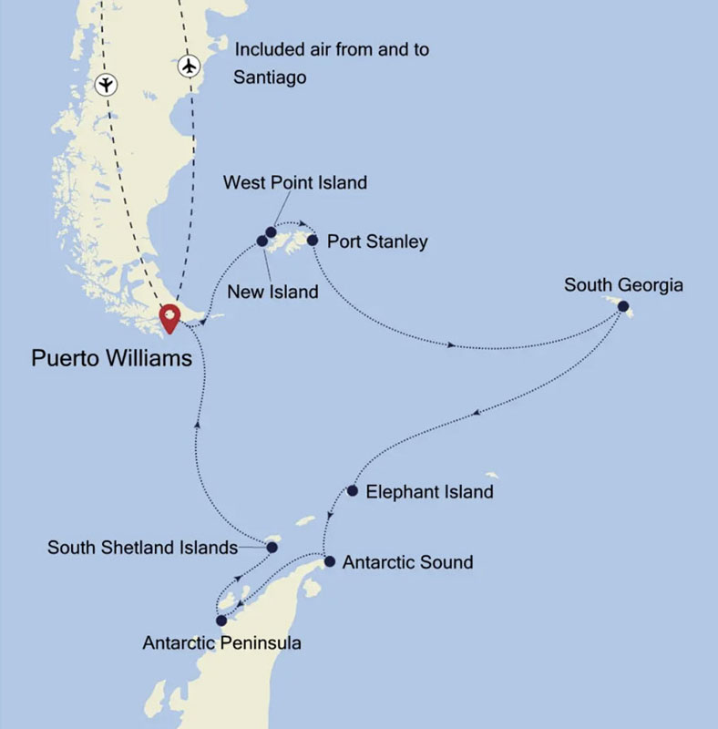
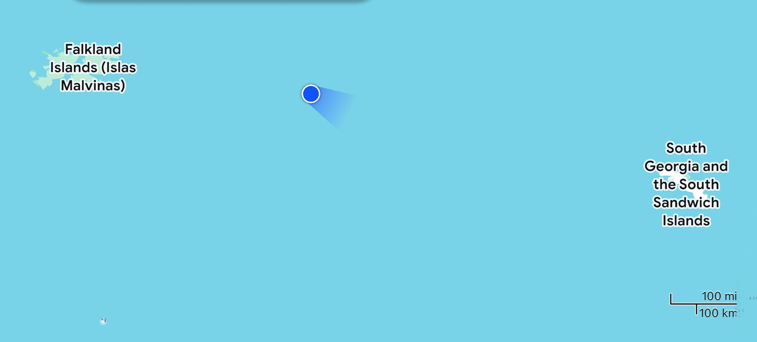
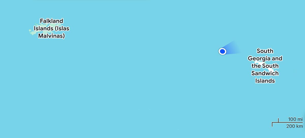
our cruise continues. I'll leave this map up for reference. As I start this installment we're heading for the Falkland Islands.
+++++++++++++++++++++++++++++++++++++++++
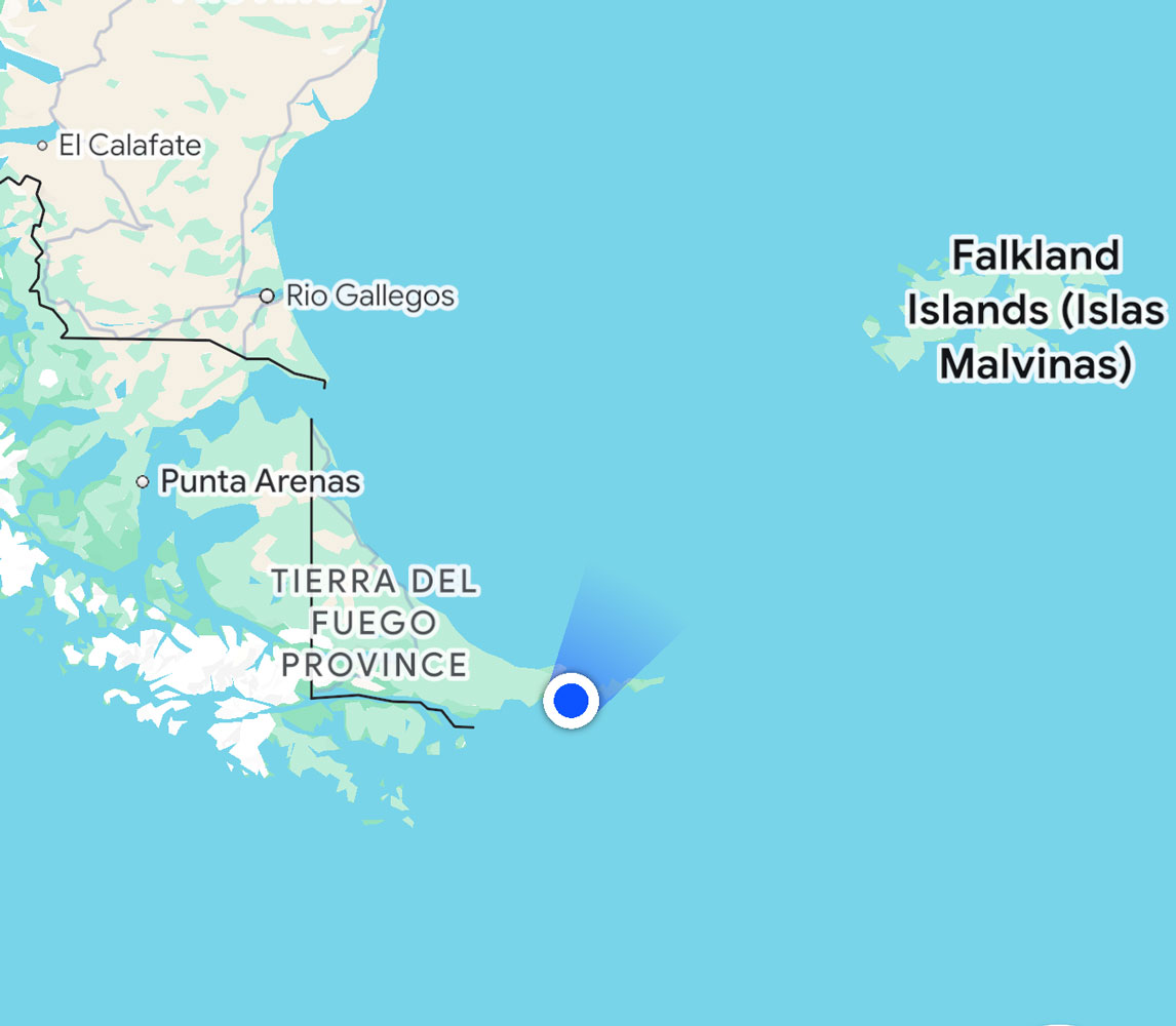
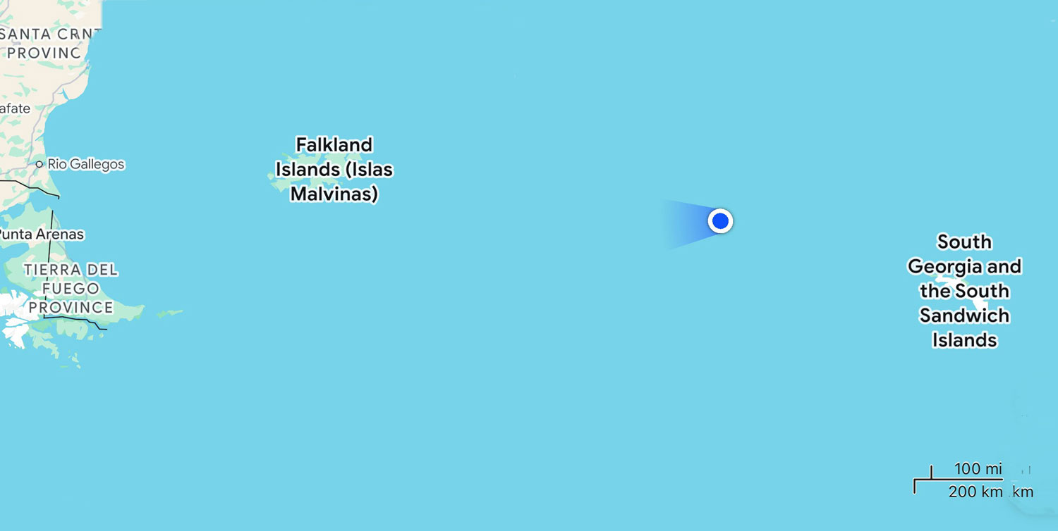
12/22/2025 (Monday) - At 7am this morning we're at 54°59'18"S, 65°10'13"W. We've departed the Beagle Channel and are heading around the tip of South America, on our way to the Falkland Islands.
We were up about 6am this morning, and had our first opportunity to use the shower. To quote Judy, it was "horrible". It's very awkward showering in the tub, and the tub only has a glass divider across half the tub. The shower head is a "rain" head and is located above the center of the tub. So a lot of water splashes out of tub and gets all over the bathroom floor. No matter how hard you try, the bathroom floor gets flooded. After using your towel to dry off, you have to put it on the bathroom floor to soak up all of that water. The towel then blocks the bathroom door from opening. They could at least install a shower curtain in the opening.
It's a real mess.
I guess that's a lesson for us. There's always something wrong with the cabins that are available for upgrade.
If you make reservations on this ship, my advice is to demand a cabin with a walk-in shower - unless you just want a tub bath.
We went to breakfast at 7:30, and at 8:30 we went to get our parkas. After trying the parkas on, we both chose a medium.
I was not feeling great from the loss of sleep, so went back to the room to take a nap. Judy went to a Voyage Overview lecture by Claudia Holgate, the leader of the expedition team. At 11am we had a mandatory briefing for all the guests on Zodiac safety and biosafety in Antarctica.
By then, Judy had crashed and we both took a nap until almost 2pm, but weren't called to go down to the Mud Room to get our boots until about 3pm.
We went down to the mud room on deck 3 and got our boots. Unfortunately, all the sizes were no longer available and Judy had to settle for a pair that were a bit small. If she uses thinner boot socks they will probably work fine.
I forgot to take pictures of the mud room while we were trying on boots but here it is with no one in it and no boots. After we use the boots the first time, we'll clean the boots and leave them on the rack in the mud room.
The staff put a tag with our room number on the boots so that they don't get mixed up with other people's boots.
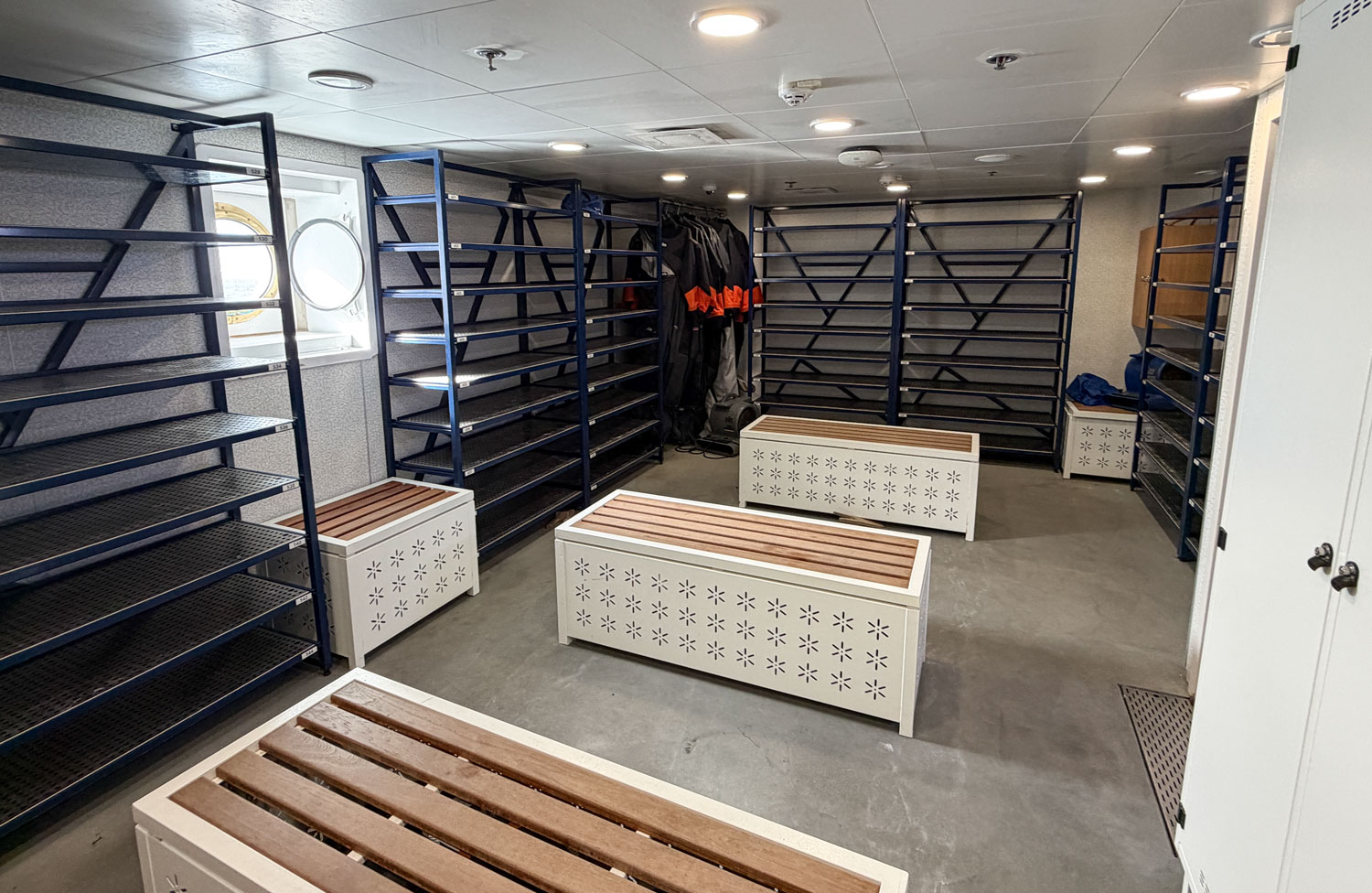
This is where we will wash our boots when we come back from an excursion.
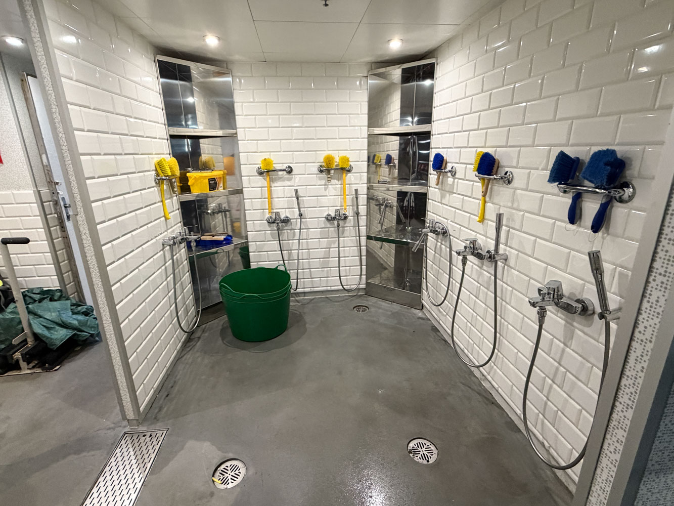
This machine is designed to scrub the boots. On our previous trip it wasn't used very much.
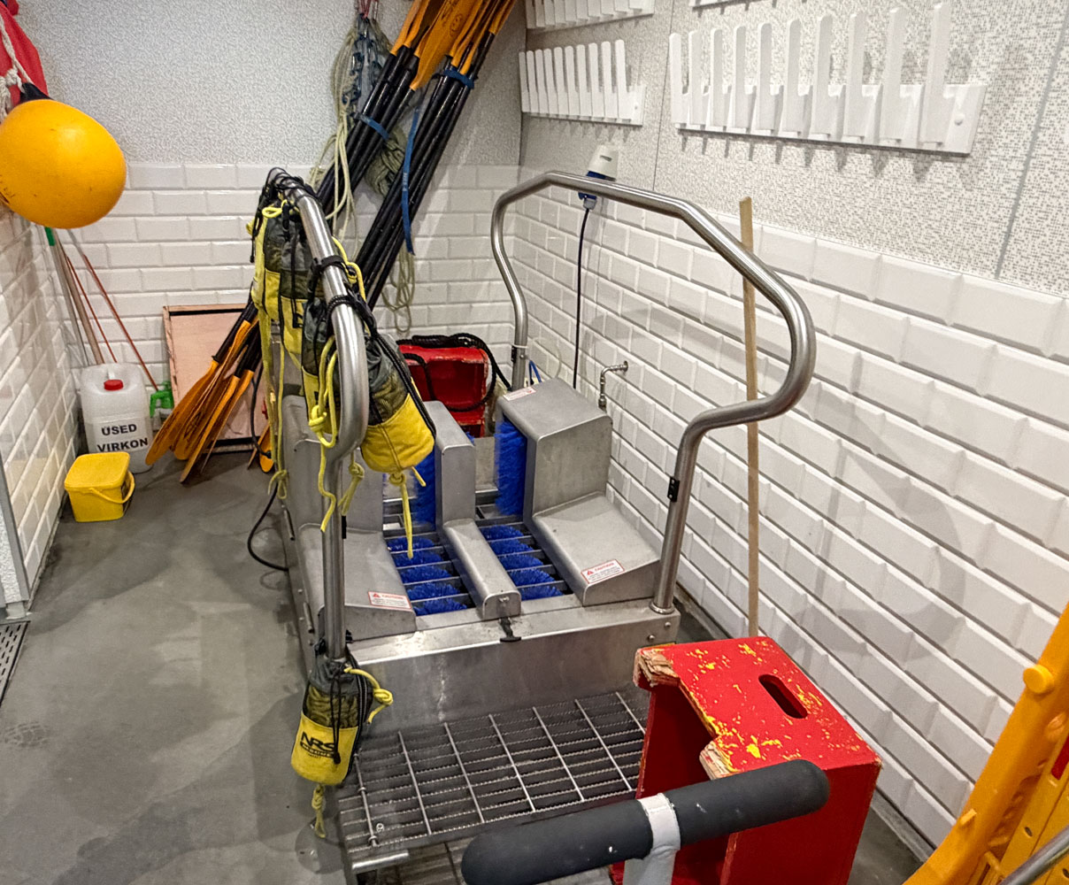
The boots are insulated and a bit heavy but they weren't hard to walk in.

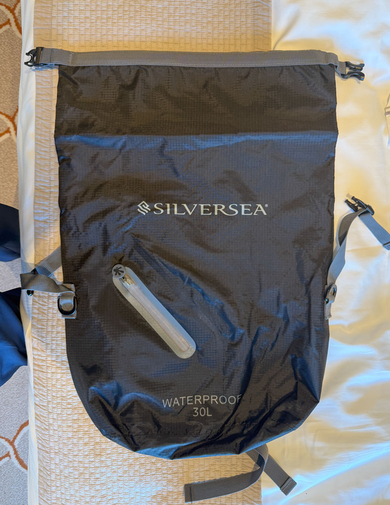
On our way back to the room, I stopped at the little store on board and bought a lightweight backpack. The ones Silversea provided are fairly heavy.
We went back to the room and slept until 5:30pm. We probably won't be able to sleep tonight but we both needed the rest.
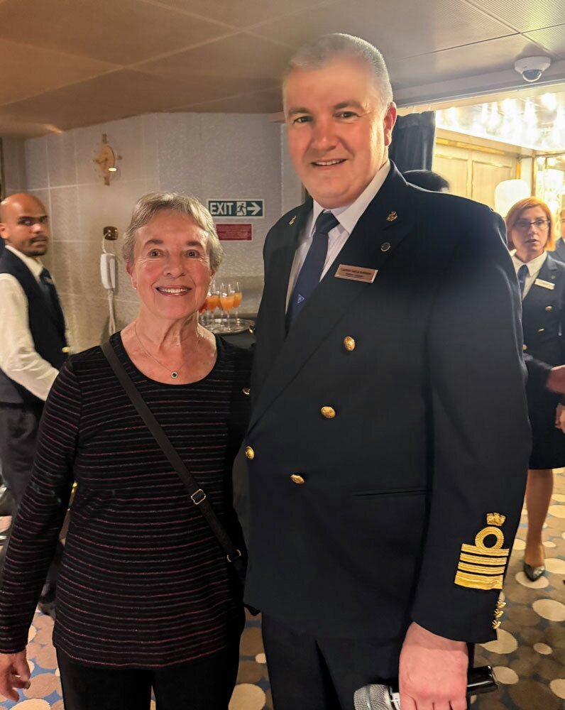
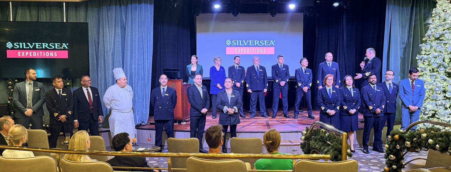
The Captain's general reception began at 6:30 in the theater, where we met him and his staff.
When we entered, I took this picture of Judy and the Captain, Sasha Kolosov. Turns out, he was the Staff Captain on the Silver Cloud on the Antarctic voyage we took in December/January 2021/22.
He gave a good presentation.
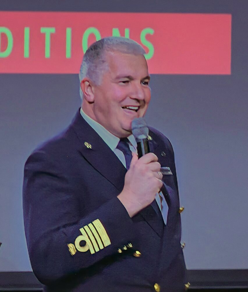
And introducing his staff.
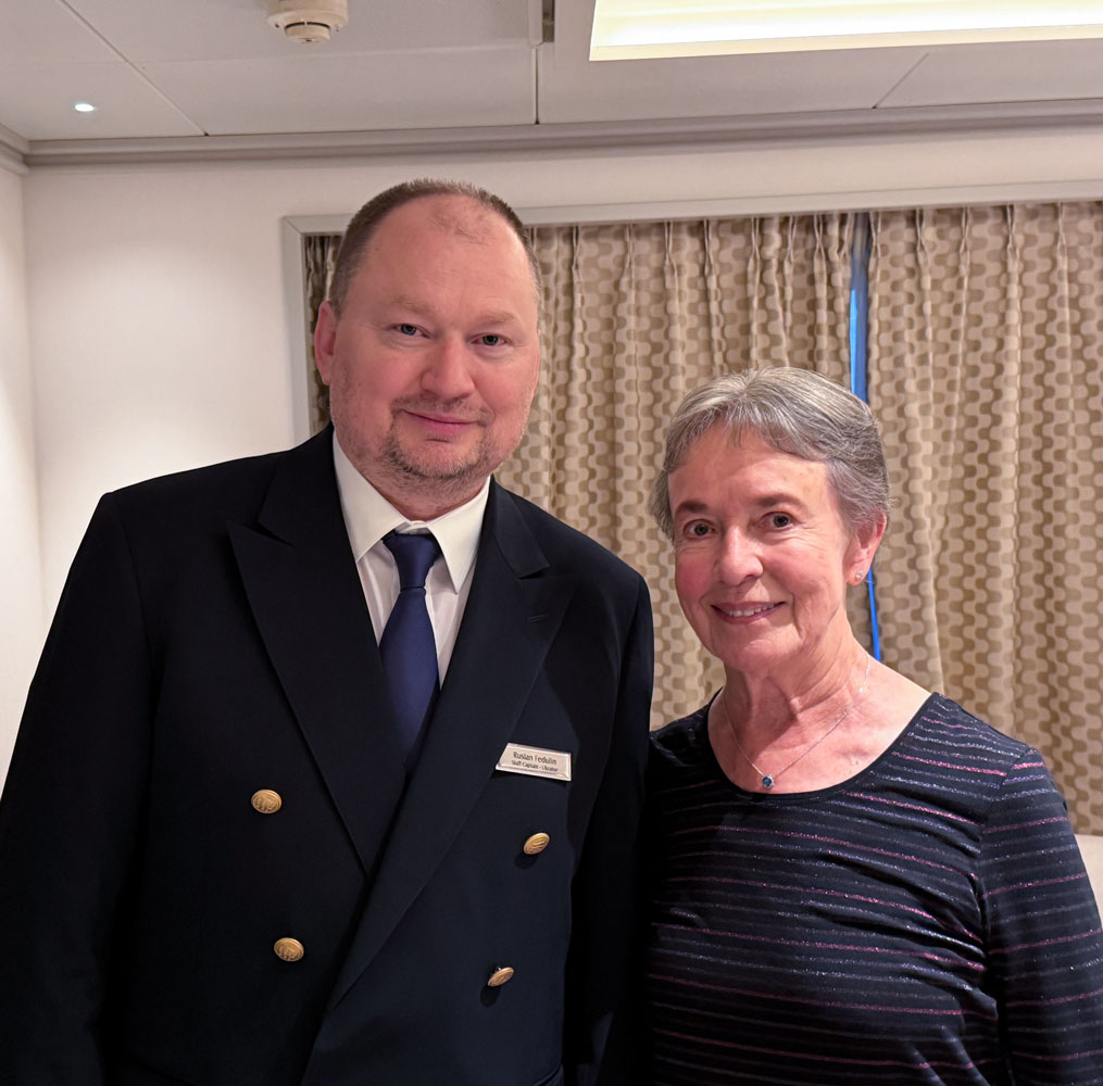
At 7:30pm, after the general reception we went to the dining room for the captain's dinner. We were seated with the Staff Captain, Ruslan Fedulin and one other couple.
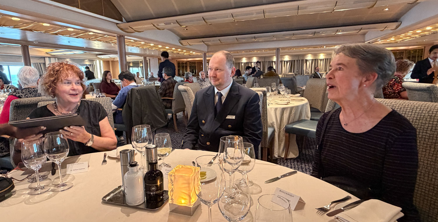
It was a good evening with enjoyable conversation. Judy told the Staff Captain of a problem we had with a door in our cabin, and he asked if he could come see it himself. We took this picture while he was there.
By then, it was close to midnight and was the end of our day. Both Judy and I were still tired and went immediately to bed. We have a 6:30am excursion tomorrow and the restaurant opens at 5:30. We set our clocks for 5am.
+++++++++++++++++++++++++++++++++++++++++
12/23/2025 (Tuesday) - We arrived about 6am at New Island of the Falkland Islands this morning.
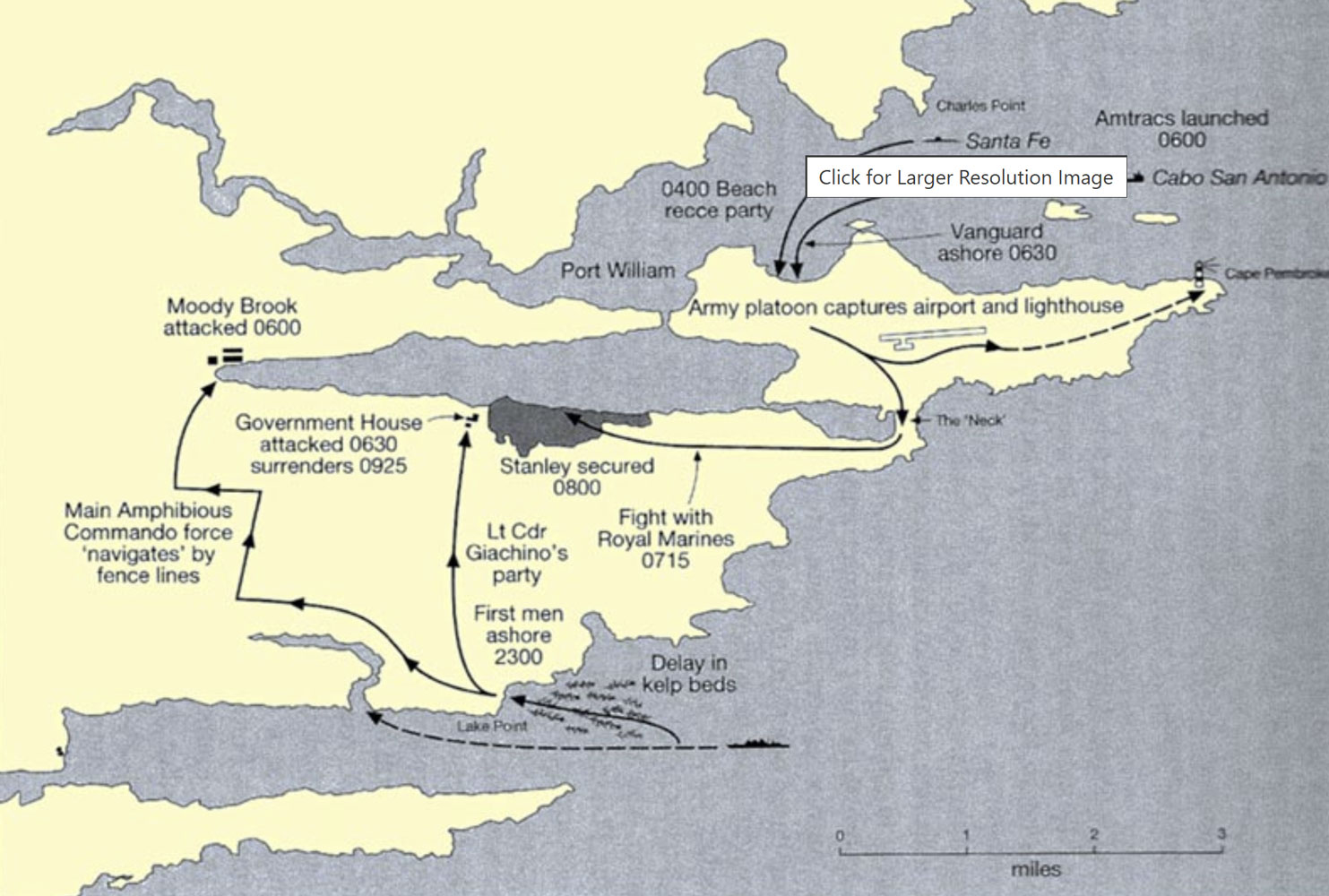
The Falkland Islands are primarily known today because of the war between Argentina and the UK in 1982. On April 2, 1982, Argentina invaded and occupied the Falkland Islands. This map shows the invasion landings and subsequent attacks.
Argentina claimed the Falkland Islands, which they called the Islas Malvinas, based on an 1816 claim to the islands by Argentina. However, Britain had maintained a colony on the island since 1833, almost 150 years, when the war started in 1982. If you want to learn more about the various claims to the Falklands, see here and here.
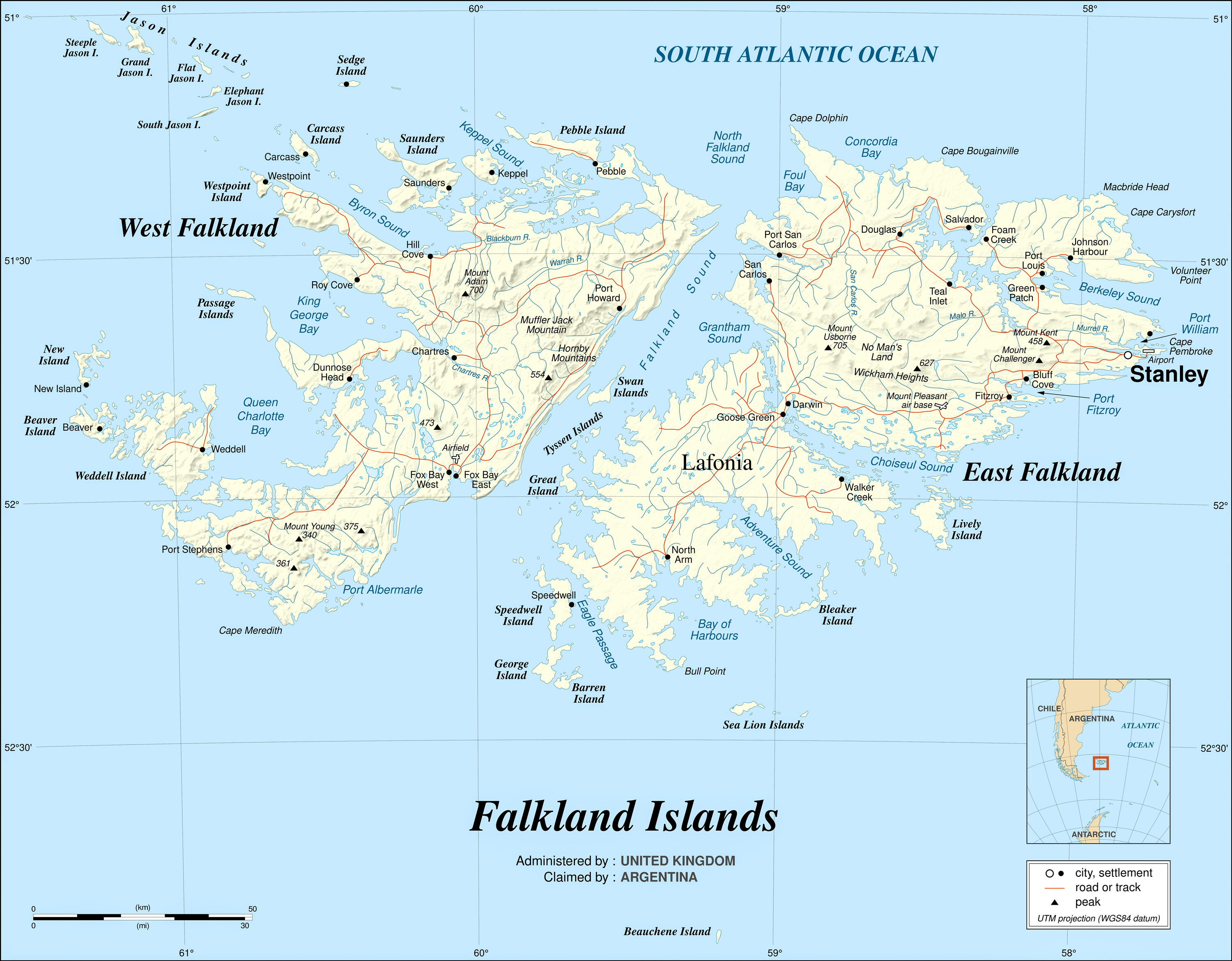
Here's the best map I found of the Falkland Islands. I scaled it down for this page but if you download it you will get a larger version. An even larger version of the map can be found on Wikipedia, but it's in svg format.
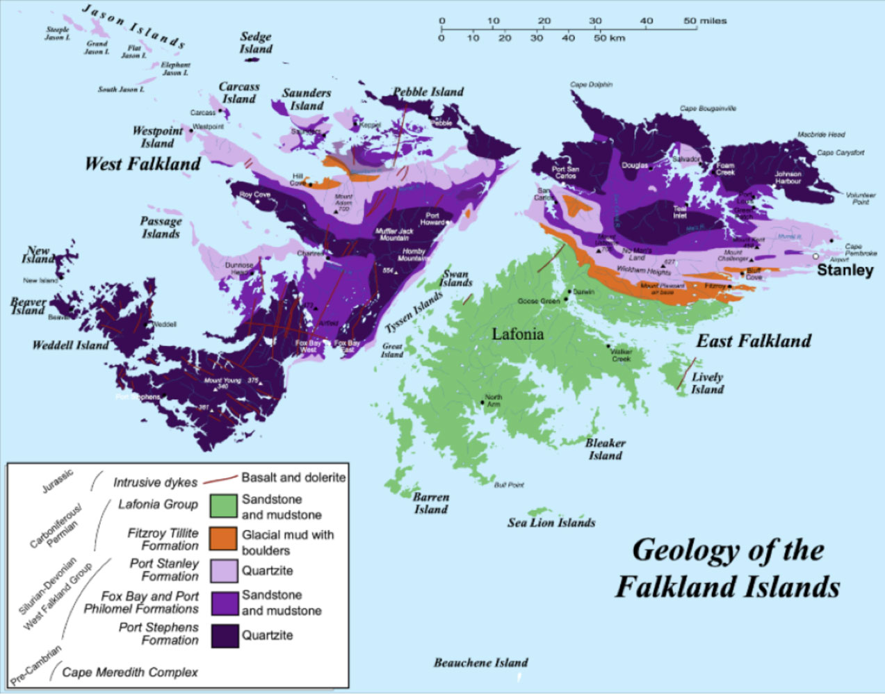
The Falkland Islands are not of volcanic origin. Here's a geology map and you can see more here.
Prior to 1982, the UK was open to giving up the islands because they were so far away, they had no economic value, and there were not many people on them - less than 2,000 on all of the Falklands in 1982. One proposal was a recognition of Argentine sovereignty, but with a 99-year-lease to Britain, as was done with Hong Kong. But the islanders were very opposed to Argentine sovereignty, so the issue was never resolved.
Argentina brought actions in the UN and other places based on the historical record of territorial grants. And based on that record, Argentina had a good case. But the UN, especially, was not very interested in history and had adopted a policy of self-determination by the people living in the area. To do otherwise would have opened up a lot of demands for the return of colonies by European countries.
And since almost all of the people living in the Falkland Islands were British, it was clear what the outcome of a referendum would be. So Argentina chose military action.
In Argentina, the Peron government had been replaced by a military dictatorship in 1974, which by 1981 was failing. The leader, Leopoldo Galtieri, decided that an invasion of the Falklands would unite the country and rally the citizens to his leadership. The ruling junta had instigated the Dirty War (1976-1983) and the people were rebelling because of it.
The Argentine leadership believed that the UK would not fight to recover the islands, but they were wrong. The UK put together a naval task force and sailed to the islands. There was a major difference between the two militaries. The UK had modern, well-trained and well-equipped forces. While some of the Argentine forces were well trained, especially the navy and air force, much of the army consisted of short time conscripts. The majority of them were not well trained (and were poorly treated by their officers), and the Argentine forces had very few modern aircraft, ships or weapons.
But it was not a cake walk for the Brits. The Falkland Islands were 8,000 miles from the UK, so the logistics were daunting. Additionally, the UK did not have an AWACs (Airborne Warning And Control) capability, which allowed Argentine aircraft to successfully attack a number of the British ships - six were sunk and many more damaged. Argentina lost the light cruiser General Belgrano to an attack on May 2nd by the British nuclear submarine, Conqueror and after that, the Argentine navy did not participate in the war.
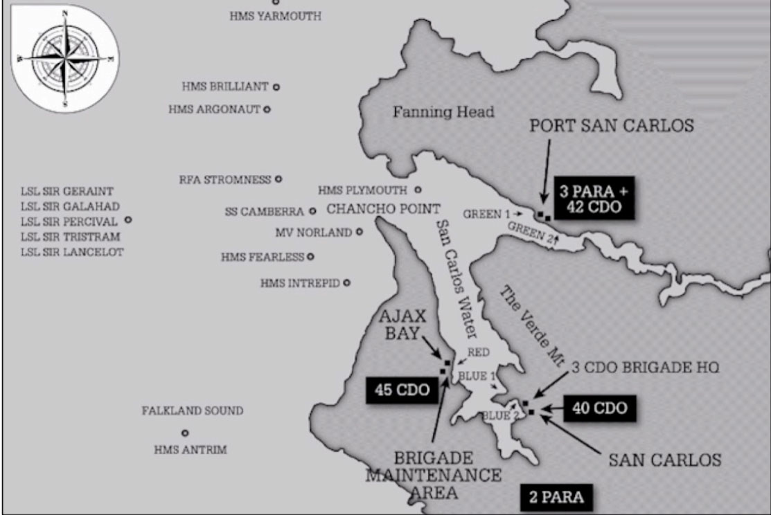
British forces landed on the islands on May 21, 1982 at San Carlos Water, 50 miles across East Falkland Island from Stanley. The Argentines had expected the British to land closer to Stanley and had arrayed their forces to repel such landings. The British essentially came in behind the Argentine prepared positions.
Helicopter transport was scarce and reserved mainly for supplies so the soldiers had to walk to Stanley across some difficult terrain. They called it "yomping".
Gorse (Ulex europaneus) had been brought to the Falklands in 1848. It's a dense plant with thorns that was difficult to walk (or crawl) through, and made the yomp across West Falkland Island difficult. The war was in the middle of winter so, in addition to the gorse, the troops also faced cold and wet weather. Gorse also burns easily and it often caught fire from tracer rounds during combat.
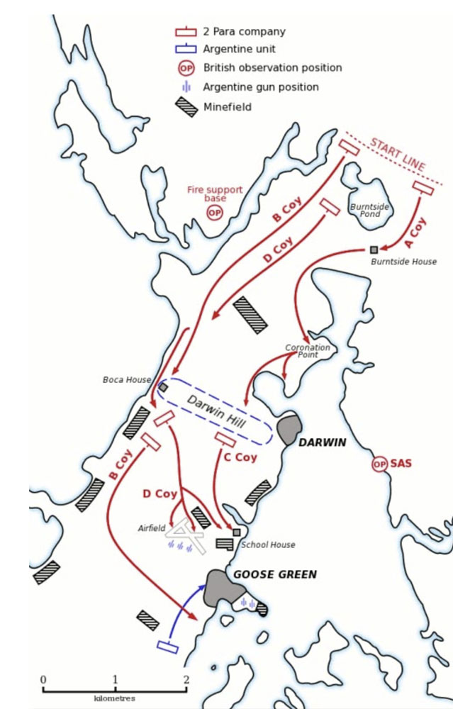
The first battle was the attack on the Argentine position at Goose Green. In a hard fought battle the British soldiers captured the position. Here's a map. (Coy is their abbreviation for "Company")
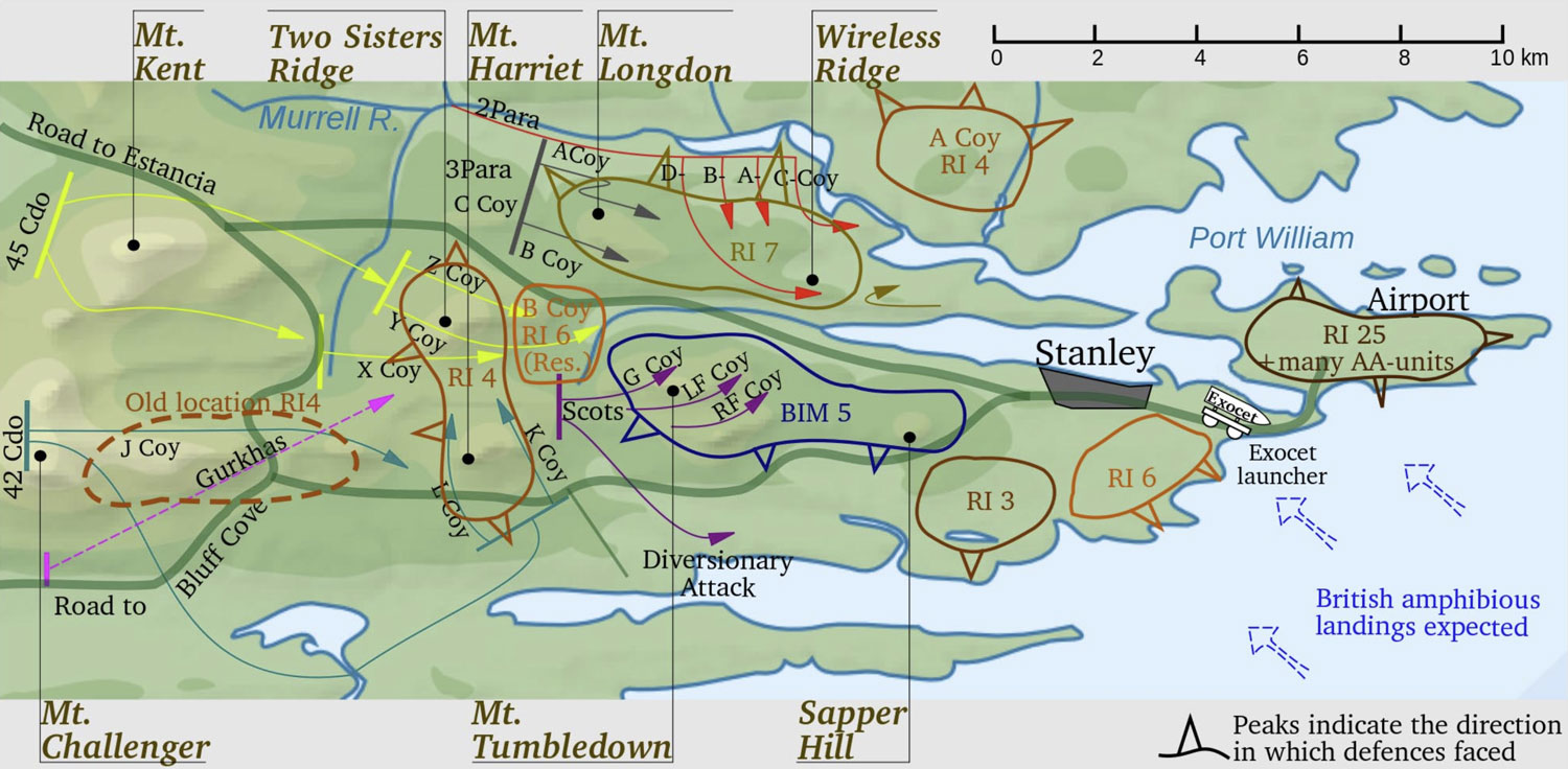
Then the army crossed the island and fought difficult battles in the approach to Stanley, especially Mount Longdon, Two Sisters, Mount Harriet and Tumbledown Mountain.
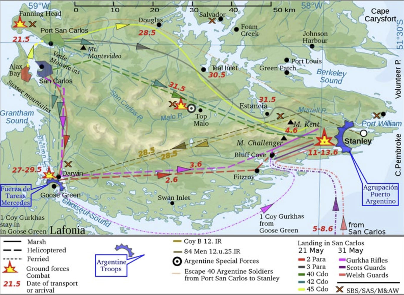
Then they converged on Stanley.
The situation was then hopeless for the Argentines for many reasons and they surrendered on June 14, 1982. It's worth saying that the British were extremely fortunate they were fighting a third rate military power. A better trained, motivated, and better led military would likely have defeated the British. For example, Argentina had three submarines which could have attempted to sink or damage the two British aircraft carriers. If successful, that could have put an end to the war immediately. But the submarines did not even make an attempt.
There are many websites which have pictures from the Falklands War, but surprisingly many of the pictures are not very good.
Since the war, Argentina has continued to press their claim to the Falklands, but the UK has refused to even discuss the sovereignty issue, for obvious reasons - 255 of their service members and three British civilians were killed retaking the islands. The UK will never give up the Falklands now.
In 1982 there were about 1,847 people on all of the Falkland Islands. Today, the population estimate is 3,470, with about 80% in Stanley, and it is growing. To a large extent, Stanley is the Falkland Islands. Everything outside of Stanley is called the "Camp" by the Falklanders.
There are many books about the war. If you're interested in learning more, a good, easy-reading one is "The Falklands War" by Martin Middlebrook.
A piece of trivia - the latitude of the middle of the UK is about 55˚ N, while the latitude of the Falklands is about 51.8˚ S. So the Falklands are closer to the equator than the UK! The Falklands are about as far from the equator as London.
++++++++++++++++++++++++++++++++++++++++++++++++++++
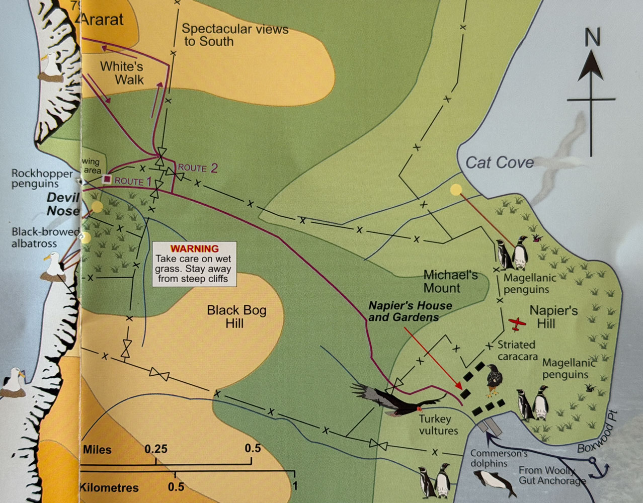
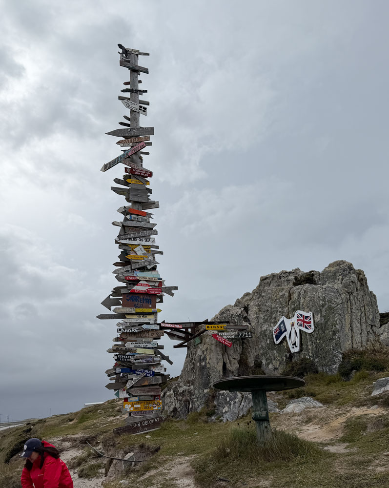
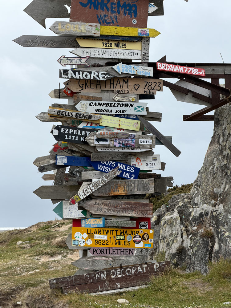
But back to today. Here's a map of New Island and a detail of both the north and south parts of the island.
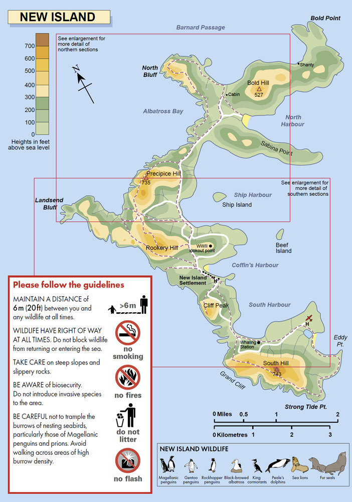
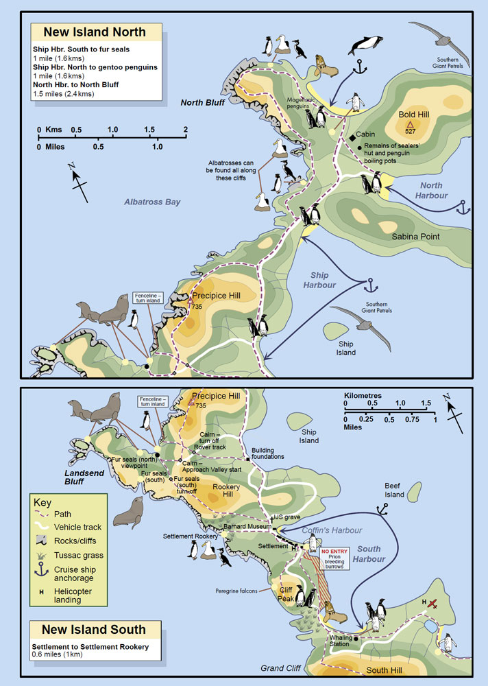
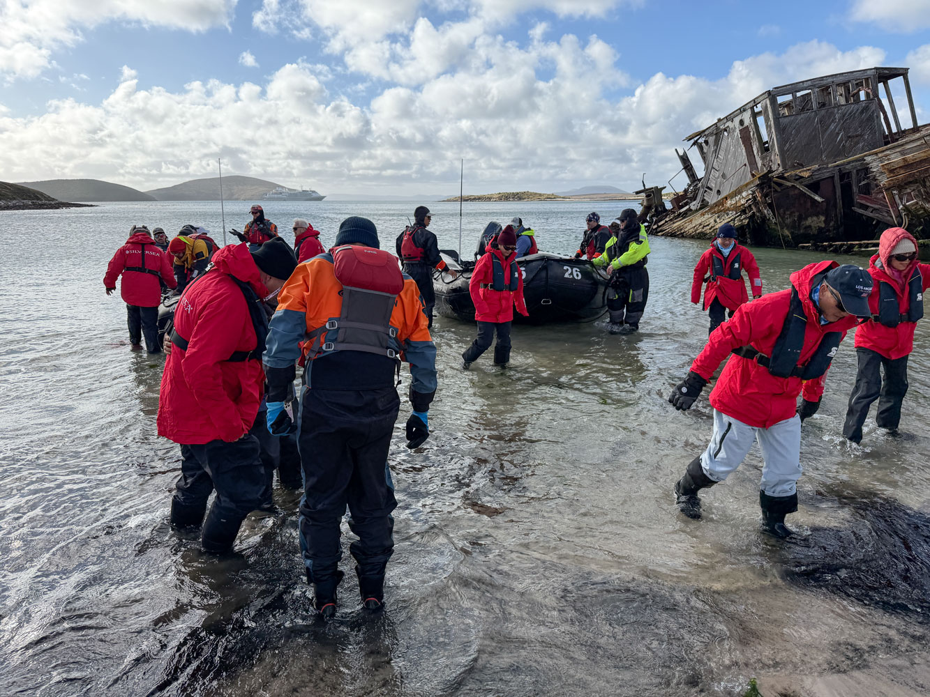
We landed at Coffin's Harbor and walked up to Rookery Hill to see nesting birds and Rockhopper Penguins.
This will be what they call a "Wet Landing" meaning that when we get out of the Zodiac, we'll be standing in shallow water. So the dress for today is insulated boots, waterproof pants, and our parkas (plus a stocking hat and gloves).
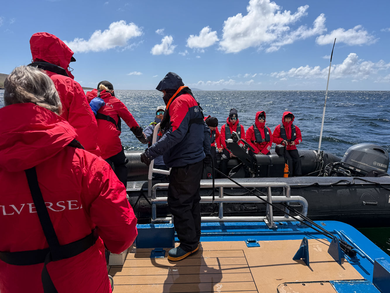
When we boarded the Zodiac I was in the front and took this picture of some of the other people on the excursion. The temperature was about 1°C and there was a wind but the sea was fairly calm.
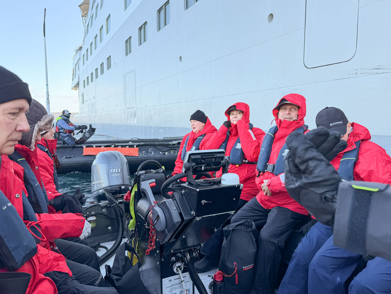
Here's our landing area. It's nice sandy beach with a gradual slope, allowing the Zodiacs to get close to shore - which gives us shallow water to offload into.
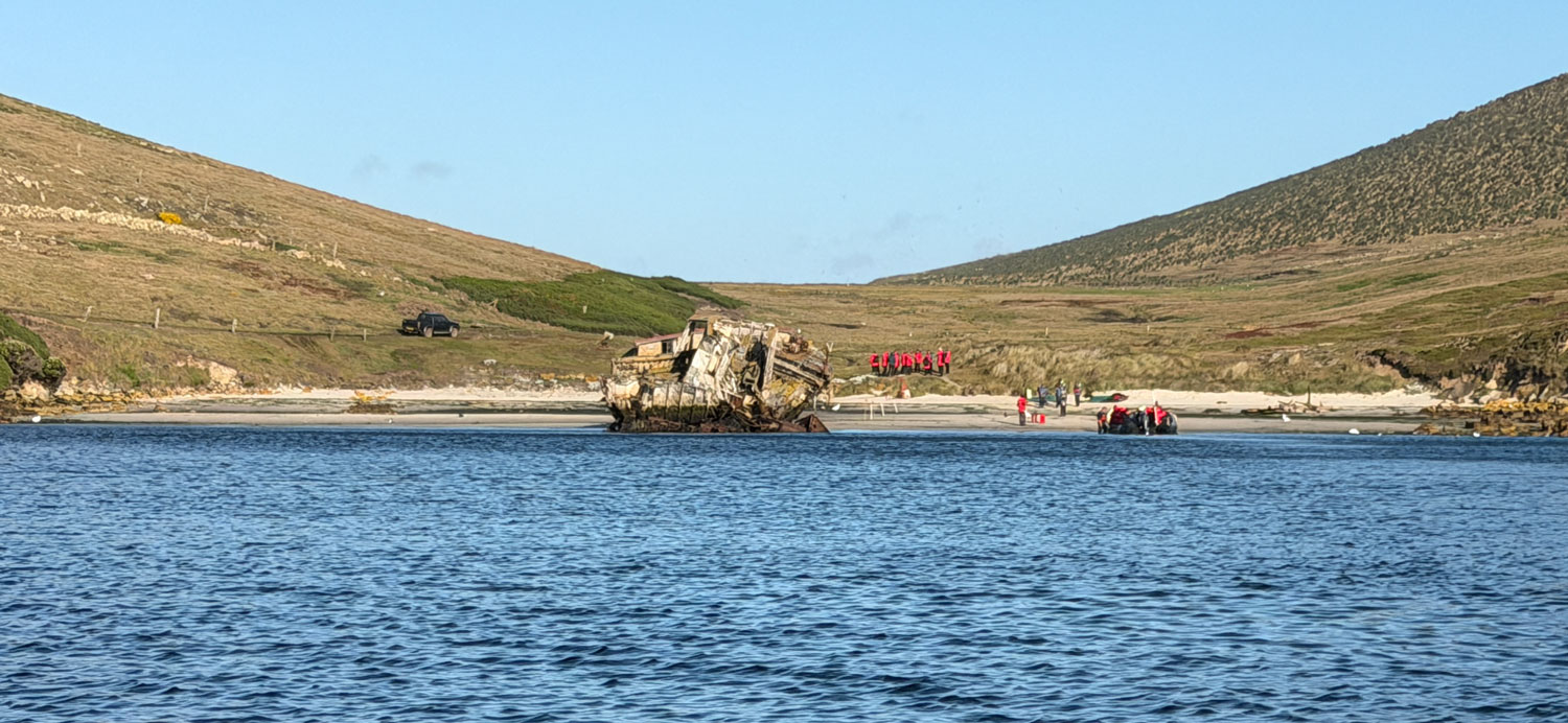
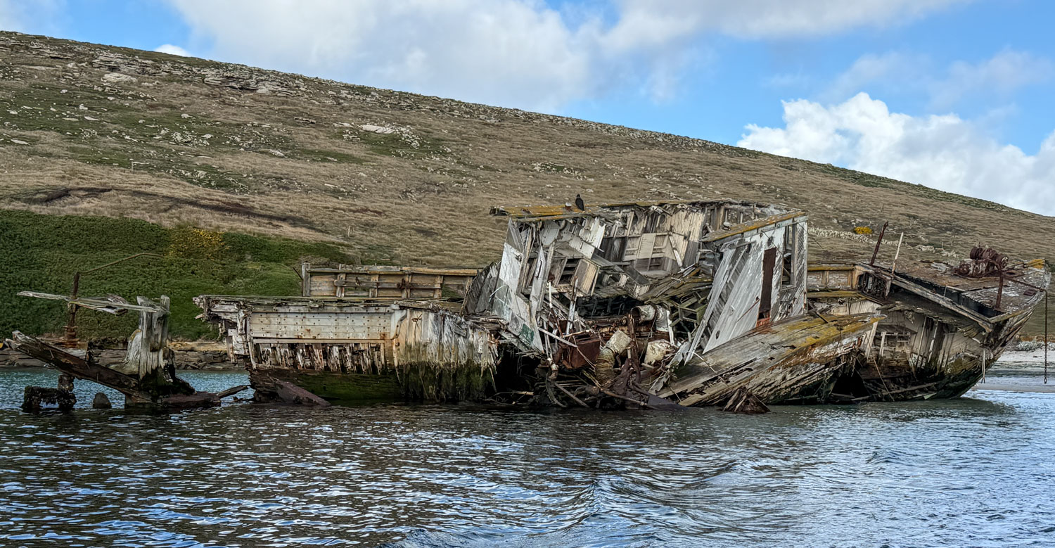
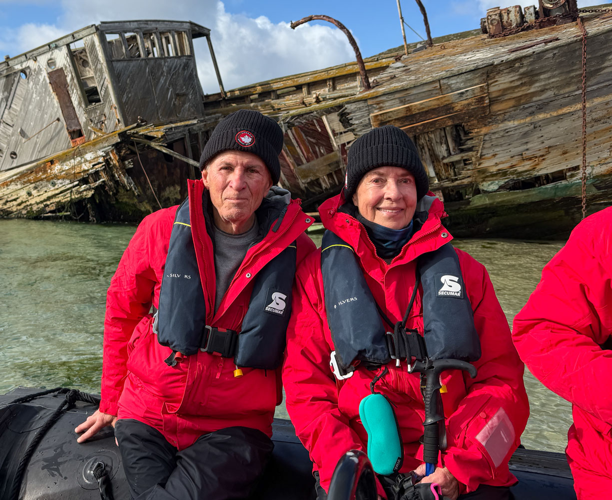
The remains of an old wooden-hulled boat rest at the landing area. We were told it was run up on the beach and abandoned.
After landing, we met our guide.
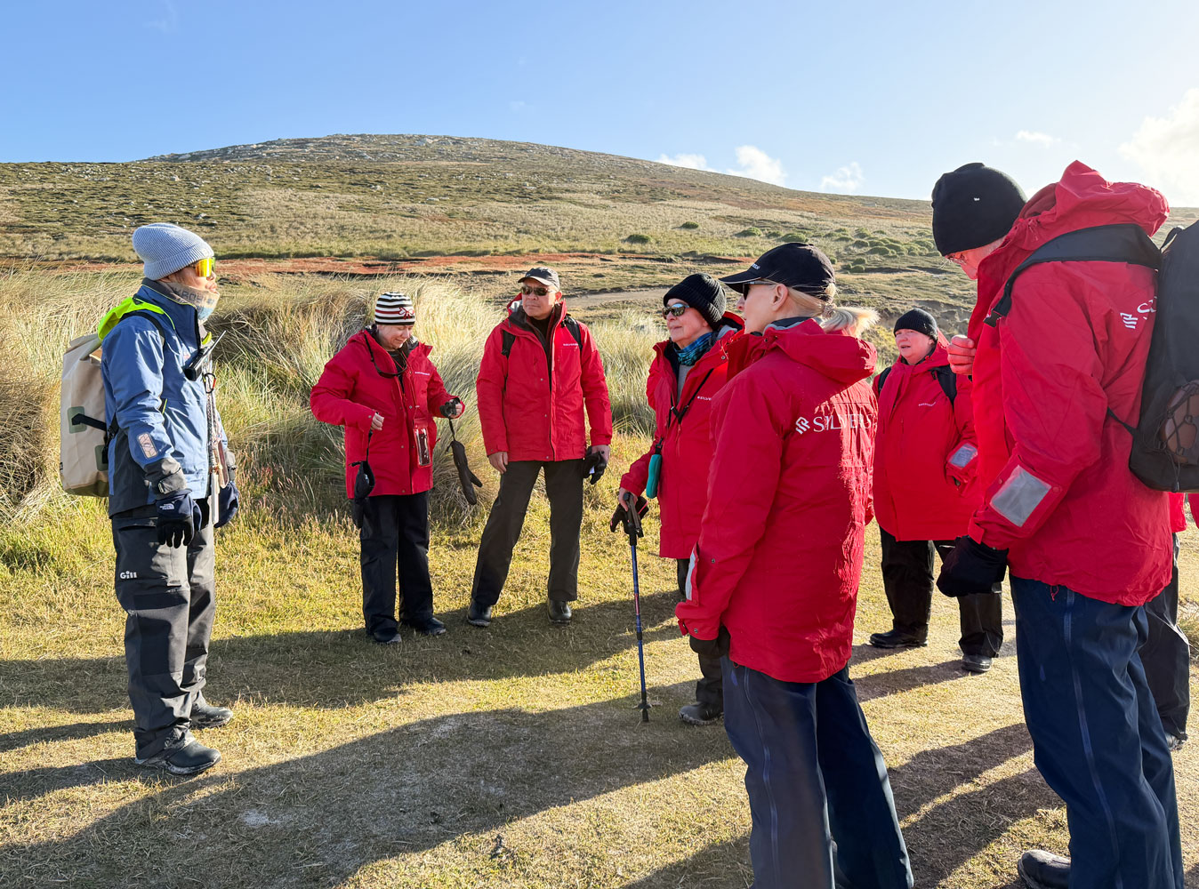
We began our walk to Rookery Hill. It was maybe 1.5km, but the ground was muddy and slippery in some places. Judy slid in the mud but landed sitting down, with no ill effects except mud on the back of her parka.
Here's the group walking along in easy terrain.
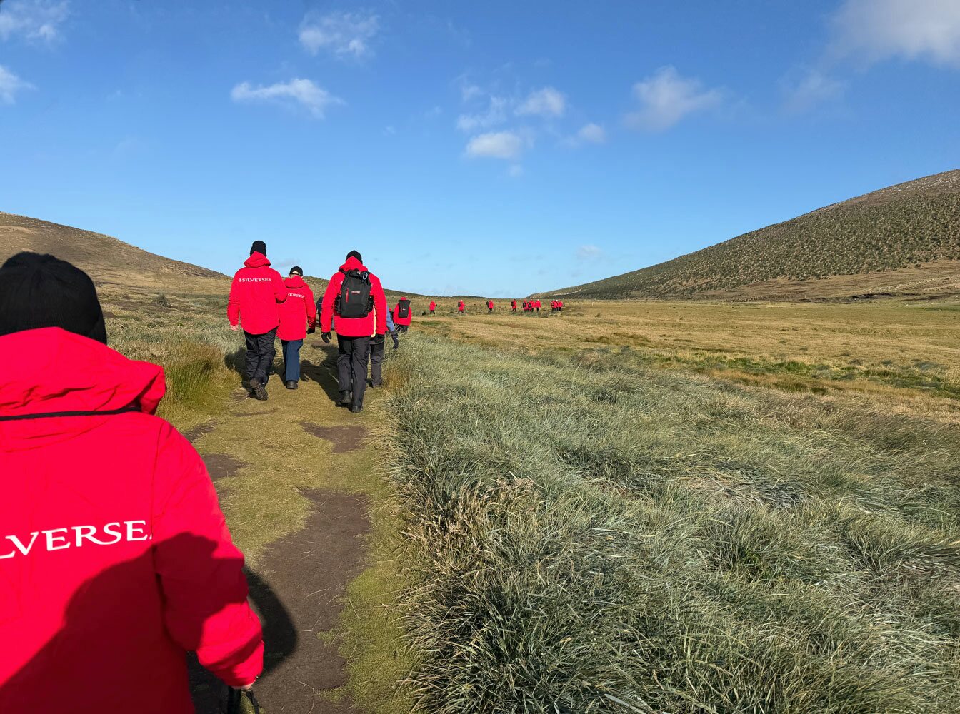
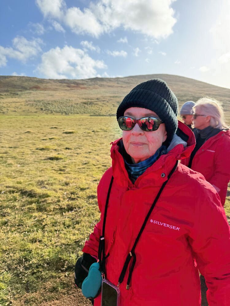
Here's Judy early in the walk.
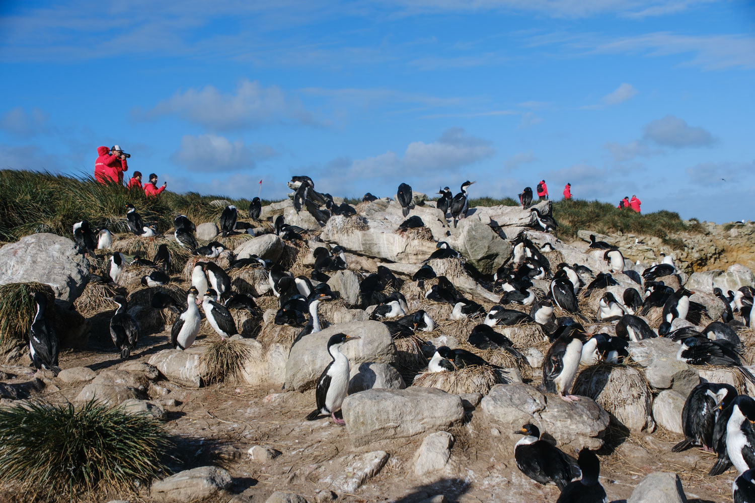
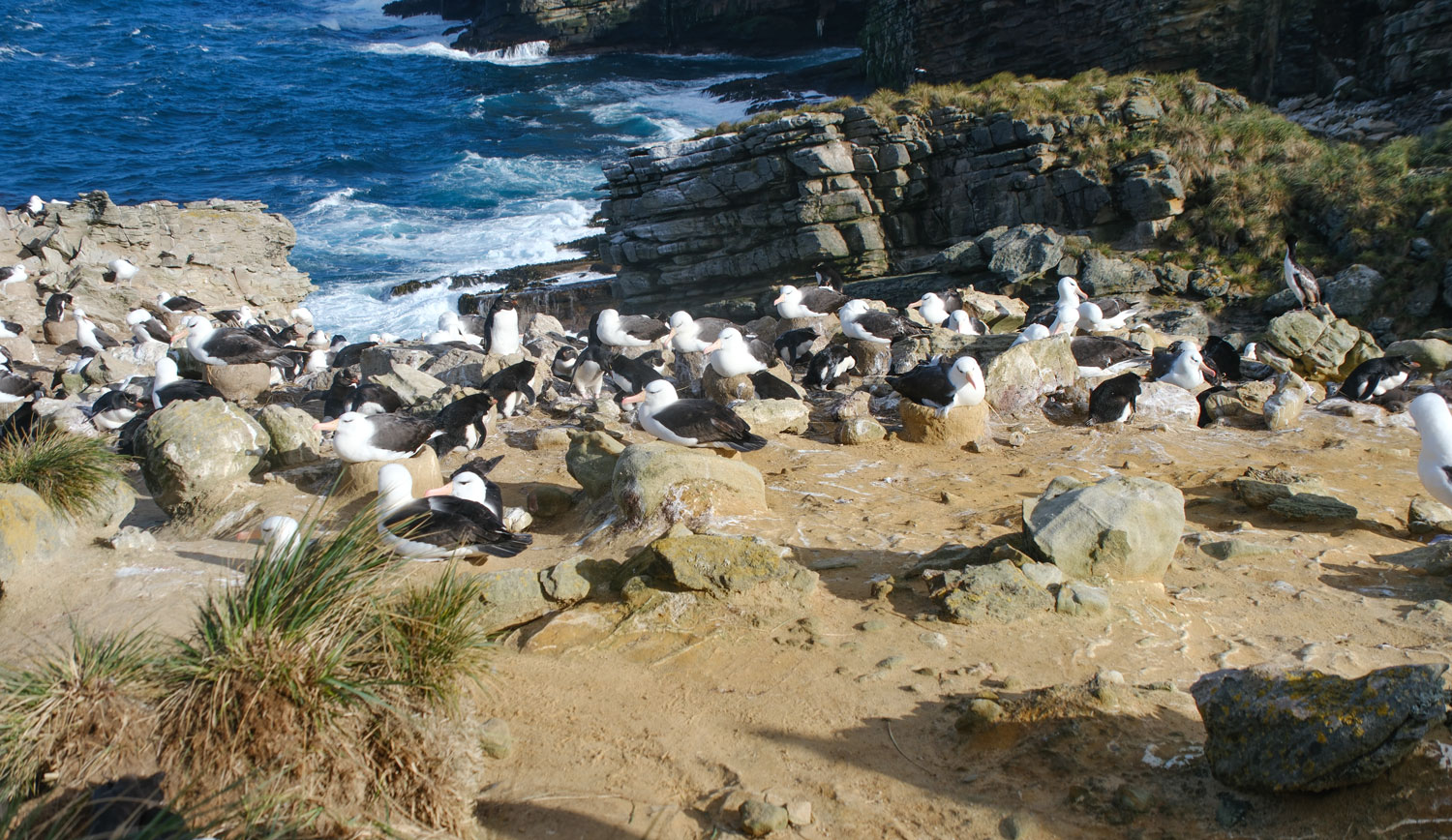
We eventually reached the rookery, on the back slope of the hill we climbed. In this picture, some of the people in our group are looking over the animals.
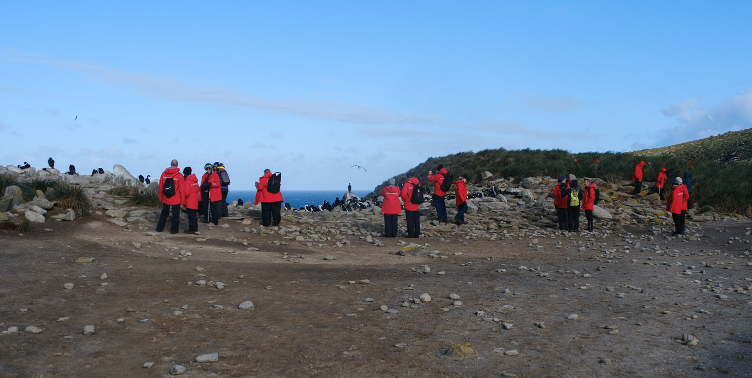
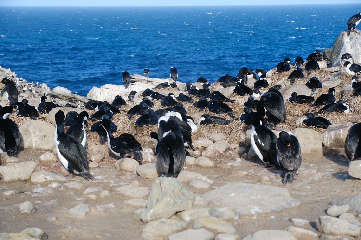
Some of the birds are cormorants.
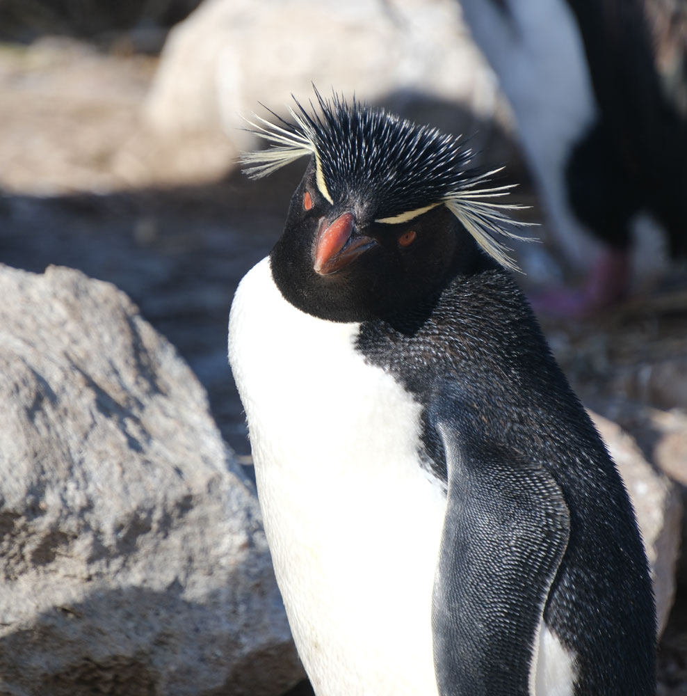
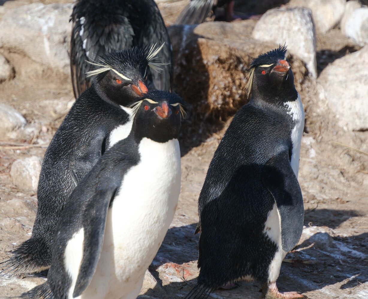
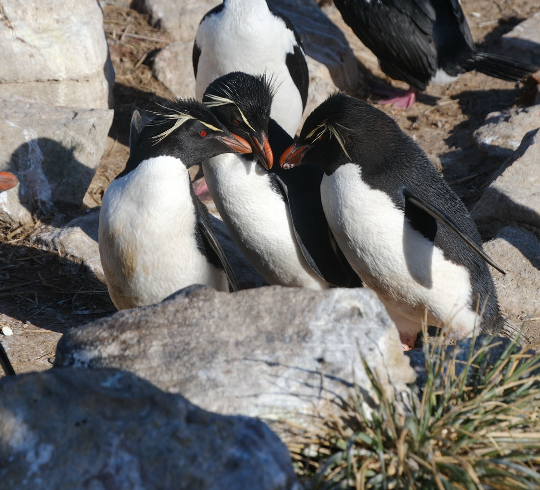
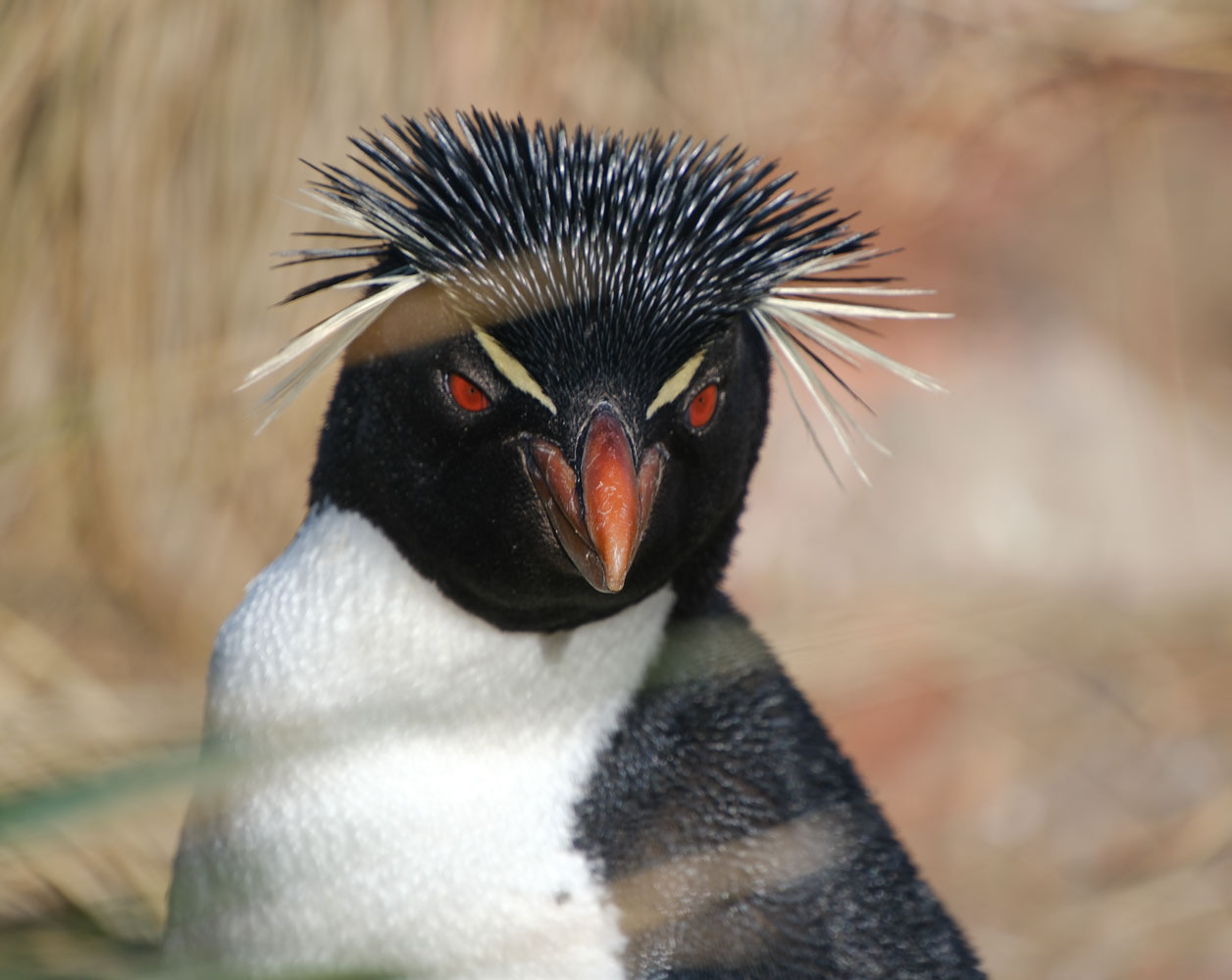
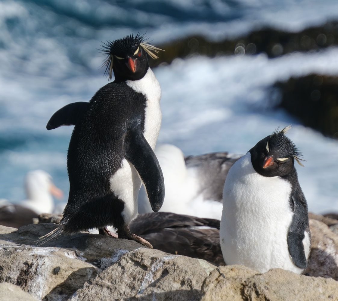
But the stars are the Rockhopper Penguins. They look like punk rockers. Their eyes are red, under their straight yellowish "eyebrows".
Another part of the rookery.
And more cute Rockhopper Penguins.
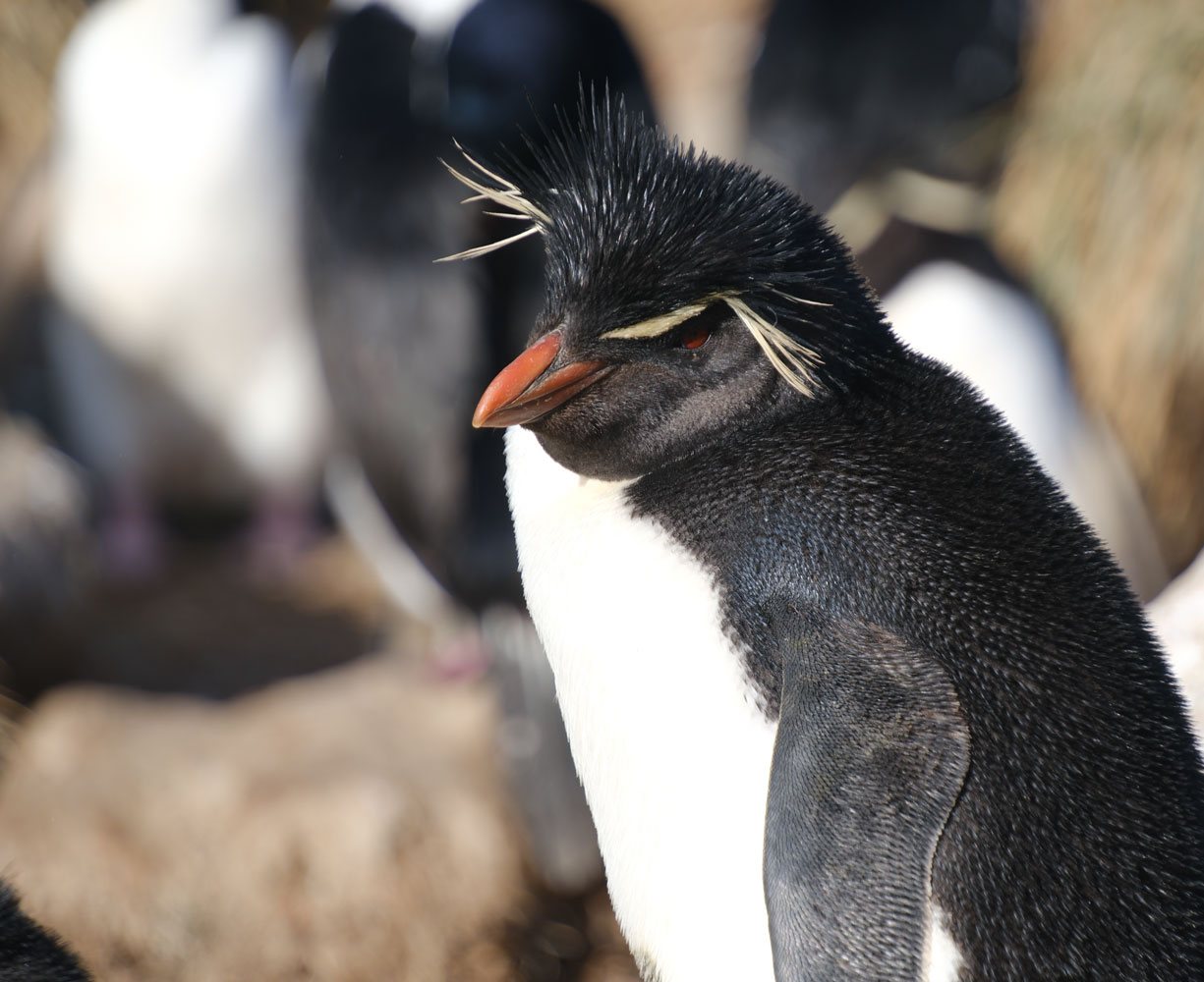
Here's a mother bird attending to her chick.
More of the rookery.

Those punk-haired Rockhopper Penguins again.
Two more rookeries are some distance from us, on the hillside. Lots of birds nest here.
We went back to the landing area and visited the "museum".
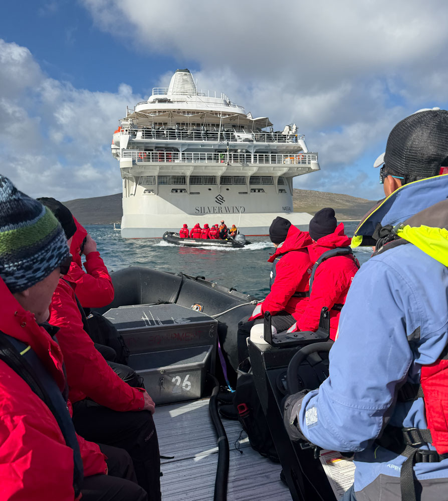
We'll wade out to the Zodiac returning to the ship.
One of the other guests took this picture of me and Judy, with the beached boat in the background. We were fairly warm in all the gear.
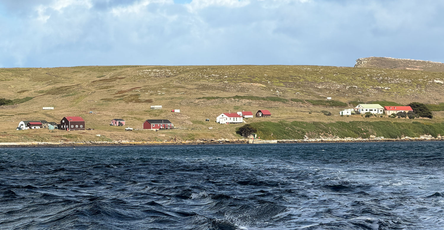
As we were pulling away we saw this little settlement. Can you imagine living here?
Approaching the ship.
We went through the boot washing procedure and then back to our cabin. It was still early, about 8:30am.
Later in the morning, I got a call from the front desk. They said that the passport number on my South Georgia Island ETA was different from my passport number. Turned out, I had a new passport and we didn't update Silversea with the new number so they applied for the ETA with my old passport number. Looks like we got it straightened out now.
We have another excursion on West Point Island this afternoon about 3pm, so we took a nap.
We had a late lunch and then got ready for the excursion. This one will be a "dry landing" so I wore my regular hiking shoes - and glad I did.
Boarding the Zodiac.
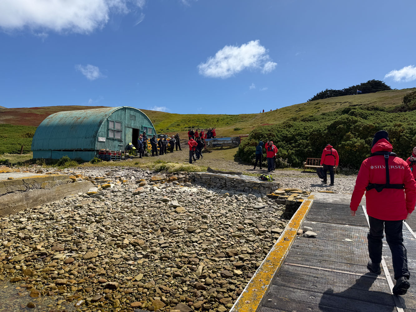
When we arrived at the landing spot, there was a dock so we did not have to wade through any water.
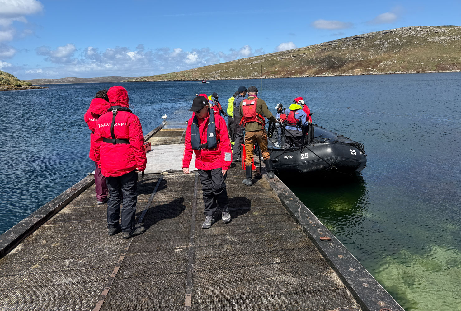
We walked over to the Quonset hut to gave the crew our life preservers. They are heavy and stiff, and it's nice to leave them behind.
Here are two maps of the area. The second map is a detail of the first.
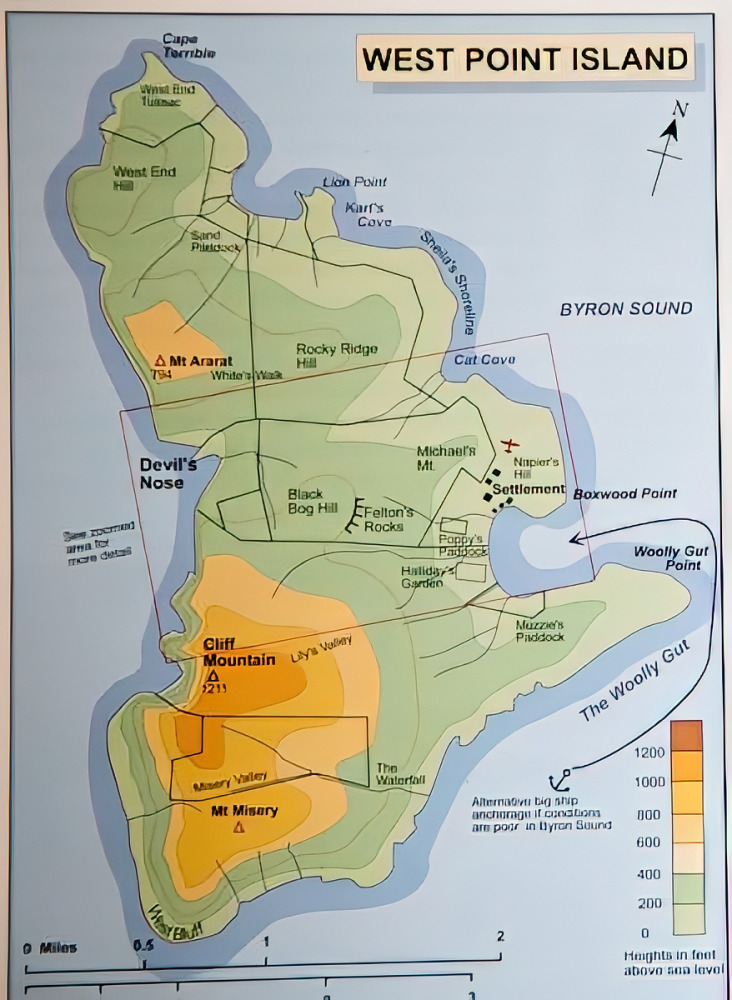
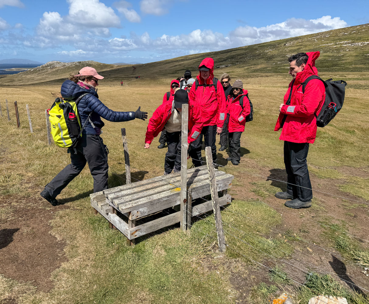
Look at the map detail, below. We landed at the end of the black arrow attached to the anchor symbol in the bottom right of the map below. We hiked along the dark red line on this map, marked "Route 1". From the Quonset hut at the dockage area, to the gate where the birds are was 2.04km, checked with my Apple watch. But the beginning of the trail was fairly steep - steep for a guy my age. They offered a ride in a Range Rover and Judy took them up on the offer.
As we hiked the trail, we came to one of these "fence stairs", called a stile, in two places along the trail. You step up on one side, lift your legs over one at a time, then step down on the other side.
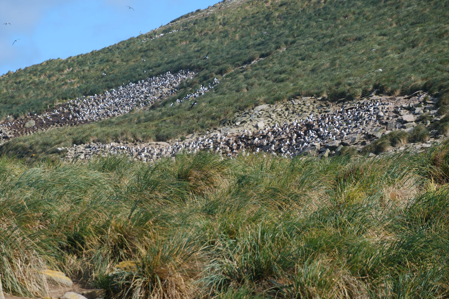
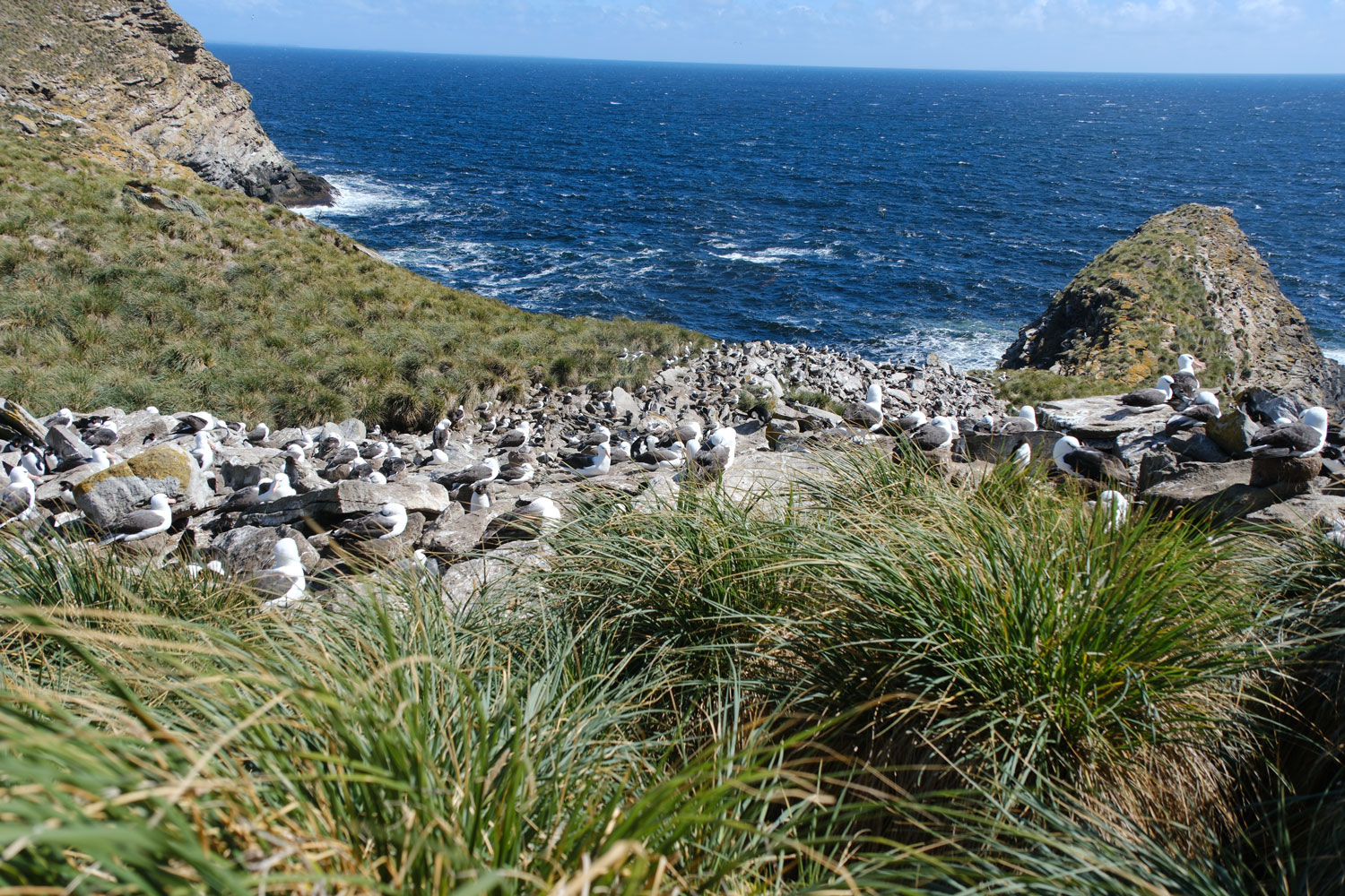
The rookeries were hard to see, with grass clumps blocking the view. But I think I got a few pictures.
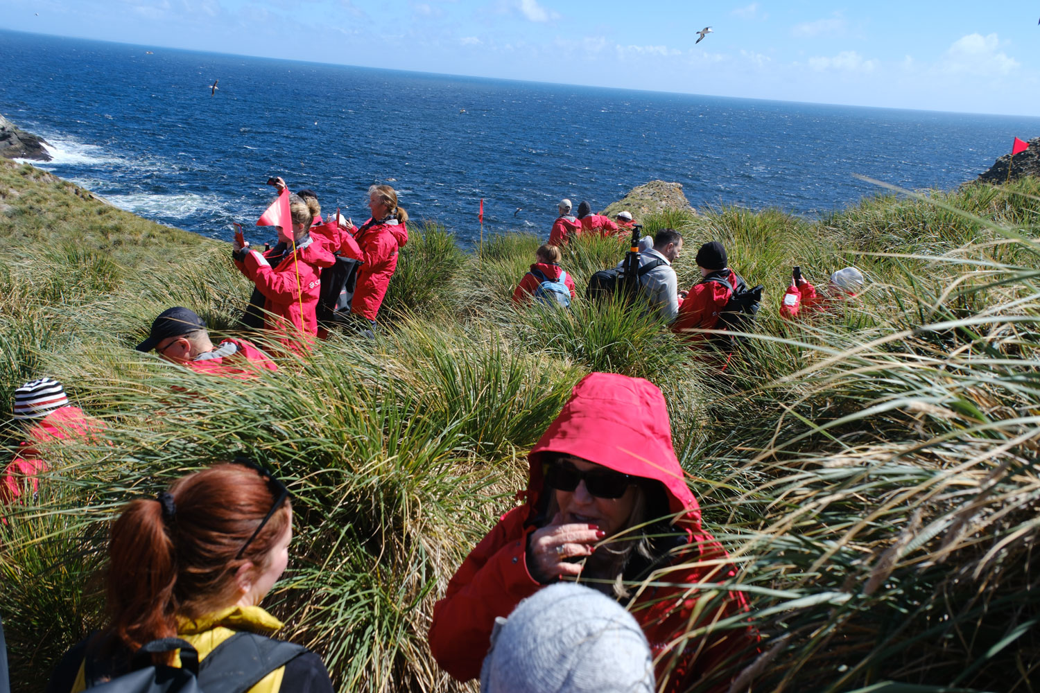
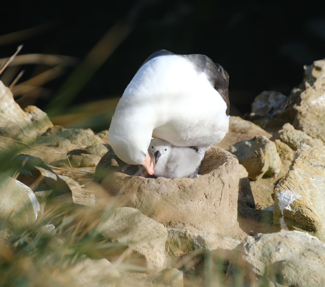
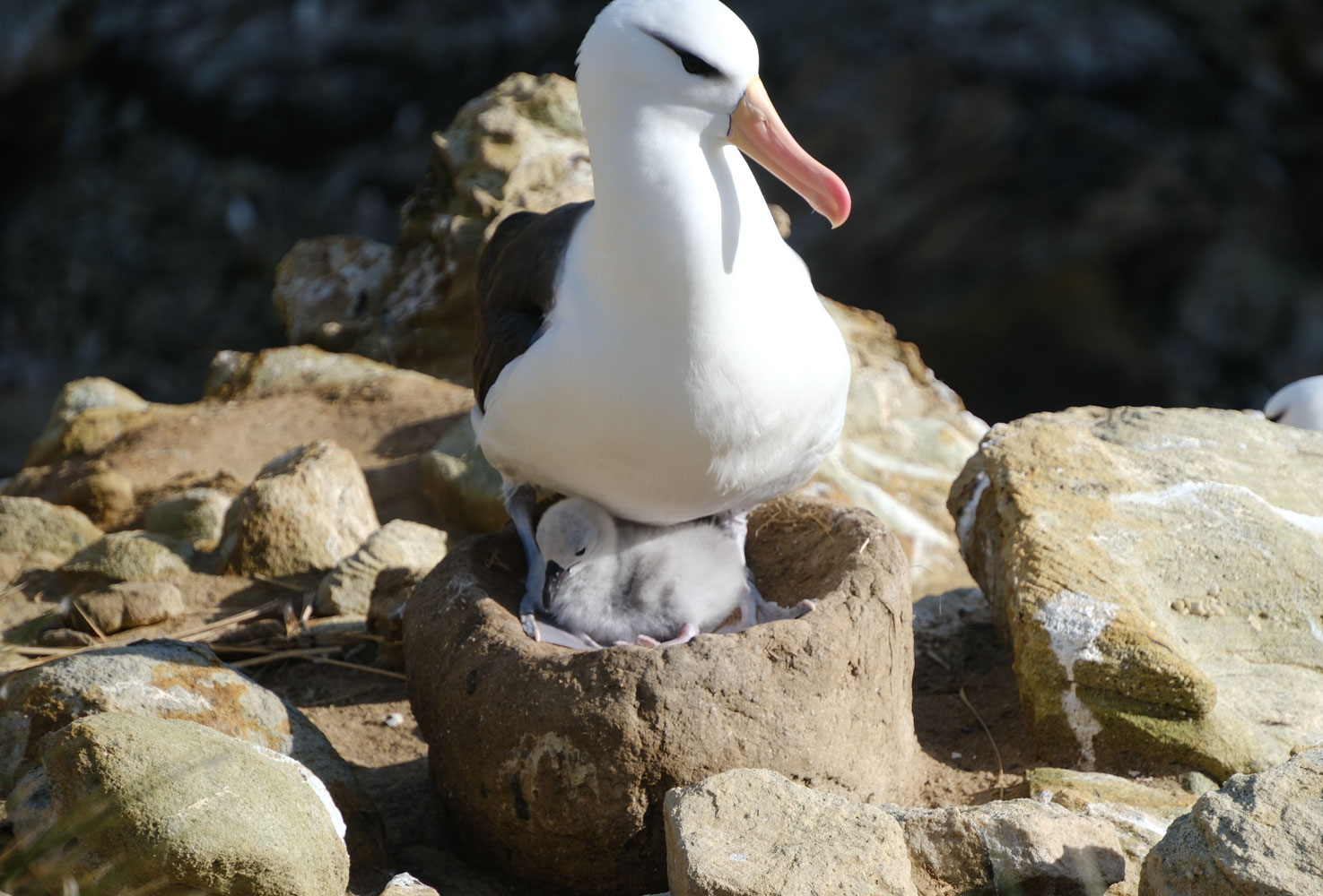
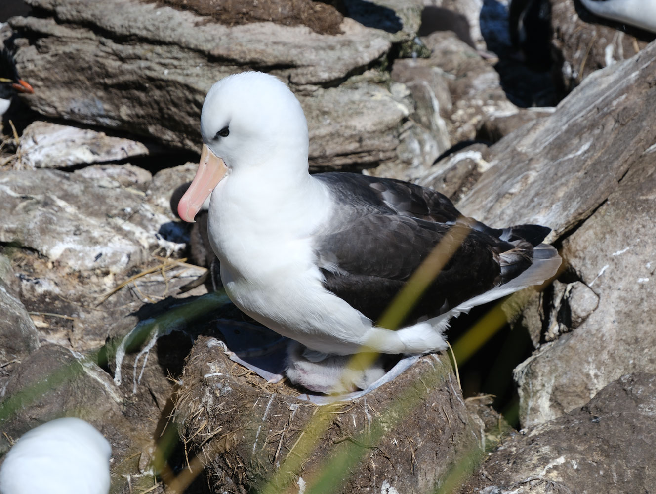
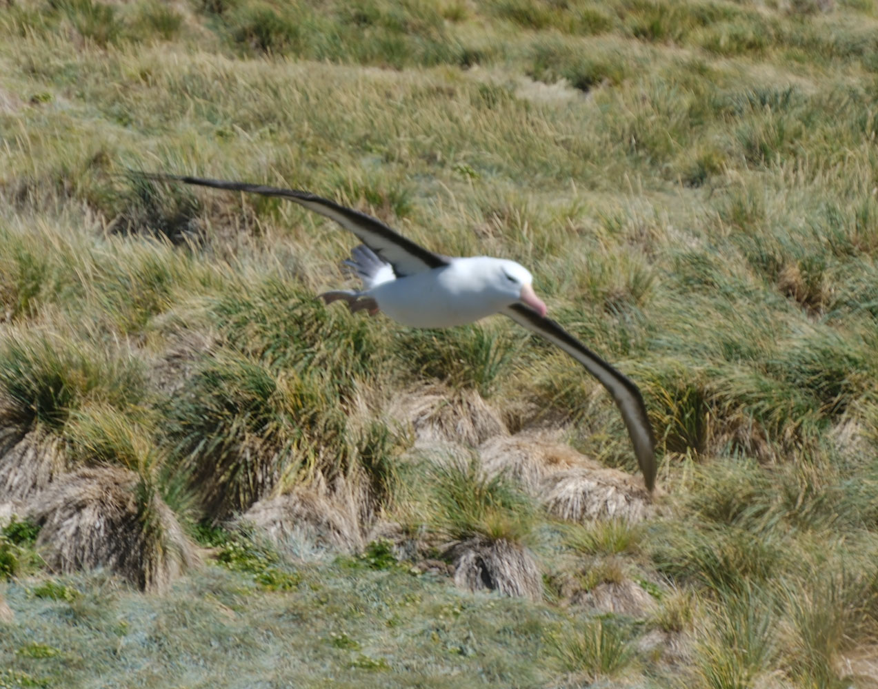
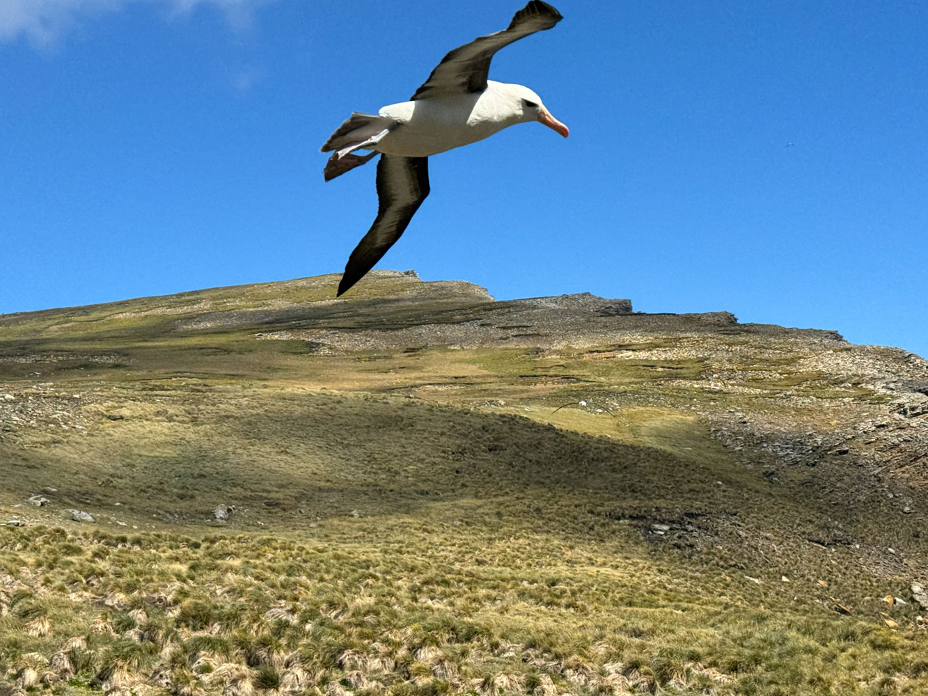
A small area of the rookeries, shared by the Albatross and the Rockhopper Penguins.
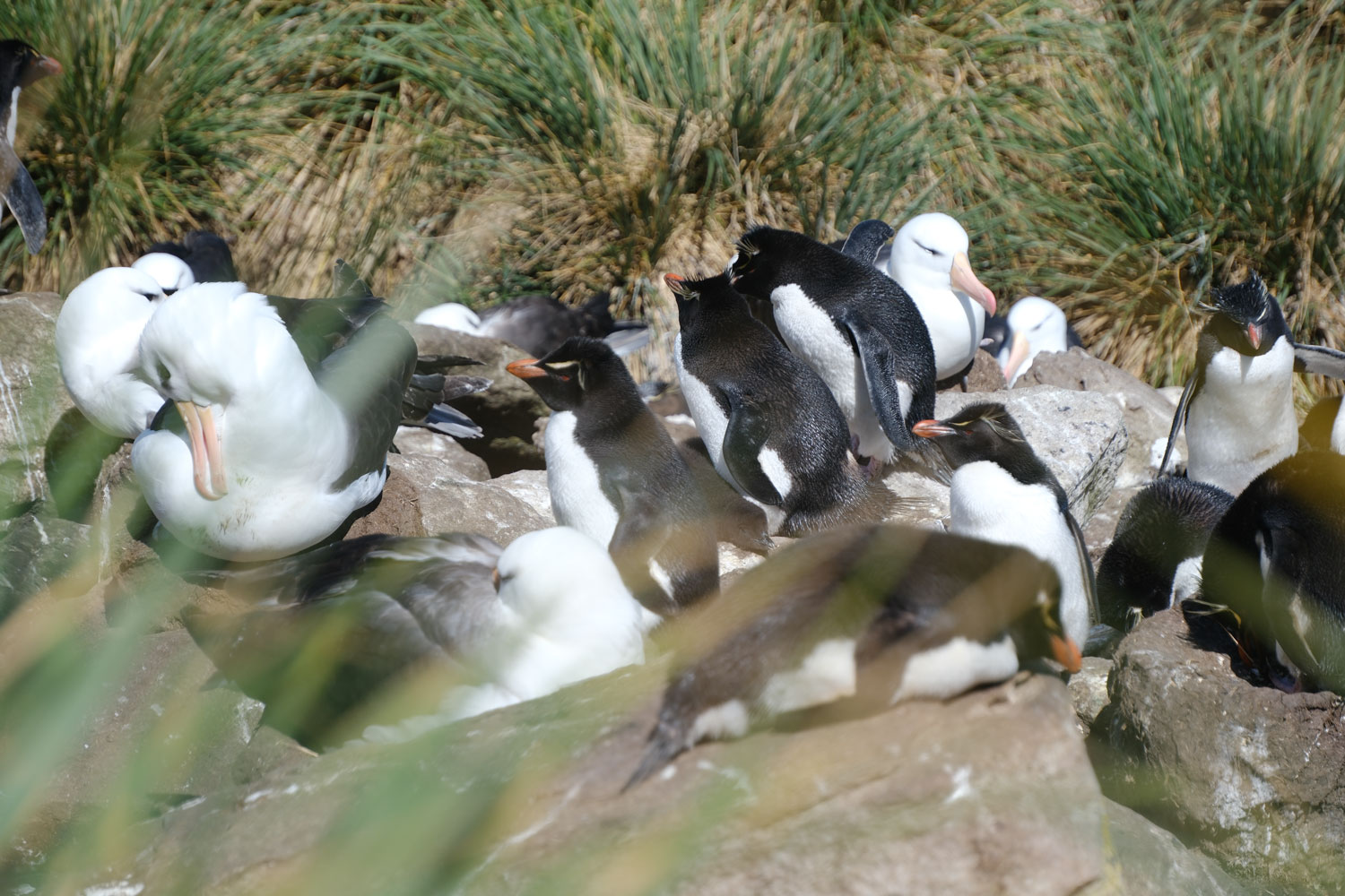
An Albatross mother with a chick under her.
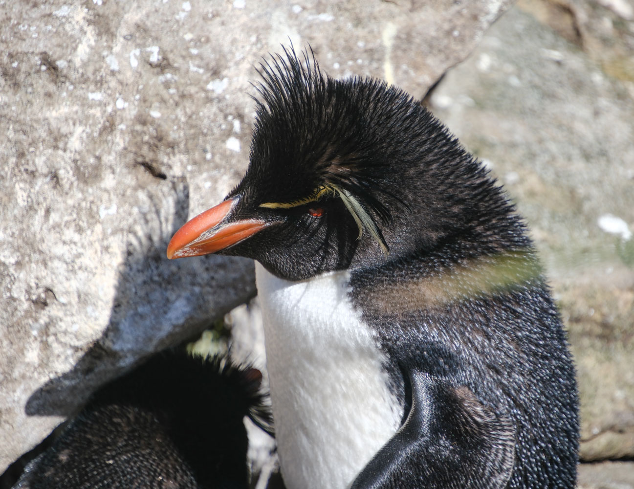
A Rockhopper.
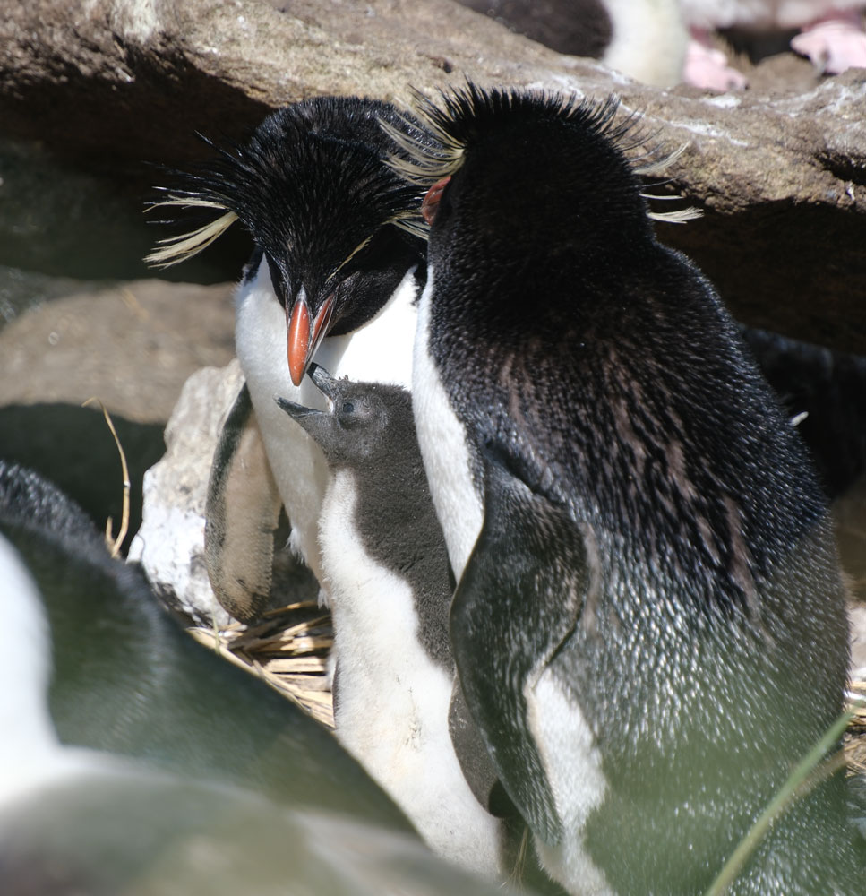
A Rockhopper mom feeding her chick.
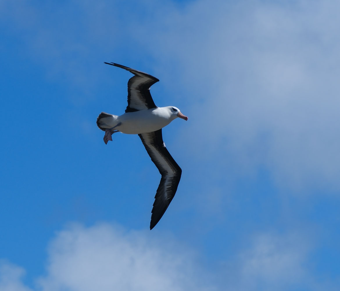
A few Albatross flying.
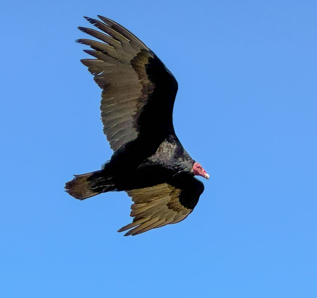
And a Turkey Vulture.
A shot of part of the rookeries. That mound to the right of the picture is called the "Devil's Nose" (I think).
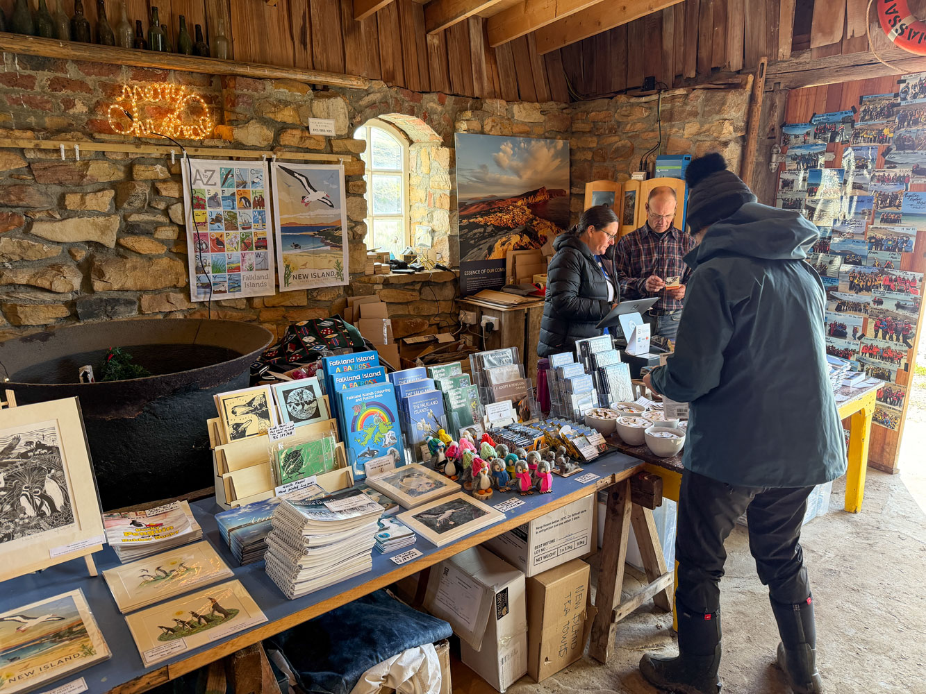
I walked back to the landing point and forgot that there was a "Tea" offered at the home of the two residents on the island. Judy remembered, and went there. They presented a beautiful table of tea treats.
The ride back to the ship was uneventful. We went to dinner and shared a table with another couple - it was an enjoyable evening. Then, to bed. If we're lucky, we'll get to see Stanley tomorrow.
[Added note: When we went to Antarctica in 2021, we visited Bleaker Island, Saunders Island, and Carcass Island in the Falkland Islands. Bleaker Island had some similarities to West Point Island - a long walk and only one rookery of Rockhopper penguins - I thought Saunders Island was superior to New Island. The population of penguins at Saunders Island was much greater and there was a wider variety of penguin species, including Emperor penguins. Carcass Island was interesting - we did a fairly long hike and saw some interesting animals, including a group of Elephant seals. Take a look at the links and see what you think.]
+++++++++++++++++++++++++++++++++++++++++
12/24/2025 (Tuesday - Christmas eve) - We arrived off Stanley this morning. Judy and I were anxious to see Stanley - this was our third attempt. In 2017 we took a memorable Regent cruise along the coast of South America, but the visit to Stanley was cancelled due to bad weather. Then, in 2021 we did an Antarctic cruise and, while we stopped at three small islands of the Falkland Islands, our visit to Stanley was cancelled due to bad weather. This was our third (and probably last) attempt to see Stanley.
The first announcement from the crew was that the wind was quite strong and movement to shore was to be delayed.
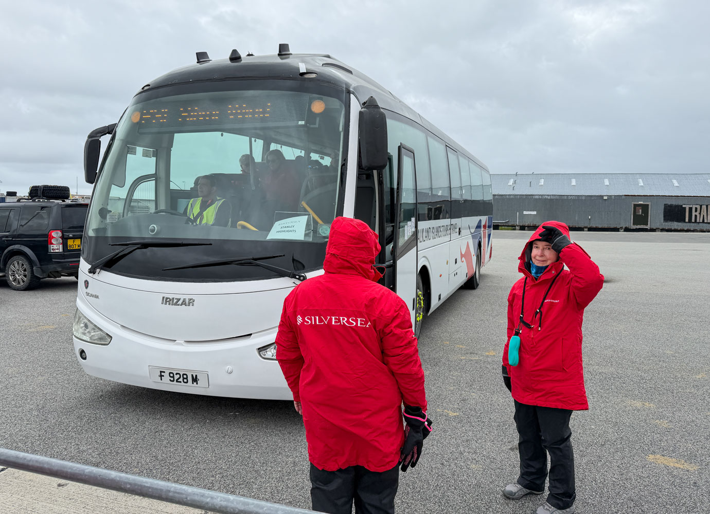
There were several choices of excursions at Stanley but we had forgotten to sign up for any of them, so we went and begged to be added to the highlights tour of Stanley, and we were allowed to join the morning excursion.
The Zodiac ride to Stanley was very mild - the sea was not that large and there was almost no spray over the bow of the Zodiac.
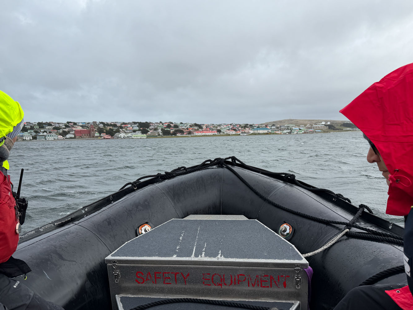
And then we were in Stanley! We finally made it.
Here, we're waiting to board the bus. Turns out there was lots of room left on the bus - it could have fit ten more people.
Leaving Stanley we passed the airport. During the Falkland war, the British bombed this airport to attempt to deny it's use to the Argentines - so Argentina would not have air support for the upcoming land battles.
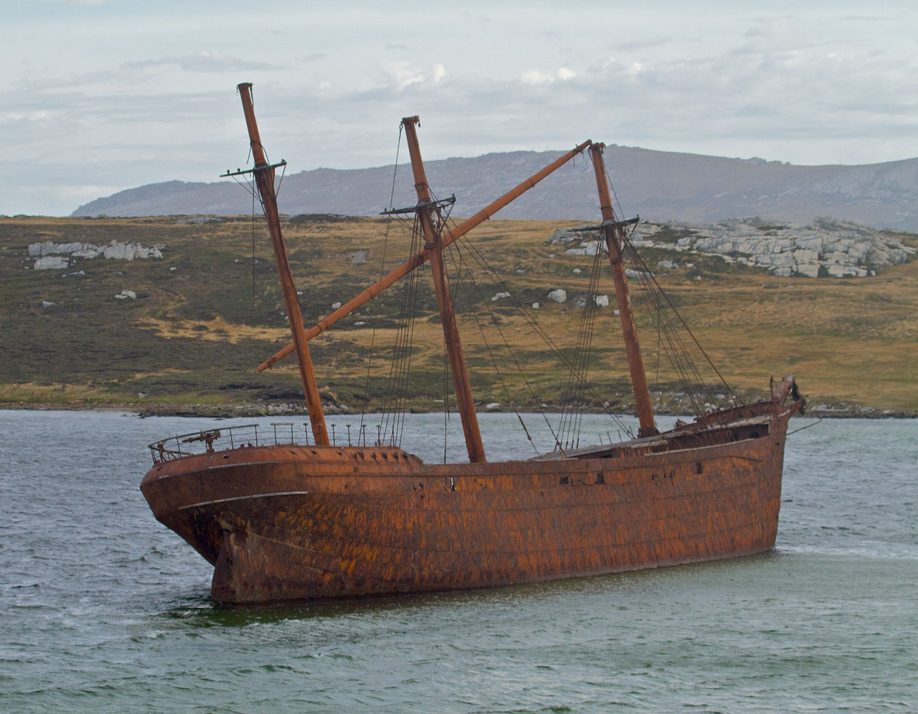
We continued on to Whalebone Cove, which is mostly known for the wreck of the ship the "Lady Elizabeth" which had put into Stanley with serious storm damage in 1912. She was deemed damaged beyond reasonable repair and left anchored in the harbor. In 1936 she broke her mooring lines and drifted into Whalebone Cove where she is now.
Photo from the web, taken on a brighter day. Note that she is a iron-hulled ship.
We departed Whalebone Cove and passed the airport again. This time I was able to get a picture of one of the Britten-Norman BN-2 Islander aircraft. The tour guide explained the these aircraft are used to ferry people to different places in the Falkland Islands. The flights are not scheduled - you call and tell them where you want to go, and later they contact you with details of a certain day and time. The aircraft can carry nine passengers and one pilot. A kind of Dial-a-ride.

We drove to the Stanley "Totem Pole". The story is that it was started by British soldiers after the Falkland war but has been added to over the years.
A detail from the pole.
The tour guide talked about the health system at Stanley. The net is that there's not a lot of specialty treatment available. If you have anything serious, they will evacuate you to Montevideo or back to the UK.
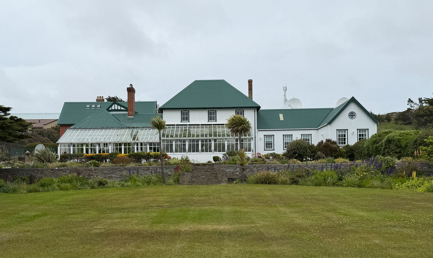
We stopped at the Government House, the official residence of the British governor of the Falkland Islands.
Then we drove by the memorial to the 1914 Battle of the Falkland Islands. Picture taken through the window of the bus as we drove by.
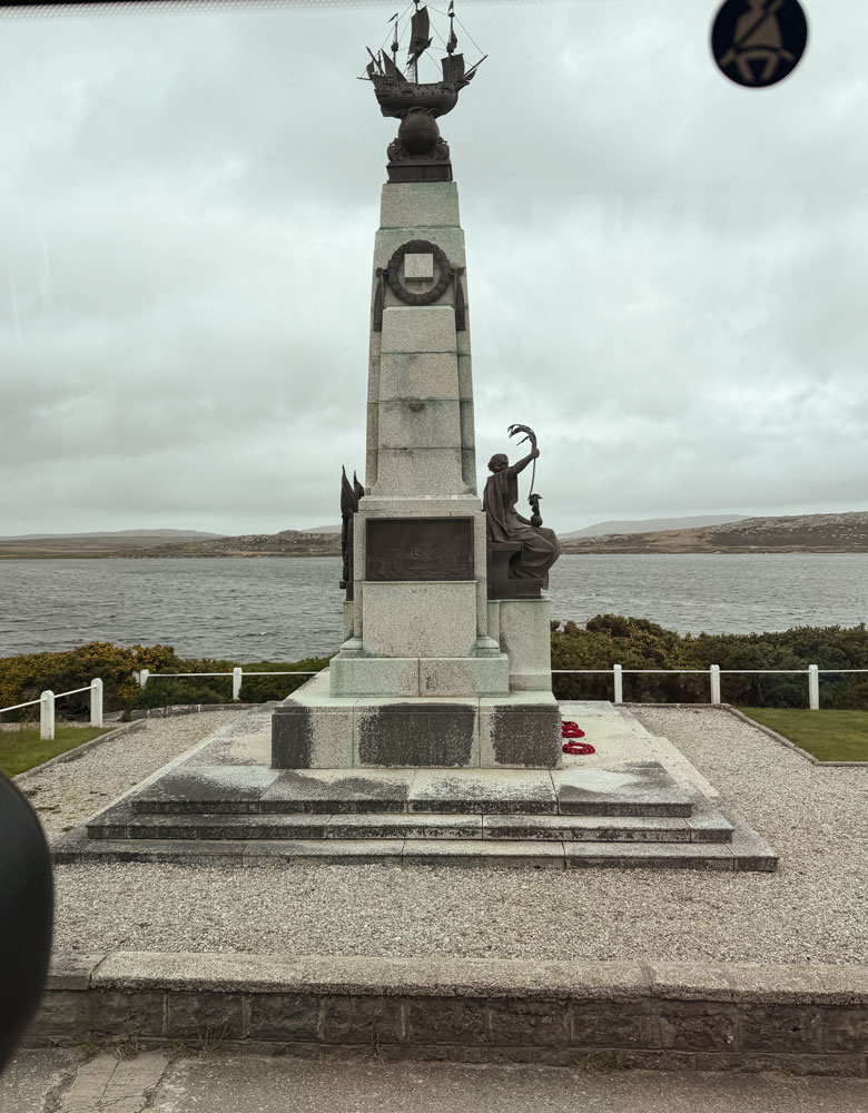
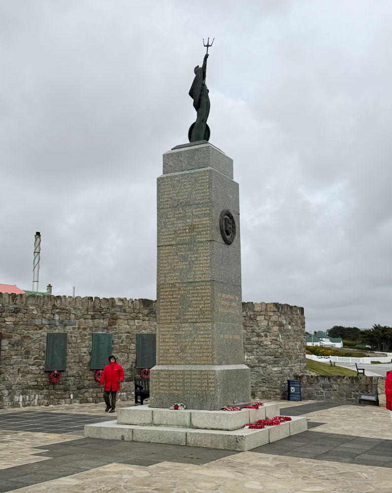
We stopped at the memorial to the 1982 Falkland War. It lists the names of all the British units that participated in the war, and the names of the 255 soldiers, sailors and airmen who were killed in the war, and three British civilian women.
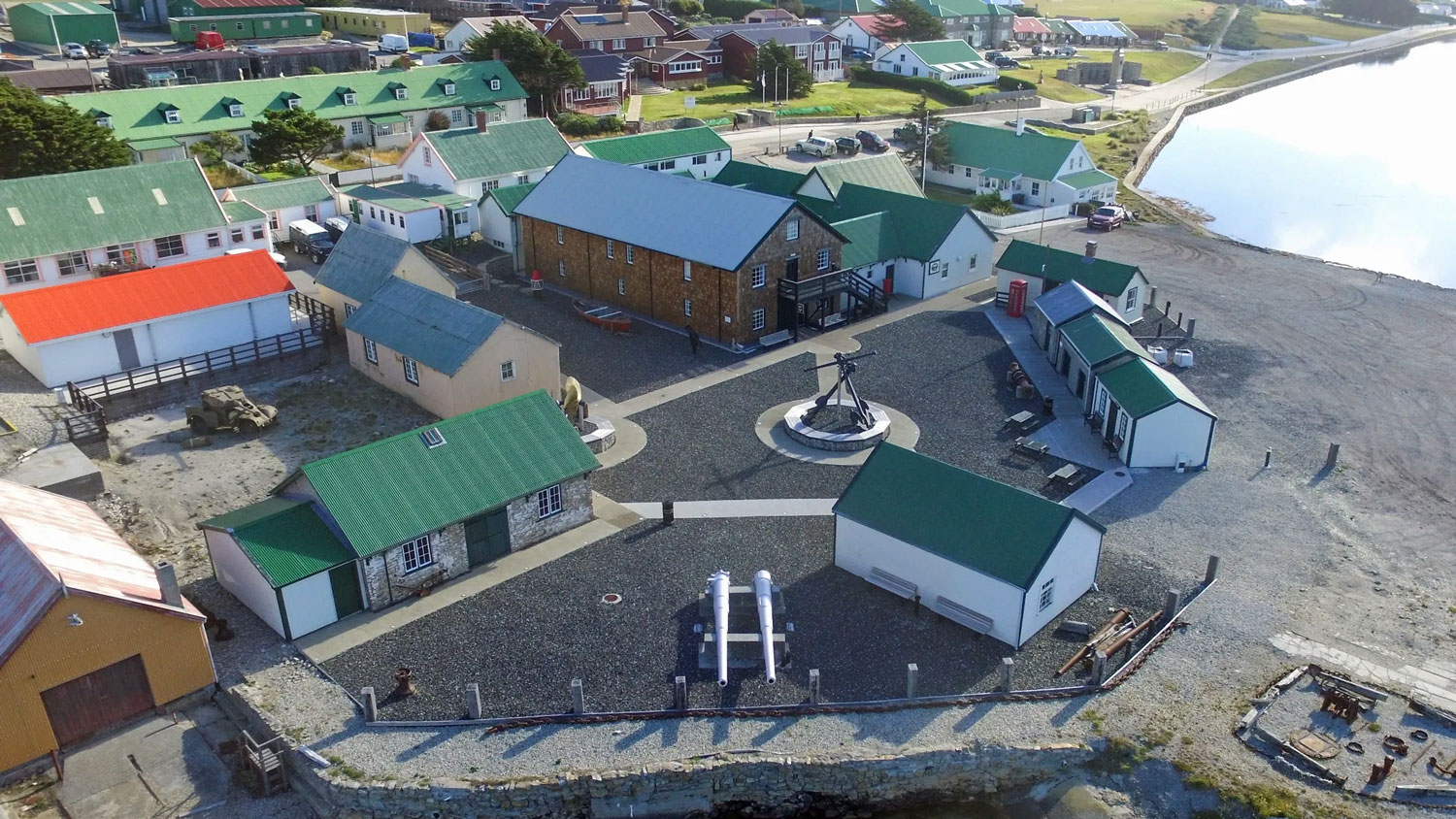
Our final stop was the Stanley Islands museum, and that was the end of the official tour. Here's a drone's eye view of the museum. It was an interesting place.
We were given a ticket for a free cup of coffee at one of the shops in the museum area, so that's the first place we went. After that, we wandered through some of the exhibits.
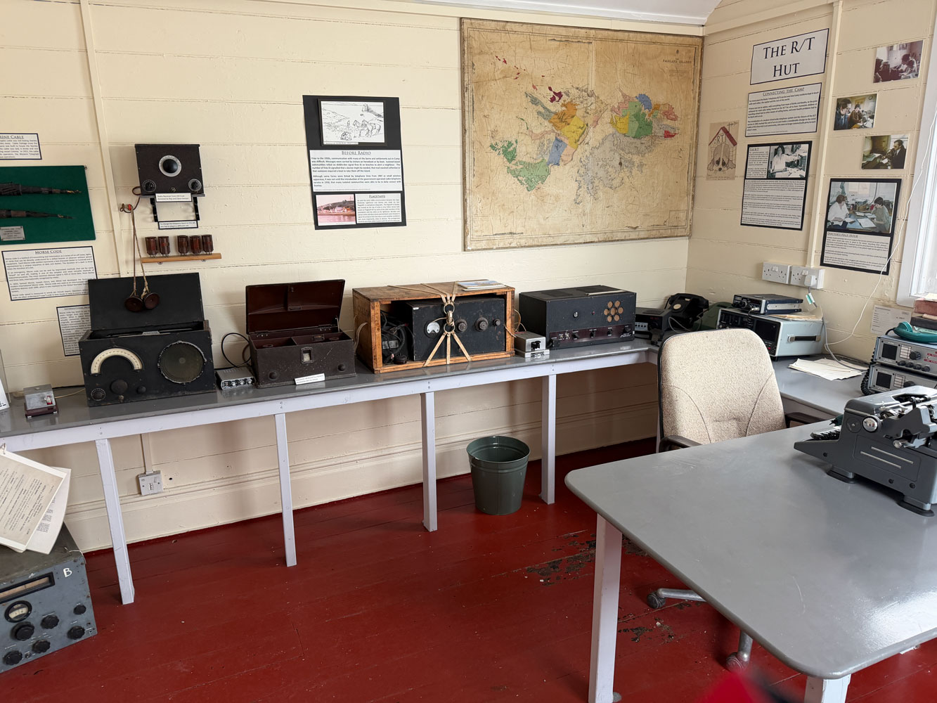
The first place was the R/T (radio/telephone) hut where they had some of the old equipment.
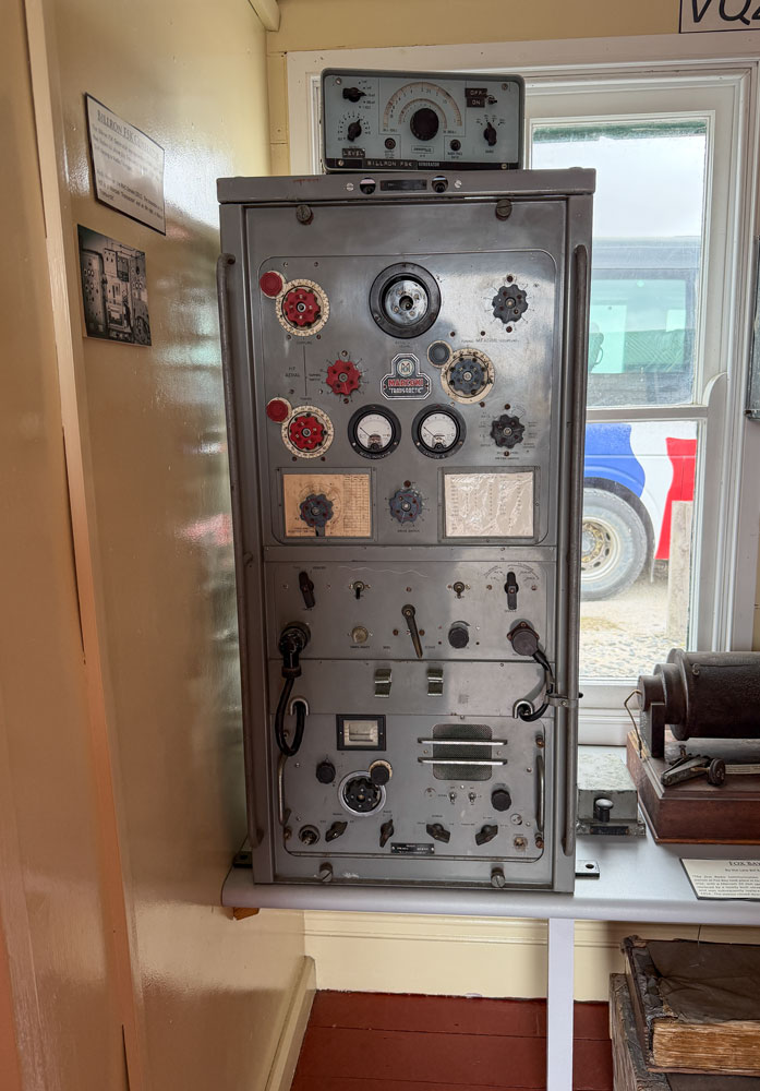
This is a radio transmitter.
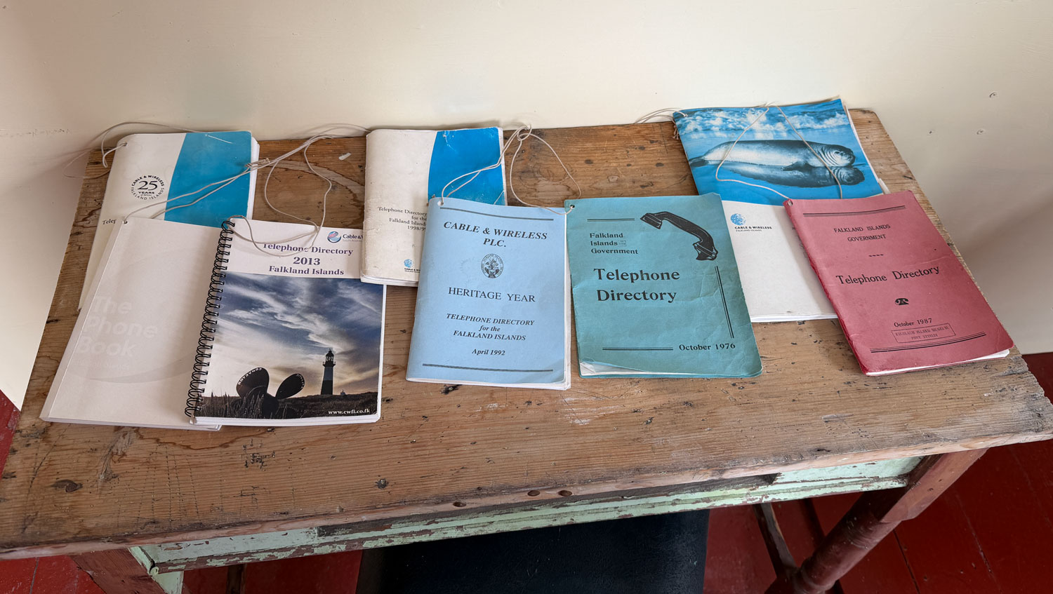
Look at the difference in size between the 1975 telephone directory and the 2013 directory. Stanley has grown.
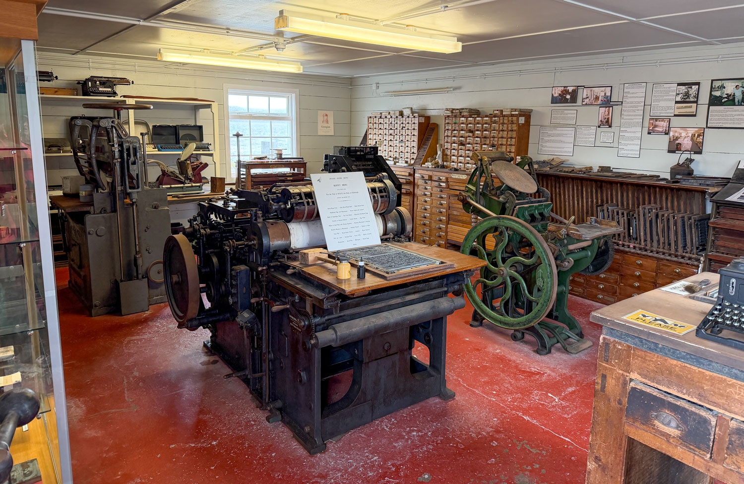
This was the printing office. Hand set movable type.
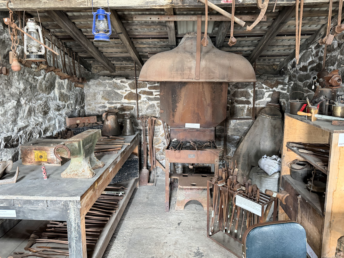
This was the blacksmith shop.
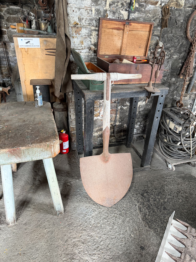
This must be a shovel for digging peat.
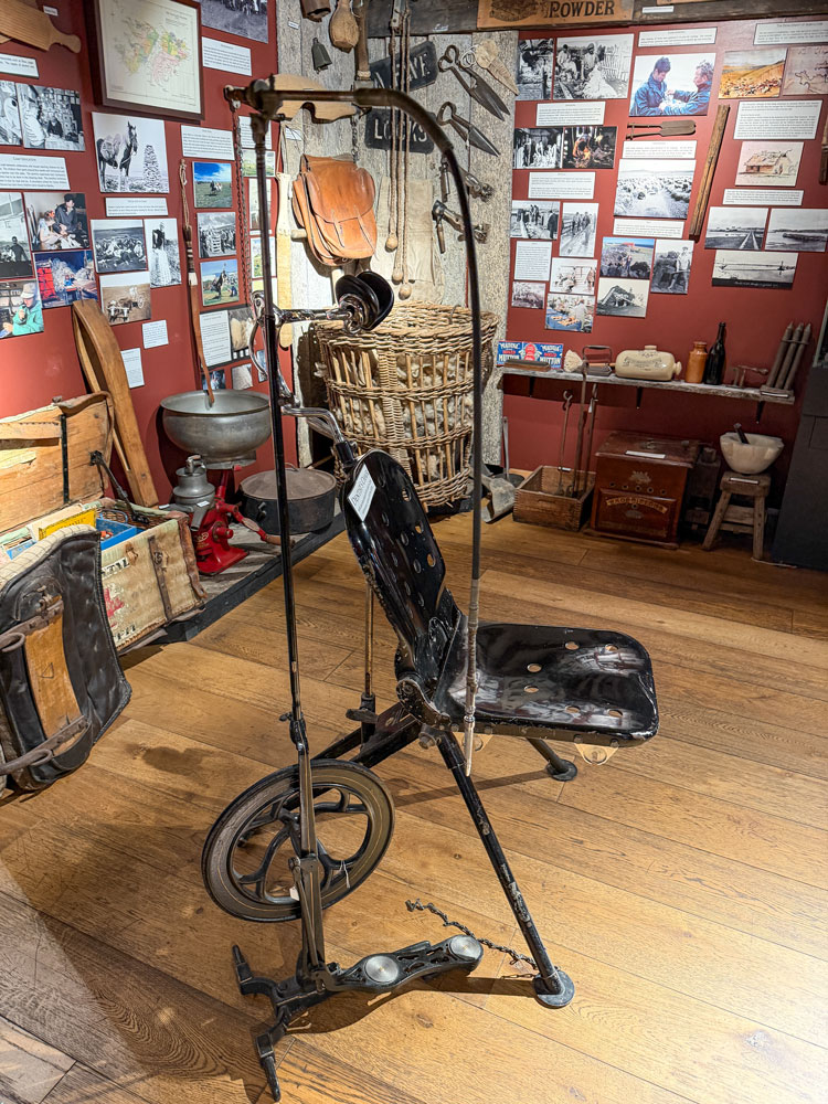
Then we went into the main part of the museum. Here's something that was very interesting. A portable, foldable dentist's chair, and to the side of it is a foot-pumped dental drill. They're a bit hard to see against the busy background.

Here's a view from the side.
Here was a period kitchen. Note the bathtub in the kitchen. That was so they could put hot water from the stove into it, and bathe in the warmest room.
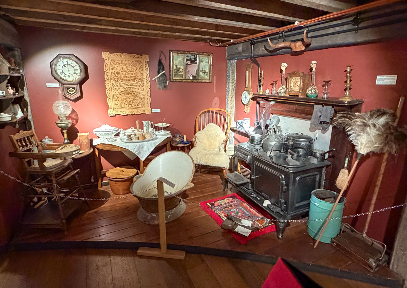
And in the background, on the wall, is a hand carved plaque of the Lord's Prayer, carved in 1938. The comment was that before television, people used handicrafts to pass time in the evening.

I've done a small amount of carving - this is really well done and took real talent.
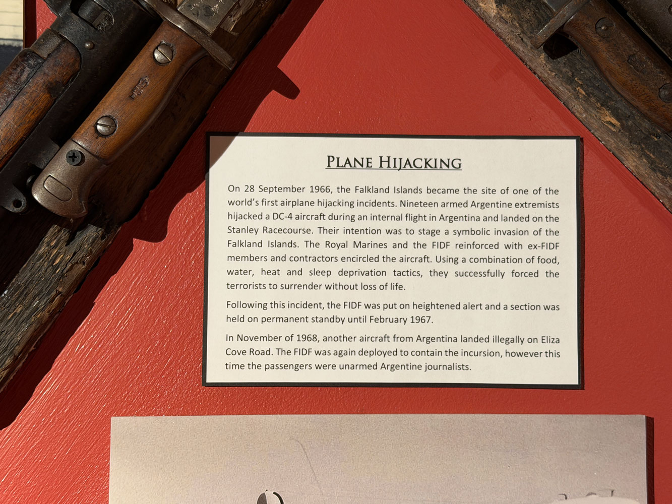
There was an exhibit about the 1966 hijacking of an Argentine Airlines flight that was forced to land in the Falkland Islands. I had never heard of this event, but I suppose things that happened in the Falkland Islands didn't make the national news in the US.
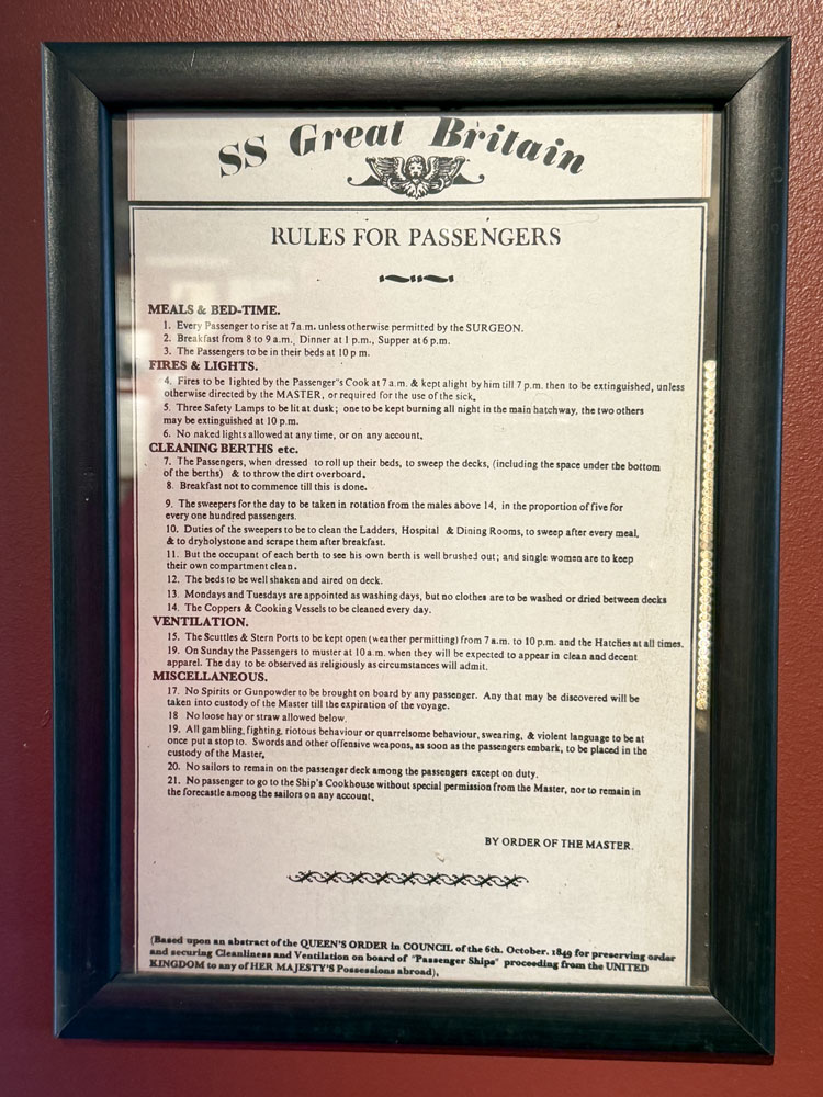
There were a number of exhibits about the SS Great Britain ship. She was a revolutionary ship, but her only connection to Stanley was that late in her life (1886) she ran aground in Stanley harbor and remained there, scuttled, until 1970 when she was raised and taken to Bristol and restored.
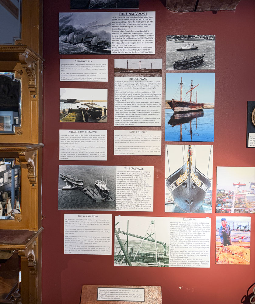
A model of the ship.

I thought these rules for passengers was interesting. Can you imagine modern cruise ships having these rules?
Leaving the museum, we went next door to the post office. Our tour guide had given each of us a stamped post card that we could mail anywhere in the world. Judy and I wrote notes and addressed the cards to ourselves, and mailed them.
There was still much to see in Stanley as we walked back to the dock area to return to the ship.
The first thing we came upon was the Whalebone Arch made from the jaw bones of two blue whales. Something like this just reminds me of the wholesale slaughter of whales that occurred between maybe 1800 and 1950. During that time, at least 3.3 million whales were killed, driving some species almost to extinction. More whales probably died after being struck by harpoons but escaped to die later. The tragedy of whale killing is not something I'd want to celebrate with a monument like this.
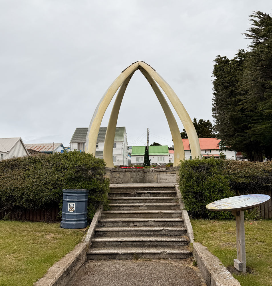
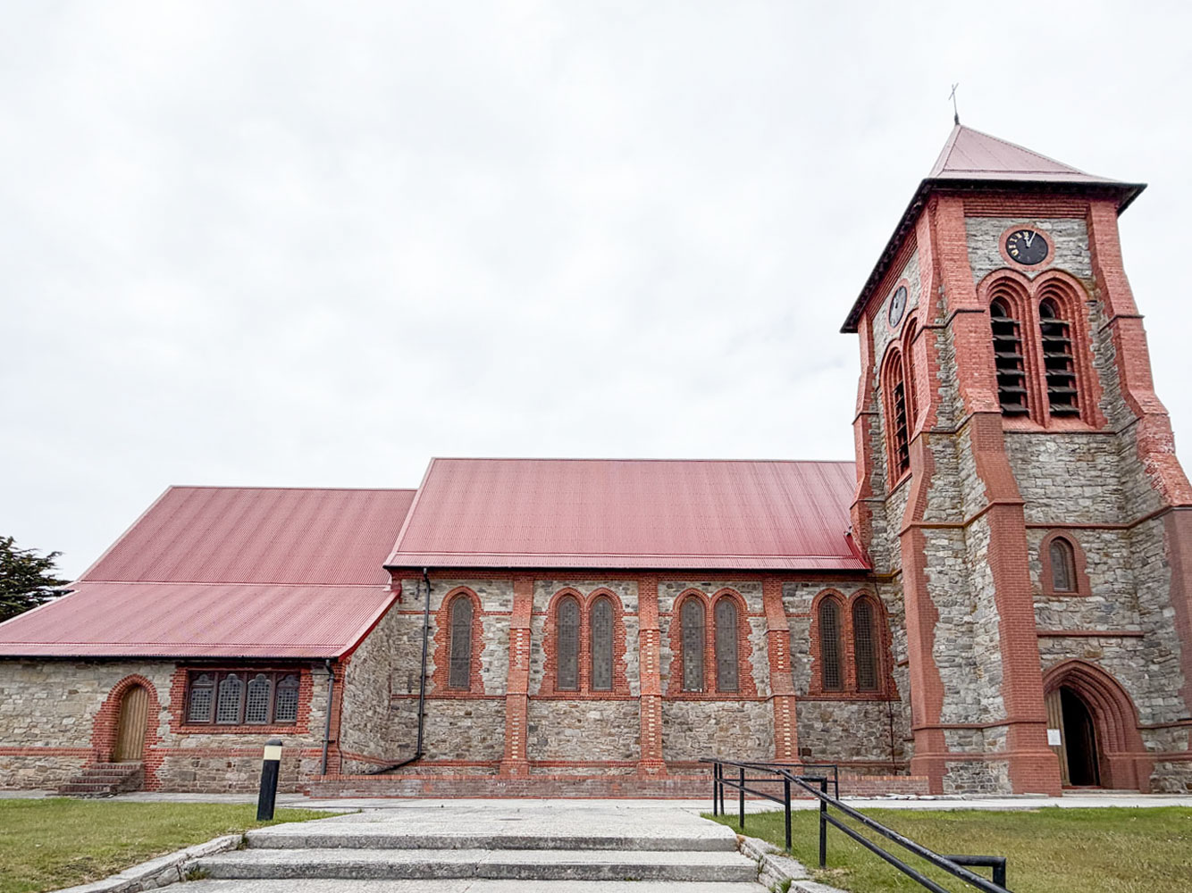
Next to this monument is the Christ Church Cathedral. The juxtaposition of this church next to the Whalebone Arch is striking.
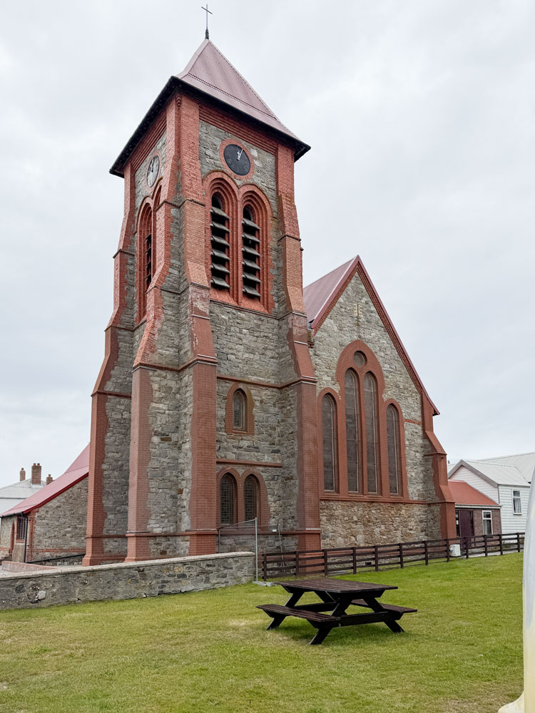
Another view of the exterior of the church.
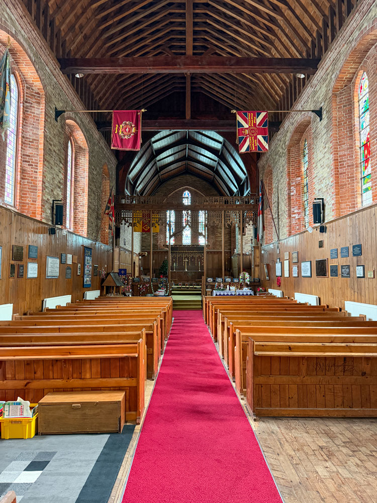
A view of the interior of the church.
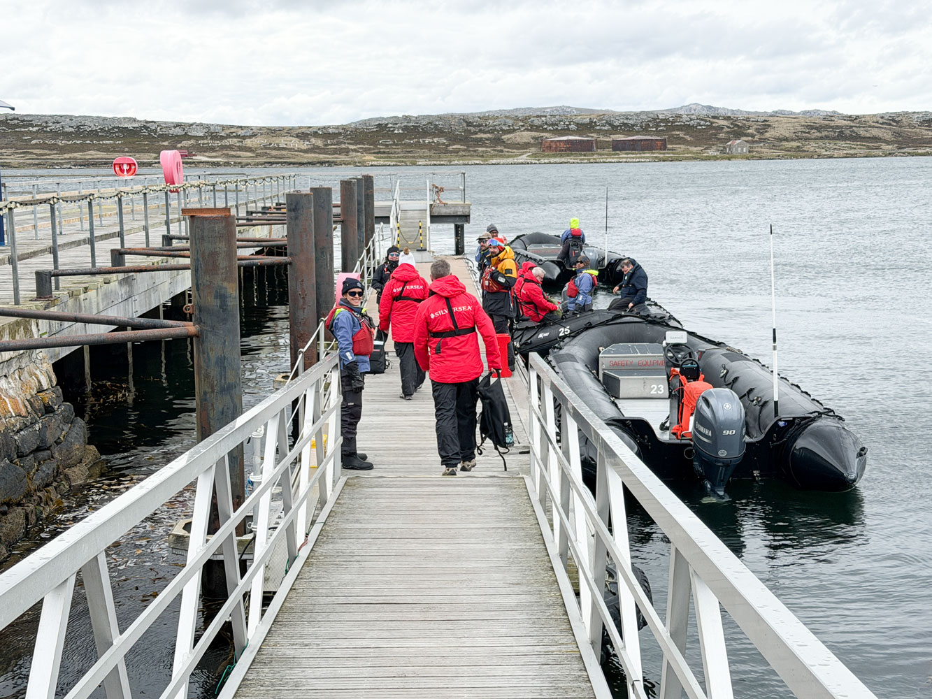
From the church we went to the dock area.
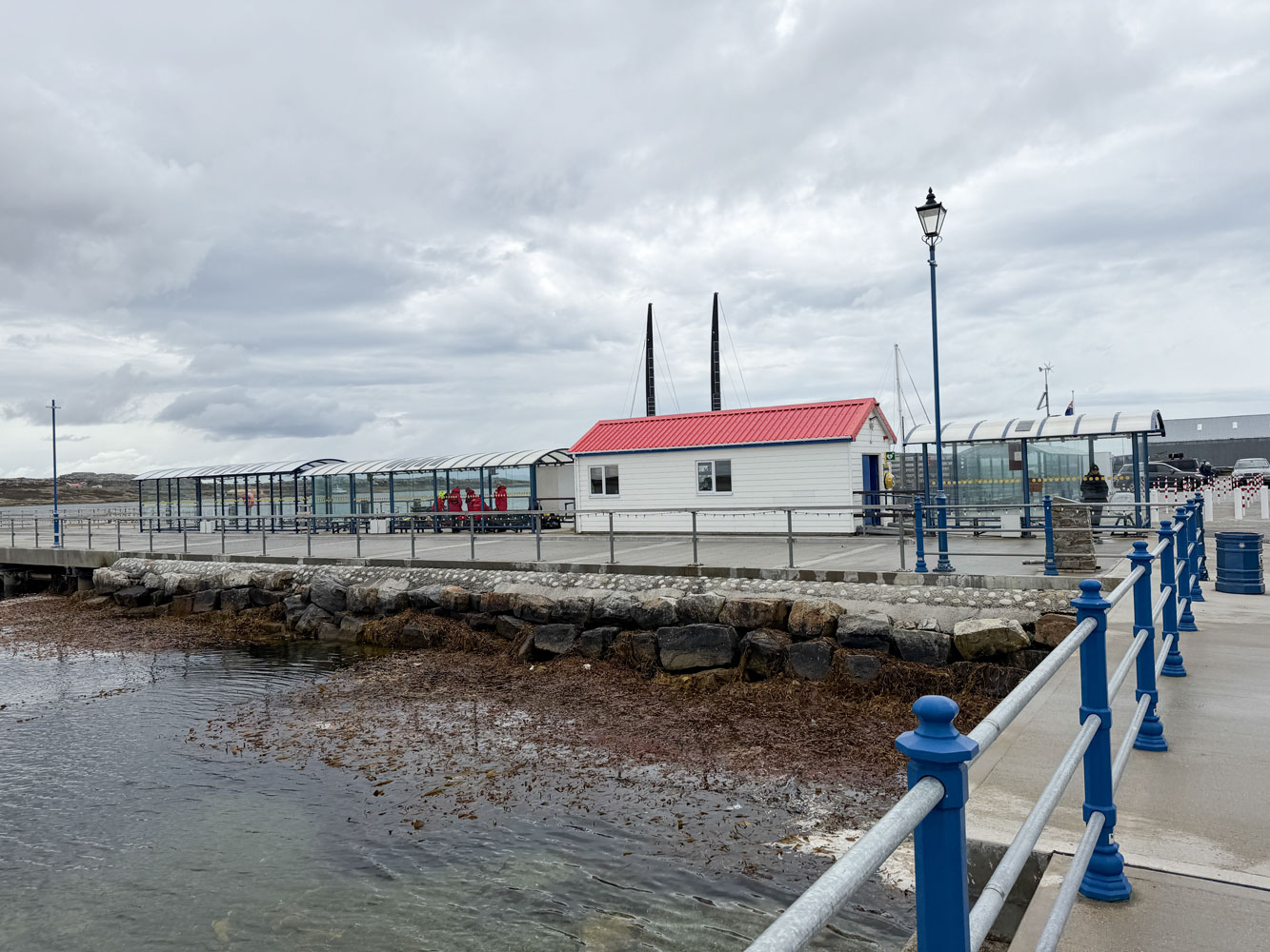
And boarded the Zodiac back to the ship. The trip was very smooth with almost no spray over the bow.
We took it easy for the rest of the day. Your faithful scribe (me) worked on this blog while Judy took a nap. At 6:30 we had a briefing on the next few days and the weather at South Georgia Island. Wind is predicted.
Then it was dinner at La Terrazza restaurant, and to bed. Tomorrow is Christmas and we have a sea day. Santa is going to have a long trip from the North Pole, but I'm sure he'll find us.
+++++++++++++++++++++++++++++++++++++++++
12/25/2025 (Thursday - Christmas Day) - At 8am this morning we were at 52°20'44"S, 50°39'49"W, on the way to South Georgia Island. The sea is fairly calm, but there is a slight roll to the ship. We have a sea day today.
Santa found us last night and left us Christmas cards. He knows we don't need more "stuff" at our age.
One card was especially good and appropriate.
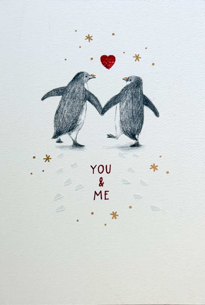
The front desk people printed this picture for us on A4 paper, so we could post it on our cabin door.
At 11am we went to a lecture on ocean currents, and especially the Antarctic Circumpolar current.
At 2pm, the ship had presentation on biosecurity on South Georgia Island, and later a mandatory biosecurity inspection of our clothing and equipment that will be taken to the South Georgia Island. Our parkas, waterproof pants, hats, gloves, walking sticks, backpack, etc. were examined for any seeds, pollen, dirt, anything that might carry any foreign plant, bacteria, or virus to the island.
Judy and I passed cleanly.
At 6:15pm we attended the daily briefing and went to dinner afterwards. When we got back to the room we had a note to set our clocks forward an hour.
Right now, we're at 52°52'41"S, 45°8'33"W
Tomorrow is another sea day. We won't get to South Georgia Island until late tomorow.
+++++++++++++++++++++++++++++++++++++++++
12/26/2025 (Friday) - We set our clocks ahead one hour last night. At about 8am this morning, we're at 52°21'39"S, 41°5'46"W. Grytviken is at 54°16'36"S, 36°30'29"W so we're getting closer.
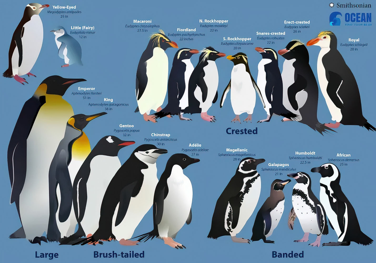
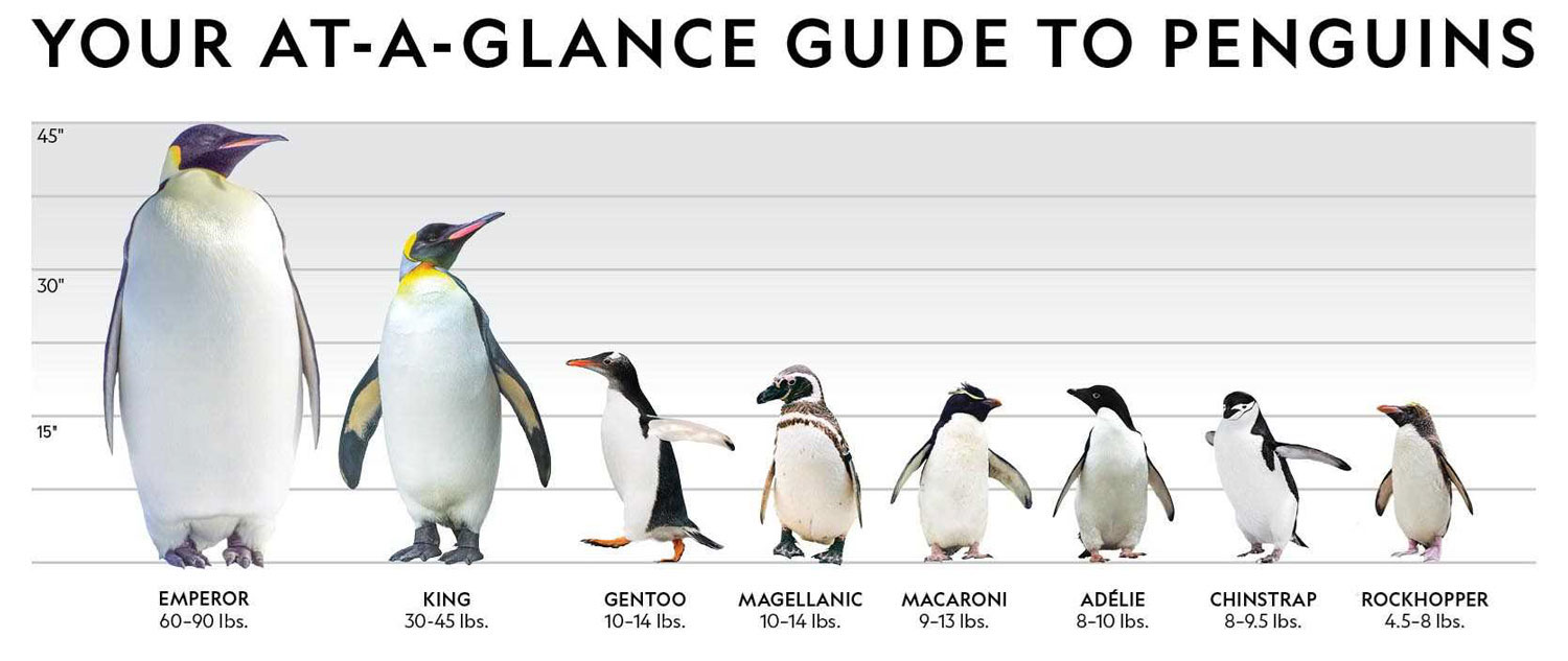
Before we left, I searched for cute pictures of penguins. Since today is a sea day, I'm going to use it to show you some of those pictures. First, some pictures showing the different kinds of penguins.
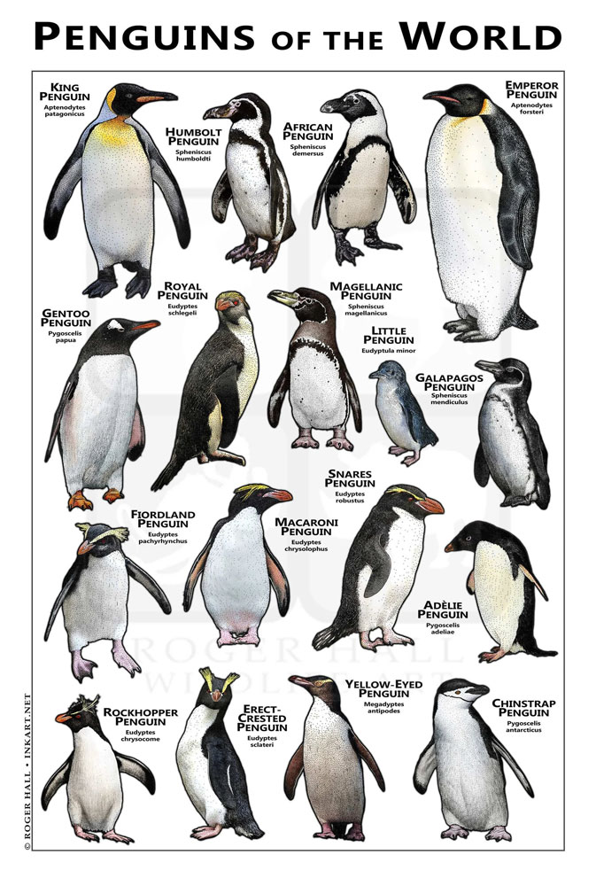
Now, some cute Christmas pictures of penguins. First, a Rockhopper.

I don't know if I can identify the rest of the penguins in the pictures. Emperor??? King???
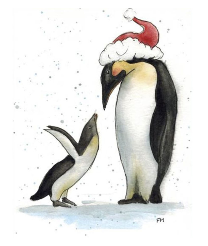
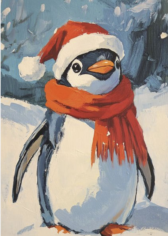
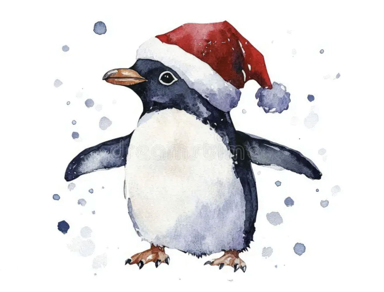
That's all for now.
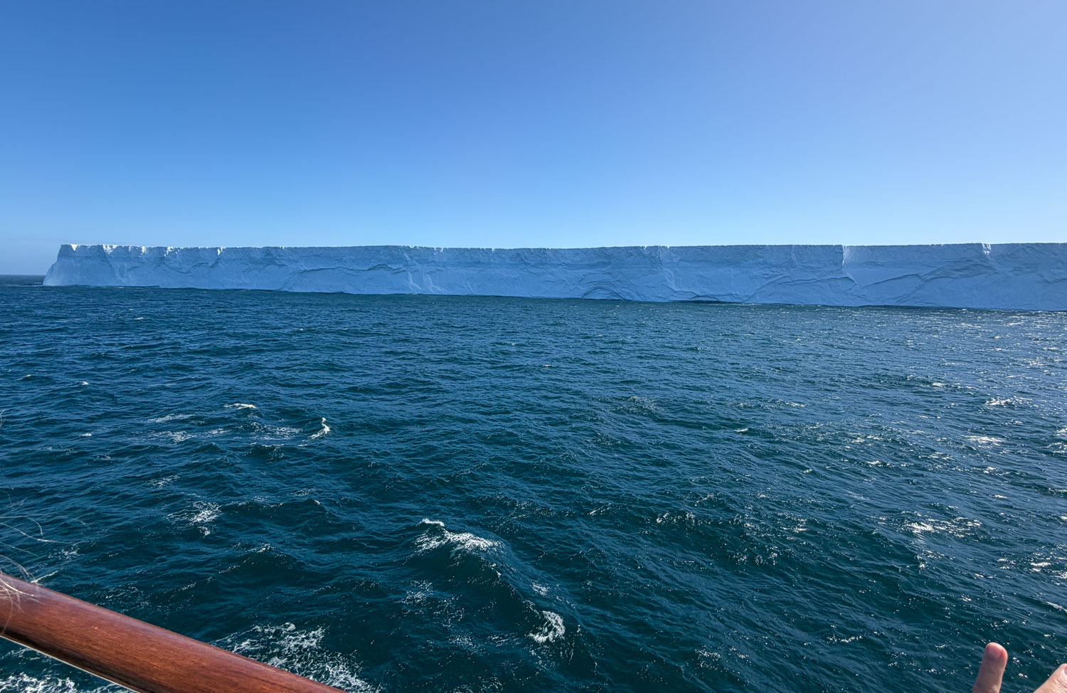
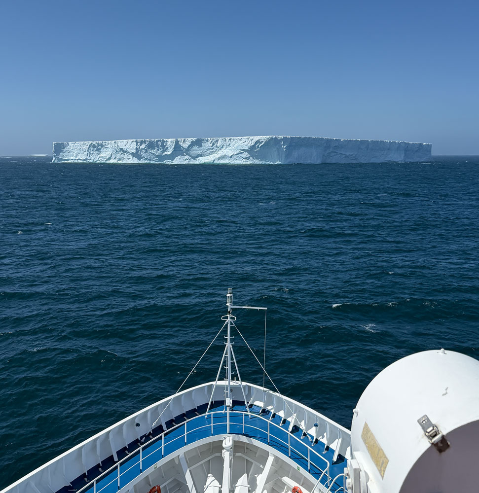
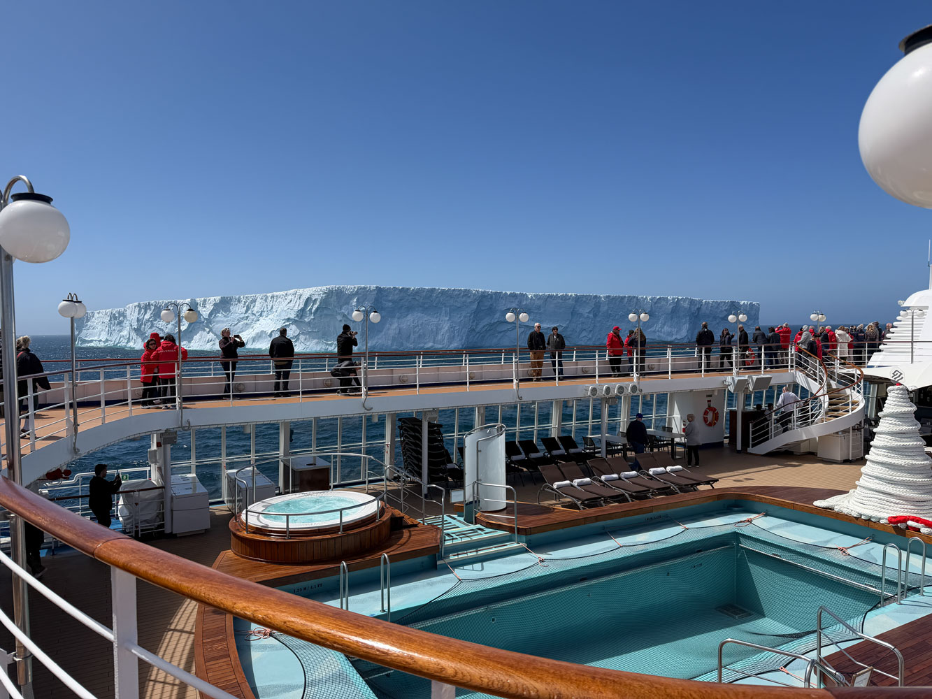
While eating breakfast we noticed two icebergs some distance away. The captain sailed to one of them so we could get pictures of our first iceberg.
There was a rush as we all went up to the top deck to get pictures.
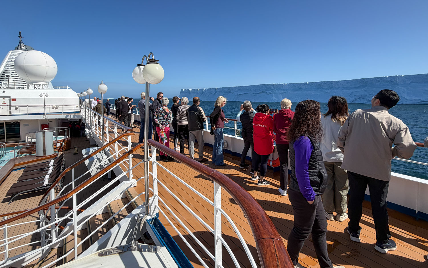
It was a big iceberg - so big I couldn't get all of it into one picture.
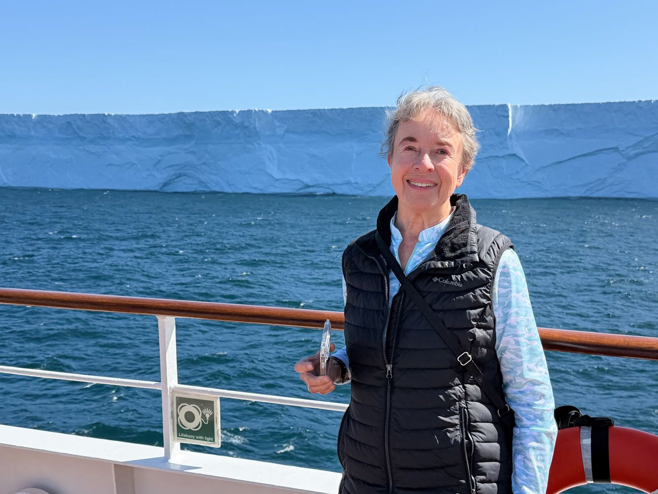
Judy and the iceberg.
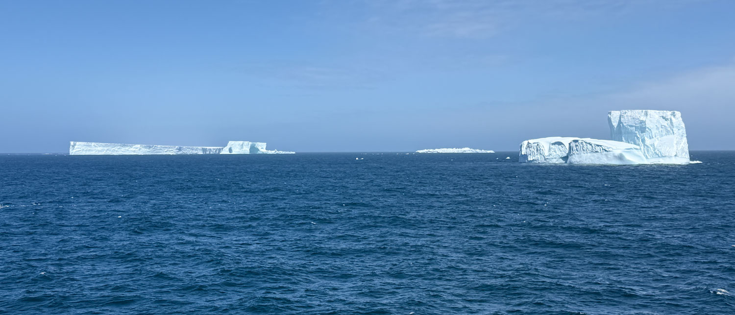
At 11am we attended a presentation on Shackelton's Expedition, which was very interesting. Just as the presenter was about to finish, an announcement was made that we were in the middle of a group of icebergs - and everybody left.
Here are a few pictures of the 'bergs. It's difficult to give you a sense of the size of these icebergs - they just look like blocks of ice in the distance in pictures - so I took a couple of pictures with part of the ship in the picture. Remember that 90% of the iceberg is under the water. These flat-topped bergs are tabular, meaning that they have broken off an ice shelf. They did not calve from the end of a glacier.
A 6pm we had a general meeting to review activities for tomorrow and then to dinner at 6:30. We were joined at dinner by an very nice couple and enjoyed an evening of interesting conversation.
That was the end of our day, We've reached South Georgia Island and will go ashore tomorrow.