Antarctica
December 21, 2025 to January 8, 2026
Mike and Judy Henderson
We have just reached Elephant Island as I start this installment. You'll remember from installment 3 that Elephant Island is where the Shackleton crew spent four months in 1916 waiting for rescue.
+++++++++++++++++++++++++++++++++++++++++
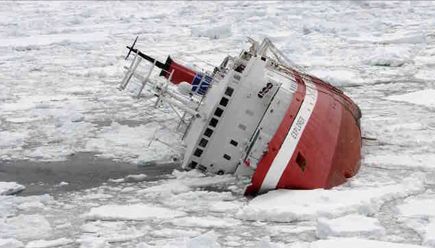
[Added note: In doing research on an Antarctic trip, I discovered that there was a cruise ship that sank in 2007 in Antarctic waters - the MV Explorer. Here's a first person account of that sinking by someone who was aboard. It's pretty interesting.
There were 158 people (passengers and crew) on board and no one was lost in the sinking.]
++++++++++++++++++++++++++++++++++++++++++++++++++
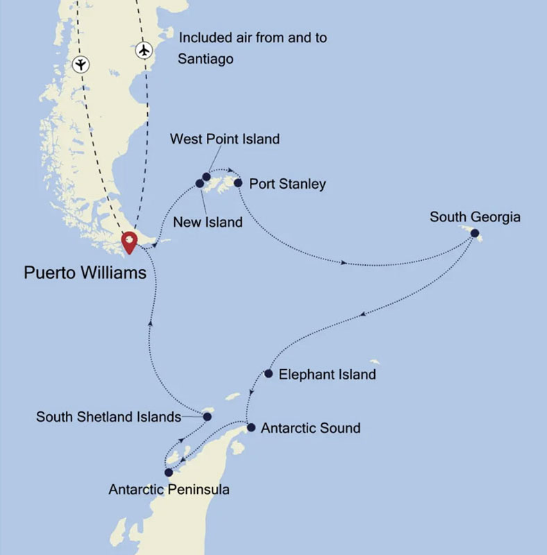
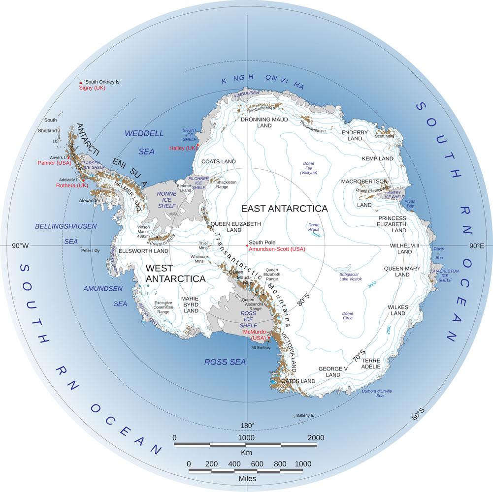
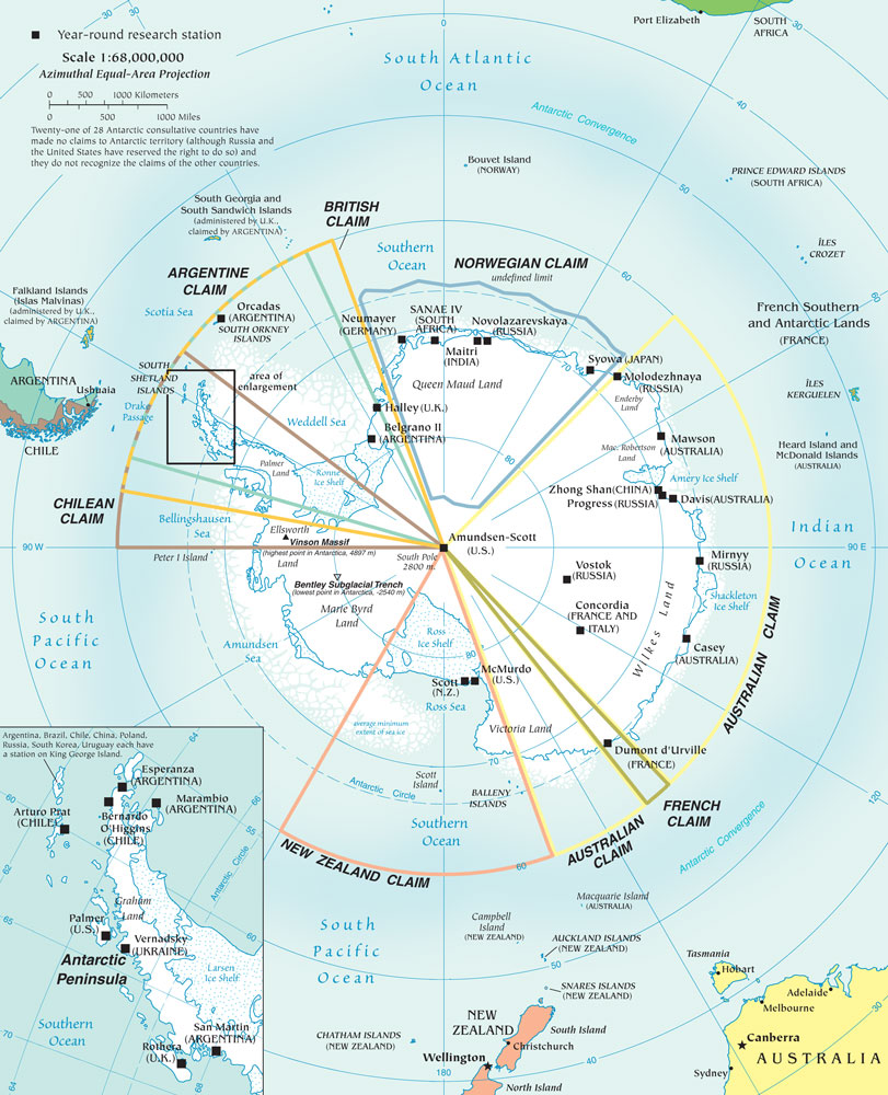
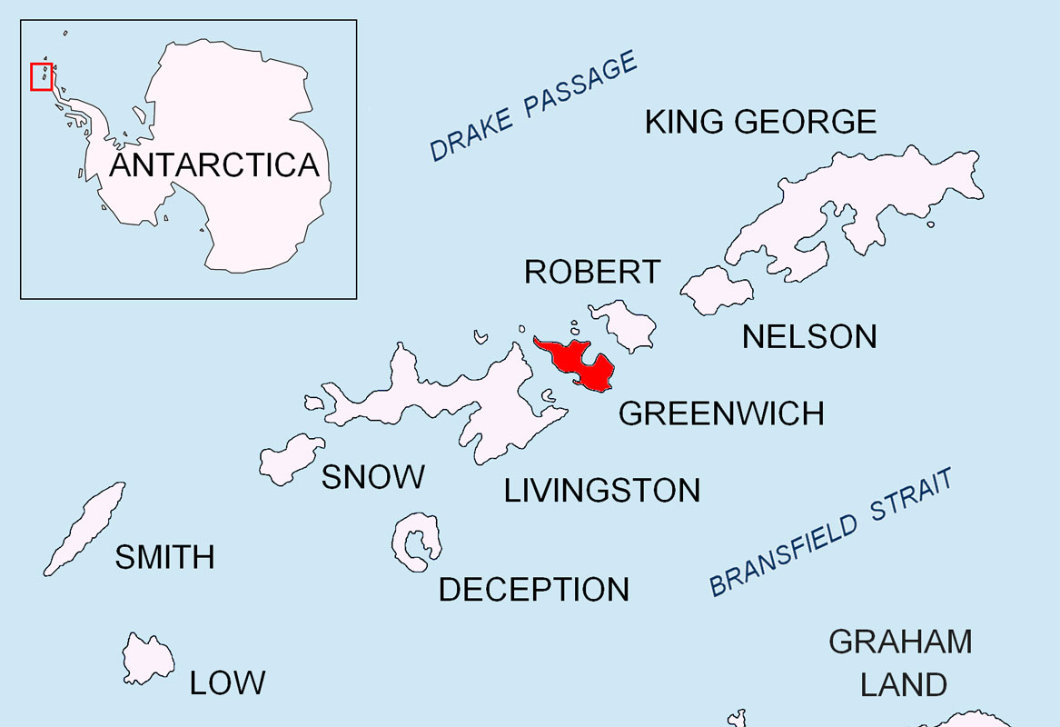
Forward: Here's a map of Antarctica for reference. The cruise ships only go to the Antarctic peninsula, and usually only towards the northern tip of the peninsula. Few even cross the Antarctic circle (66°33'50.7"S) - the furthest we got was 64°36'37"S.
Note that Antarctica is divided into east and west Antarctica. But when you're at the south pole there's no east or west, only north. So why did they divide it the way they did? Note that the dividing line is the Transantarctic Mountains (abbreviated TAM). It somewhat coincides with the prime meridian which divides the world into the eastern and western hemispheres. So they divided Antarctica the same way. The eastern side is much older than the western side.
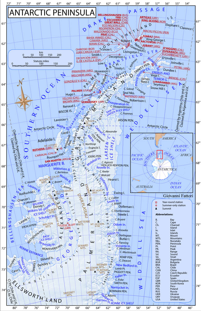
Here's a map of the Antarctica peninsula.
In 1959 twelve countries signed a treaty to share the Antarctic continent. Other countries joined and the number of countries is now 58. That did not mean that the countries gave up their claims to part of Antarctica but they agreed not to assert those claims. Here's a map showing the claims - and a few of the research stations. Neither the US nor the Soviet Union made claims on Antarctica although both reserved the right to do so and have research stations there.
+++++++++++++++++++++++++++++++++++++++++++++++++++++++++++++++++
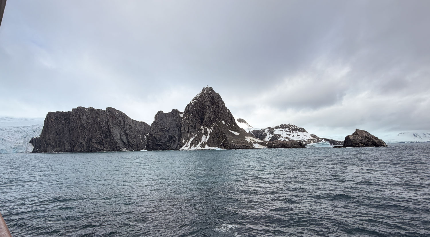
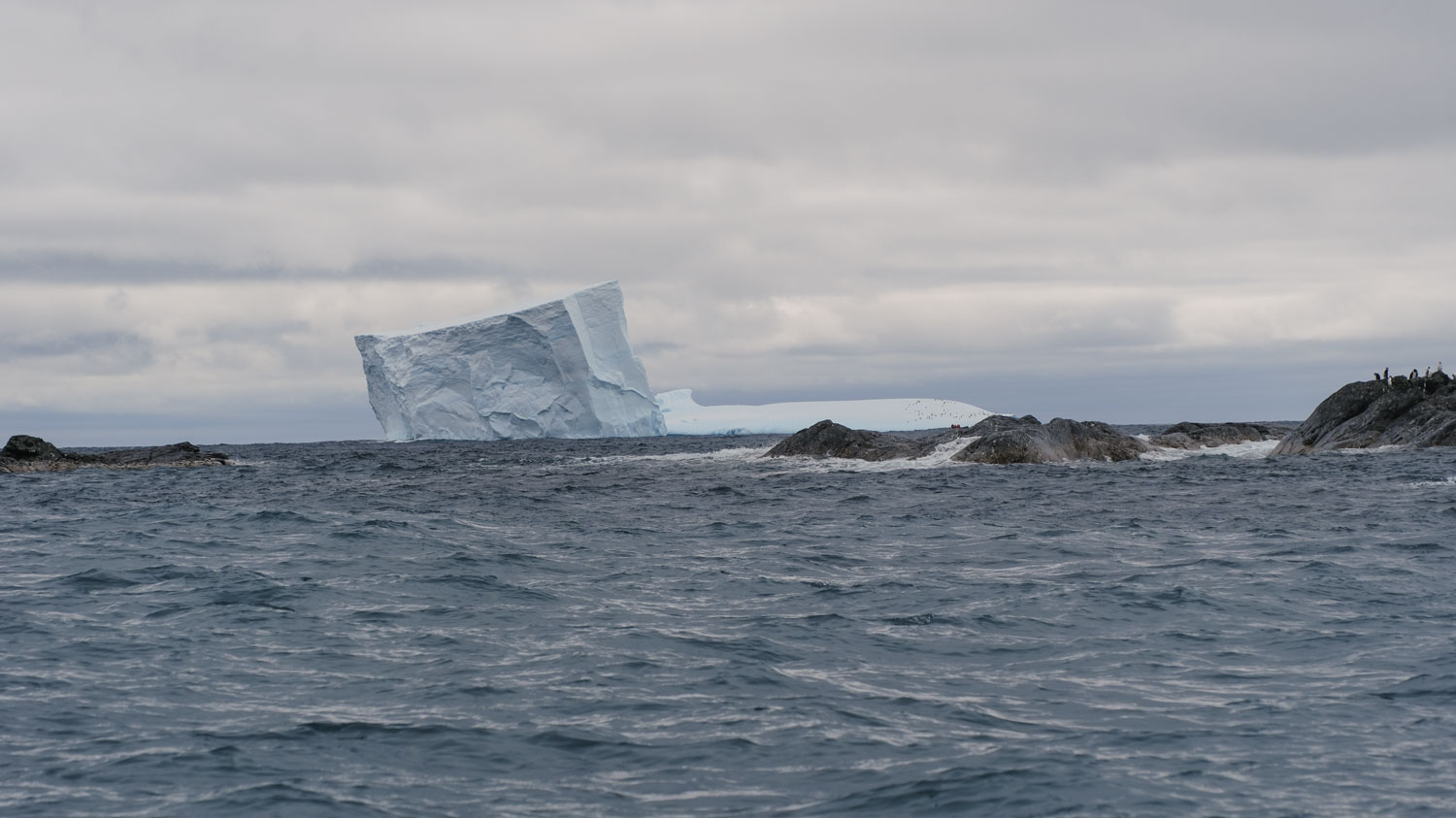
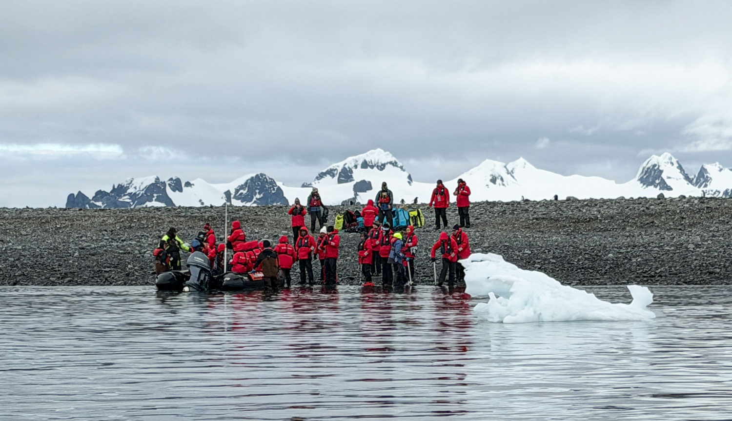
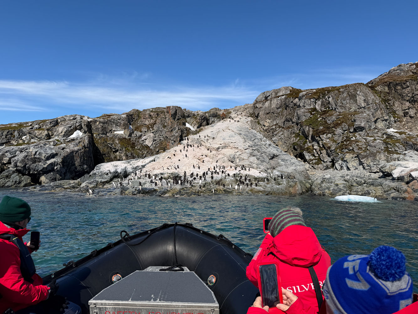
1/1/2026 (Thursday, New Year's Day) - We're at 61°3'22"S, 54°47'46"W at 6:30am this morning, just off Elephant Island. The name Elephant Island was given in 1821 because of its many Elephant seals.
It's cold, but the sea is calm. It's likely we will be able to take the Zodiacs this morning.
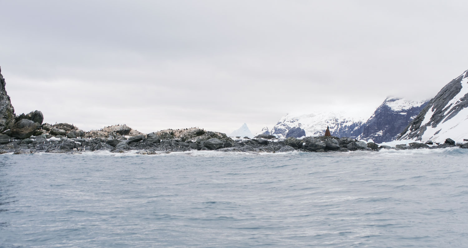
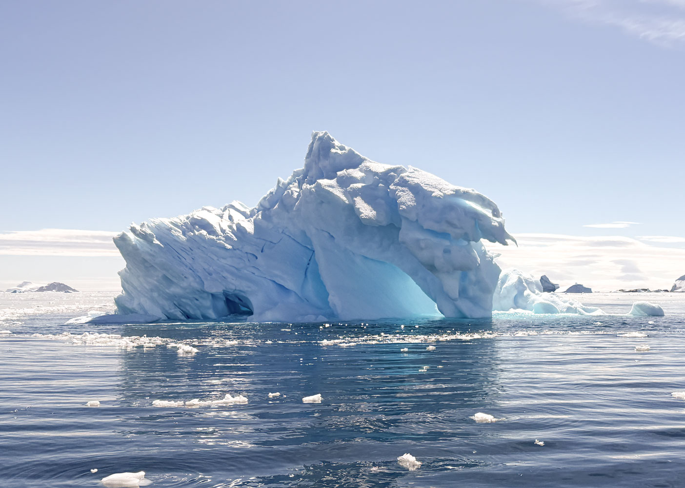
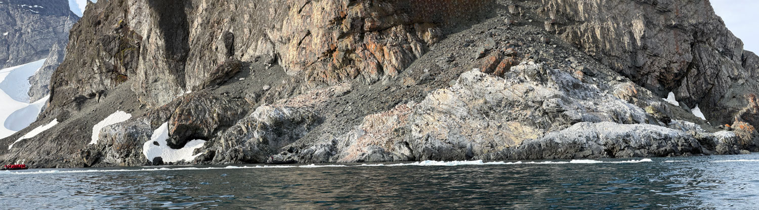
Here's our first view of Elephant Island.
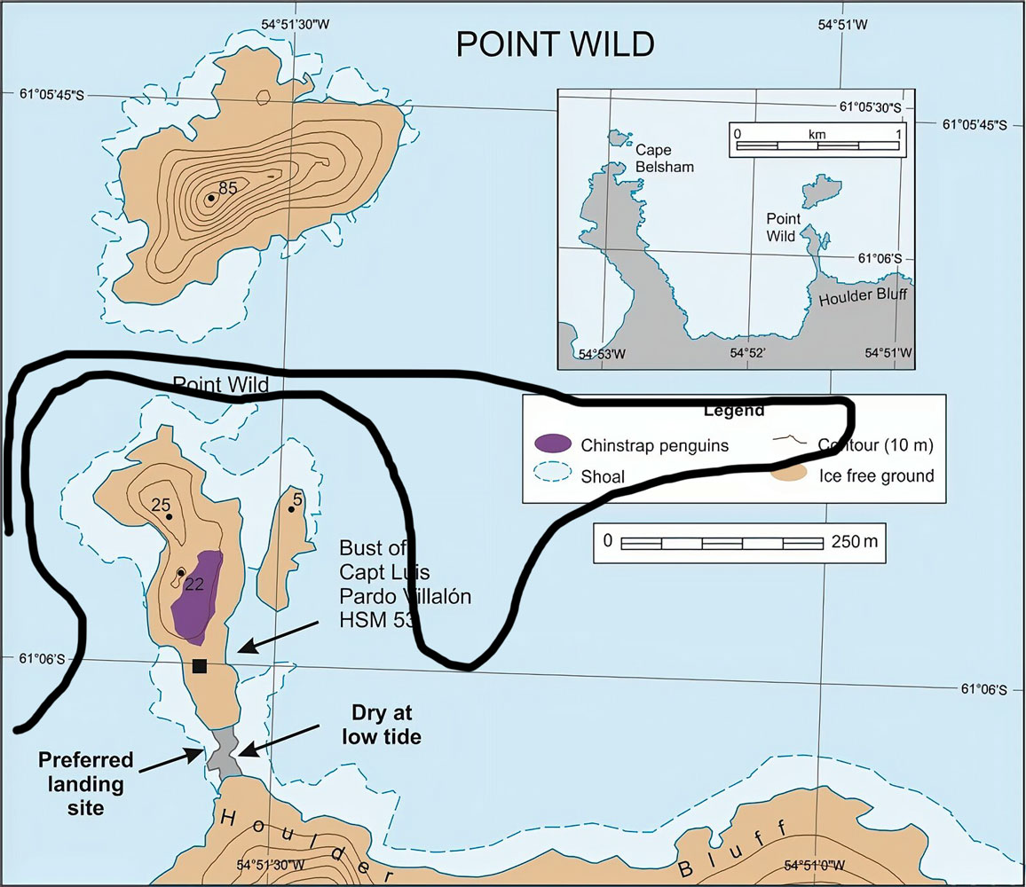
From the top deck I took a few pictures of Point Wild. Here's a map of Point Wild.
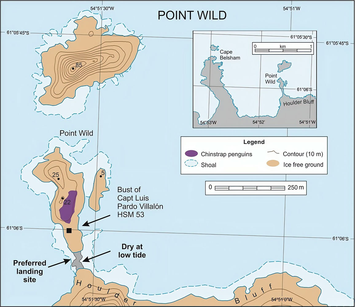
We're anchored in the far left of this map.
Here's a photo overview. The place where the Shackleton group camped is off the second island of rocks in the center right of the picture.
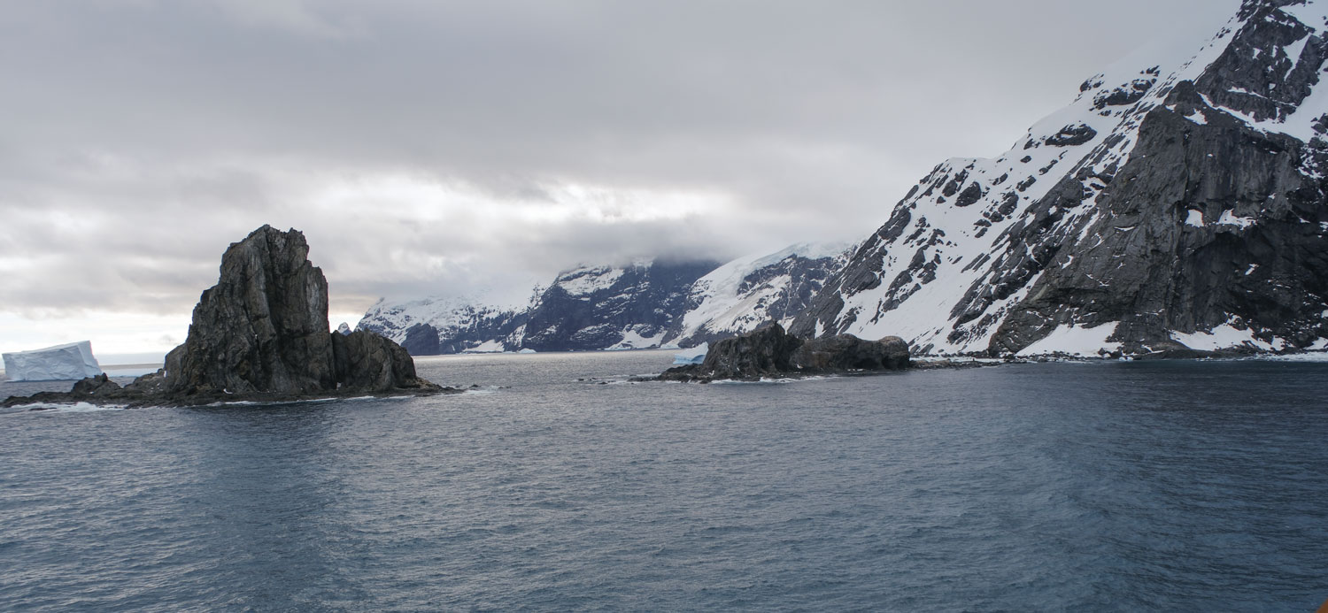
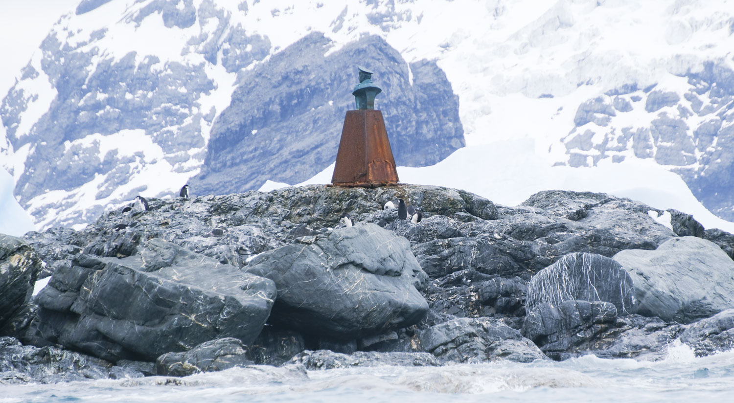
A closer view. You can see the monument to the Yelcho captain at the right. After taking our Zodiac excursion, it's clear that the rescue was done from the other side of this little spit of land.
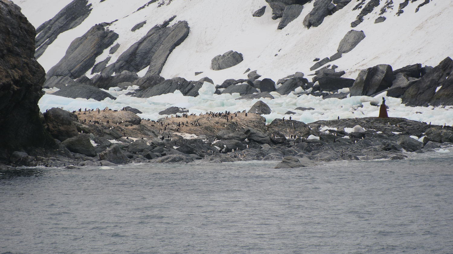
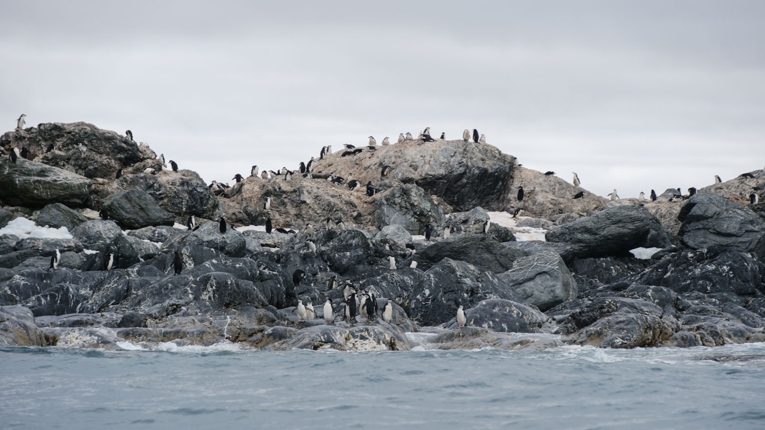
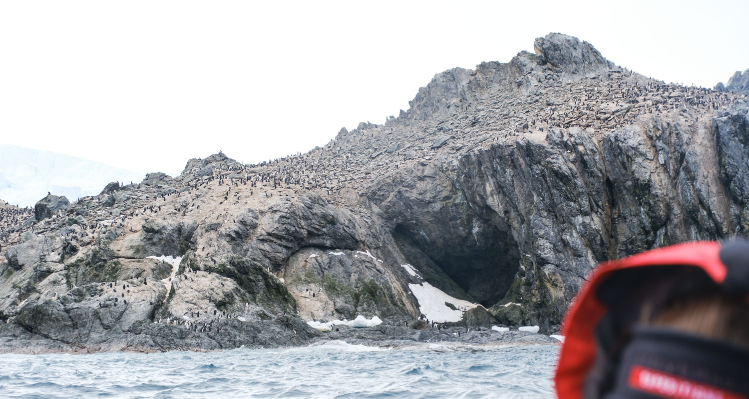
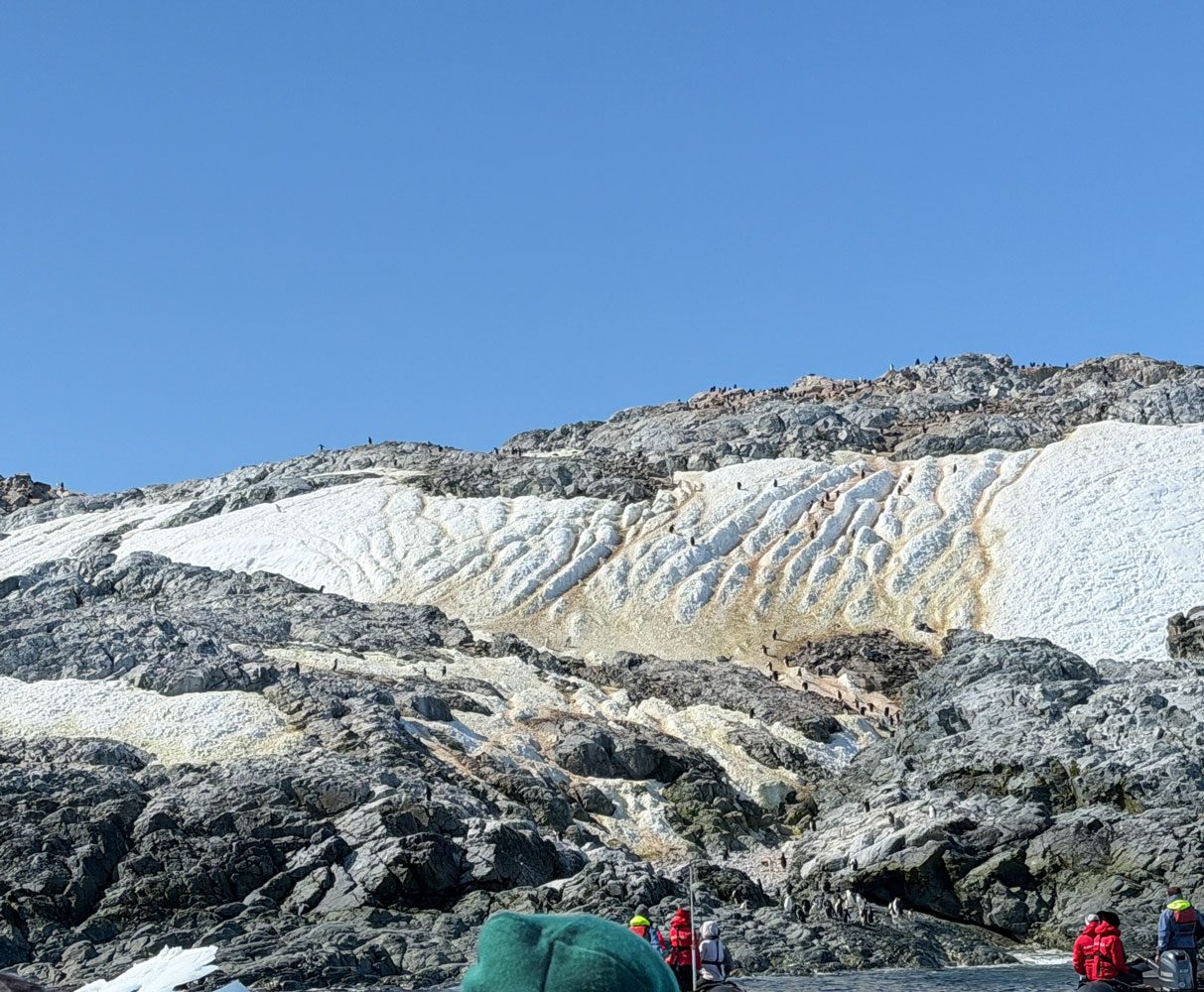
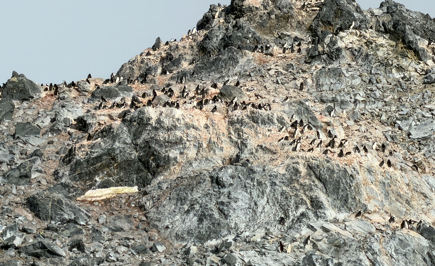
Later, Judy and I went up to the top deck to take some pictures. Here's something interesting. First a bit of a wide view of the rock at the end of Point Wild.
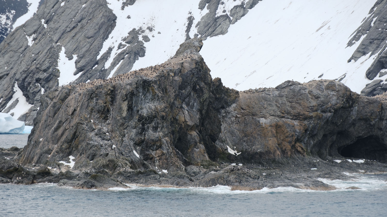
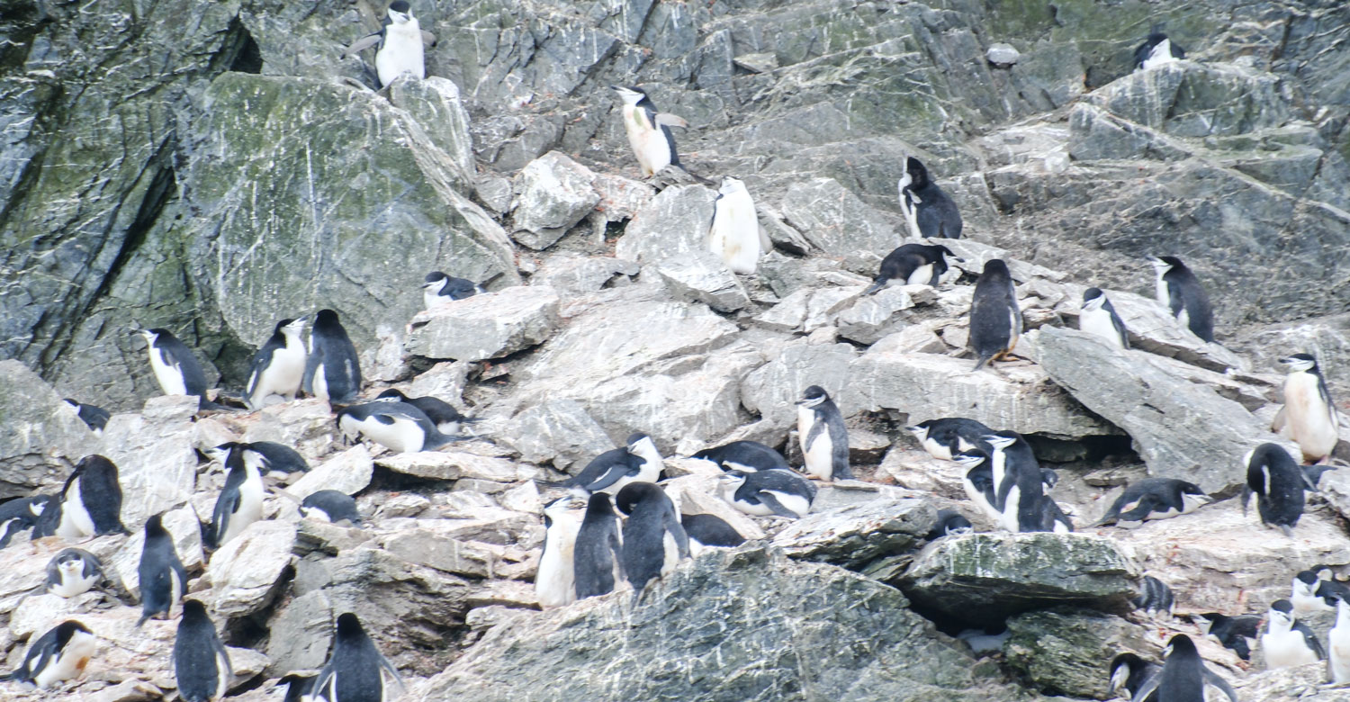
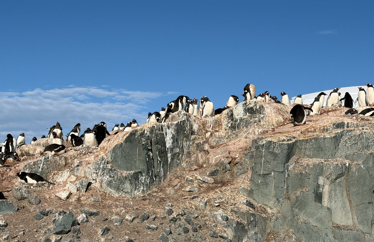
Look at all those penguins on top of that rock. How do they get up there? The slope on the other side is not steep and they come up that side, but it's still a good climb.
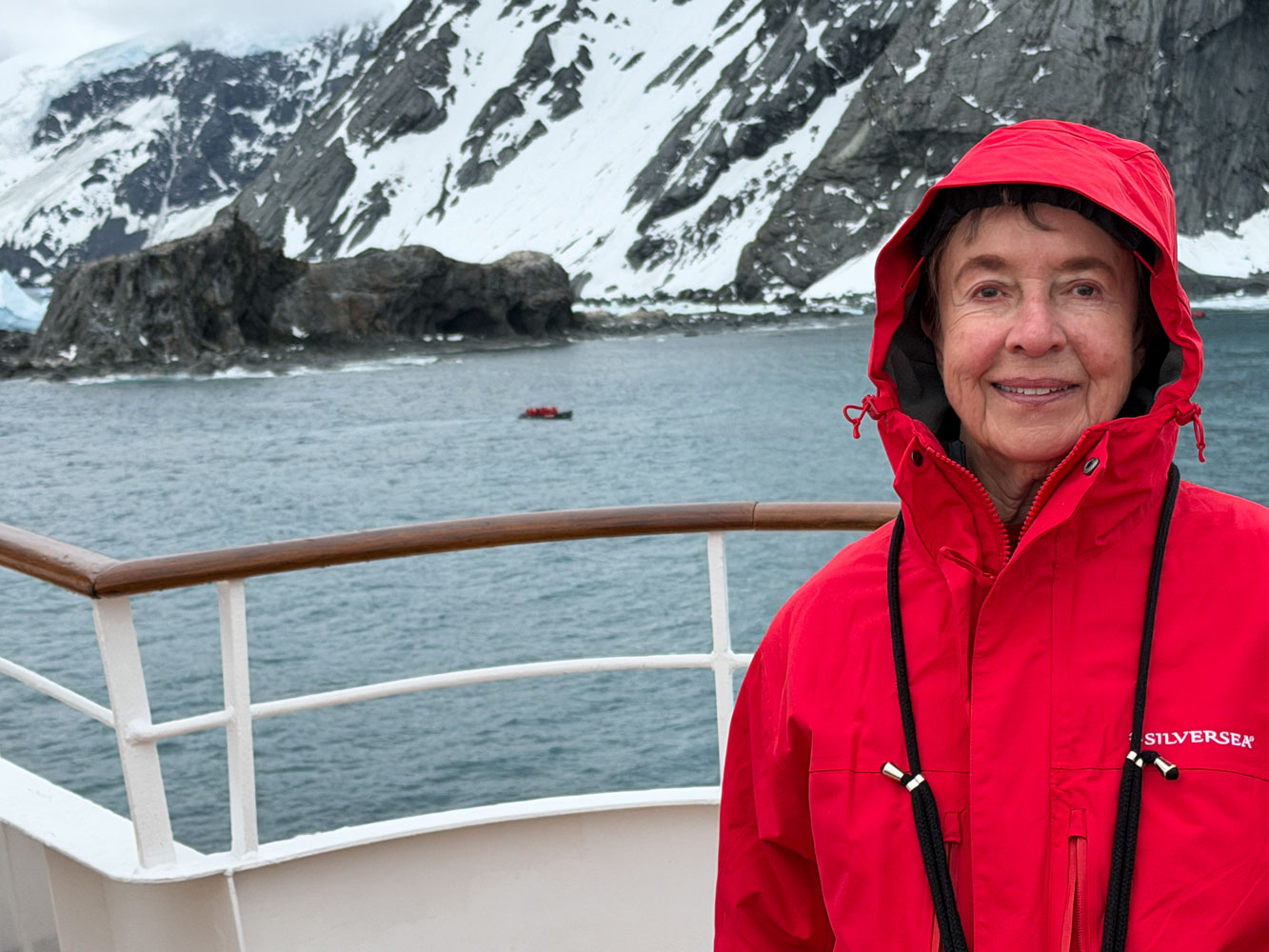
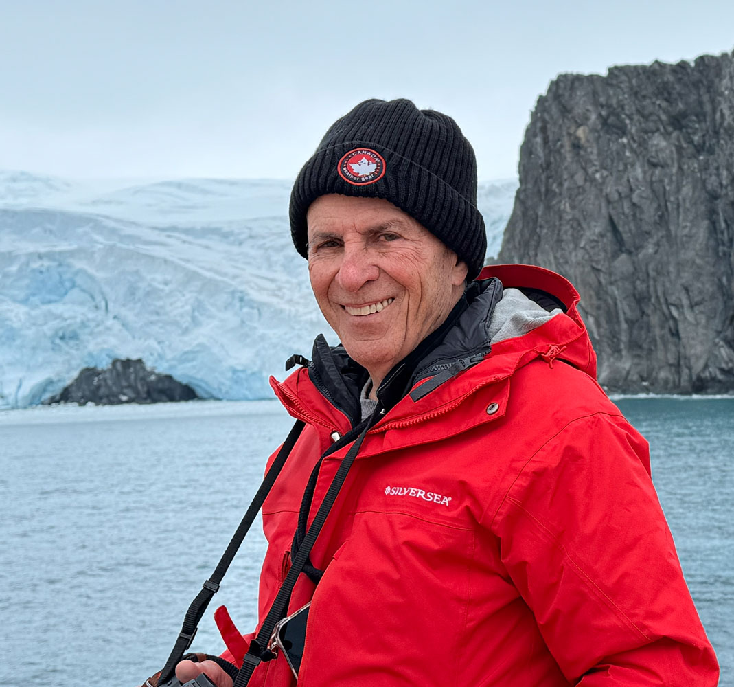
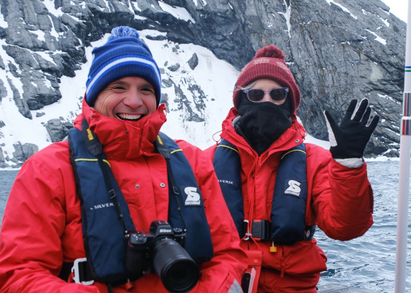
Here's a picture of Judy with Point Wild in the background.
And Judy took a picture of me.
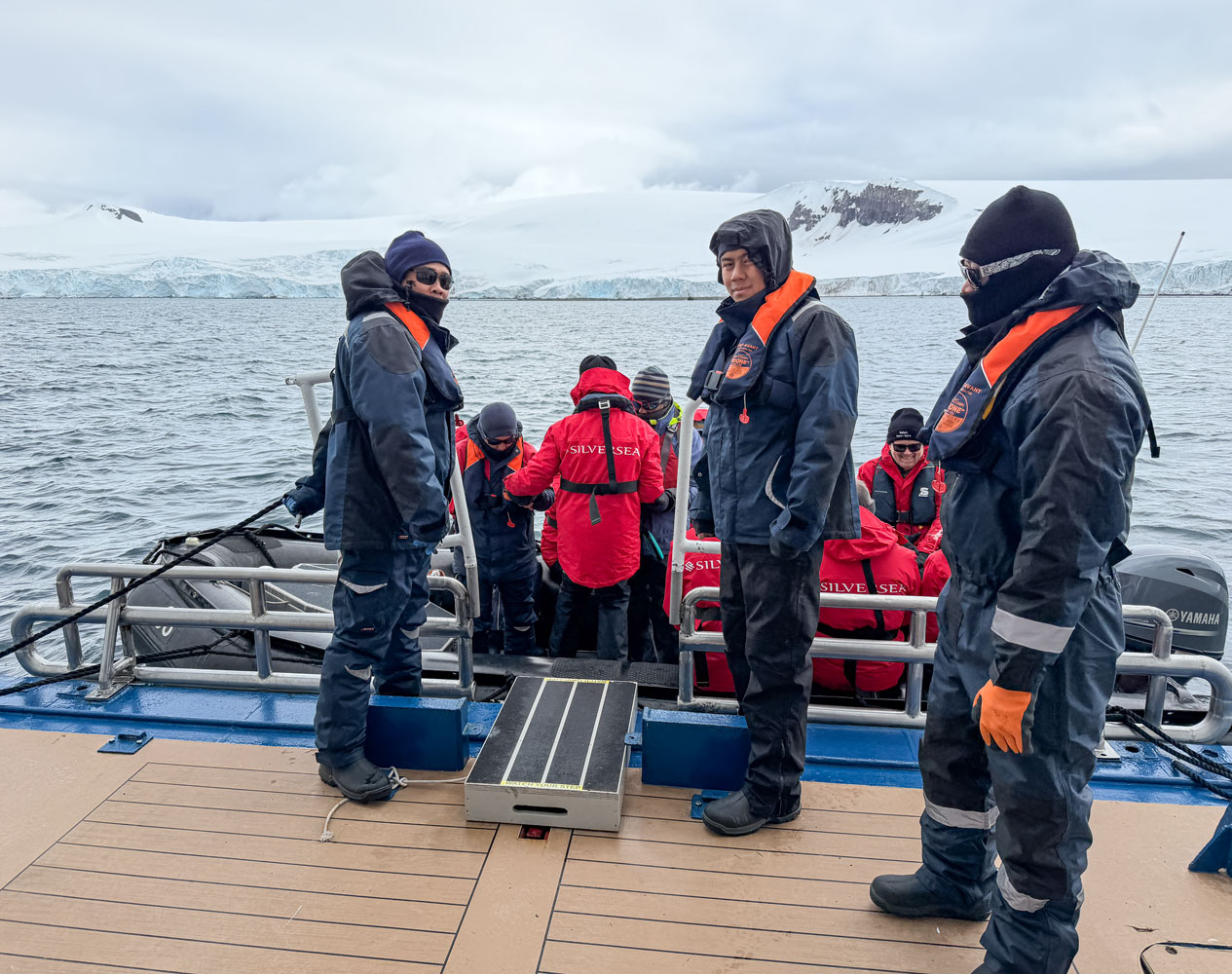
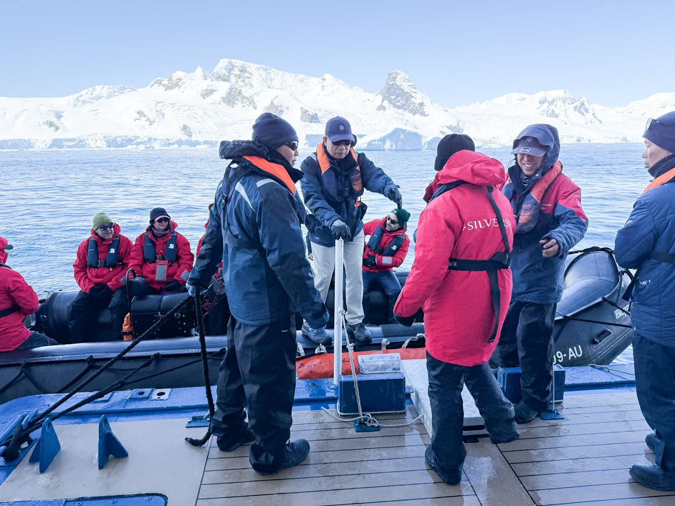
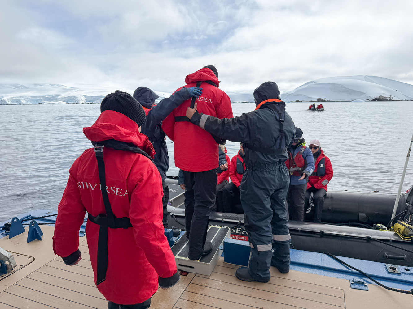
About 10am we went down to the mud room to board the Zodiac.
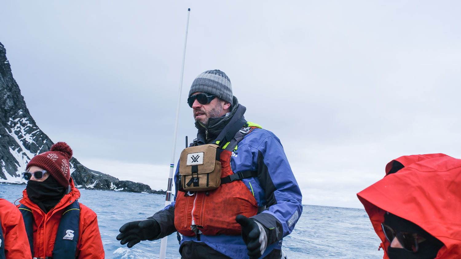
Here's our guide for the Zodiac cruise. He did a good job of explaining the area and the animals.
Here's approximately the route we took with the Zodiac (the black line). The ship is off the map to the left.
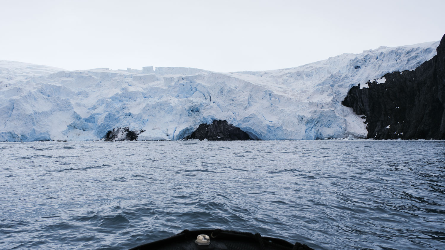
A glacier empties into the bay at Point Wild. It was difficult taking pictures because the Zodiac was bouncing quite a bit, and I had to zoom a lot to get them.
Here's the spit of land where the Shackleton crew lived for four months. You can just make out the bust of the Yelcho captain towards the right.
A closer view of the bust, from the back.
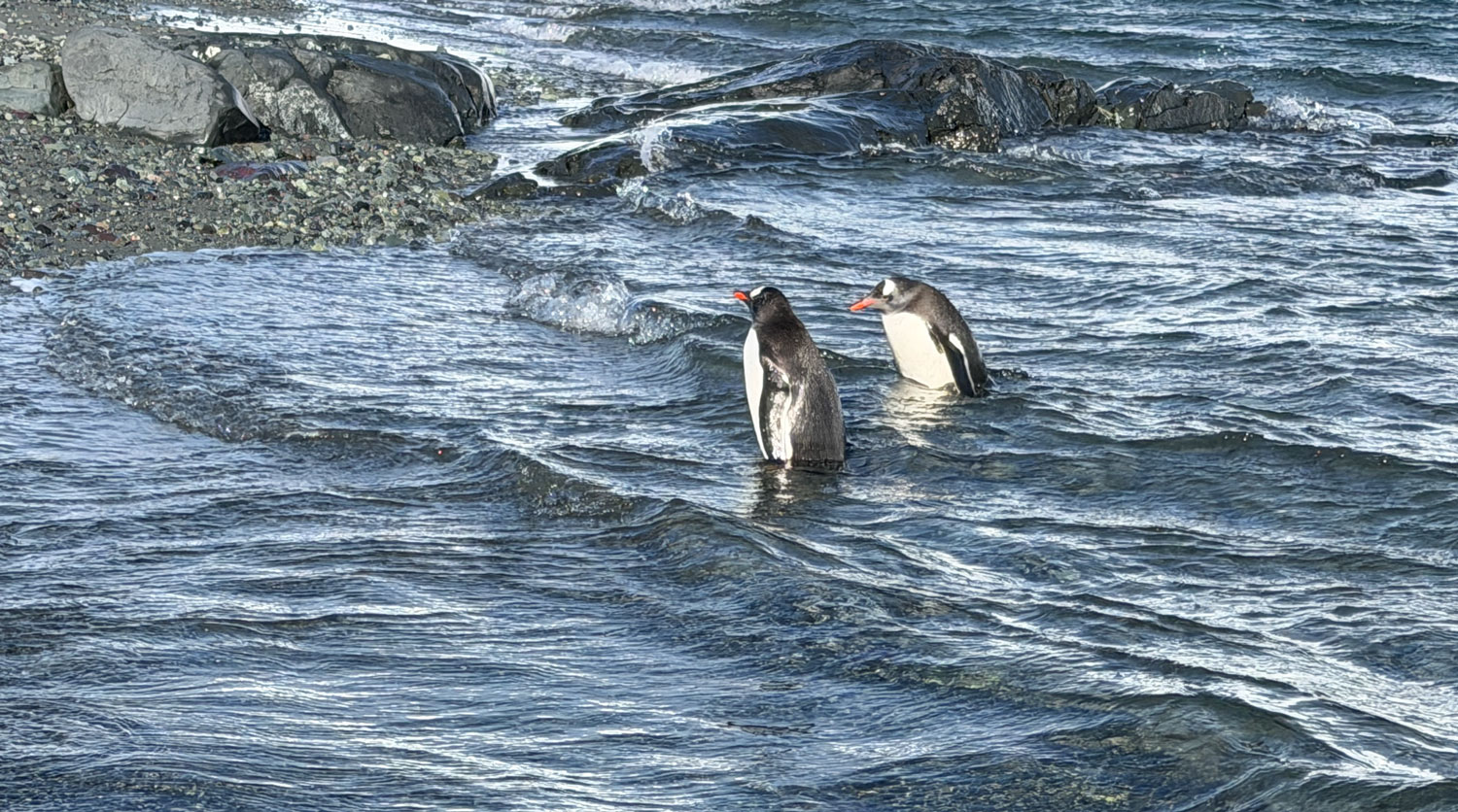
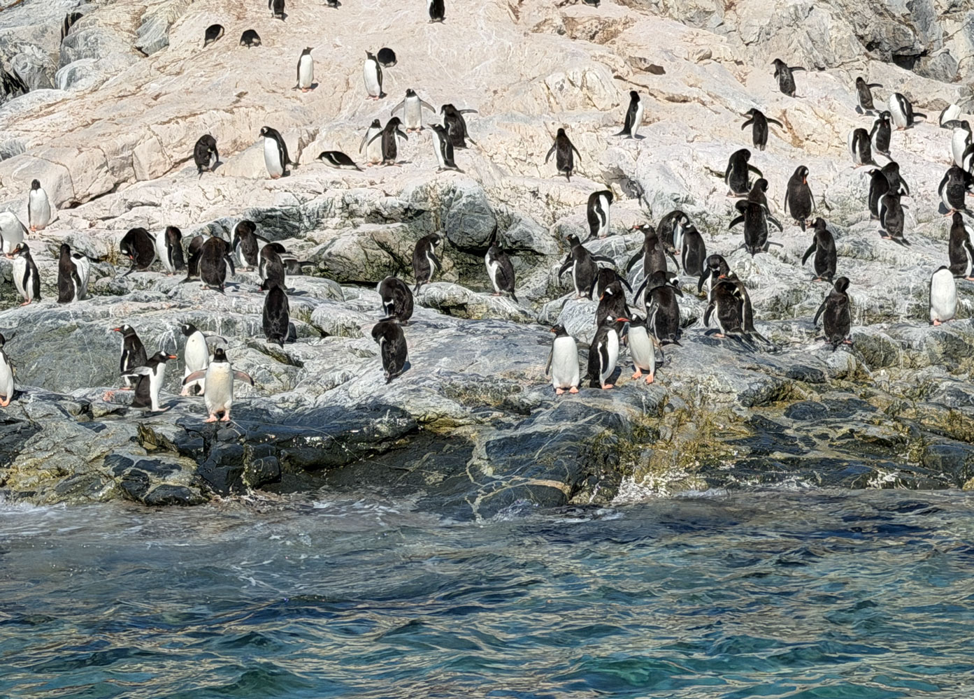
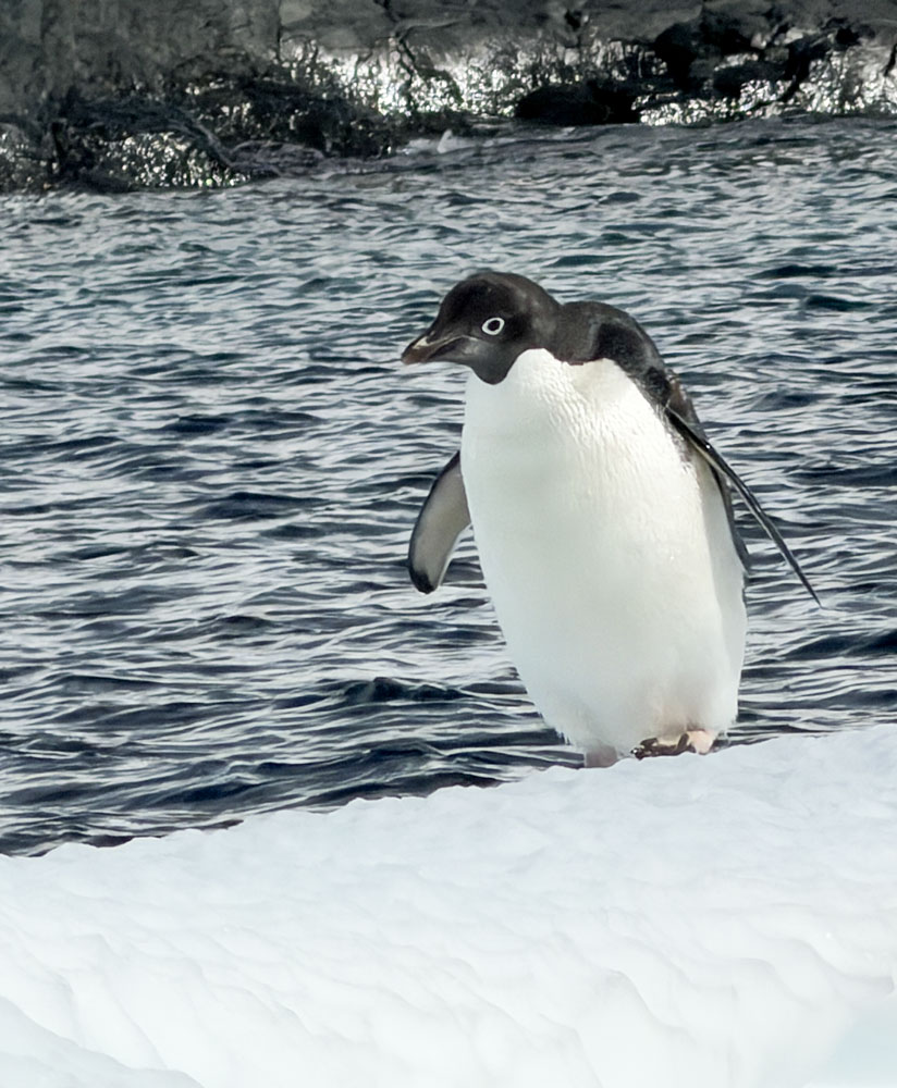
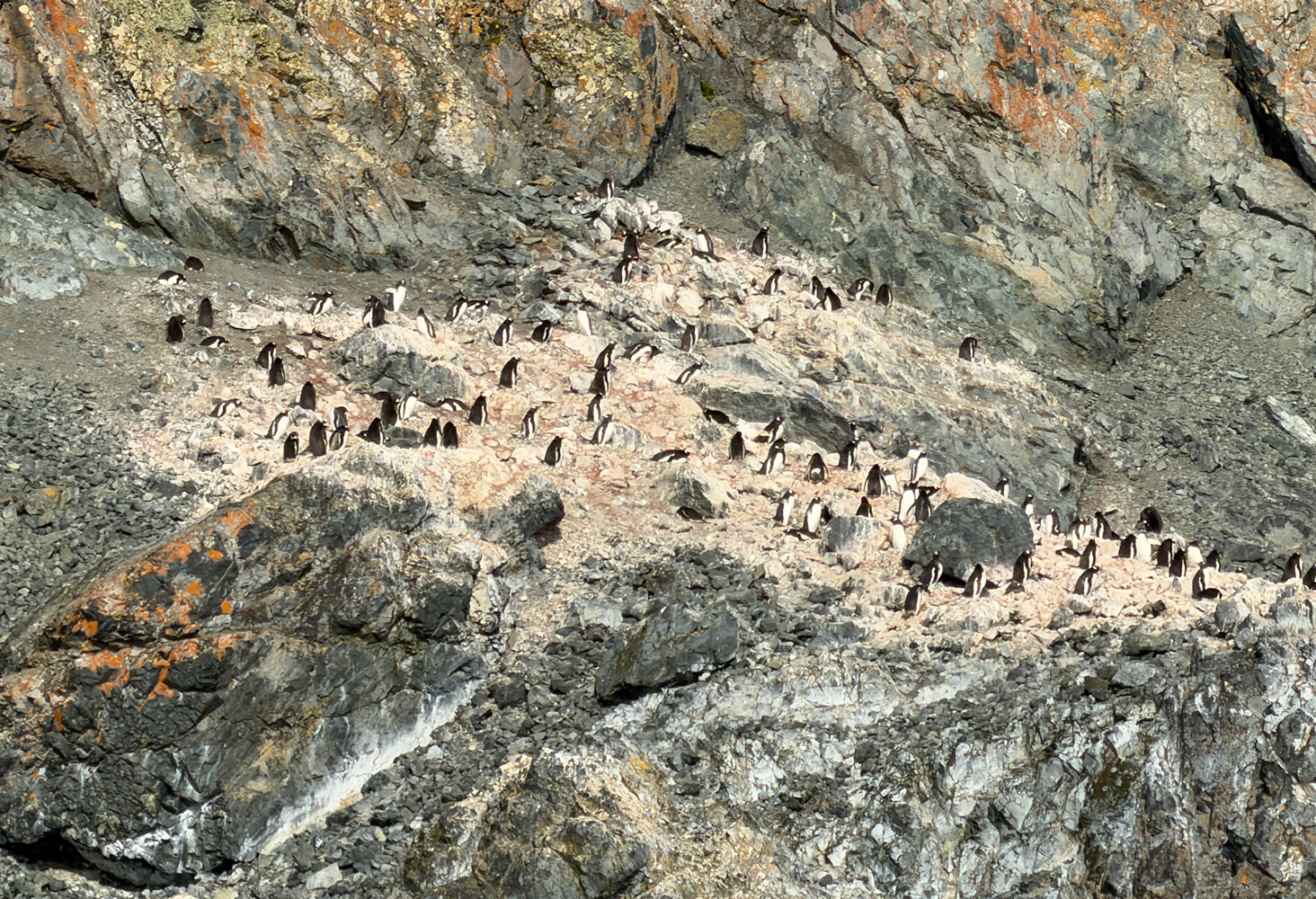
Some penguins on the shore.
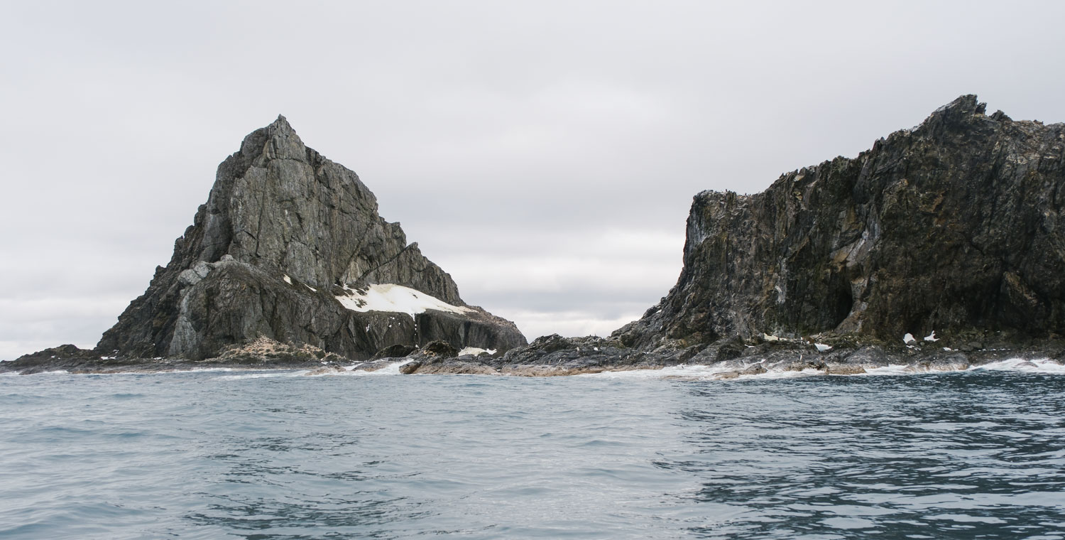
We're heading to the channel between these two large rocks.
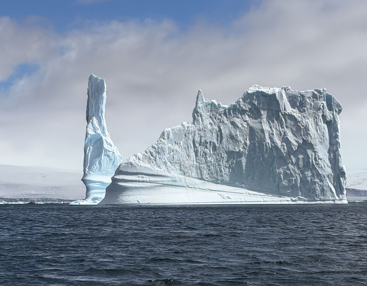
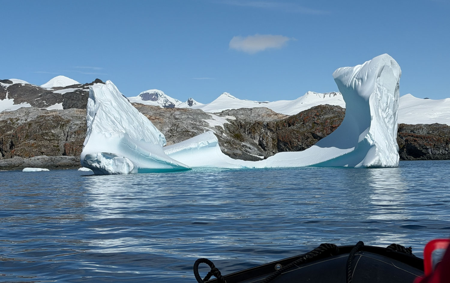
As we came through the channel, we could see these large icebergs in the distance.
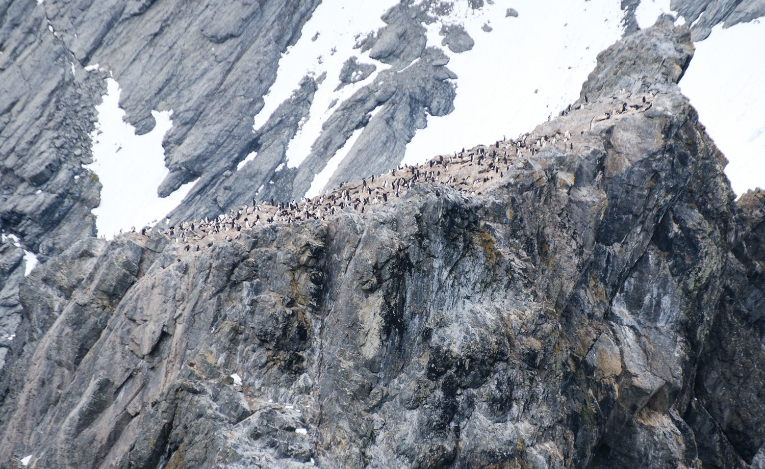
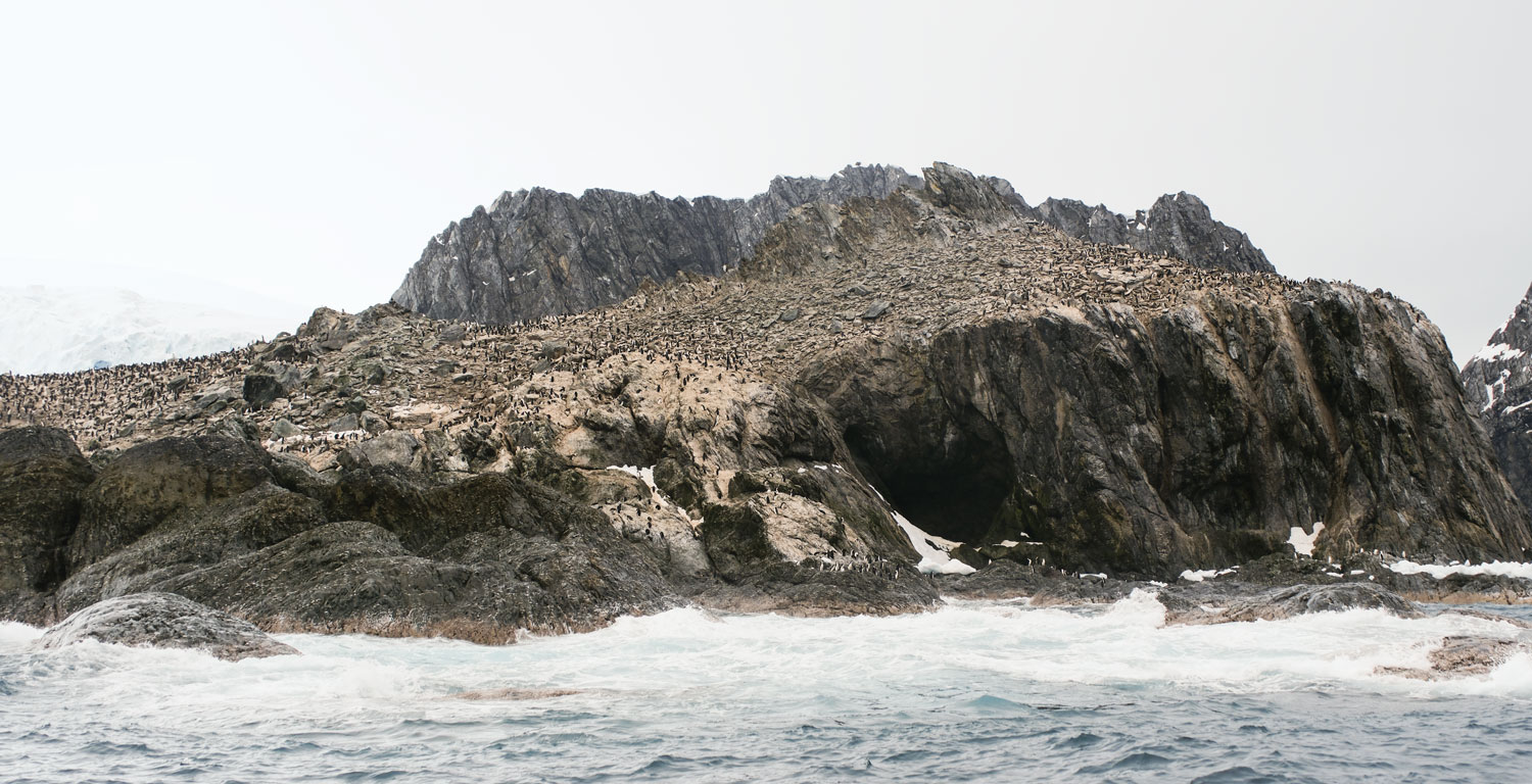
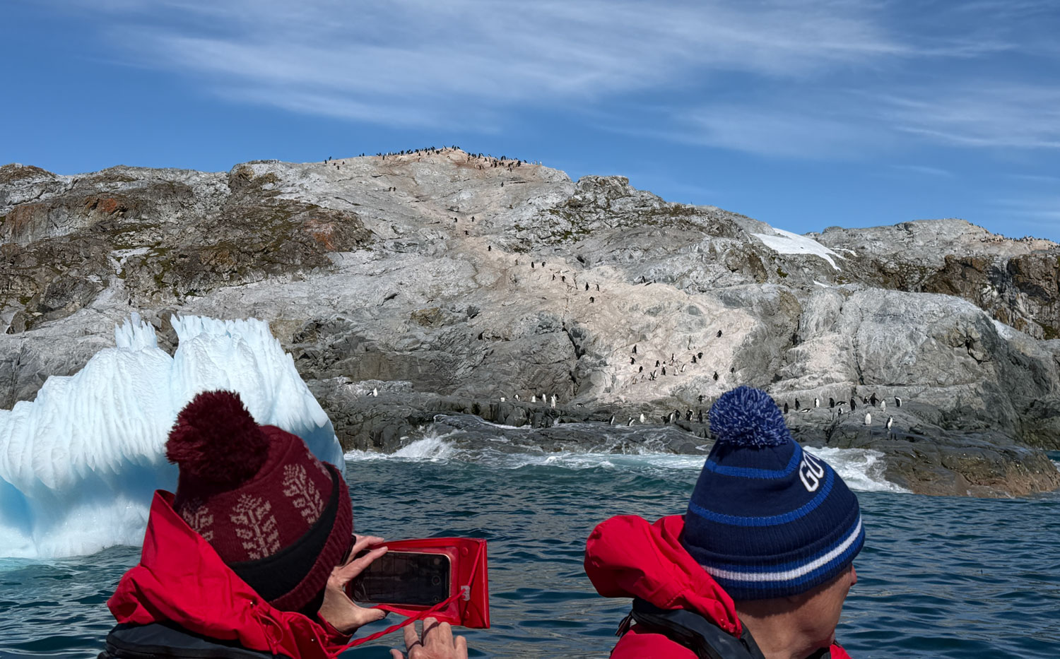
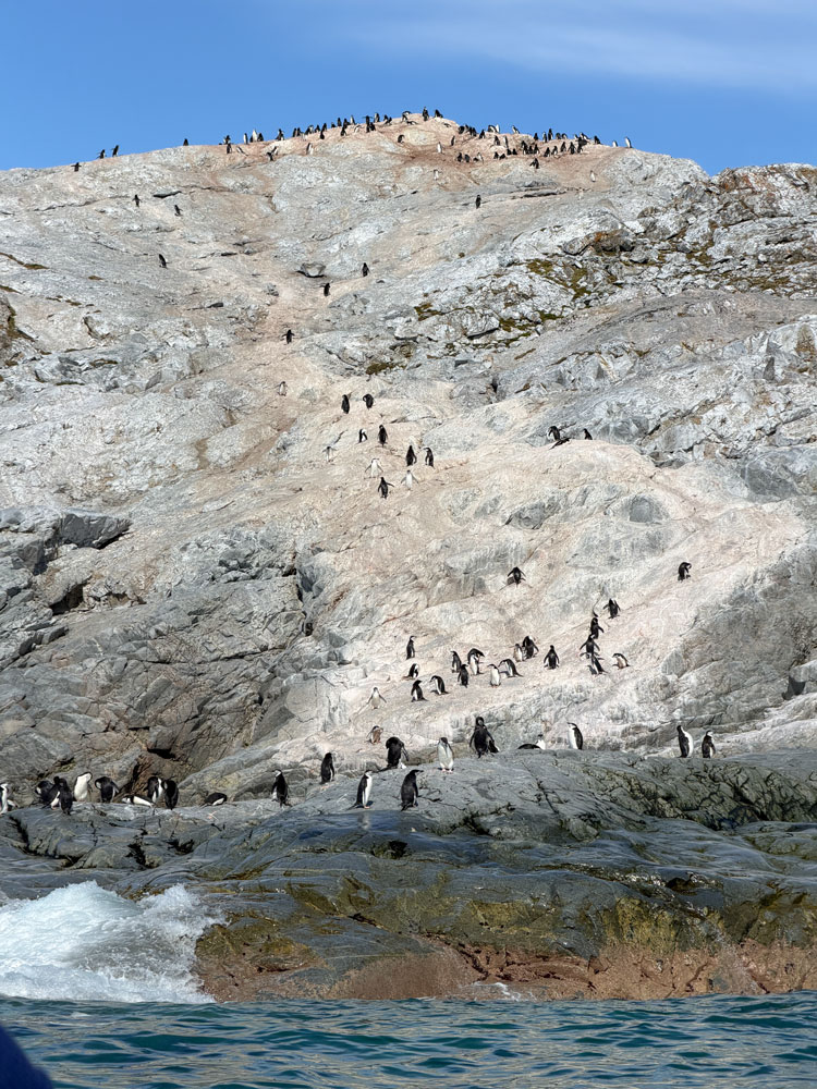
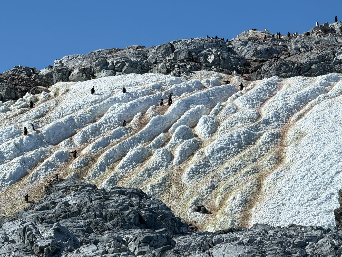
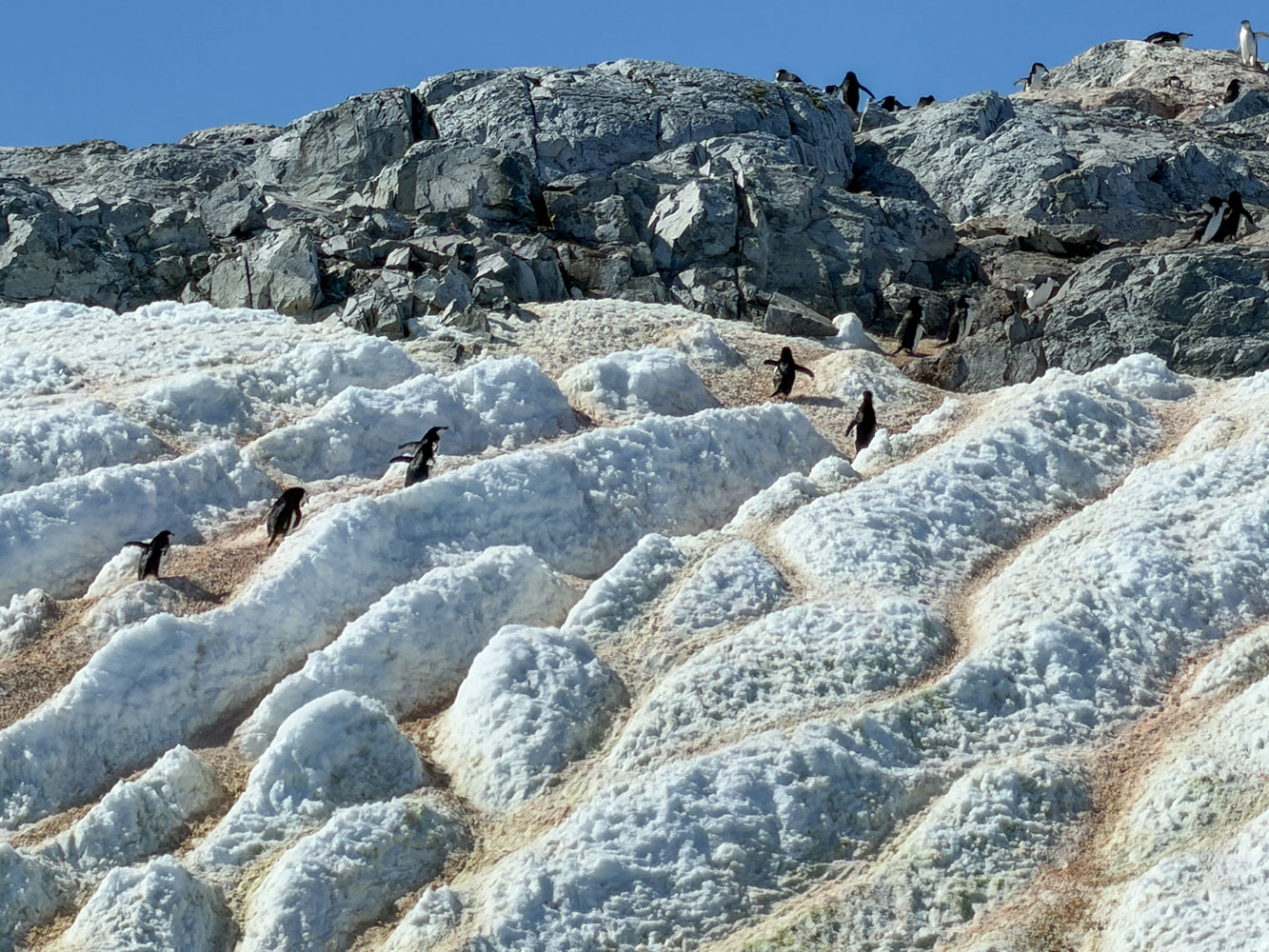
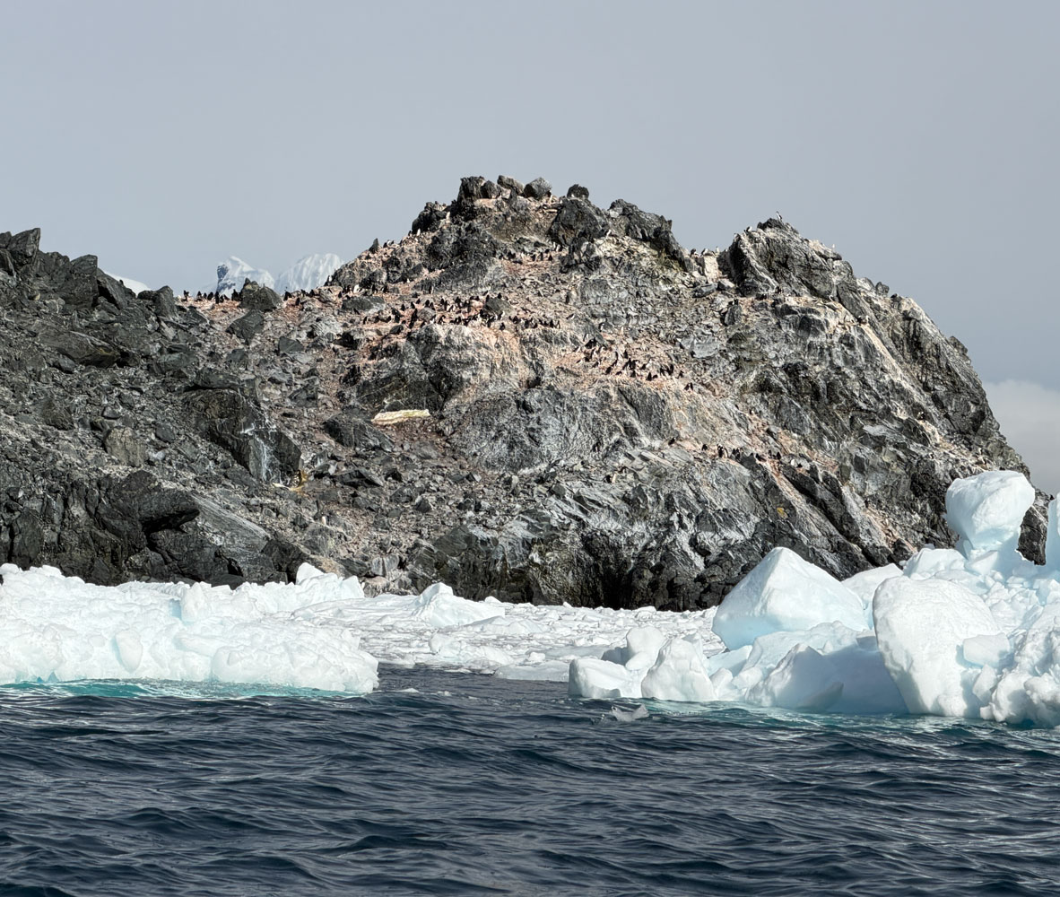
We turned right and I was able to get a picture of the "back" side of that rock with all the penguins on top of it.
Another view. There are penguins all over the hillside.
And the opposite side of that point where the Captain's bust is.

Look at this picture that Hurley took when the Yelcho arrived. There's a hill to the left where they started a signal fire, and the Yelcho is on the horizon with no land anywhere near it. This only works if the rescue was made from this (west) side of the spit of land.
If the rescue had been made from the other (east) side, there would be no hill to the left. And the east side faces a bay, which would put land behind it.
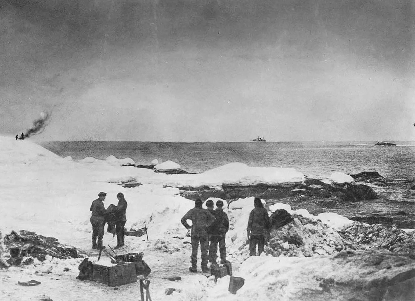
Additionally, the Captain's bust is facing that way. I doubt if they would have put the bust facing away from where the Yelcho was when it rescued the crew.
We then we headed to the icebergs.
Friends Judy and David were on the Zodiac with us.
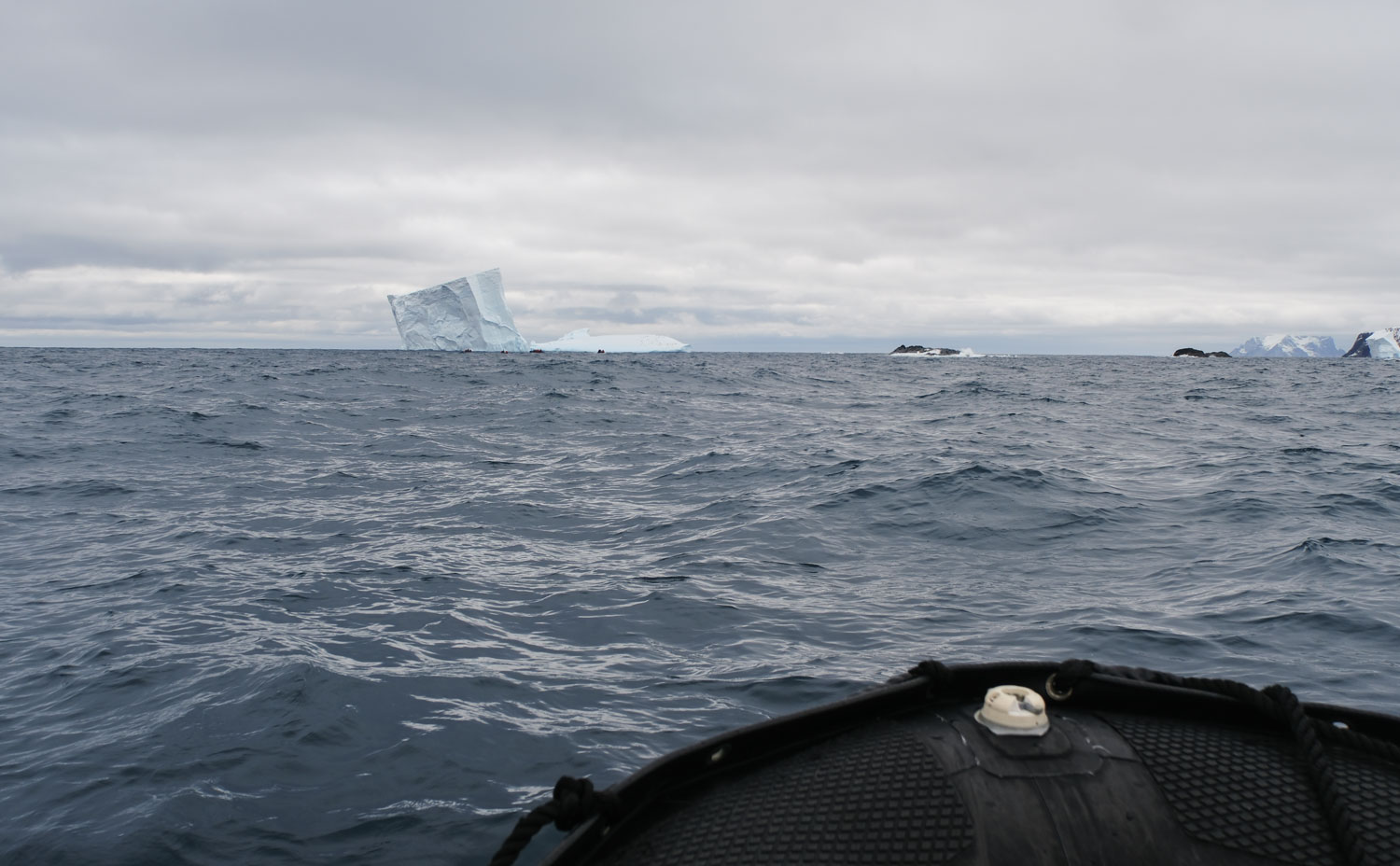
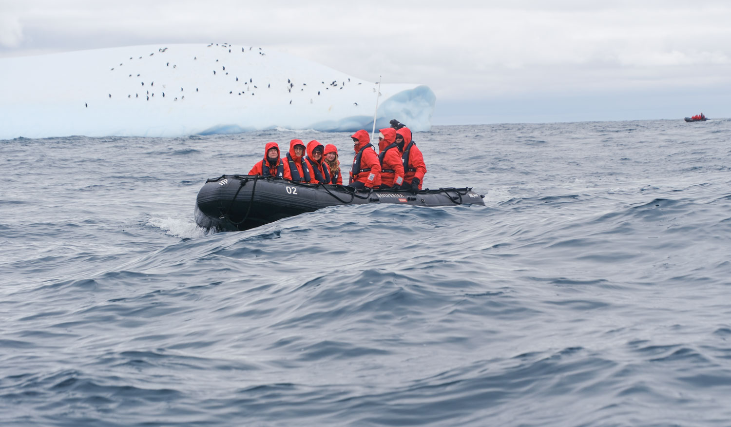
On the way to the icebergs we came upon another Zodiac. I was struck at how small the Zodiac is in the big ocean. The dots on the iceberg in the background are penguins.
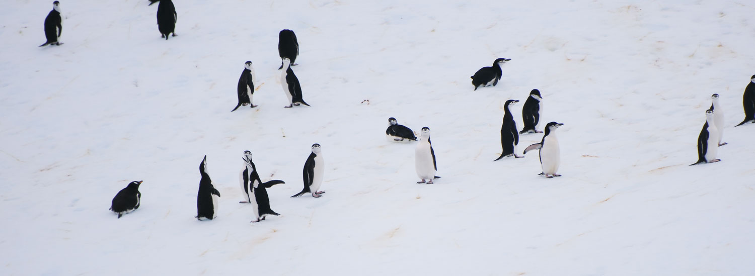
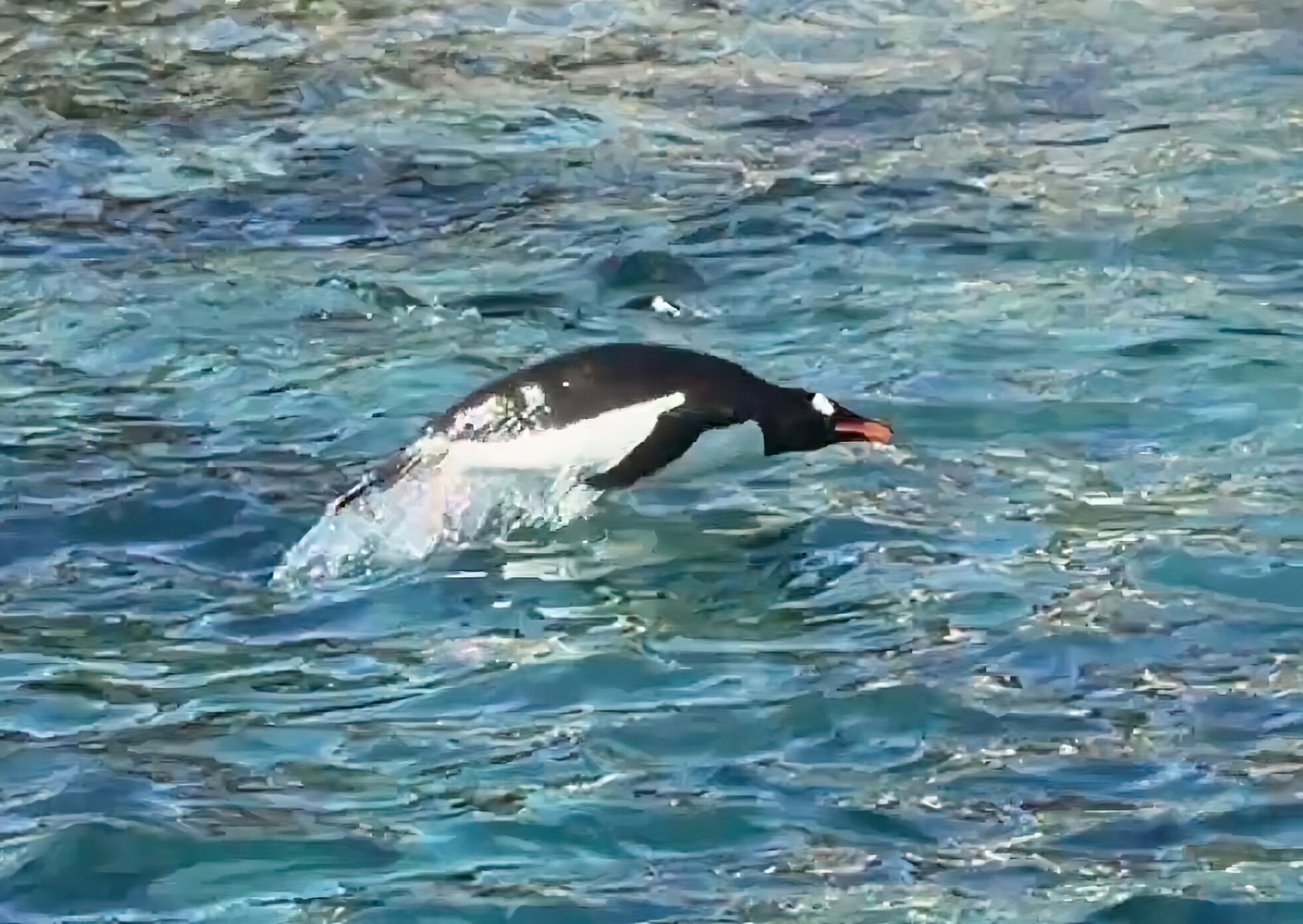
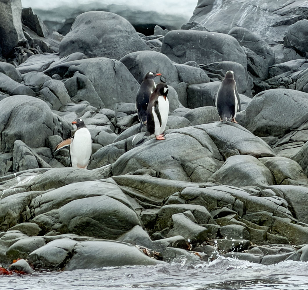
Now the penguins are more visible. Our guide said they were just resting from hunting. They are able to jump several feet out of the water to reach a landing spot.
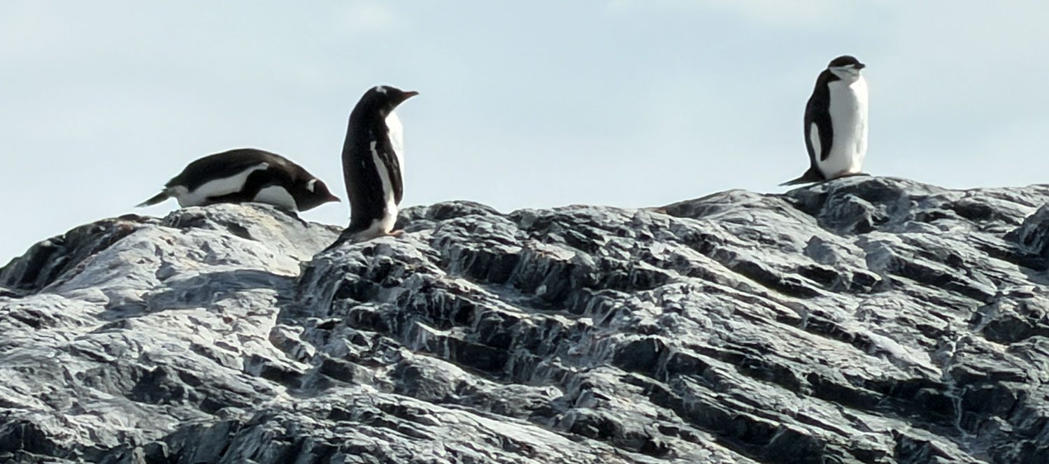
A closer look. These are Chinstrap penguins.
Returning to the ship, while passing through the channel, we saw some Chinstraps nesting on the rocks.
Then we went back to the ship.
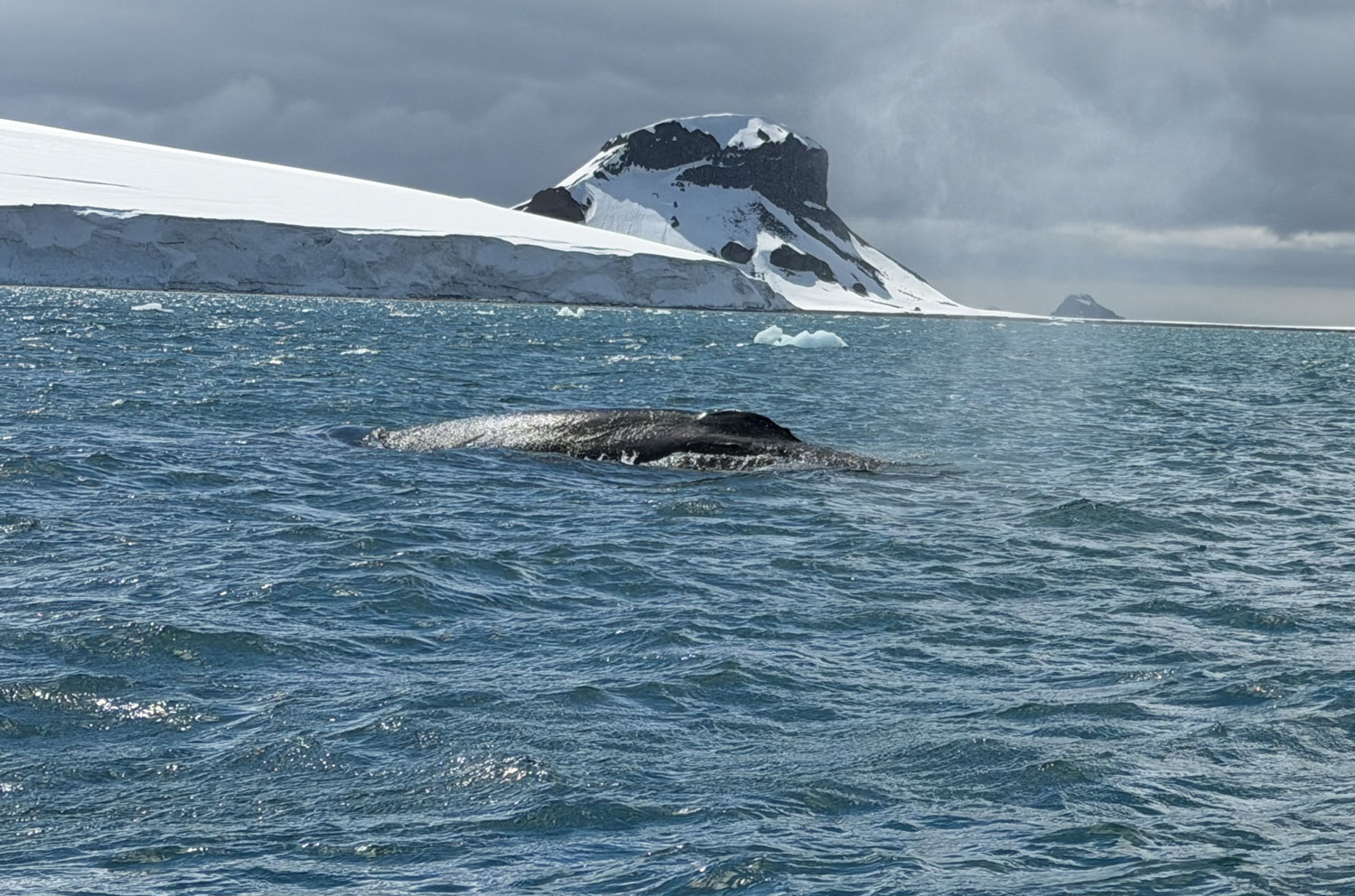
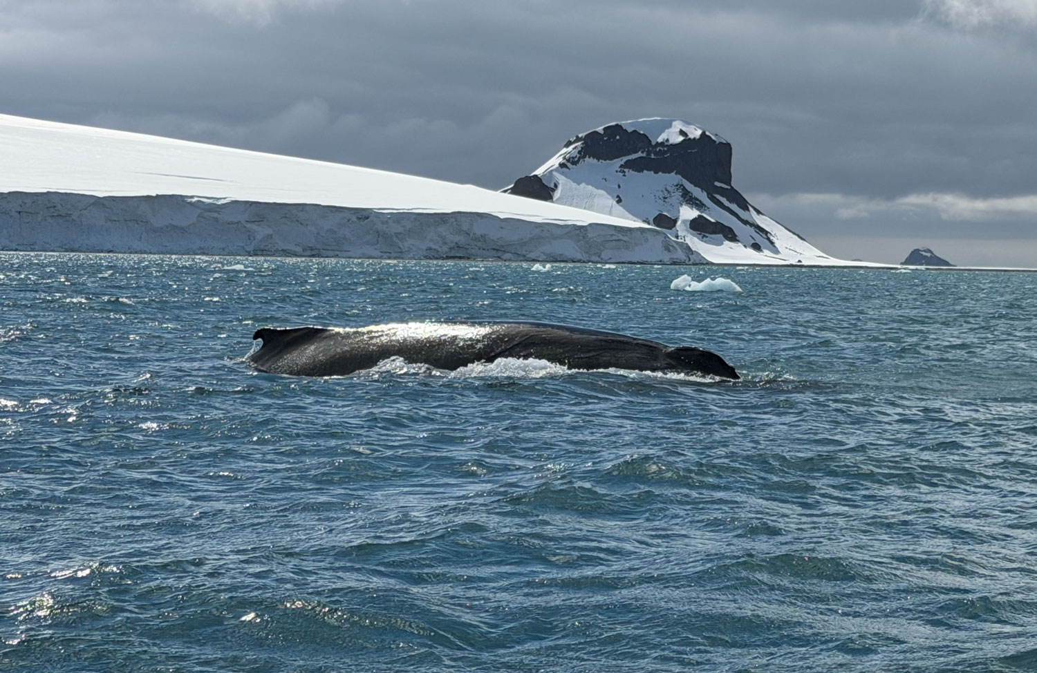
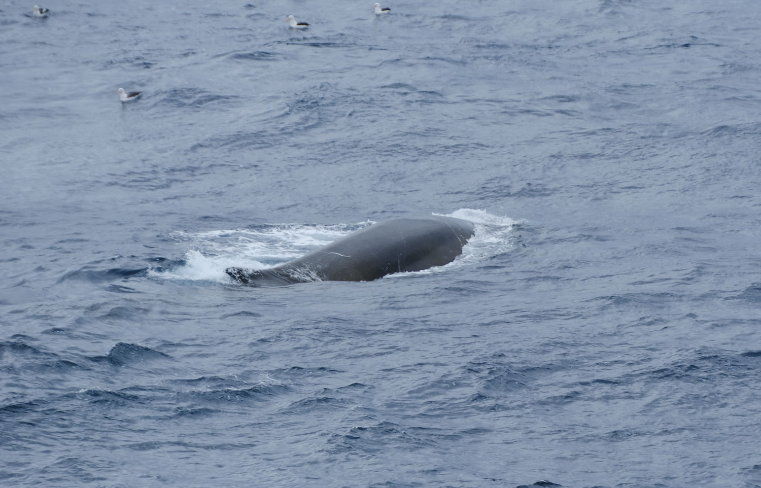
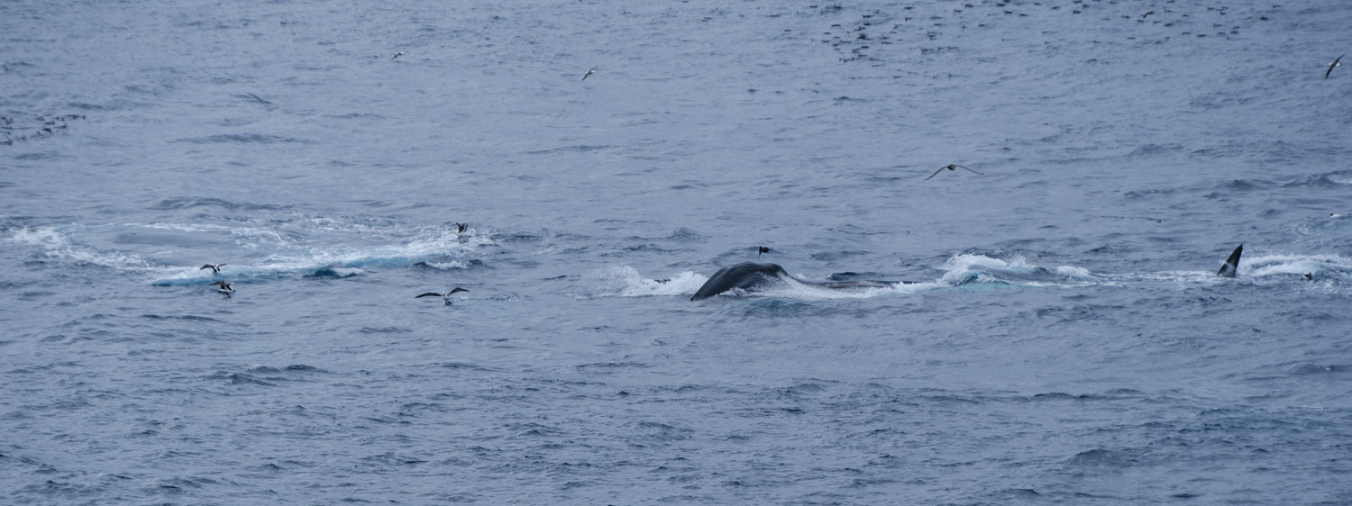
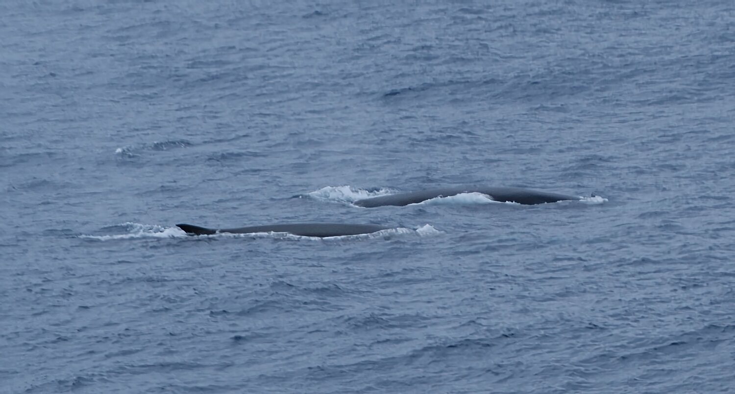
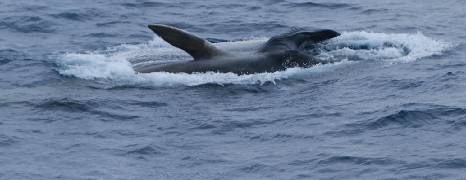
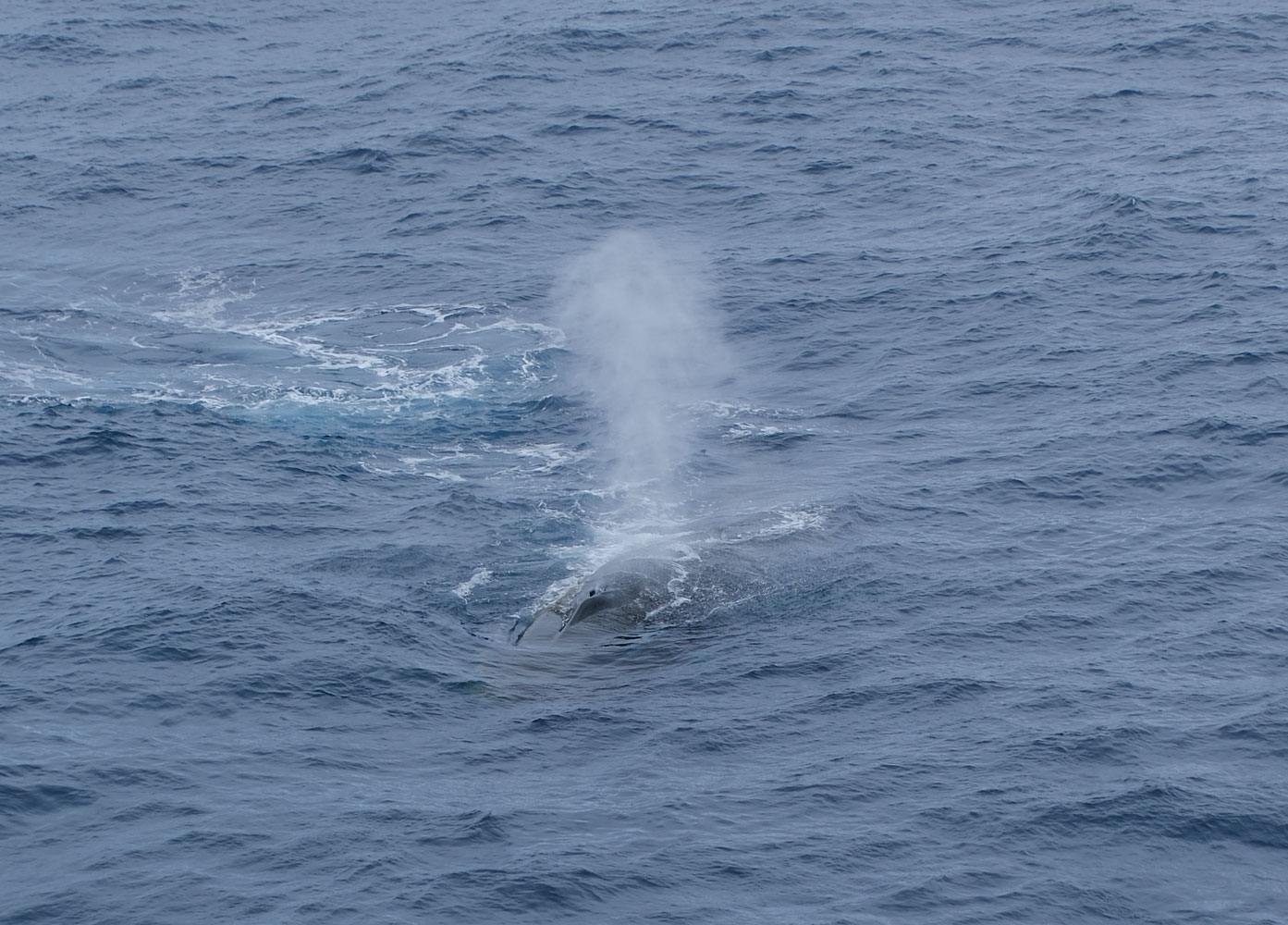
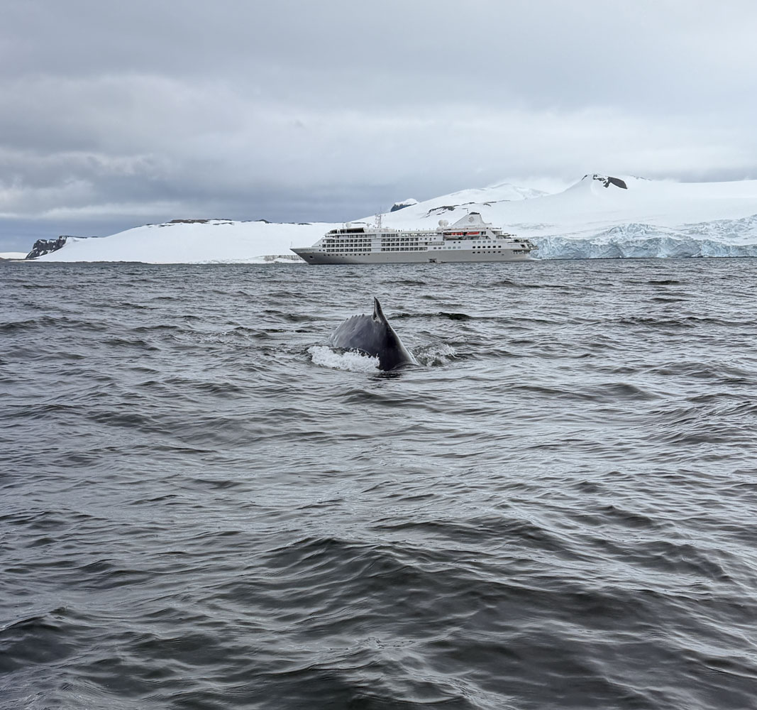
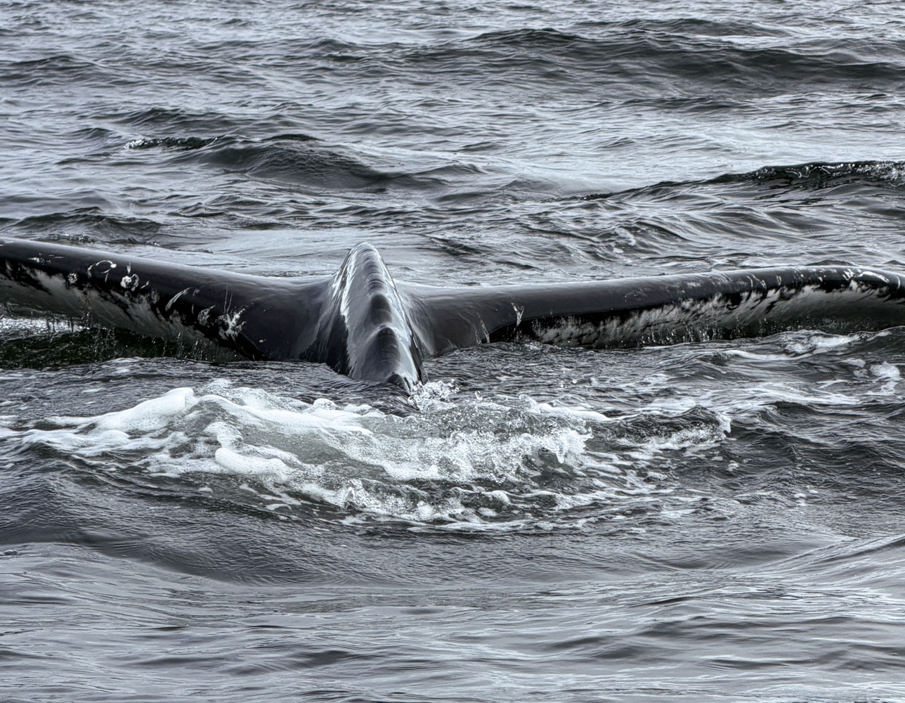
After lunch the ship encountered a pod of fin whales feeding close to the ship. I went up to the top deck to take pictures. It's difficult to take pictures of whales. You stand there scanning the sea for some indication of a whale. Usually your first sight is of one blowing, so you swing your camera over and start shooting. Sometimes you get a decent image and sometimes not. This was a pod of fin whales engaged in lunge feeding, and was an unusual event to see. The captain slowed the ship for us to capture the experience, and to protect the whales.

The rest of the day was routine. We played Trivia, attended the briefing, had dinner and then to bed.
+++++++++++++++++++++++++++++++++++++++++
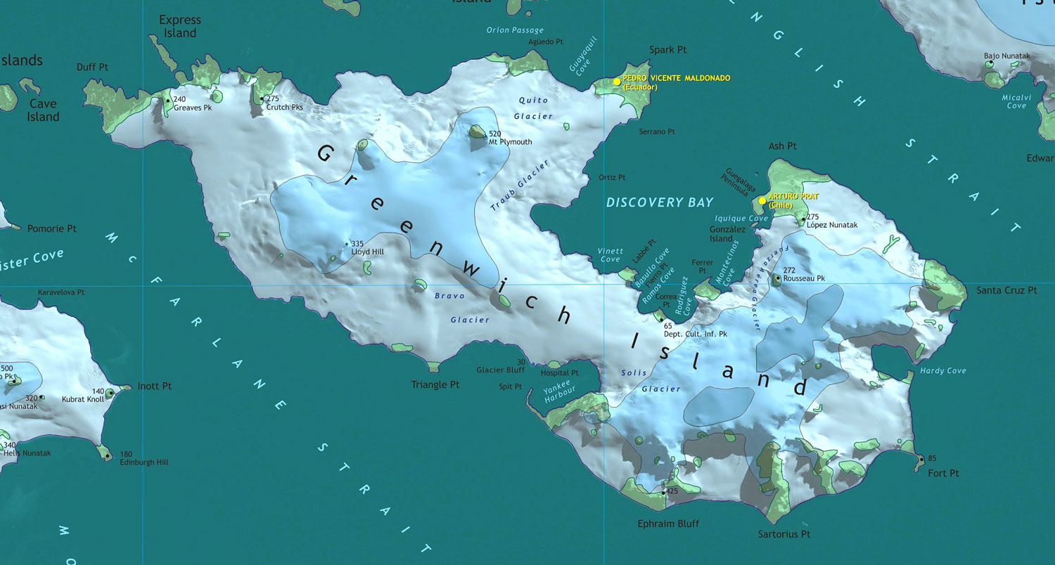
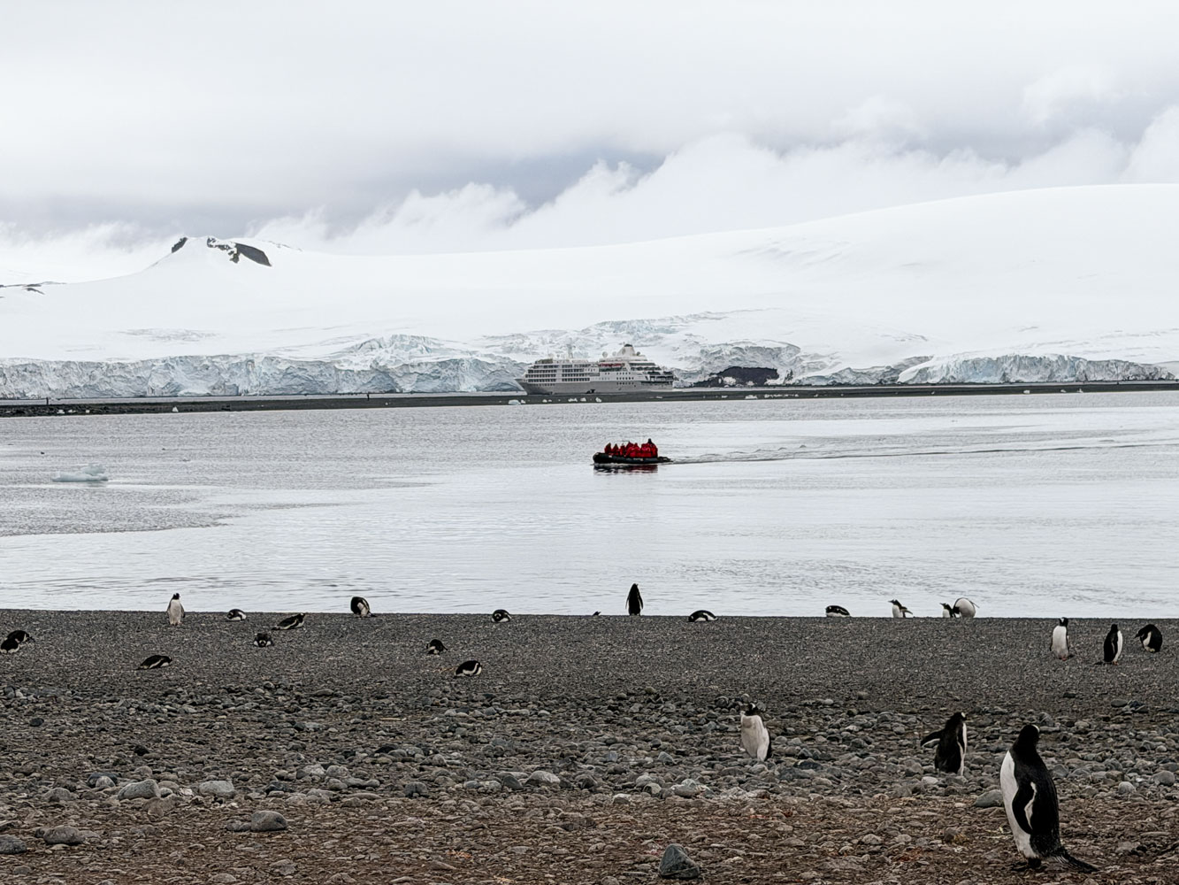
1/2/2026 (Friday) - We're at 62°31'14"S, 59°48'0"W at 7am this morning. We're just offshore from Yankee Harbor, of Greenwich Island, which in turn is part of the South Shetland Islands.
Here's a map of Greenwich Island, and part of the South Shetland Islands. Note Yankee Harbor toward the bottom of the map.
We're not far from Deception Island, which we visited in 2021/22.
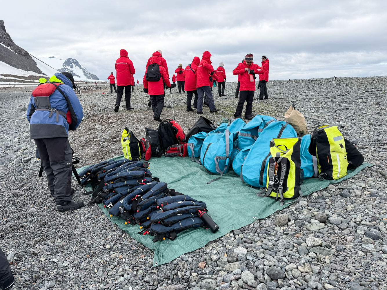
We went ashore via Zodiac about 8:30am. It was cold, about 0°C, but no wind blowing and the sea was calm.
As we were coming in for a landing, a small iceberg drifted by. Luckily, it just kept drifting and was out of the way for us to land. From one angle it looked like an ice animal.
We had mentioned taking off our life preservers and putting them on a tarp on shore, but had never shown a picture of how it works. Here's a picture of the arrangement.
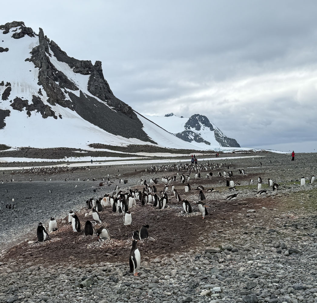
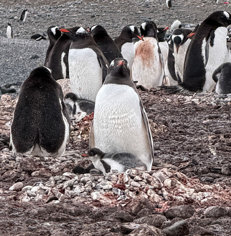
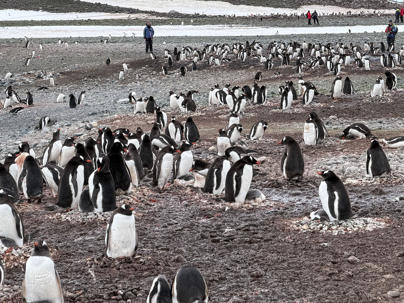
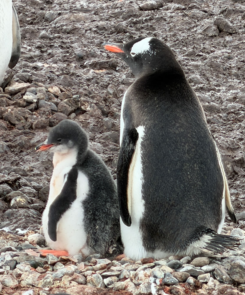
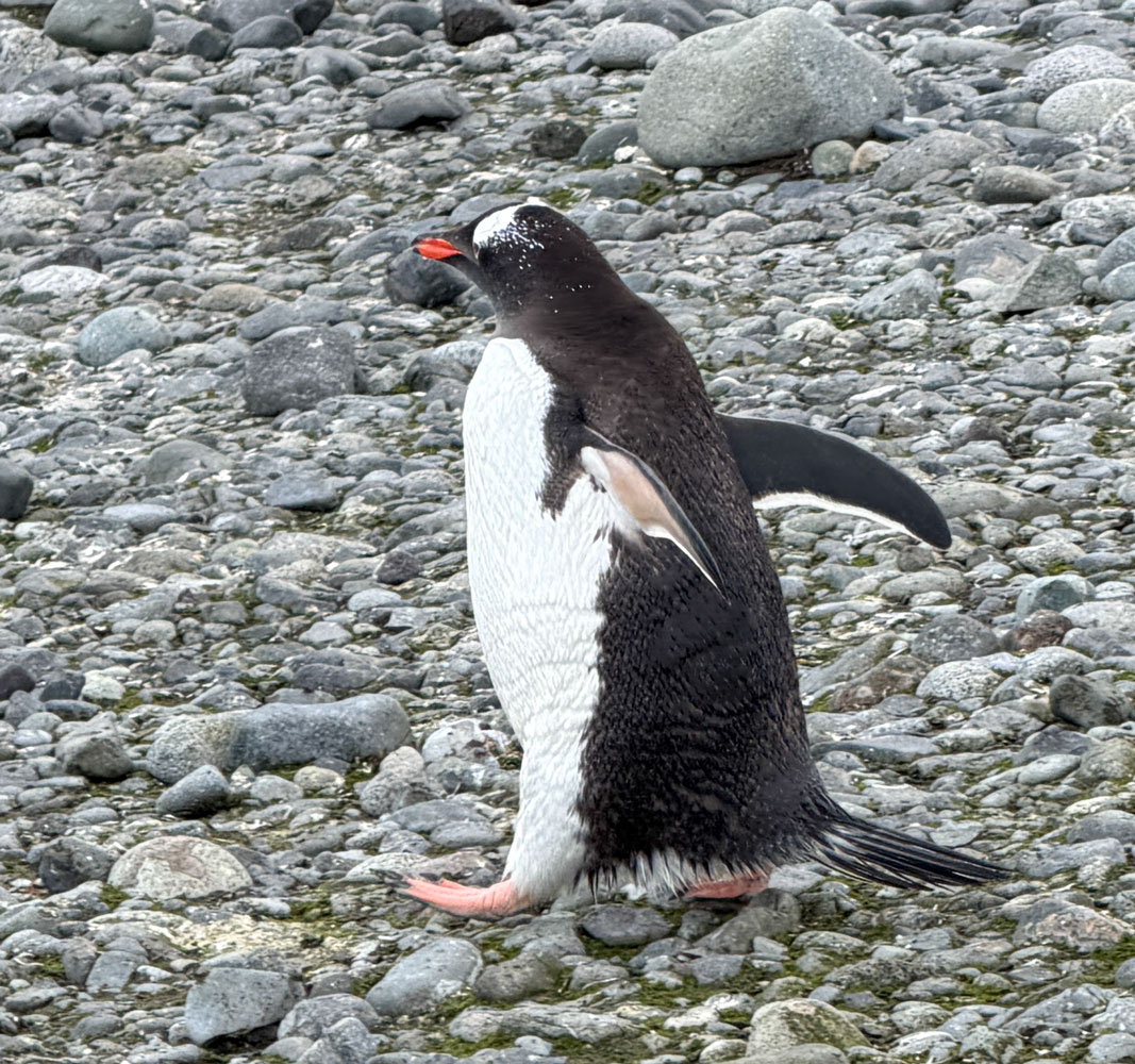
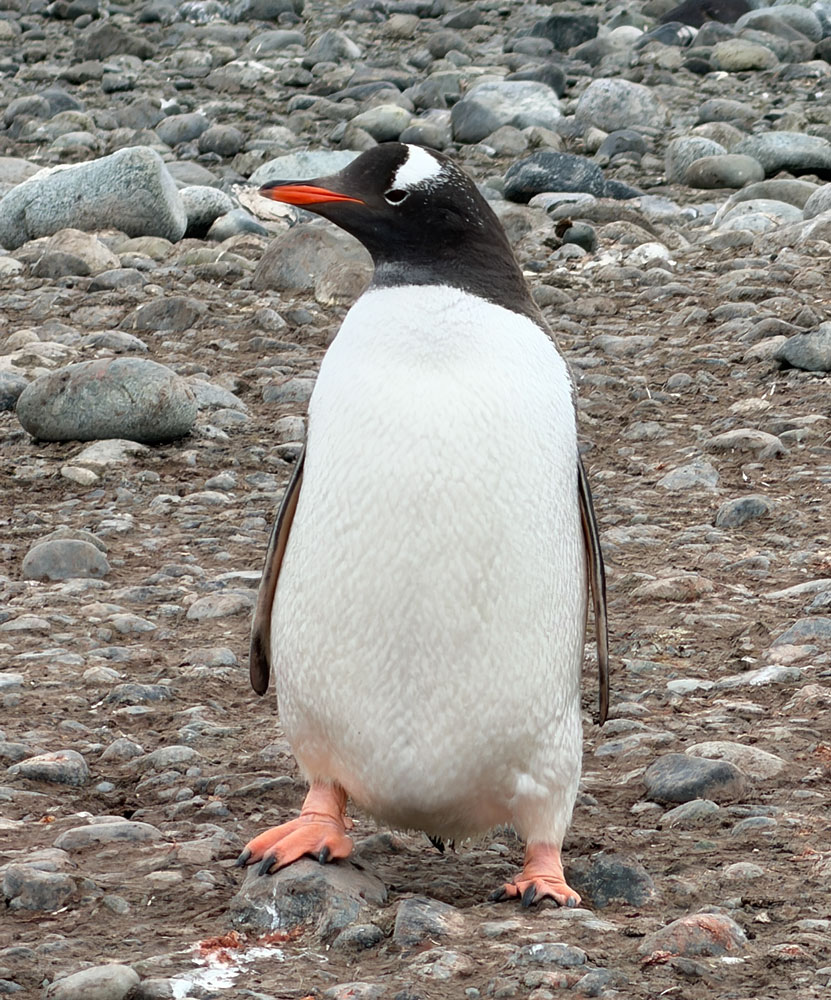
There are a lot of penguins here. While you can't see them well in this picture, they have rookeries all the way to that mountain. These are Gentoo Penguins.
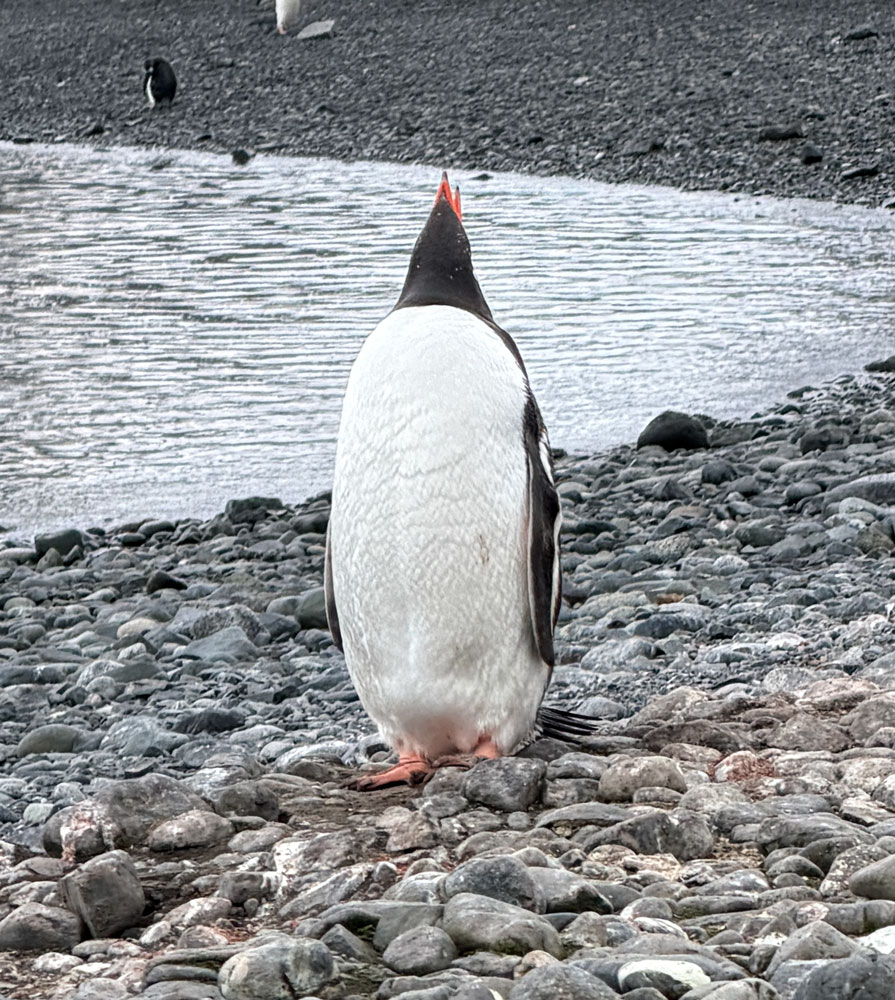
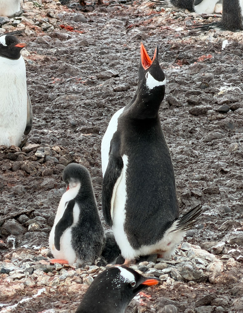
I tried to take some closer views of the penguins. This one is making a call. They throw their head back and call. The rookery is a very noisy place, also permeated with eau de penguin.
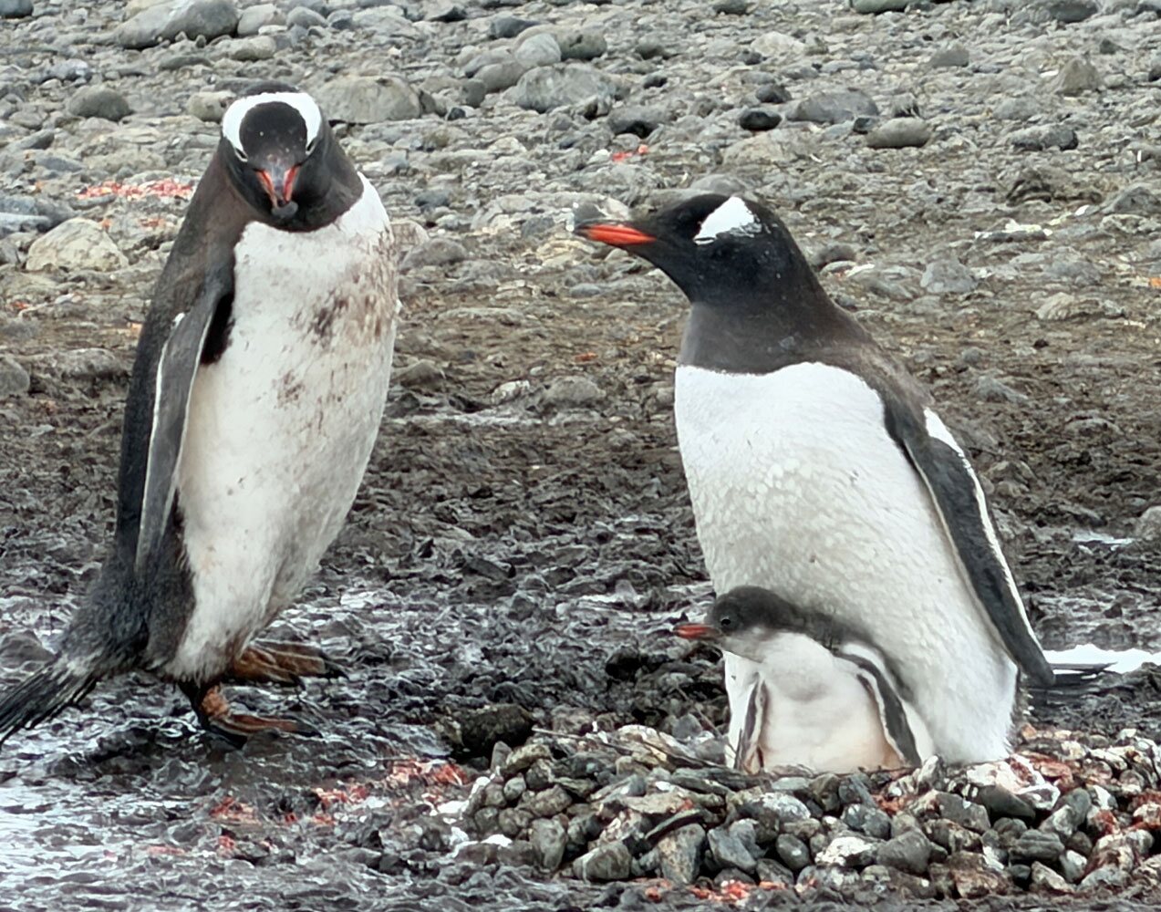
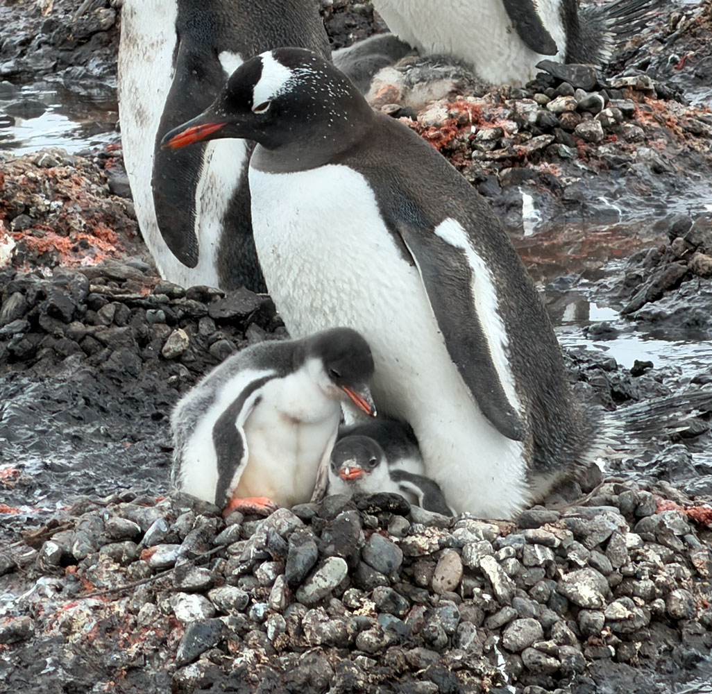
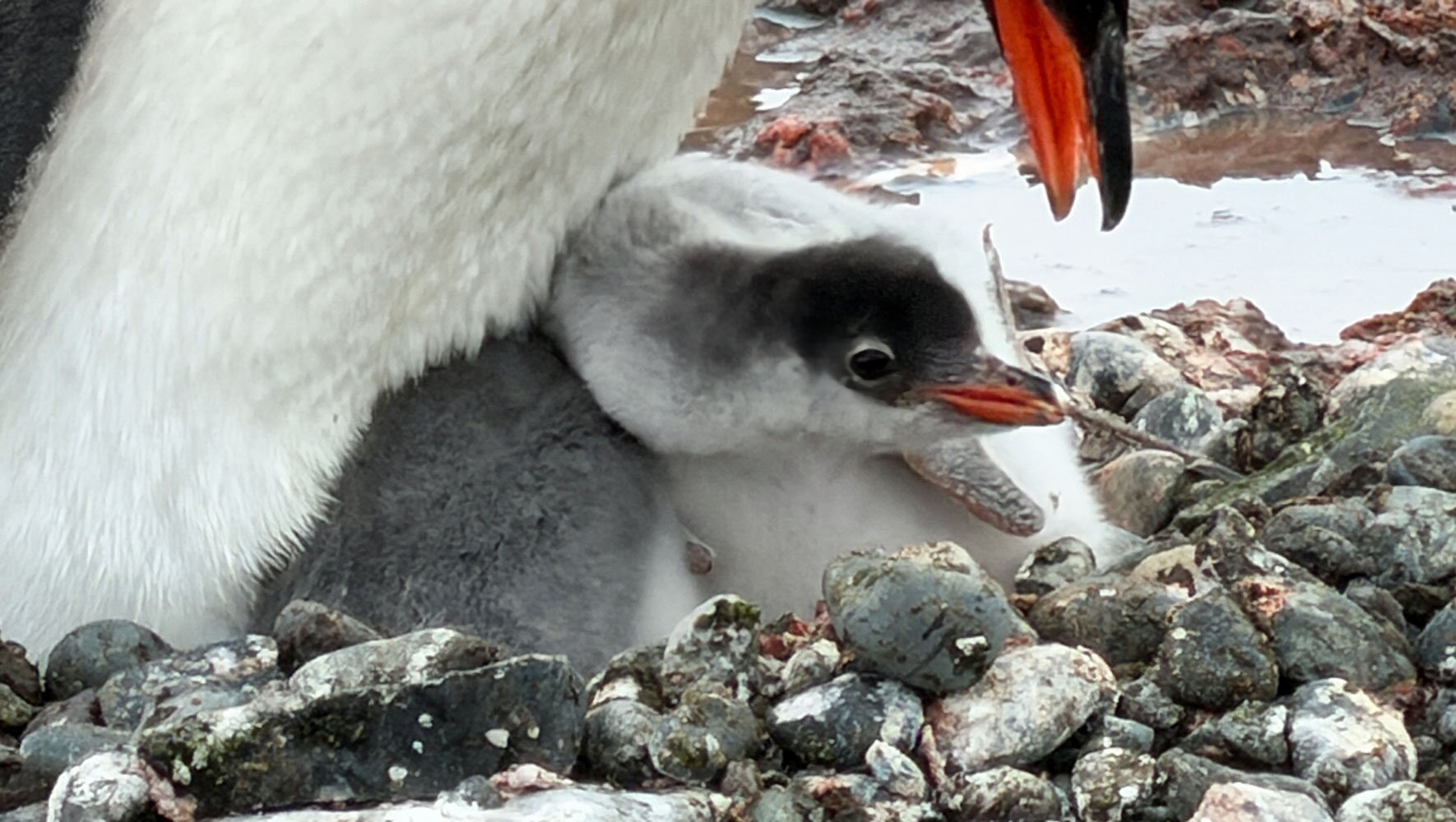
We arrived at a good time. The baby penguins had hatched and were growing. I'll have more pictures of adult penguins and babies. You can't tell if the adult is a male or female, but they both tend the nest.
A group of penguins.
An adult with two chicks.
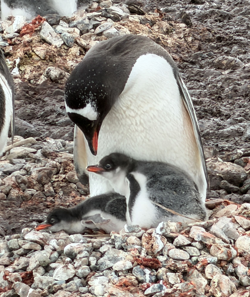
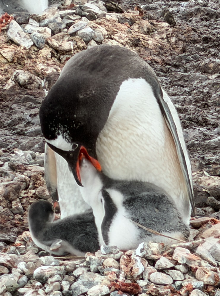
Feeding one of the chicks.
An adult with a large chick. Must have been an early hatch.
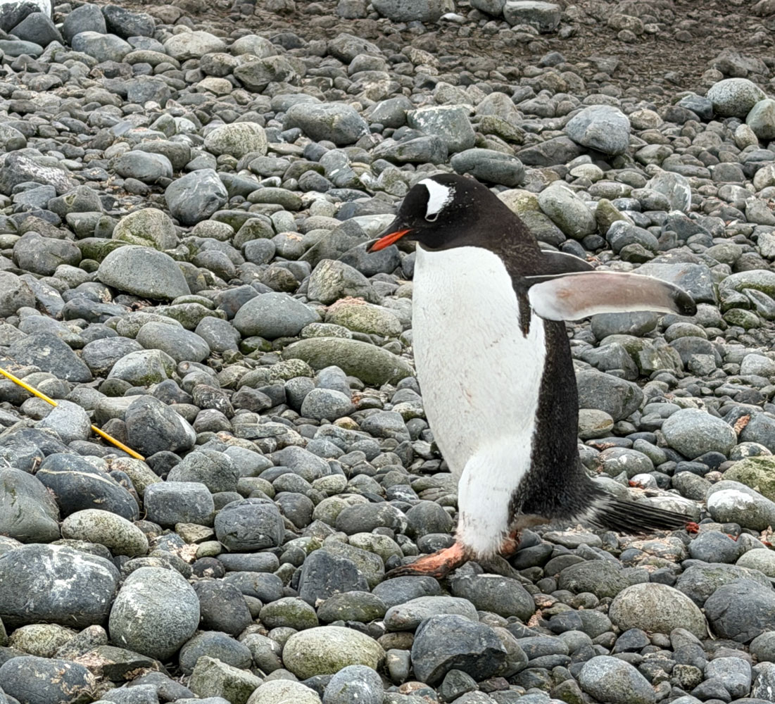
An adult calling. Note how the head is thrown back during the call, and its brush tail is raised.
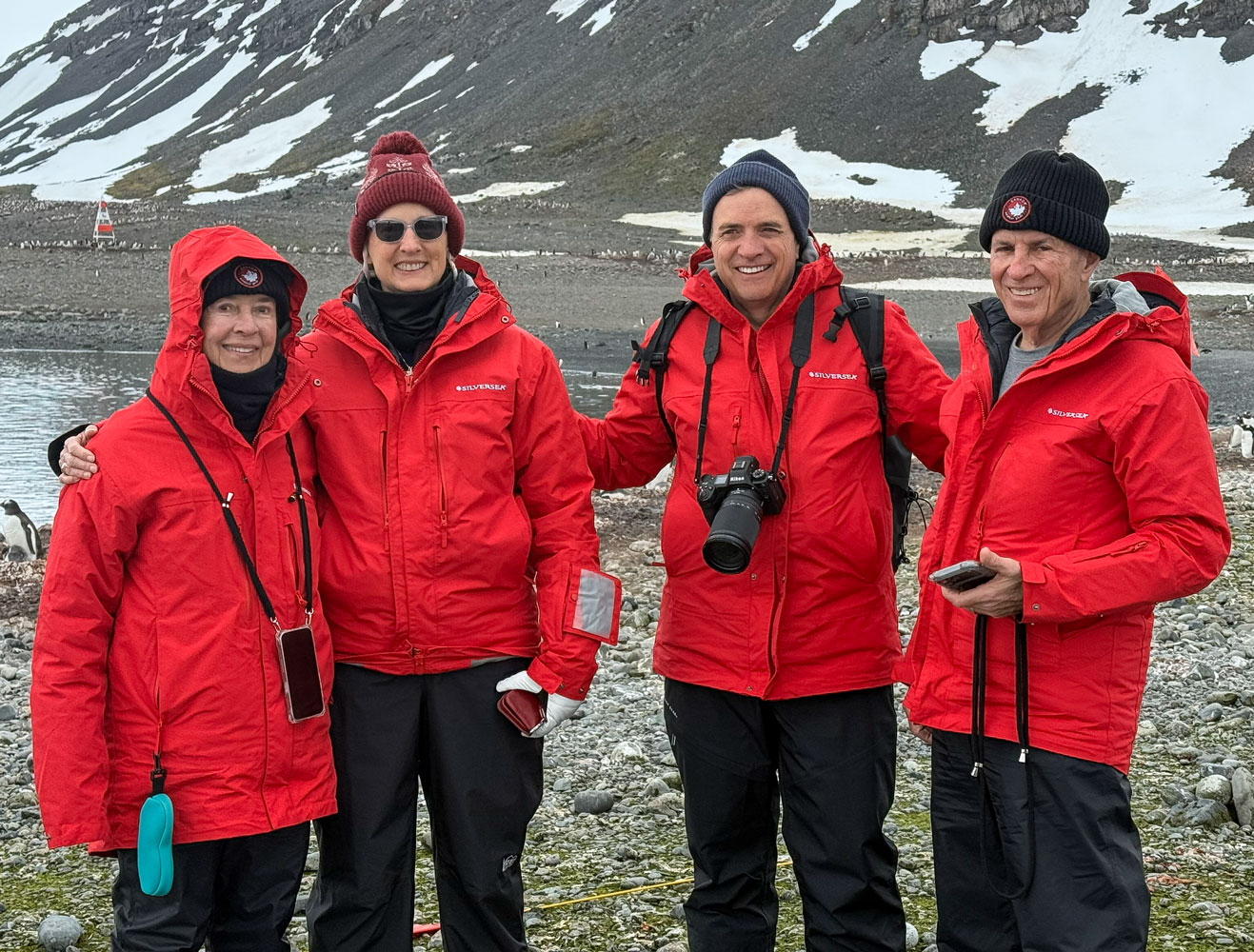
Then we ran into Judy and David talking with one of the Silversea photographers. I took a picture of them with Judy.
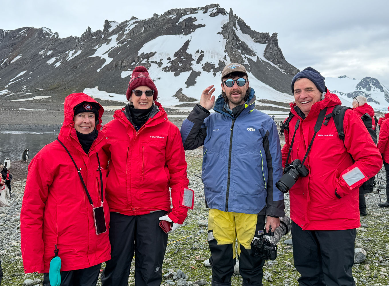
Then, the photographer took a picture of all four of us.
A Gentoo scurrying along.
Maybe a penguin family.
Another adult with two chicks.
A Zodiac coming in from the ship.
An adult penguin.
Crossing right in front of us. Penguins have the right-of-way.
Close-up of a chick.
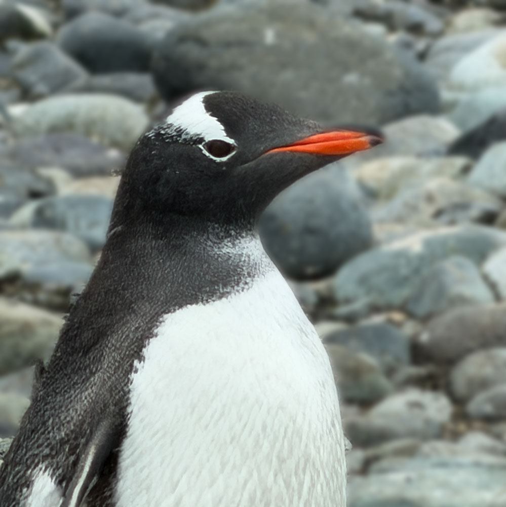
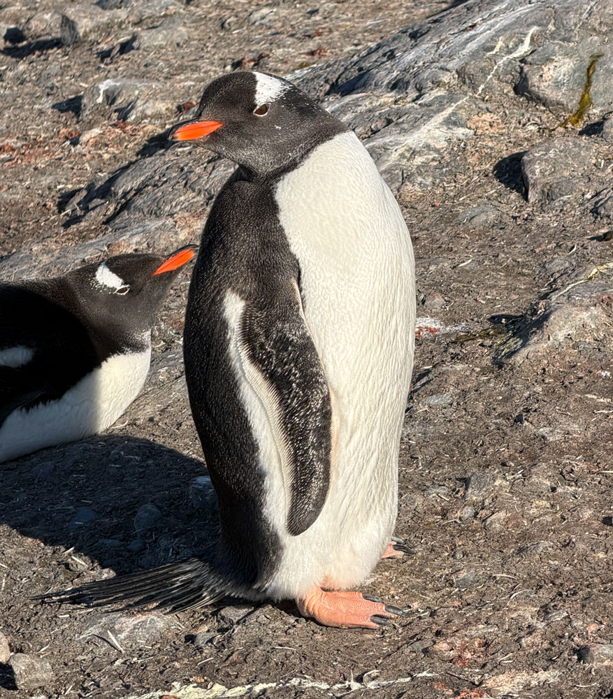
A close-up of a Gentoo penguin.
Then we decided to go back to the ship. On the way we passed humpback whales. We'd see their "blows" and they would break the surface.
One broke the surface quite near us.
That was the end of our morning excursion. We went back to the cabin, rested and eventually went to lunch.
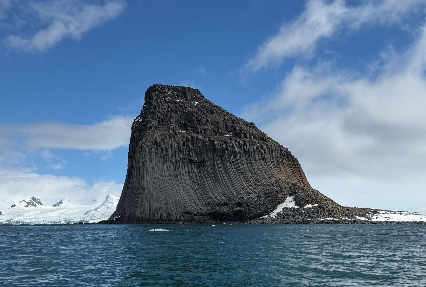
The ship moved to Edinburgh Hill, which is a short distance from where we were in the morning. At about 2:20pm we went down and boarded the Zodiac.
It was not the most interesting excursion. Our guide's heavy accent made things difficult, and I couldn't understand anything she said. I think Judy was able to understand some. Our main destination was Edinburgh Hill.
Here's a map showing where Edinburgh Hill is located. You can see it's very close to where we were in the morning at Greenwich Island.
There was an interesting iceberg in the area. It must have been quite large - or grounded - because 90% of an iceberg is below the water. Given how much is sticking up, it must have been huge below water. That's Edinburgh Hill in the background on the left.
A side view of that iceberg.
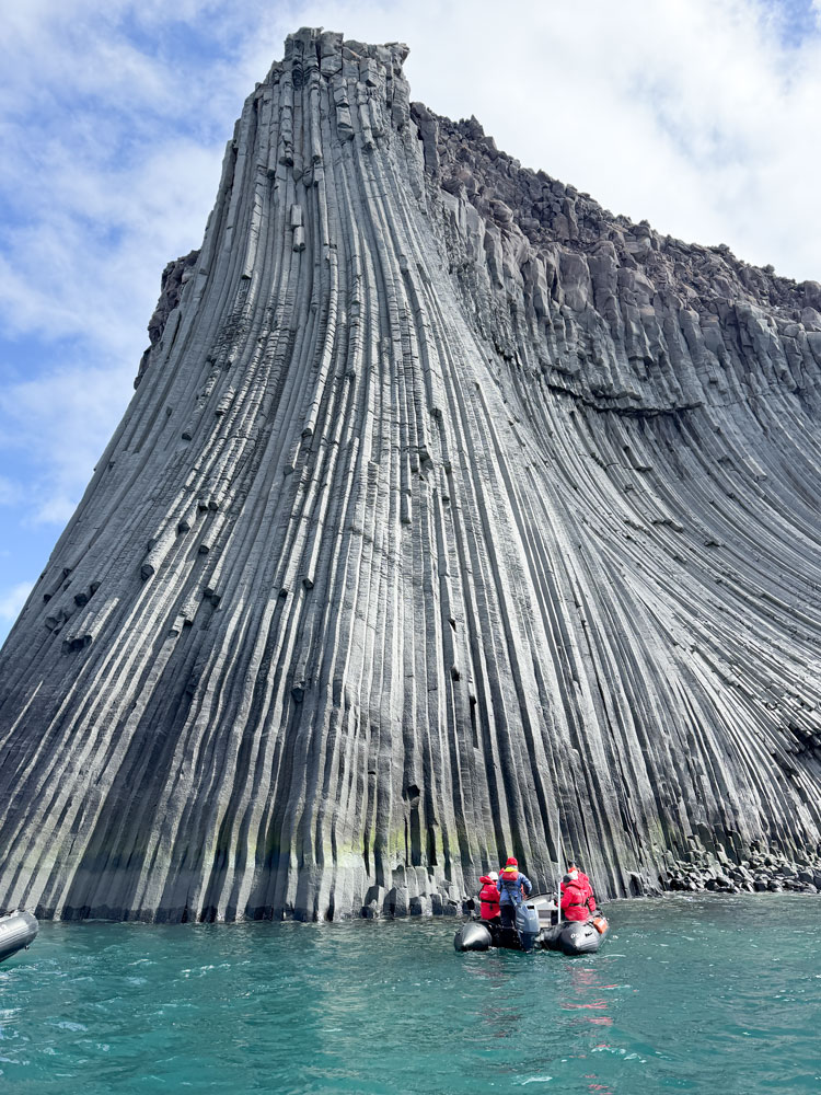
This is Edinburgh Hill. It's a columnar basalt hill, and was formed when lava cooled and set into hexagonal columns. There are many examples of this, the Giant's Causeway in Ireland and the Devil's Postpile near Mammoth Lakes in California being two.
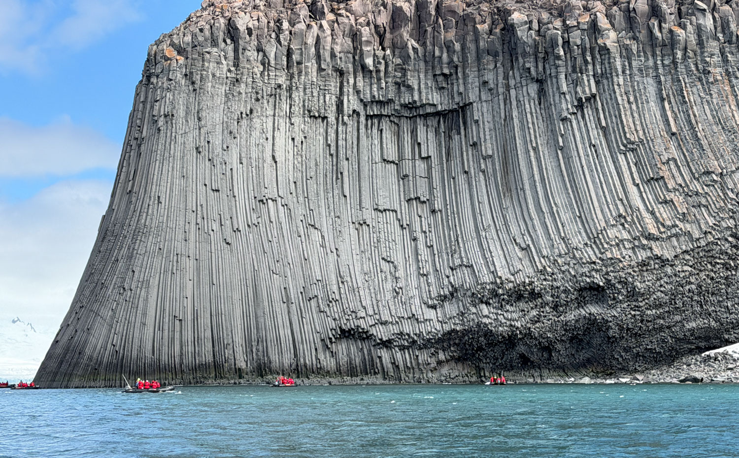
A closer view of the columnar structure.
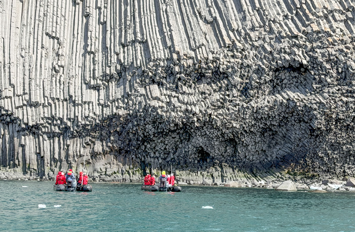
And the ends of some of the eroded columns.
From this angle, it reminded me of the Hallgrímskirkja Church in Reykjavik.
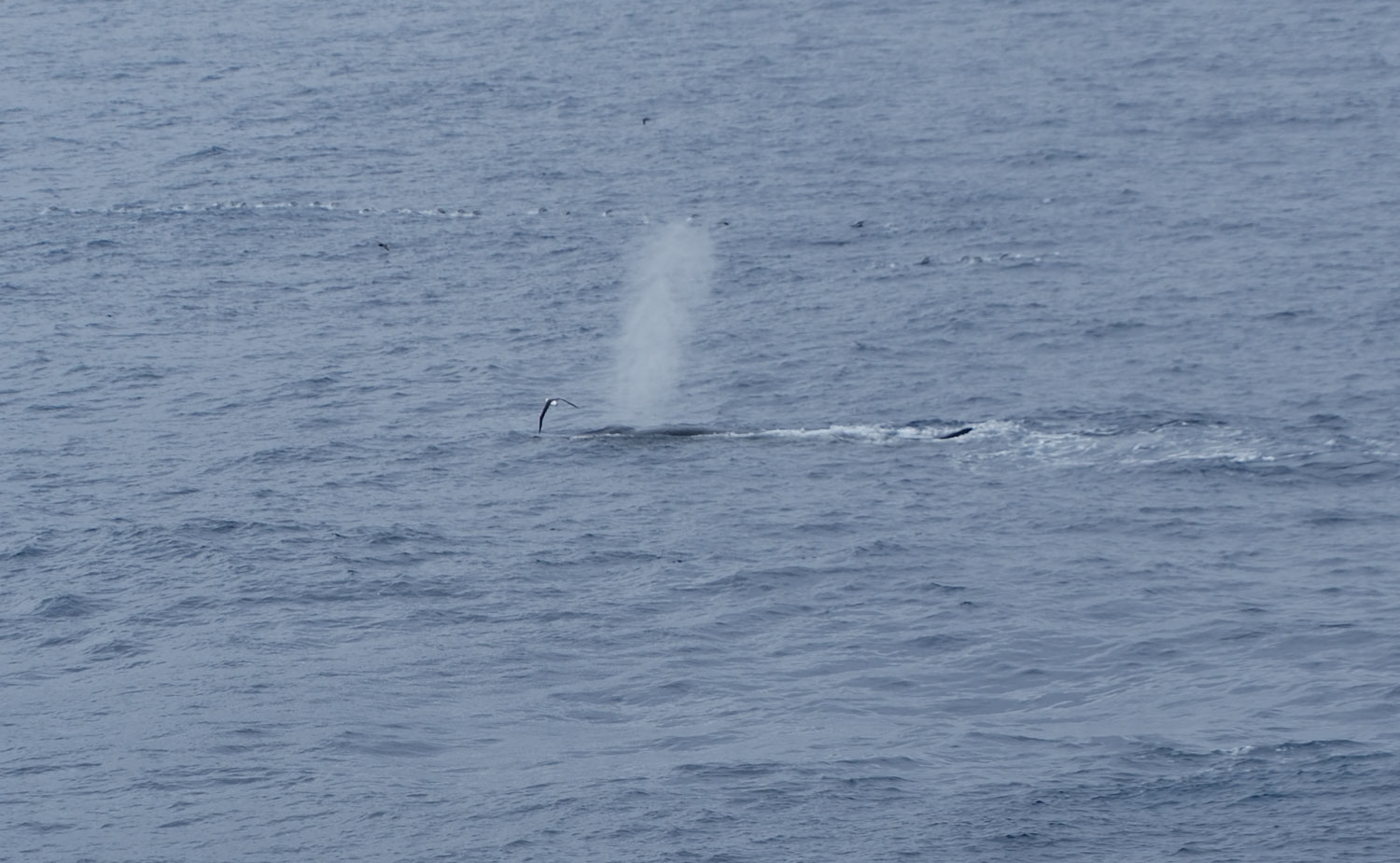
The guide received a message that there was a whale feeding in the area, so we went looking for it. It did blow and break the surface fairly close to us. Here's a picture just after we detected the blow - you can still see the cloud of moisture from the blow in the air.
This next picture was taken a few seconds later. The whale is headed back down.
That was about it. We headed back to the ship.
Later in the afternoon, we participated in Trivia (and won!), then the briefing of the next day's activities. Then we had dinner with an interesting couple.
Now, it's to bed for an early wake-up for tomorrow. We depart the ship at 6:30am.
+++++++++++++++++++++++++++++++++++++++++
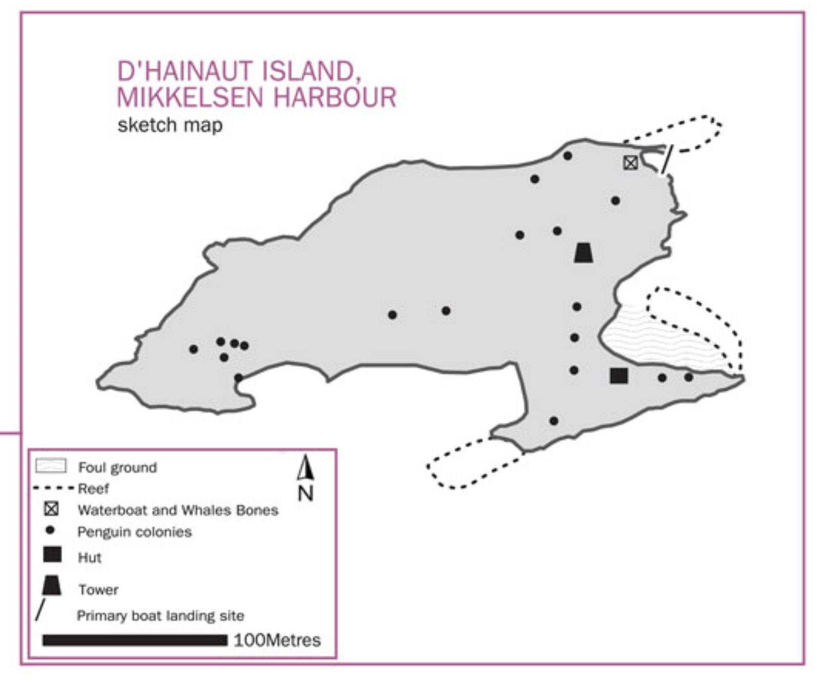
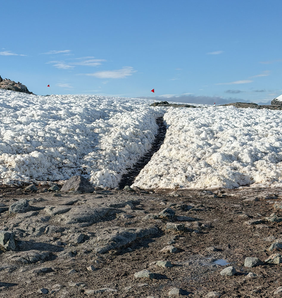
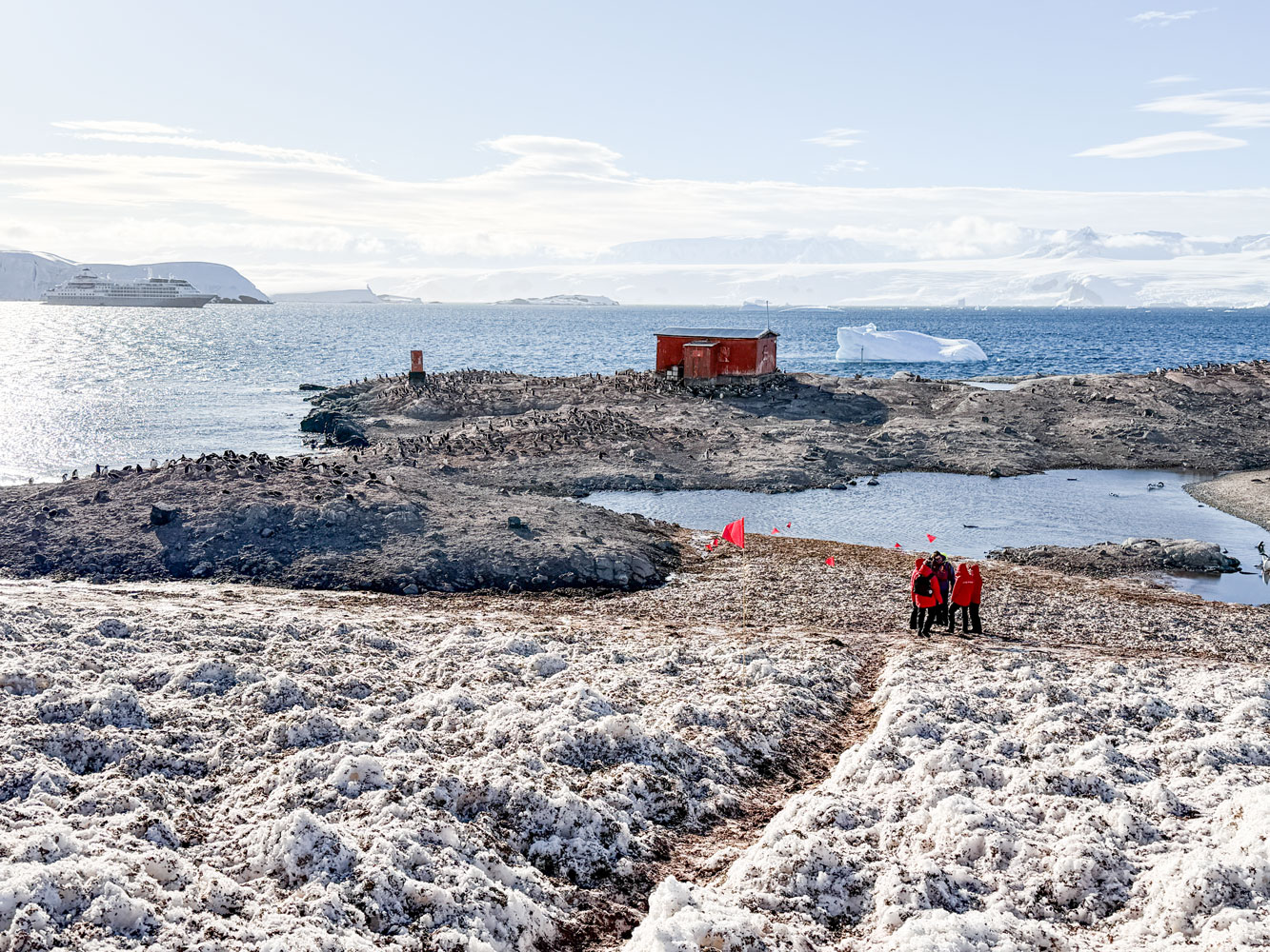
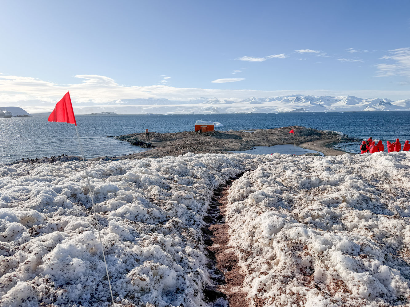
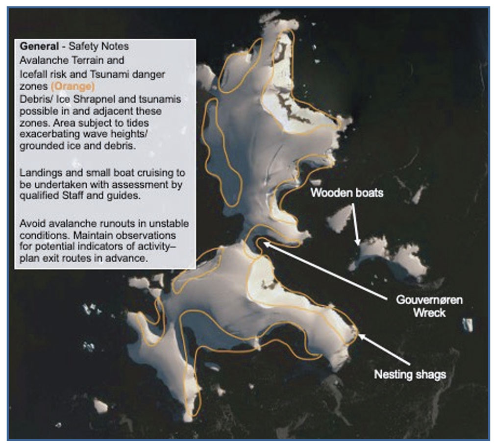
1/3/2026 (Saturday) - We're at 63°54'25"S, 60°46'5"W this morning at 5:30am. We're at D'Hainaut Island in Mikkelsen Harbour of Trinity Island. Here's a map of D'Hainaut Island. We're going to land at the top right side of the island and walk over the island to the "Hut".
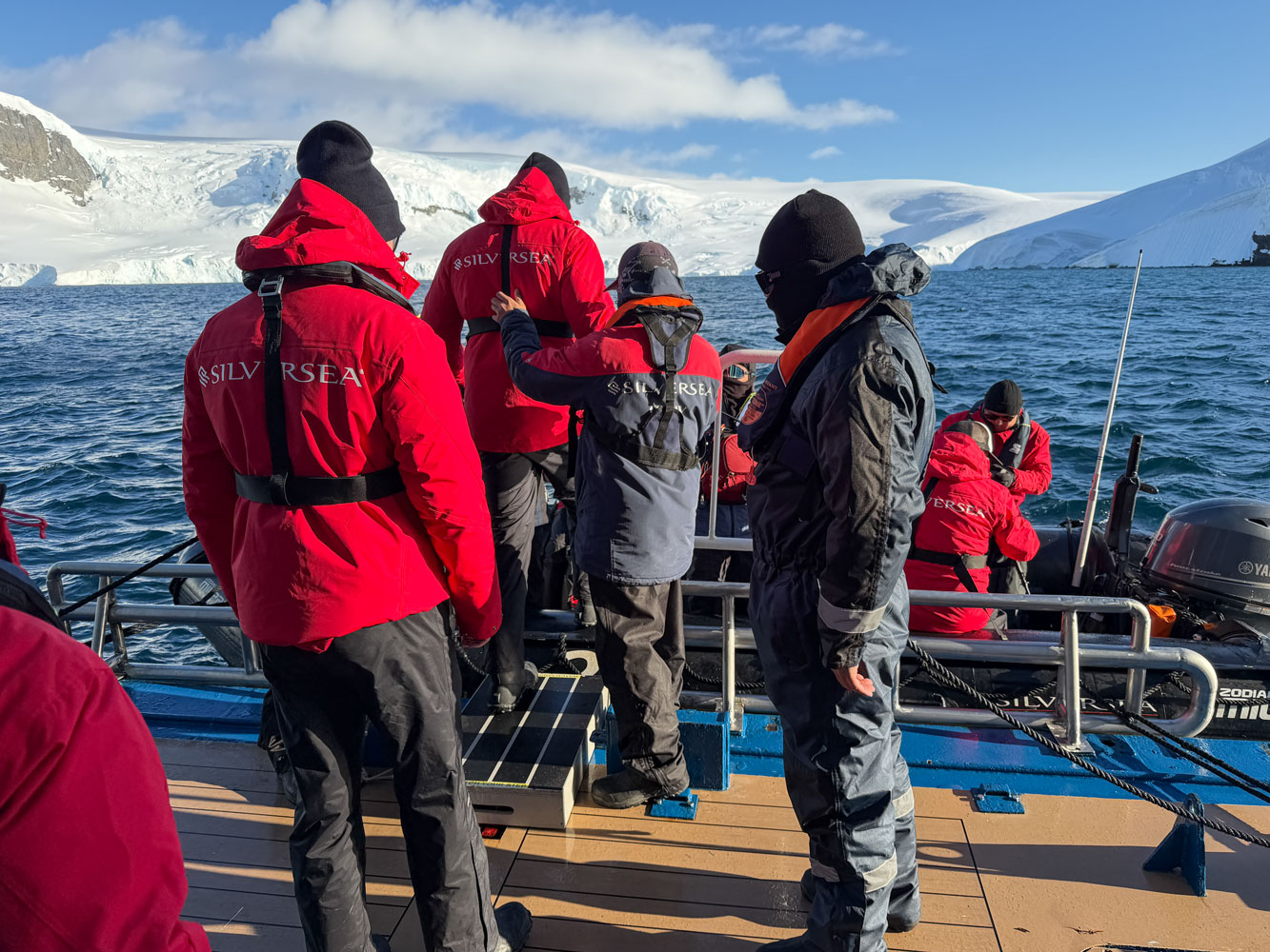
We boarded the Zodiac about 6:30am. It was a sunny day, cool but not cold, with a slight wind. The sea was fairly calm.
From the Zodiac we could see the island and the landing area (to the far right). A group of guests is beginning to climb up the hill.
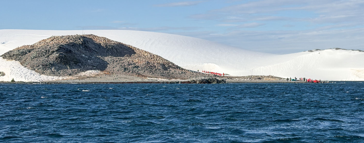
Here, we're approaching the landing area. You can see some of the crew members in the water waiting for our Zodiac to land, and that group of guests heading up the hill.
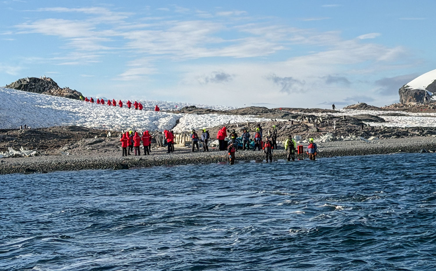
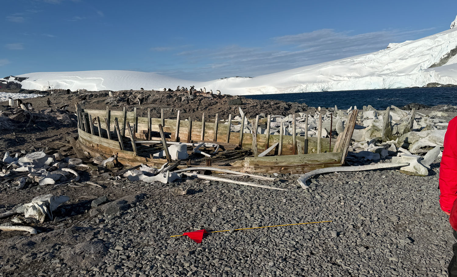
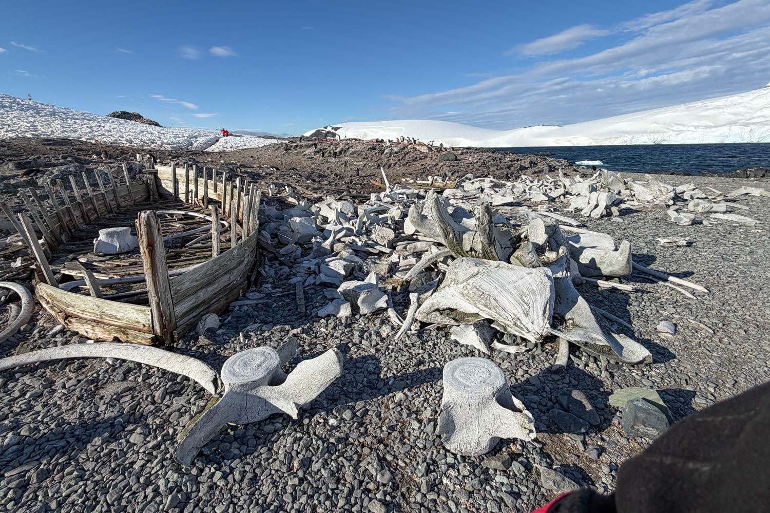
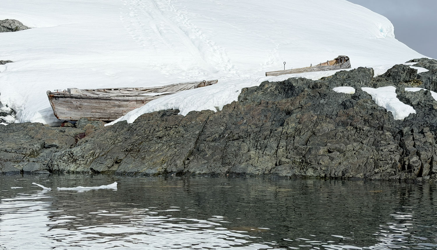
We landed on the beach where a "water boat" was left by whalers long ago. Fresh water was required for processing the whale blubber, and for the workers. The "water boat" would gather snow and ice and bring it back to the processing facility. When the whalers left, they often did not take the water boat because they did not have room on their ship, which was loaded with whale oil. The whale oil was a lot more valuable than the water boat.
Behind the boat, you can see whale bones.
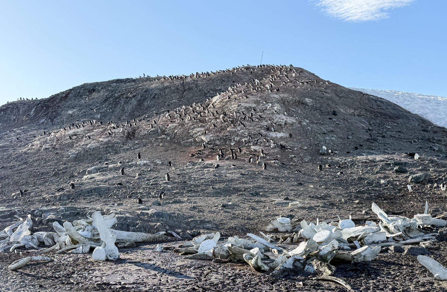
There was a hill nearby with a lot of Gentoo penguins.
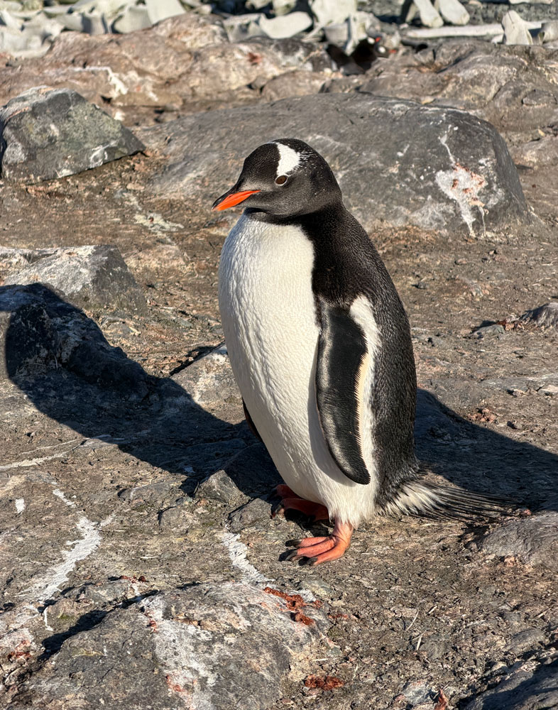
This Gentoo came out to welcome us to his island.
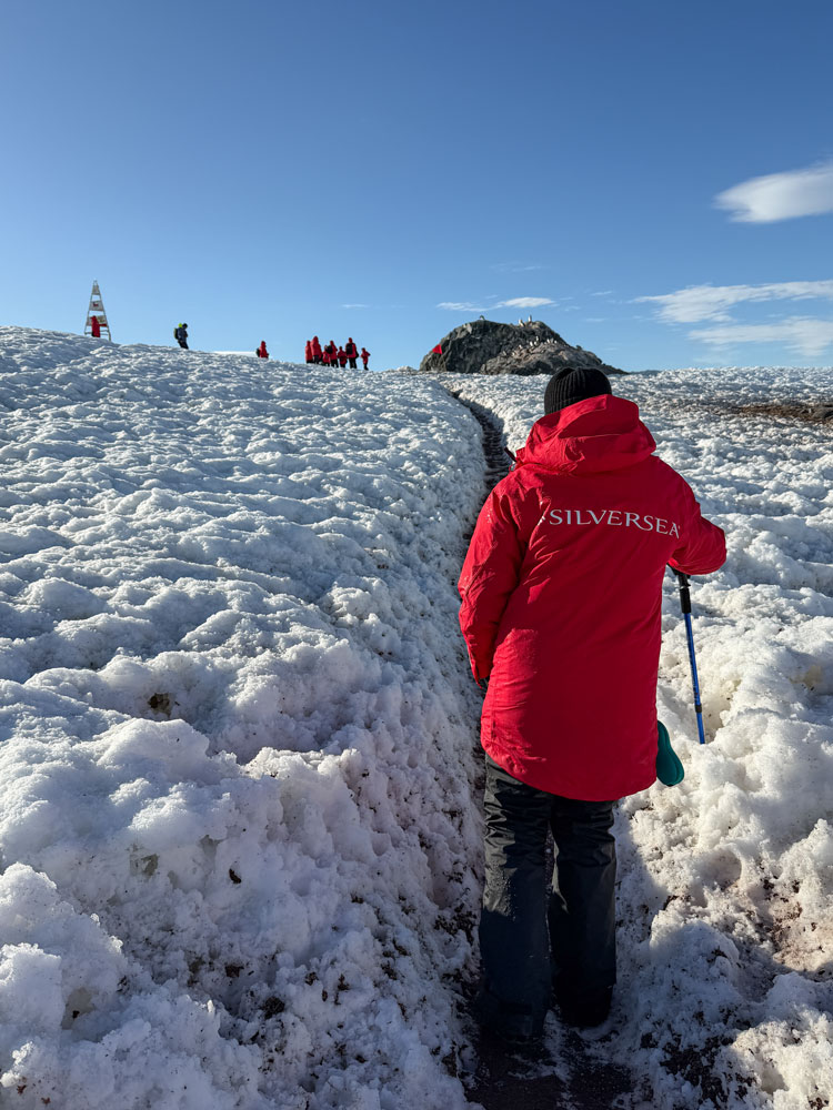
The plan was to walk over the island, as shown on the map, to the Argentine refuge hut, but it turned out to be a difficult walk. The path was icy and slippery, and sometimes muddy.
But we tackled it, anyway. Here's Judy heading up the hill.
From the top of the hill we could see the Argentine refuge hut and the penguin rookery.
A wider shot of that area. We could have gone down to that area, but decided not to. It's harder going downhill on slippery ground than going uphill.
We could see penguins on the hillside.
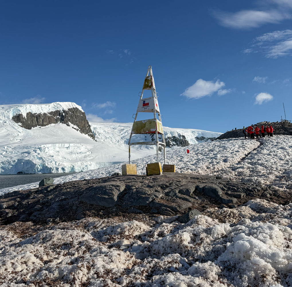
There was a structure on the hilltop. I don't know what it's used for, but Google says it might be a survey marker.
With that, we carefully headed back down the trail. This Gentoo penguin was at the shore.
A better look at the whale bones left by the whalers, and the water boat skeleton.
A couple of Gentoo penguins playing in the surf.
With that, we boarded the Zodiac and went back to the ship. We were resting in our cabin when the cabin attendant came by to clean the cabin, so we went up to Observation Lounge to get out of his way.
When we came back to the cabin, this is what we found.
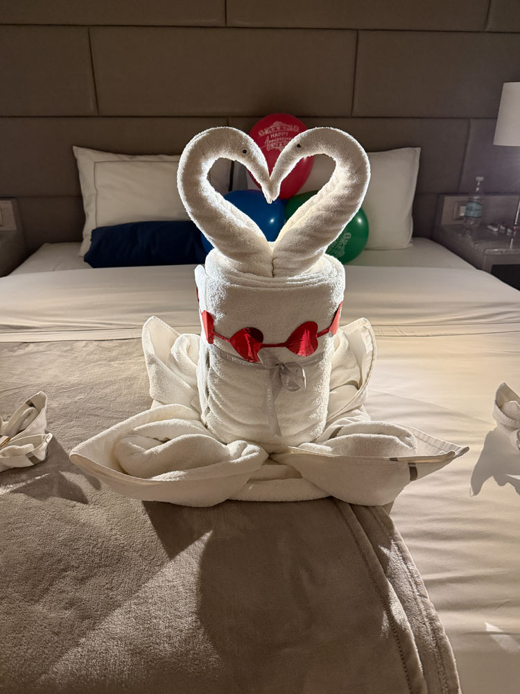
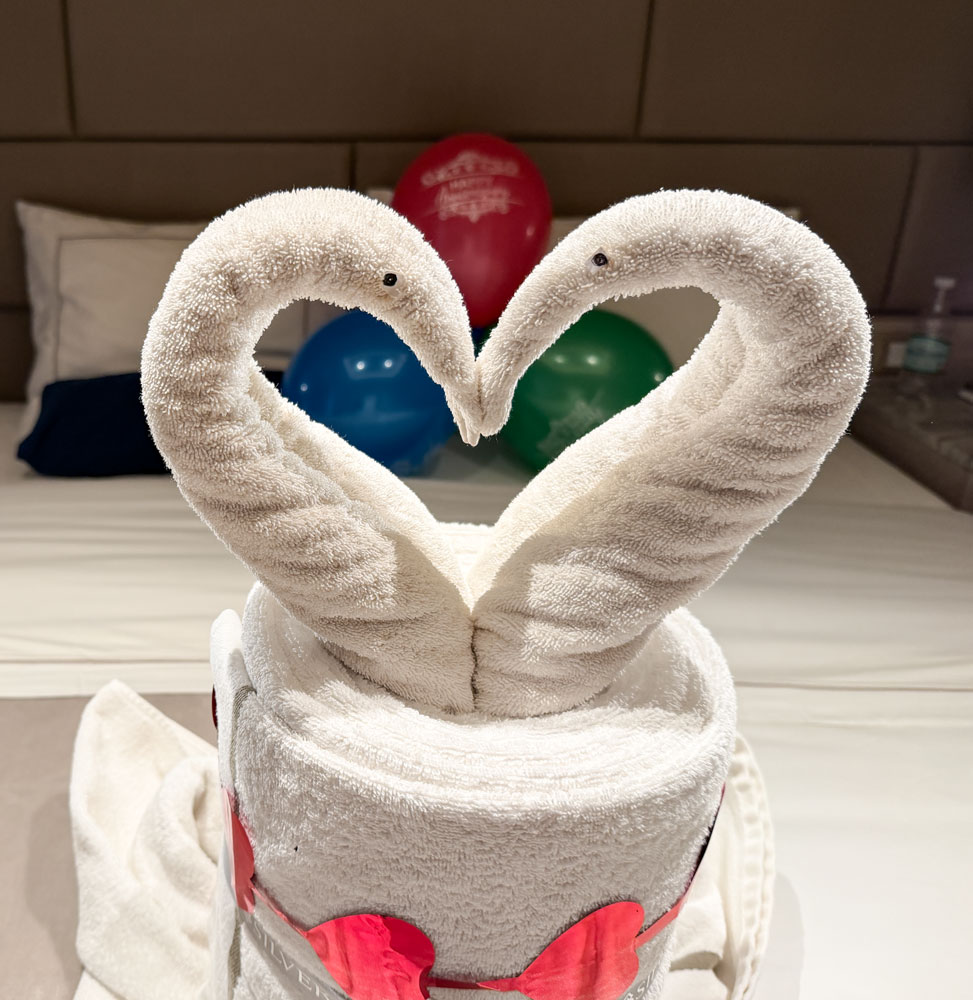
Here's a closer view of the towel sculpture.
On our previous Silversea cruise to Antarctica we fibbed about our anniversary (it was just a couple of days after the cruise ended , so we reported it as a few days earlier). On this cruise I didn't do the same, but they must have kept our anniversary "date" in their records, and did this for our anniversary. Today is the 3rd, but the real date is the 11th. This was very nice of them.
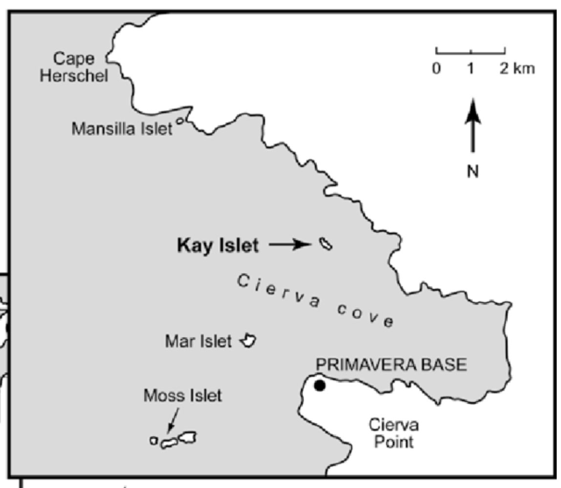
Shortly before lunch, we played Trivia again, then had lunch. At 2:30pm we went down to board a Zodiac for an excursion in Cierva Cove. Here's a map of the cove. The ship must have anchored toward the top of the map because the Argentine research base "Primavera Base" was across the cove from us.
The weather for this excursion was wonderful - warm, sunny, and the sea was almost flat. It turned out to be a really nice excursion.
Here we are boarding the Zodiac. Everyone is all suited up, but it was a fairly warm day, probably 40°.
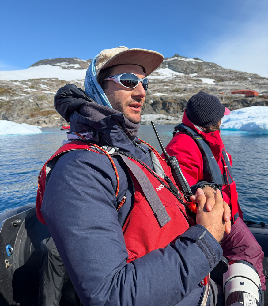
The Zodiac driver/guide was very good. He knew a lot about the area and the animals and gave a good commentary.
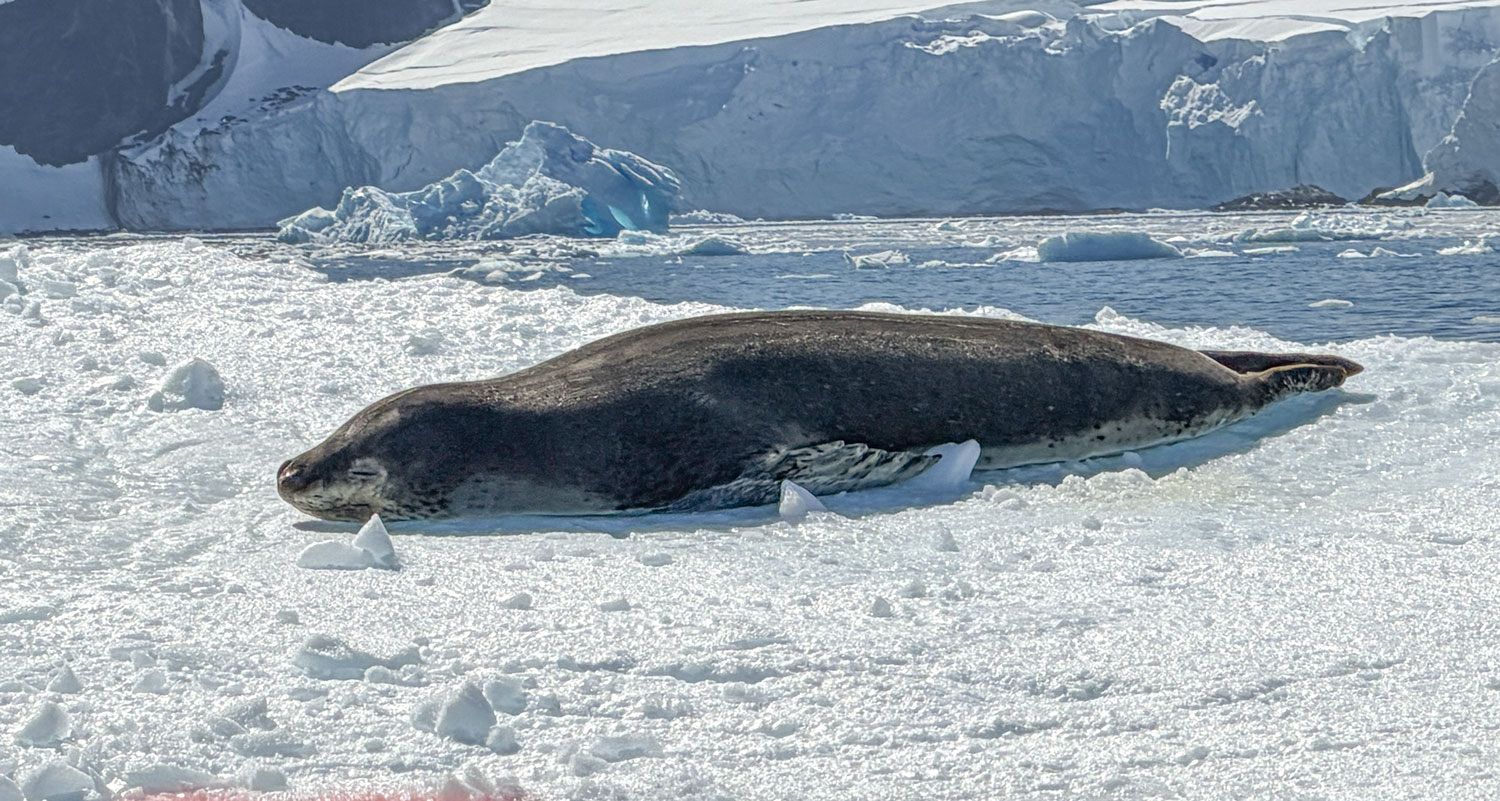
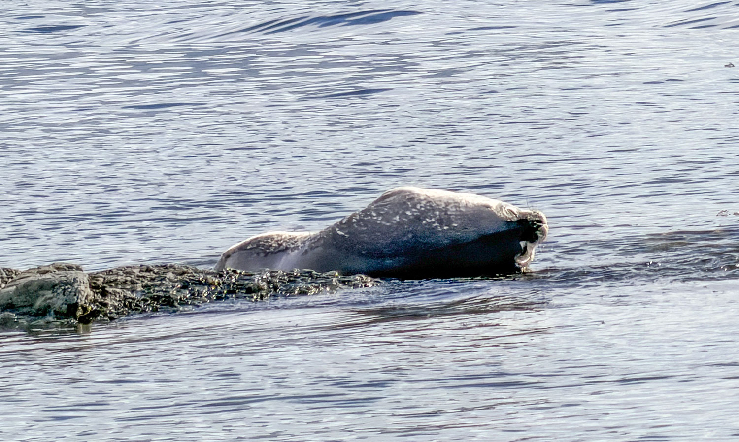
He spotted a seal on a iceberg and headed to it. He identified it as a Leopard Seal. We got closer and I took this picture.
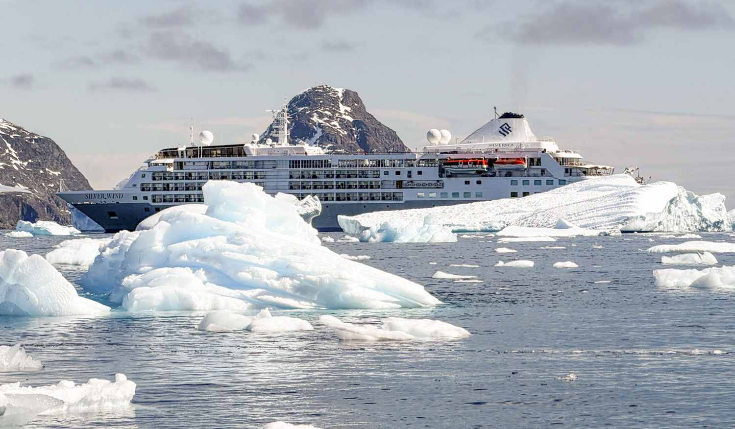
Looking back, I saw the Silver Wind in the ice.
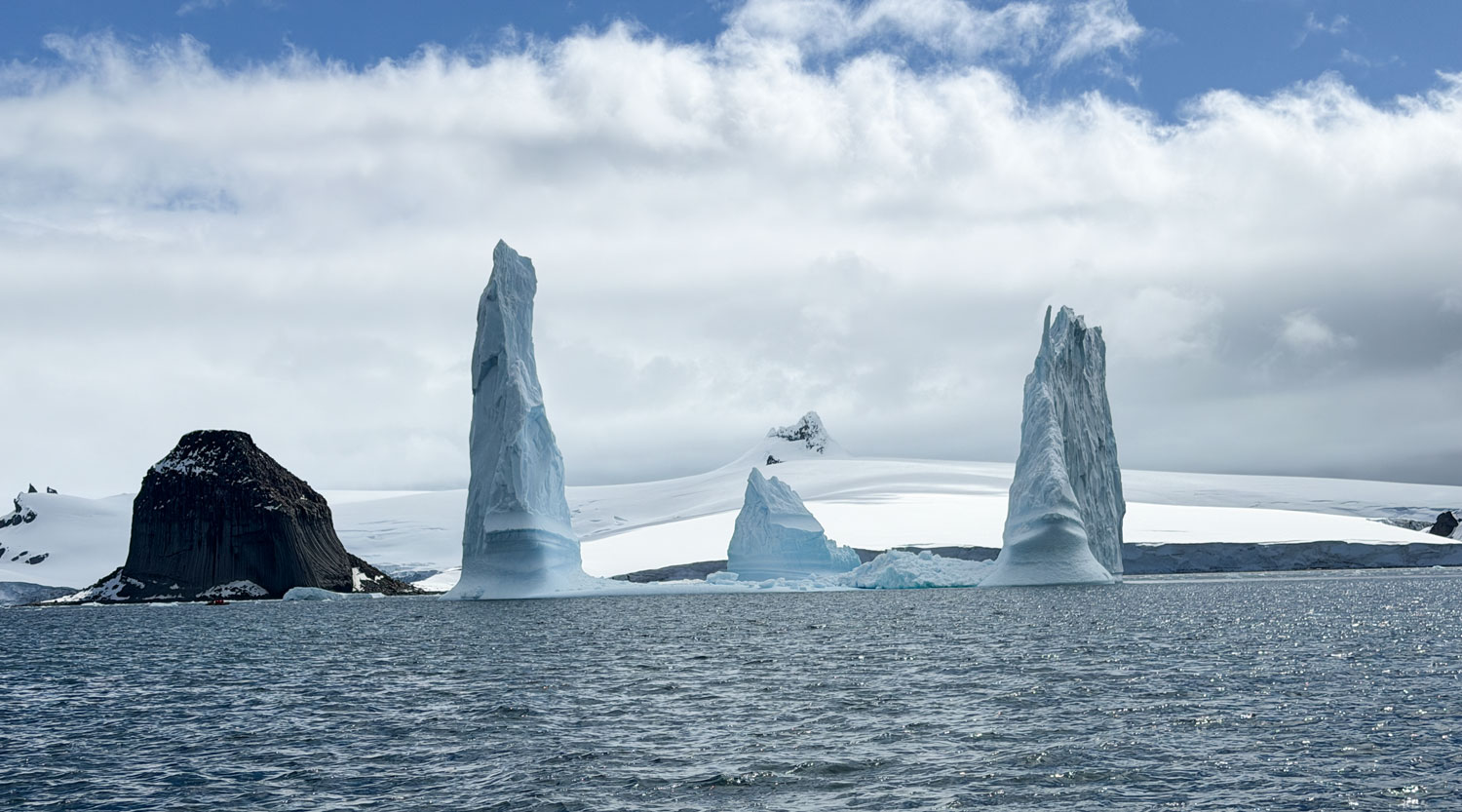
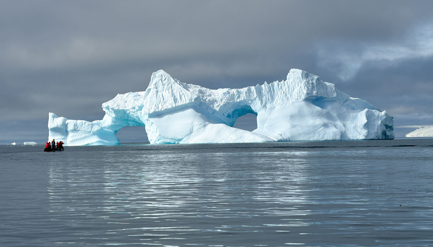
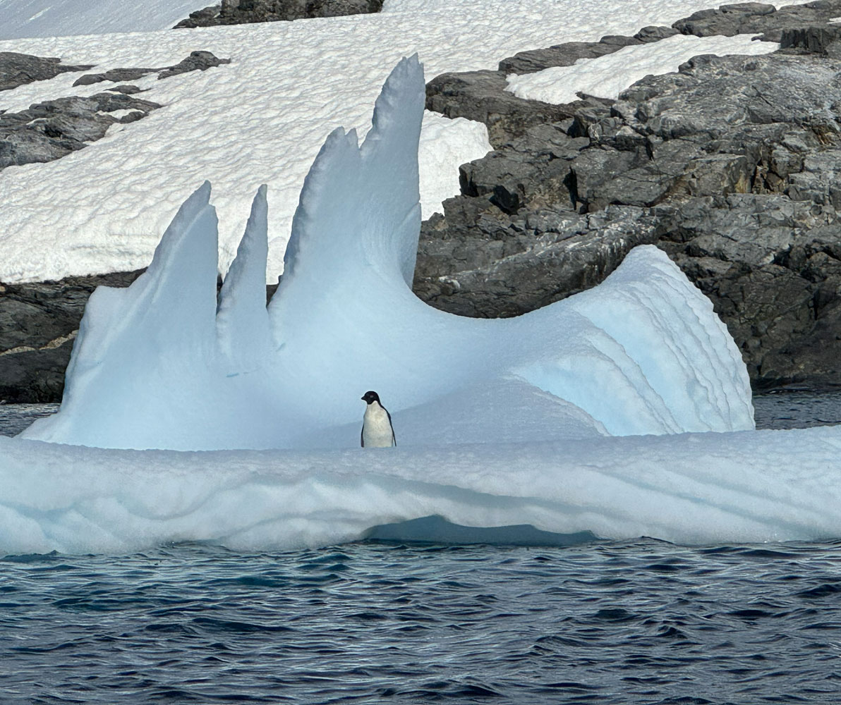
Then we encountered some large icebergs. It's hard to see how big these are because there's nothing to reference them to in the pictures - but they were big.
Next, we went to a place were penguins were jumping out of the water and climbing the hill to their nest sites.
A closer view of the penguins.
Then we moved to another place where penguins were climbing the hillside to their nests. That white band in the middle of the picture is snow, and the penguins have to cross it. They create "penguin highways" through the snow and follow them. They're easier to navigate than each penguin making its own path over the snow.
Here's a closer look at the penguin highways.
And a really close look of the penguins going up and down.
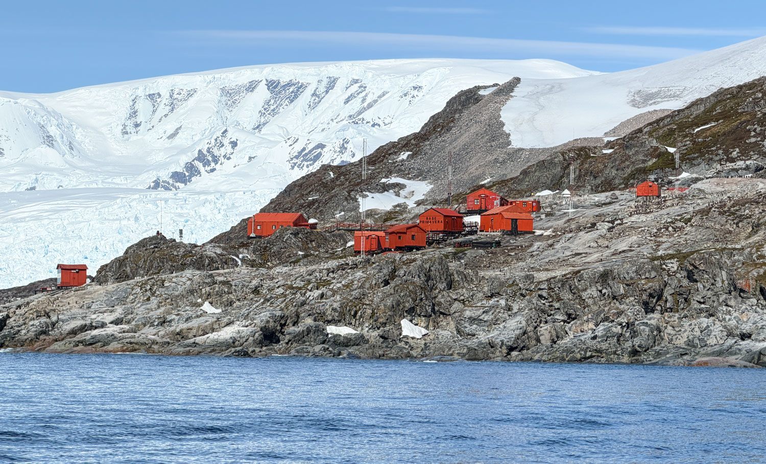
From here, we went to the area of the Argentine base, "Base Primavera". It is a summer base, only. It shuts down in the winter.
We then went to a place where penguins were entering and jumping out of the water.
Here's a closer view of the penguins. I tried to get a picture of one jumping out of the water but wasn't very successful.
A couple of penguins breaking the surface of the water. They love to "porpoise" as they swim and play. On snowy hillsides they also love to "toboggan", sliding down on their bellies.
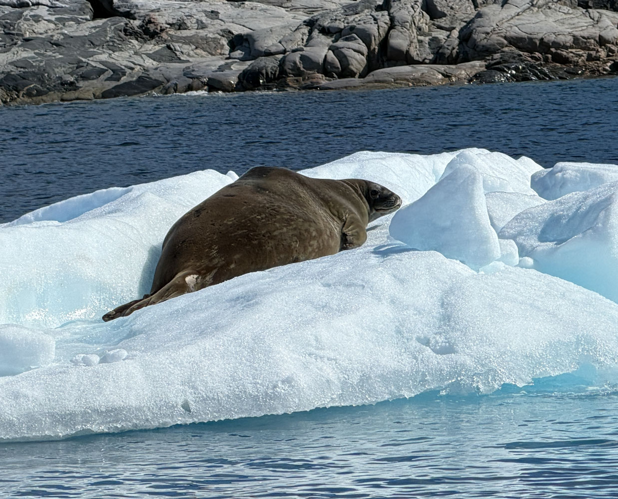
We began our trip back to the ship, and found this Weddell Seal on an iceberg. Best I could do for the picture is a shot of it's rear end:-)
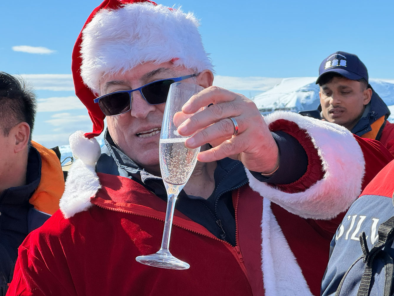
On the way back to the boat, we encountered another Zodiac. What's the commotion? Is that Santa on that Zodiac?
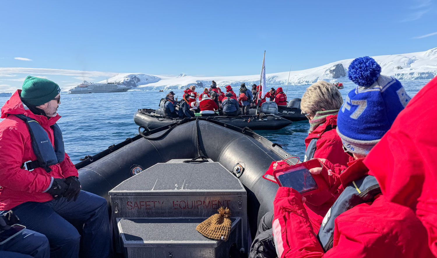
Yes, it is. And he's serving Champagne and hot chocolate.
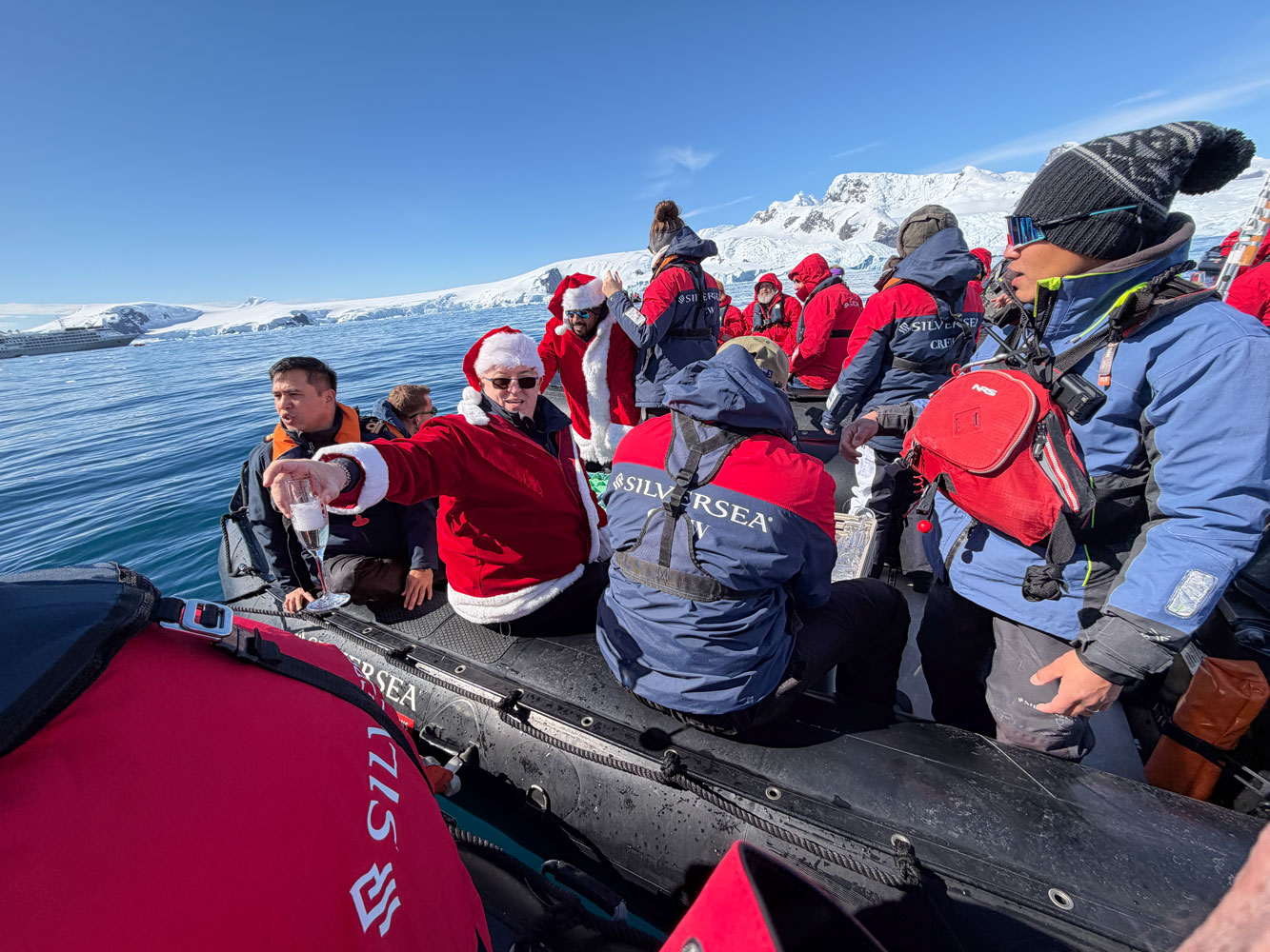
It's the Hotel Director, Fabio Marcotti.
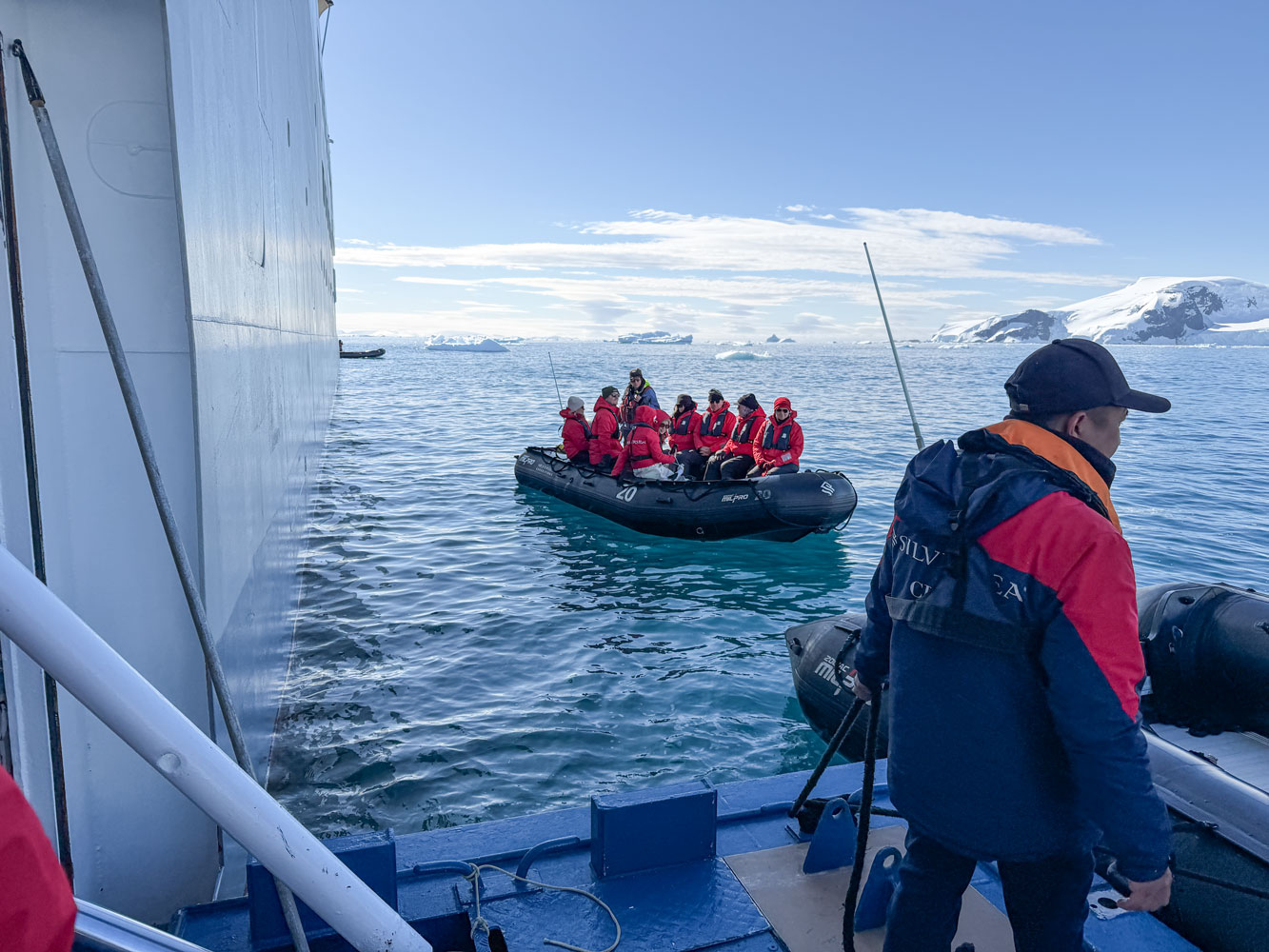
Then we went back to the ship.
We played Trivia that afternoon, then went to dinner and then to bed.
+++++++++++++++++++++++++++++++++++++++++
1/4/2026 (Sunday) - We're at 64°29'25"S, 61°45'21"W this morning at 6:30am. The sky is overcast and there's a light snowfall.
We're at Portal Point, and will do a "continental landing" - a landing on the actual continent, rather than on an island off the shore. However, Judy and I did a continental landing last time we were in Antarctica and decided to skip the landing this morning. The description given by Claudia, the expedition leader, was that the path was steep and slippery, and we're at an age where that's not good for us.
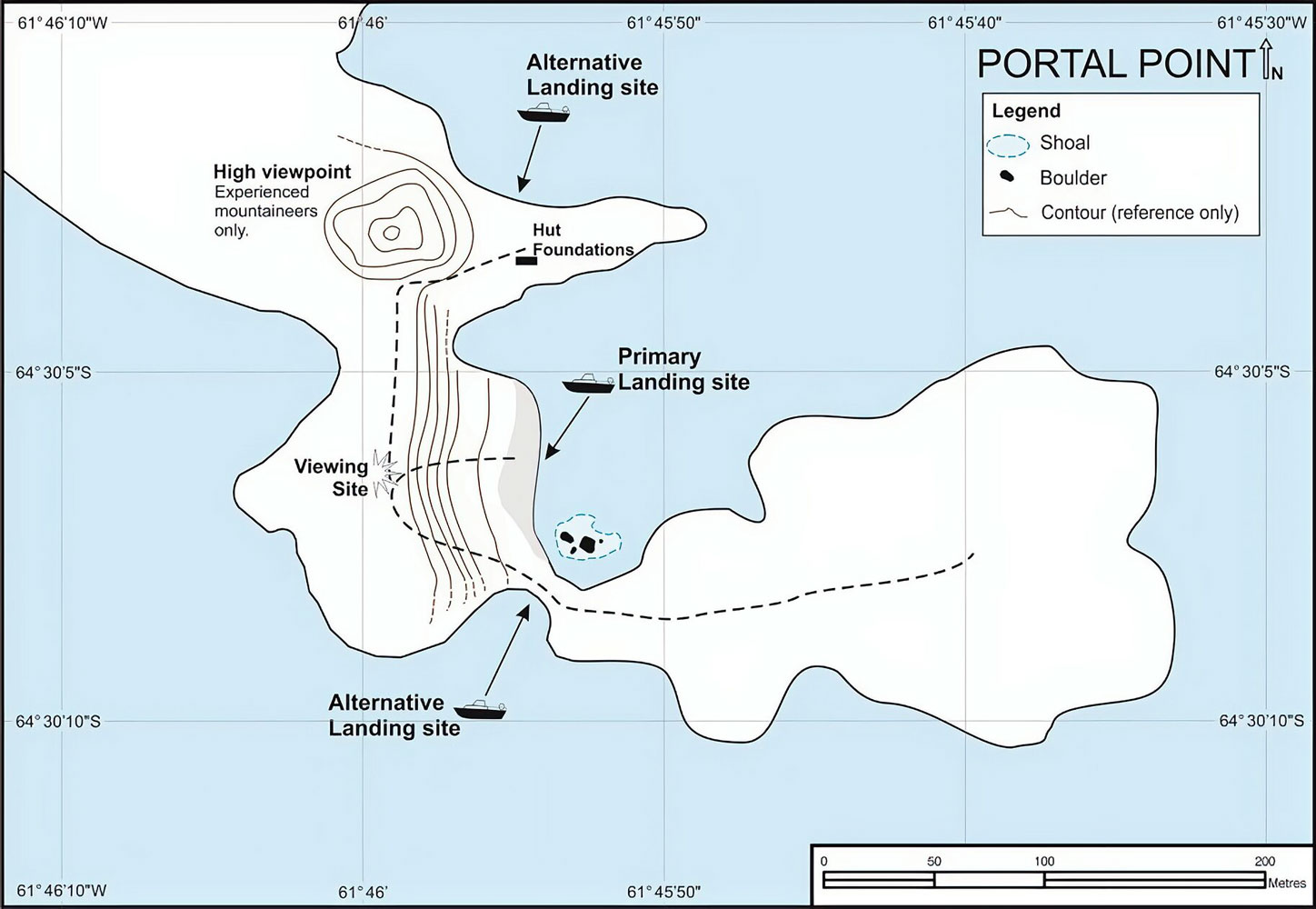
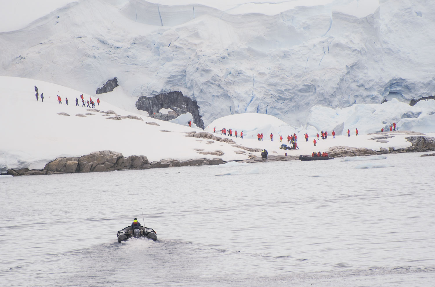
I think the ship's position is about where the ship is shown in the "primary landing site" on the map, and the landings are taking place there. Here's a picture taken from the ship. You can see some people climbing the hill to the left. My guess is that many guests will just stay in the landing area so they can say they set foot on Antarctica.
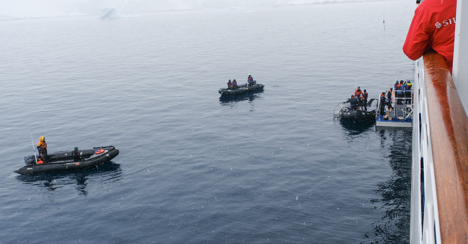
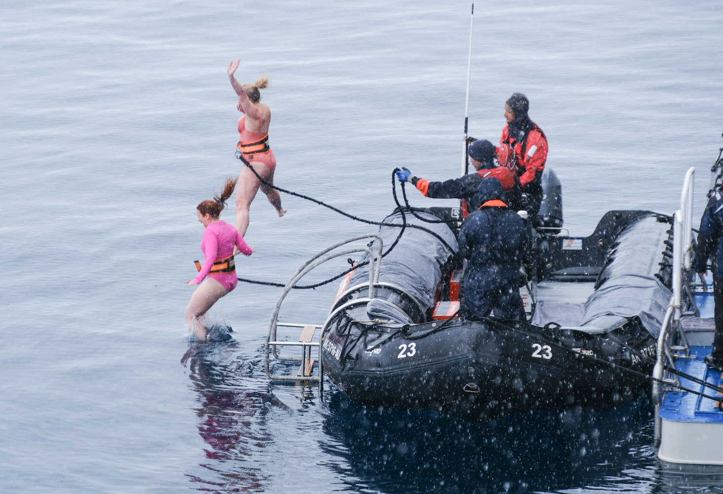
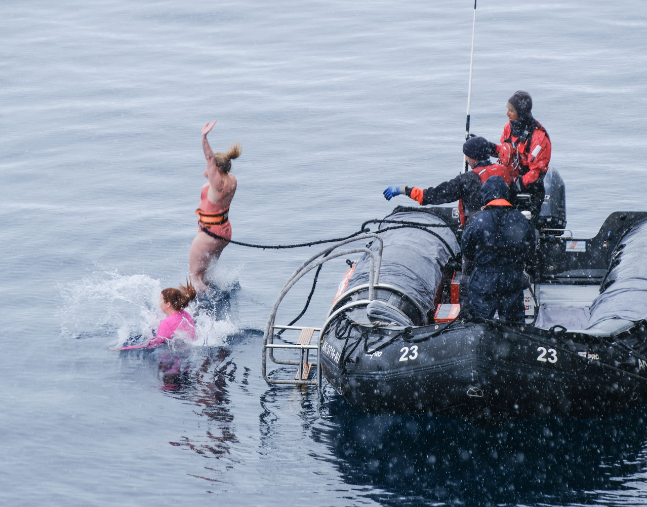
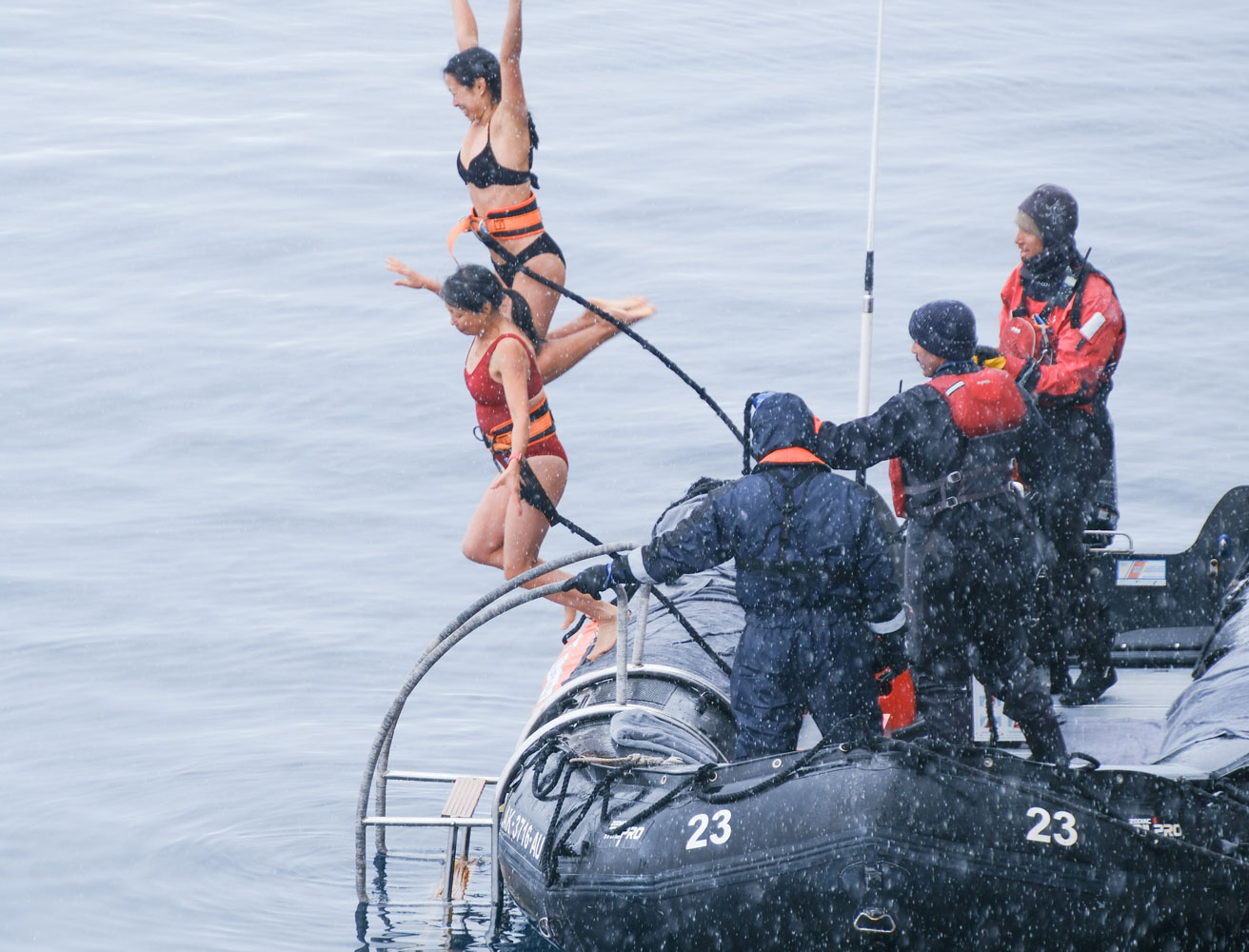
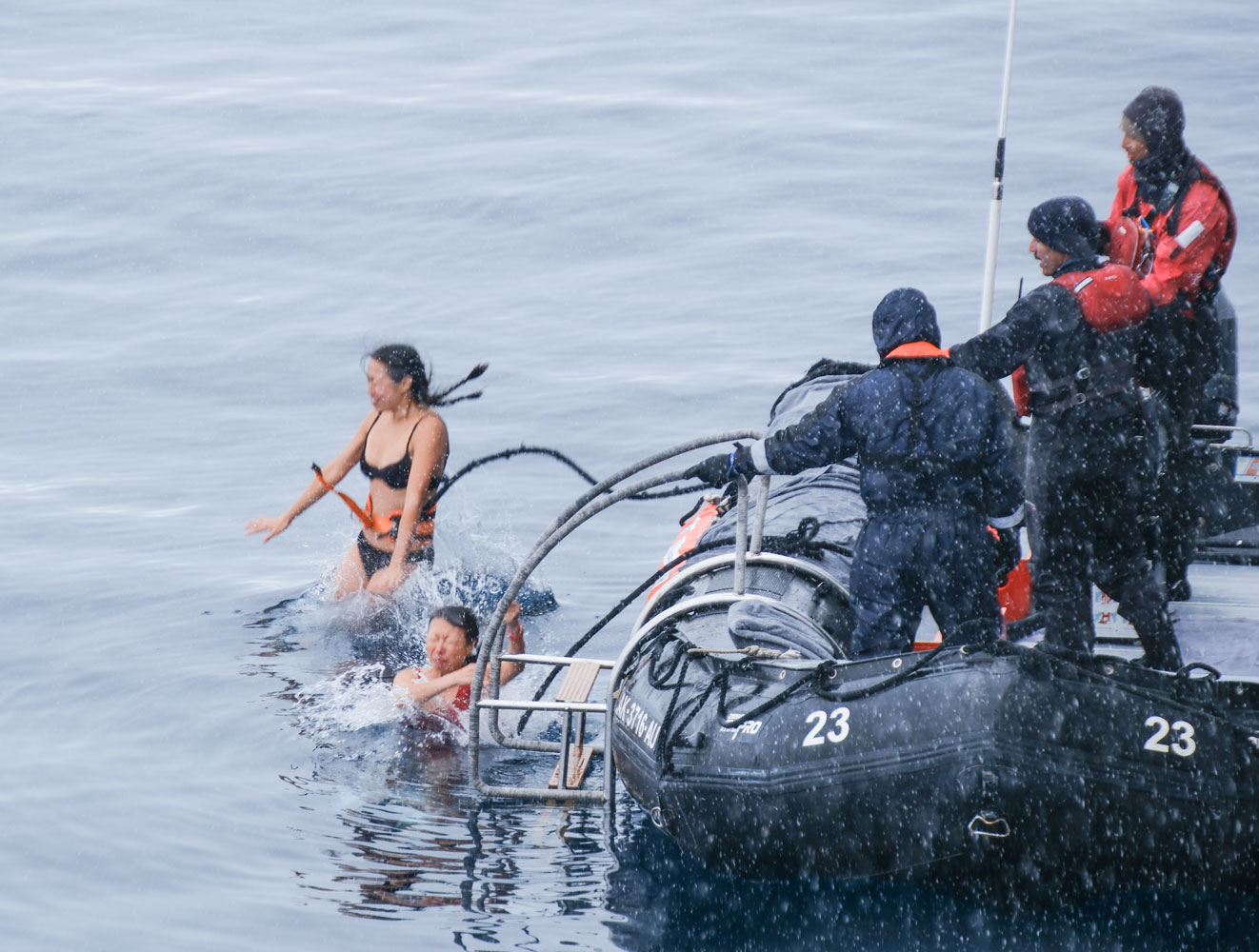
At 11am, the ship started the Polar Plunge. Here's the setup. They open the Zodiac boarding door on the starboard side and tie a Zodiac to the boarding ramp. People cross the ramp and the Zodiac, and stand on the outer side of the Zodiac. They wear a belt and are tethered. They jump, and then they must climb a short ladder back onto the Zodiac. Hopefully they are looking at the photographer as they jump.
The Zodiac at the far left is the safety boat, and the other Zodiac holds two photographers who take pictures of the people as they jump into the water. The jumpers can purchase pictures from the photo studio. I imagine this is a big money maker for the ship.
There was light snow during the event.
Now a few jumpers. Our cabin was on the starboard side, 5th deck, so we had a good view. I didn't know any of the jumpers.
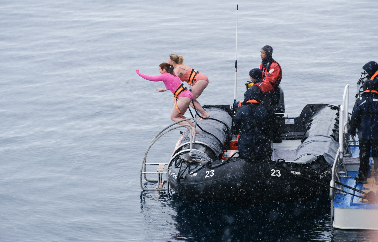
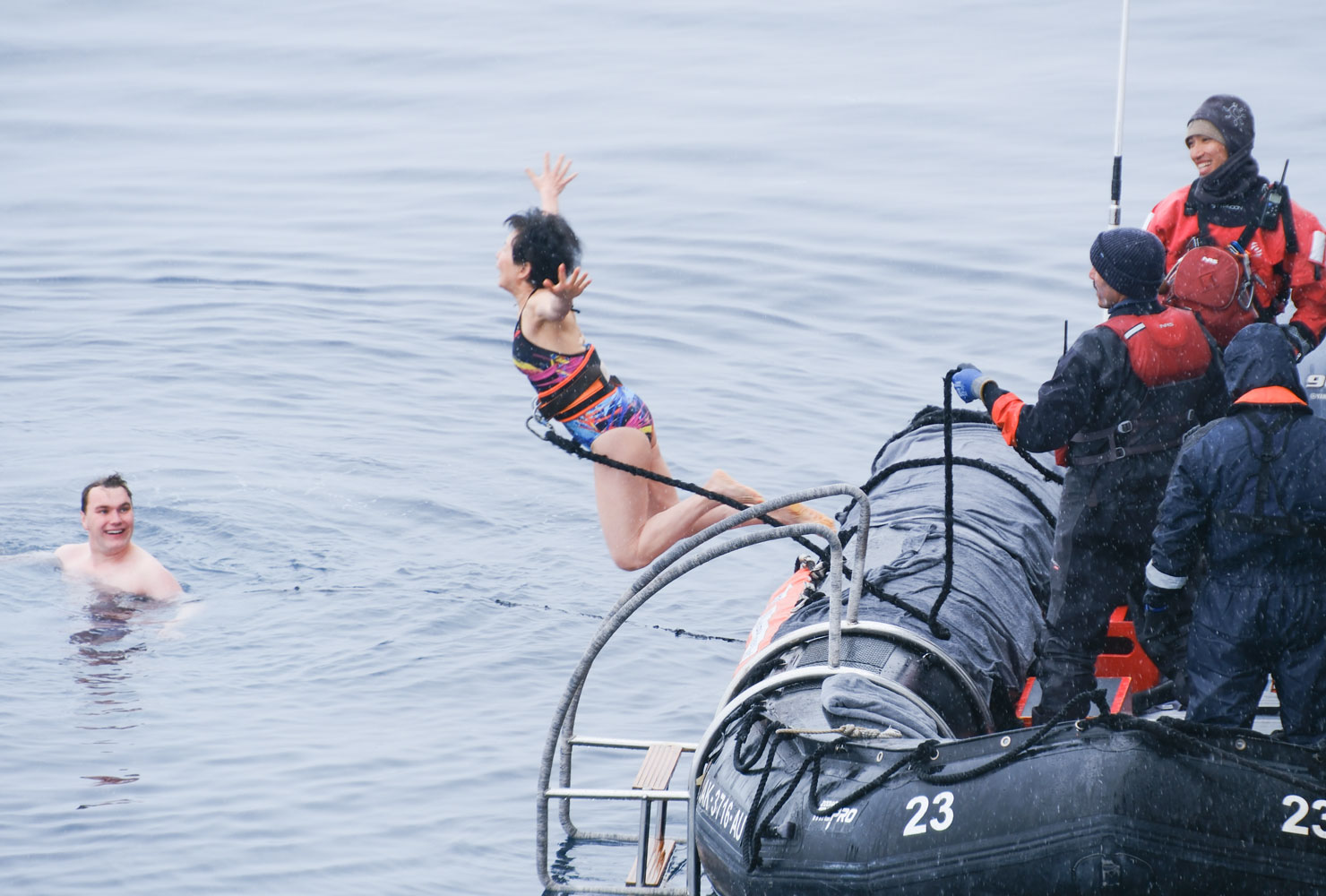
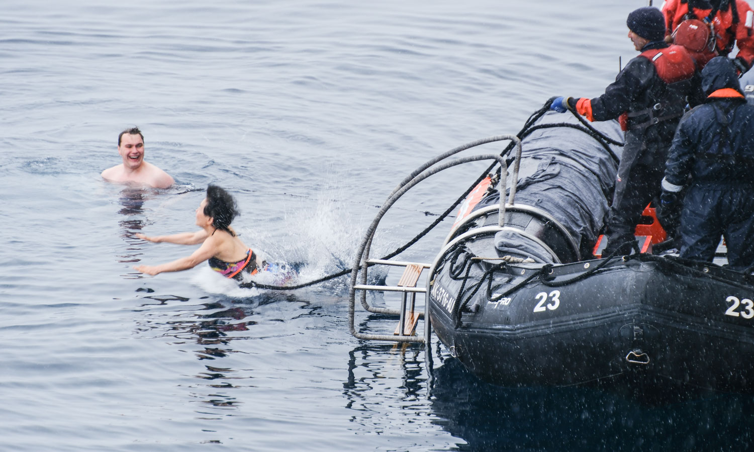
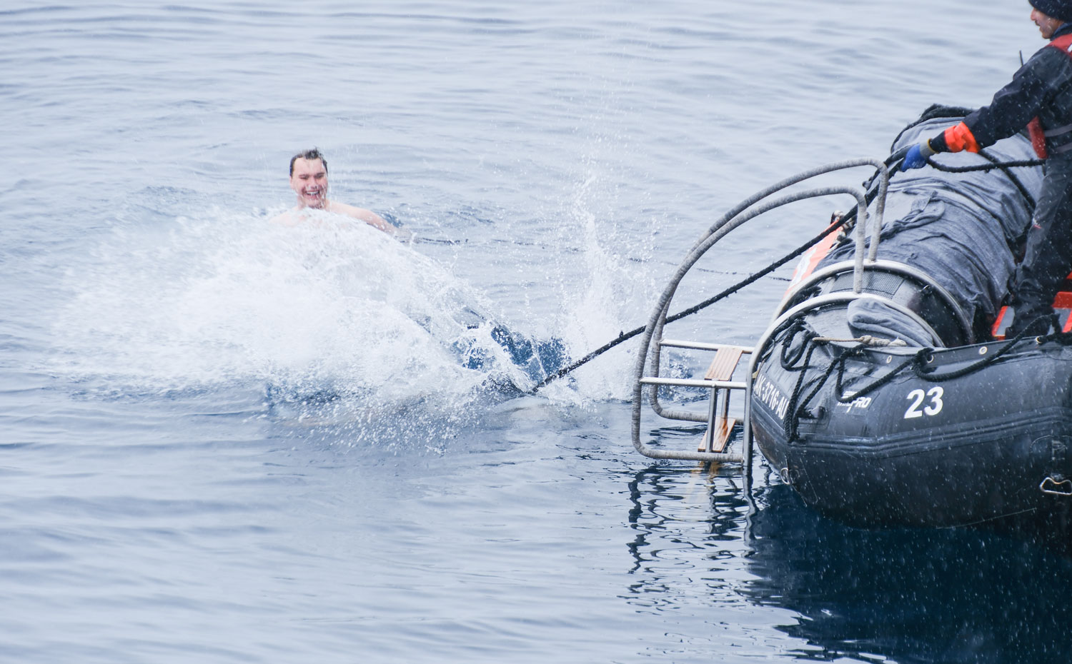
That's enough to give you the idea of what the Polar Plunge is. I was told that over 150 of the guests did the polar plunge. We didn't watch them all. We went to lunch and then back to the room.
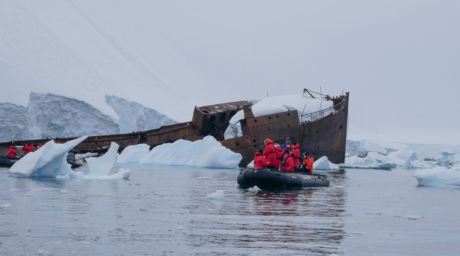
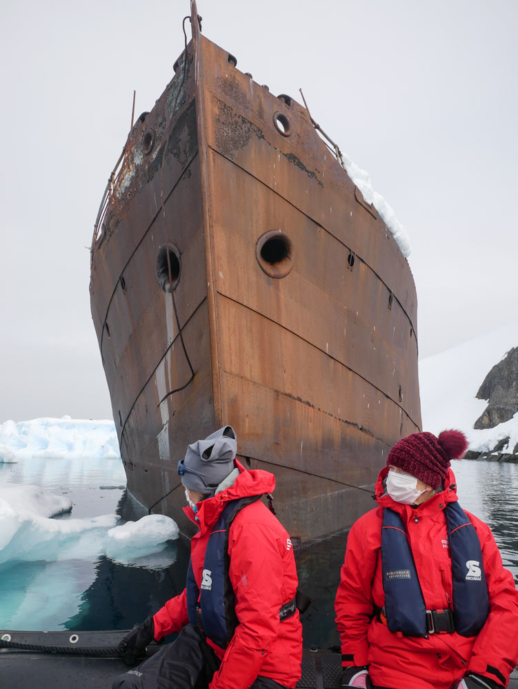
We arrived at Foyn Harbor about 2pm - 64°32'53"S, 61°58'5"W. The major attraction in this area is the wreck of the Governoren. It was a whale oil tanker that burned in 1915. After it caught fire the captain beached it at Foyn Harbor and the crew of 85 was saved by another whaling vessel, but the fully-filled ship and cargo was lost.
Here's a map of the area.
We're on the late excursion group today. At 4:30pm we went down to board the Zodiac.
The wreck of the Governoren was our first stop.
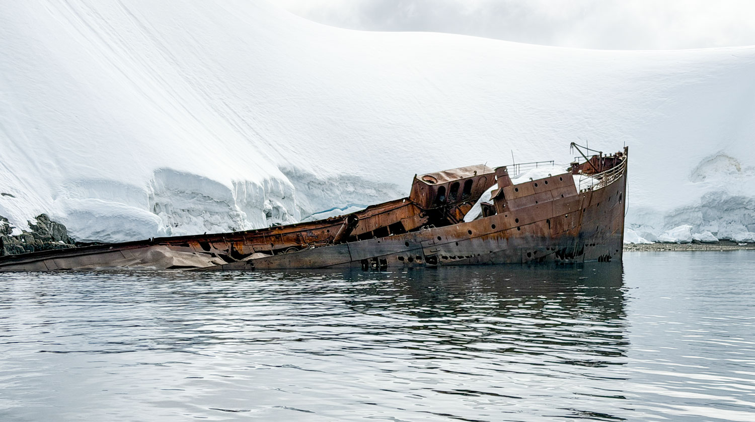
They didn't take us as close as we were last time we came here, so I'll include a couple of pictures from that previous trip. There was a lot more snow and ice last time.
The rest of the Zodiac excursion was spent cruising around looking at the sights. We saw a Weddell seal sleeping on the shore, in a light snowfall.
There was an abandoned water boat on the shore.
We approached a large iceberg. Big icebergs are fairly common here.
On a small rock island we passed some Adélie penguins. The guide said they were somewhat rare in this harbor area.
A closer view of an Adélie.
Another Adélie on an iceberg.
We went looking for whales but didn't find any. We did find some very interesting, beautiful landscape.
A seal asleep on a tiny spit of land.
Then we retruned to the ship.
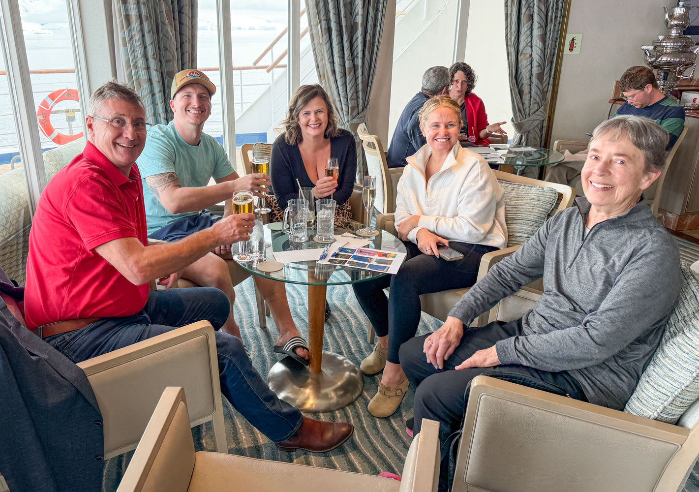
We barely made it back from the Zodiac excursion in time for Trivia. This is our Trivia group. One couple is from Canberra, Australia and the other is from London. Three of them had done the Polar Plunge today.
As a group they have an amazing knowledge of the questions asked in the Trivia game. We've come out first several times and it's all due to their knowledge of popular culture, music, geography, current events, and more.
After dinner we went to the briefing for tomorrow's activities, then to dinner. We had dinner with a very nice (and interesting) couple from Australia.
Then it was to bed. We have an early Zodiac excursion tomorrow.
+++++++++++++++++++++++++++++++++++++++++
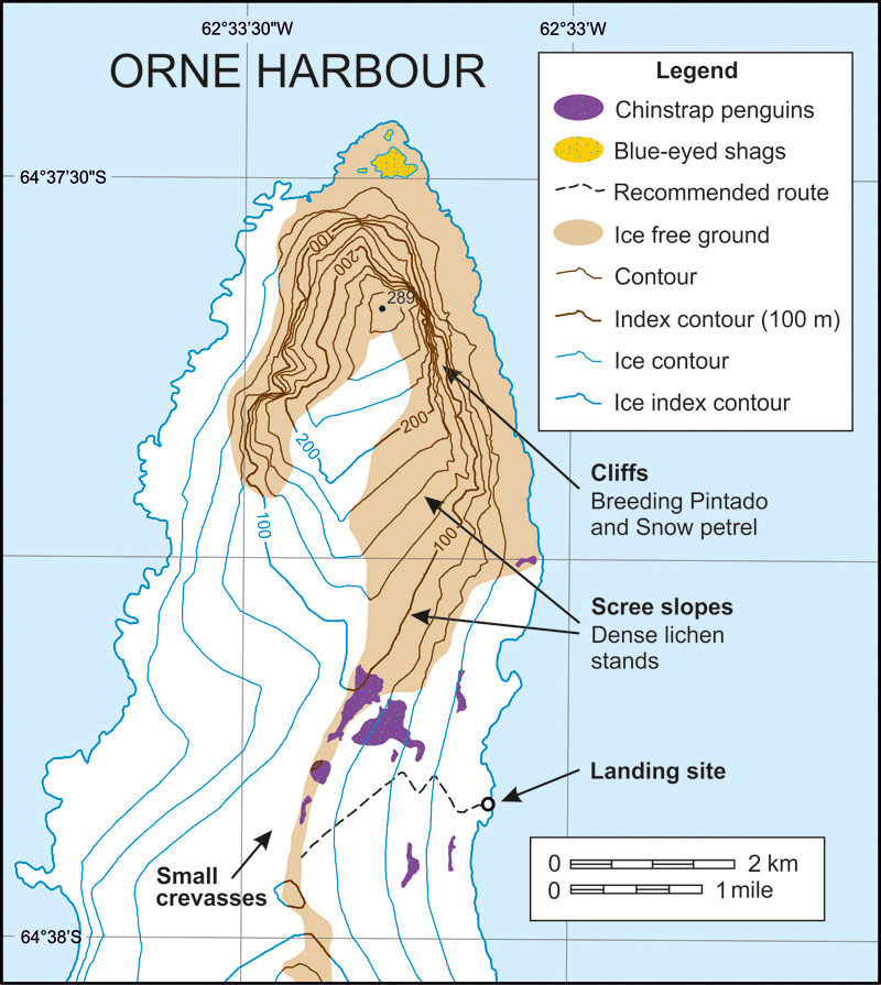
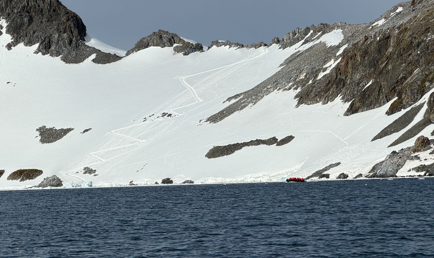
1/5/2026 (Monday, last day of excursions) - We're at 64°36'37"S, 62°33'30"W this morning at 6am, at Orne Harbour. Here's a map of Orne Harbour. You can see from the elevation contour lines that it's a steep climb to the top of the hill, which is indicated on the map as 289 meters high. Claudia, the expedition leader, calls it a "strenuous walk" so we're going to take a Zodiac excursion instead of the walk.
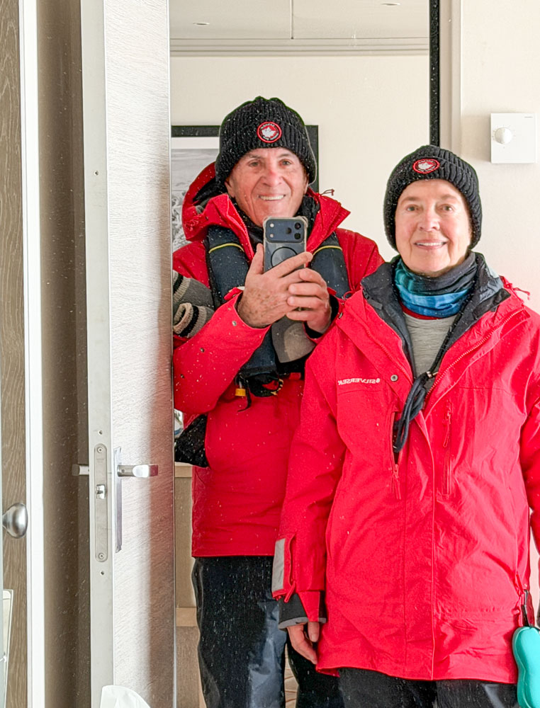
We were up at 6am this morning, and after breakfast prepared for the Zodiac excursion. I used a mirror in the room to take this "self-portrait" of Judy and me. You can see how much clothing we have to put on before leaving the ship.
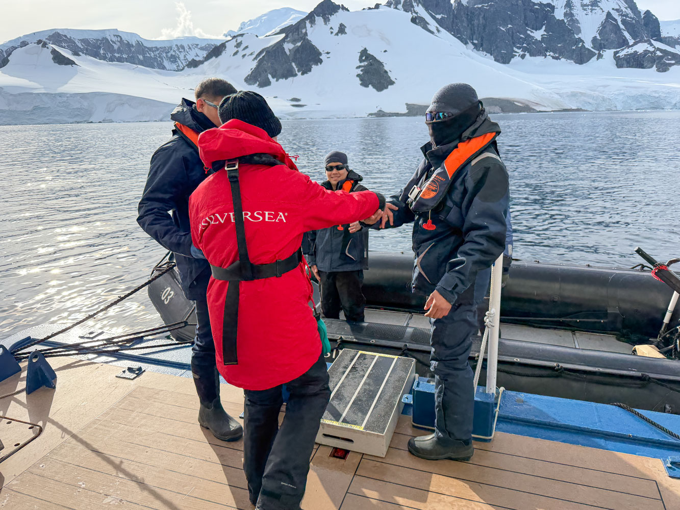
We were the first ones into the Zodiac this morning.
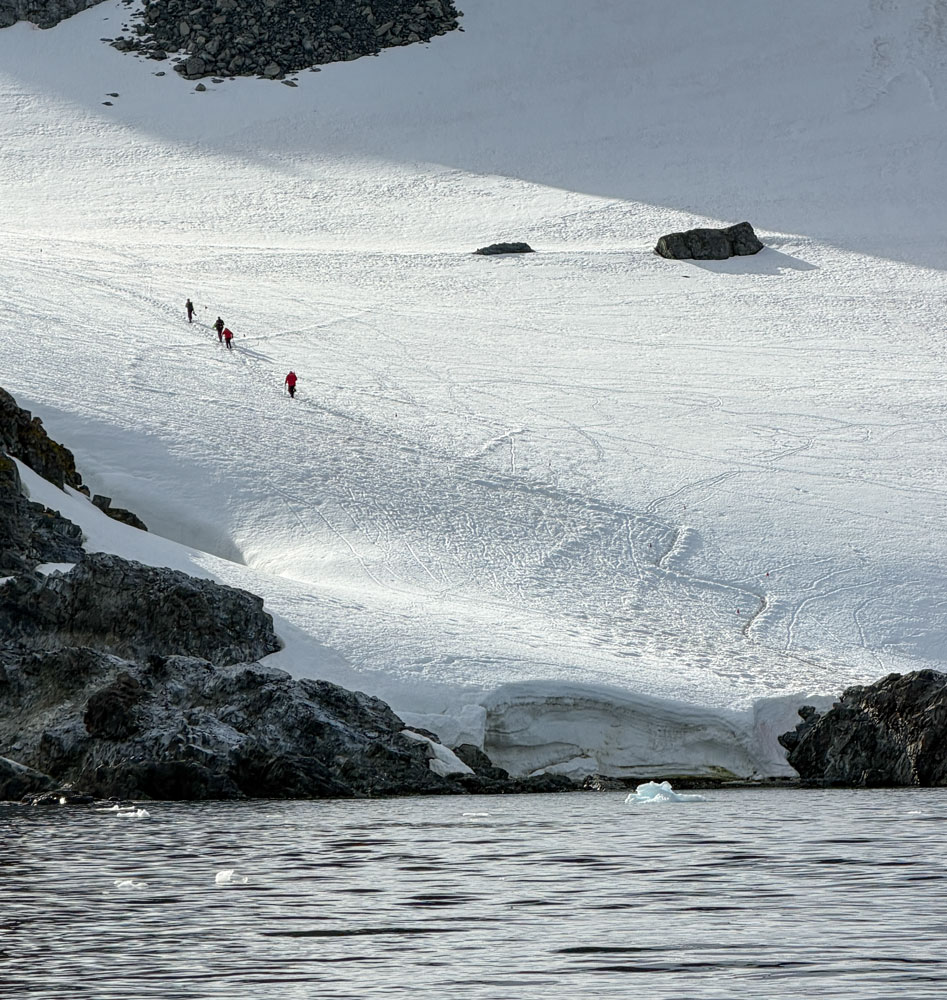
As the Zodiac pulled away from the ship, we could see some of the people who were hiking up the mountain. I talked to a couple of people who did the hike and they reported that the trail was icy and slippery - and was especially difficult coming down. We would not have been able to do that hike. Those random looking tracks in the snow are penguin tracks.
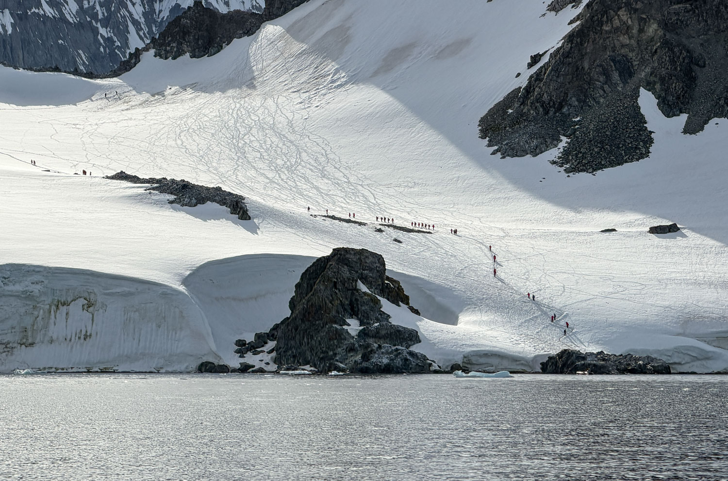
The trail was steep enough that they cut switchbacks. You can approach the ridge line from the other side of the island, but the approach is even more steep than on this side. I'll show a picture of that trail later.
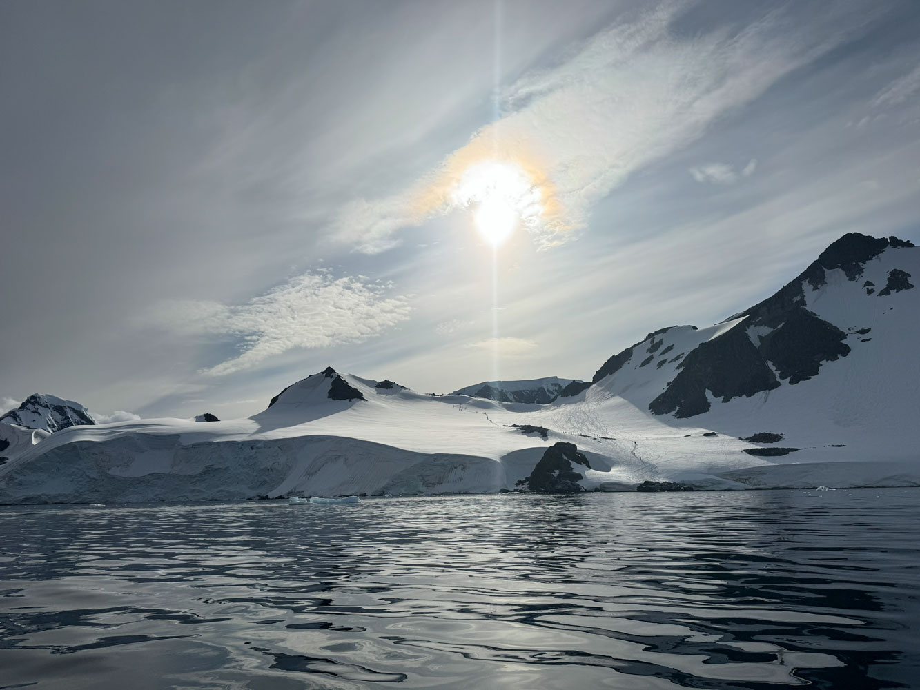
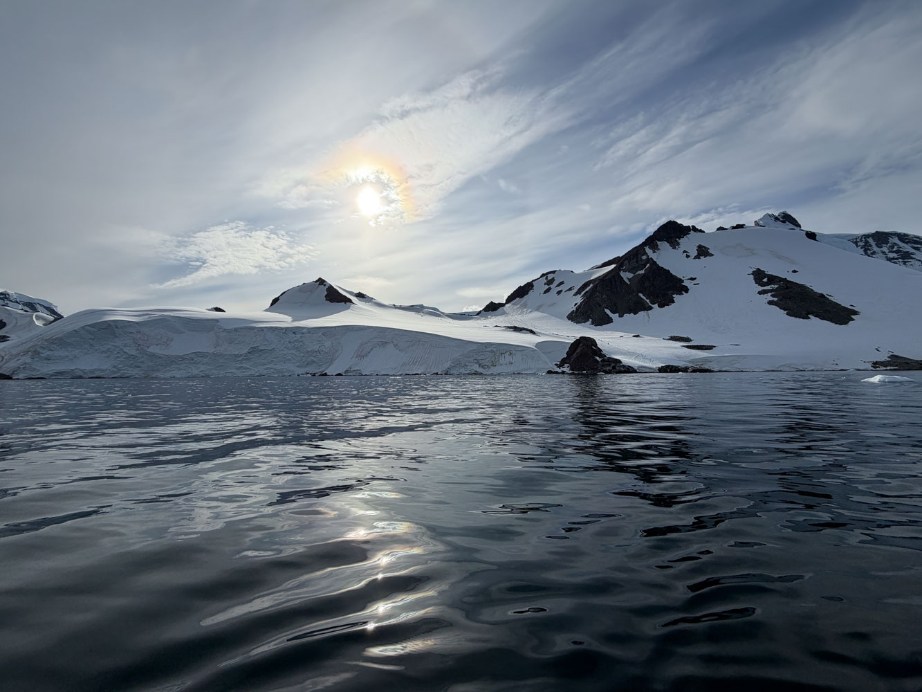
It was a bright, clear morning. The sea was flat and there was very little wind. With these long days, the sun had been up for a few hours already.
This is the hill that the hikers were climbing - seen from the sea side.
Here's a panorama of the lower part of the hill.
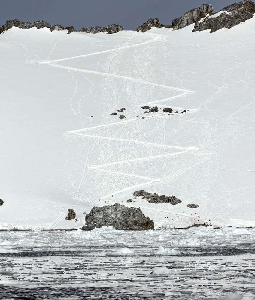
We continued around the point to the other side of the island. Here's the alternate landing site and the trail to the ridge line. Note all the switchbacks - it's a lot steeper than the approach from the other side.
They're hard to see in this picture, but there are penguin trails up this hillside. The penguins go straight up - they don't do switchbacks:-)
We saw some more penguins.
A closer view of the penguins.
We looked at some icebergs and the scenery, and I didn't take many pictures.
We got back to the ship early in the day since we were first out. Trivia was at 11:30 and we came in second.
The ship then moved to the Melchoir Islands, 64°19'9"S, 62°58'53"W, just north of Gamma Island, indicated in red in the following map.
Just as a side note, the islands of the Melchoir Islands are each given a Greek letter as a name. I found alpha, beta, gamma, delta, epsilon, zeta, eta, theta, iota, kappa, lamda, omicron, pi, rho, sigma, tau, psi, and omega.
The weather had changed quite a bit from the morning. It was snowing, overcast and cold. This was our last excursion day of the cruise. Our Zodiac excursion was mainly around Gamma island and the island just north west of it.
There's an Argentine research station on Gamma Island and we headed to it. On the way, we saw these Gentoo penguins.
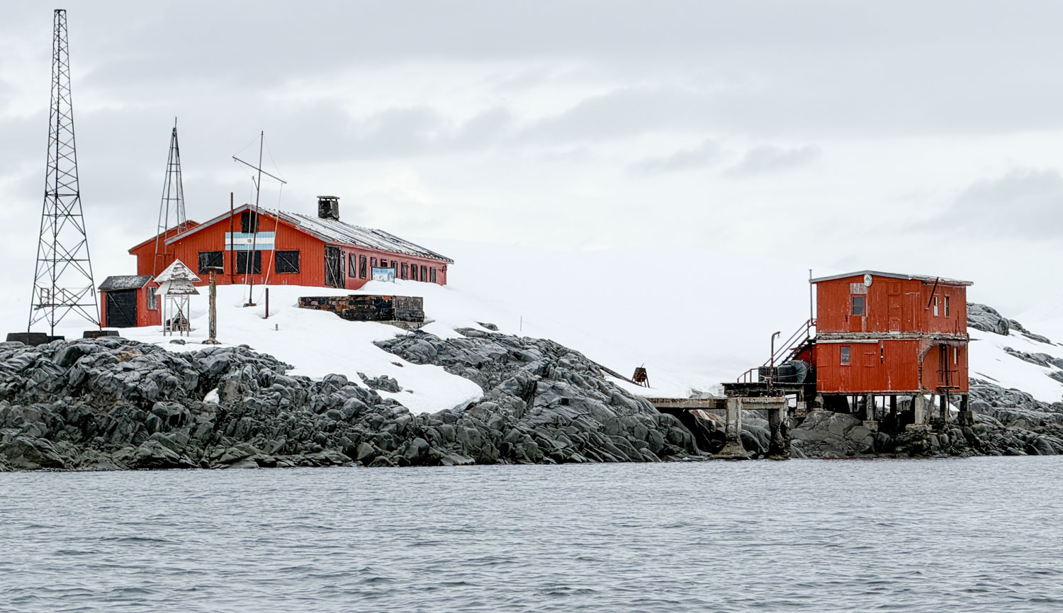
We came to the Argentine research station. It's a summer only station (closed in the winter) but we didn't see any sign of occupancy.
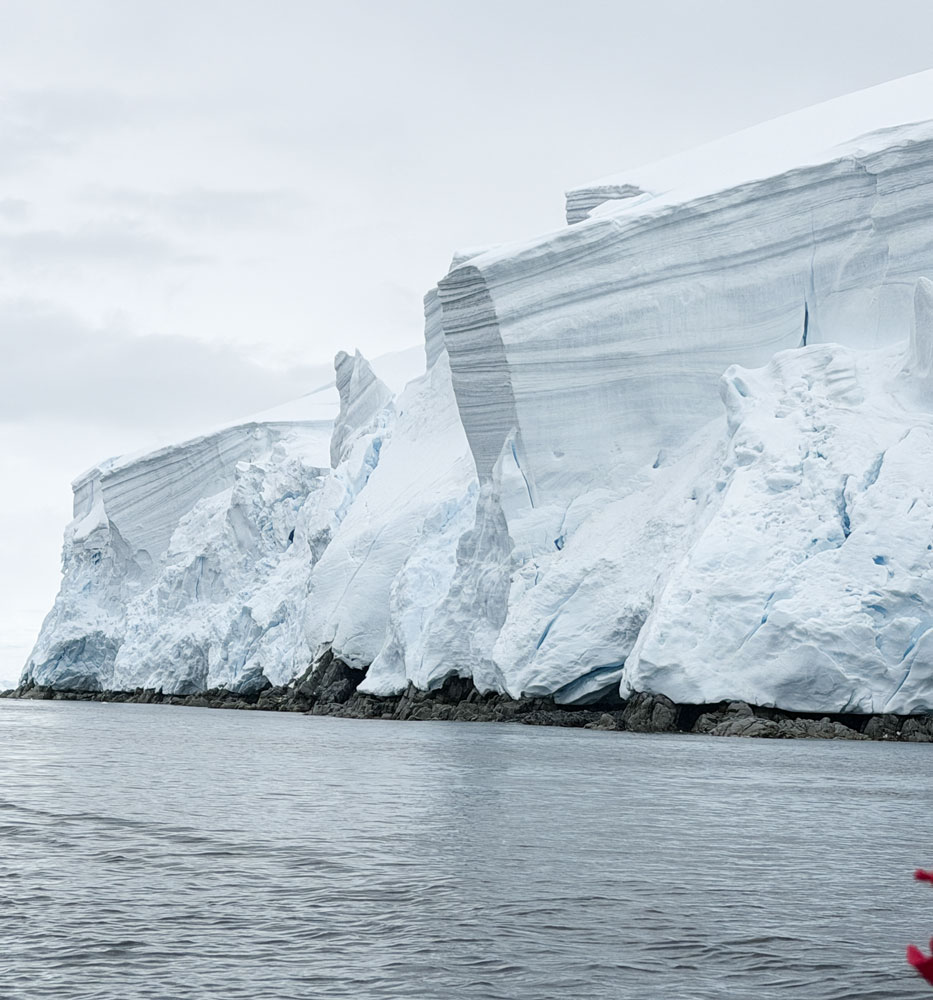
We continued around Gamma Island and saw this snow and ice at the end of a glacier. Note the striations in the snow, probobly from dust blowing in some years and leaving a layer on the snow. The visible layers indicate a weather event, not a year, as with tree rings.
Penguins on an iceberg. They can rest on icebergs between feeding swims.
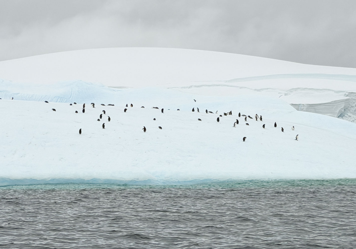
A closer view of the penguins.
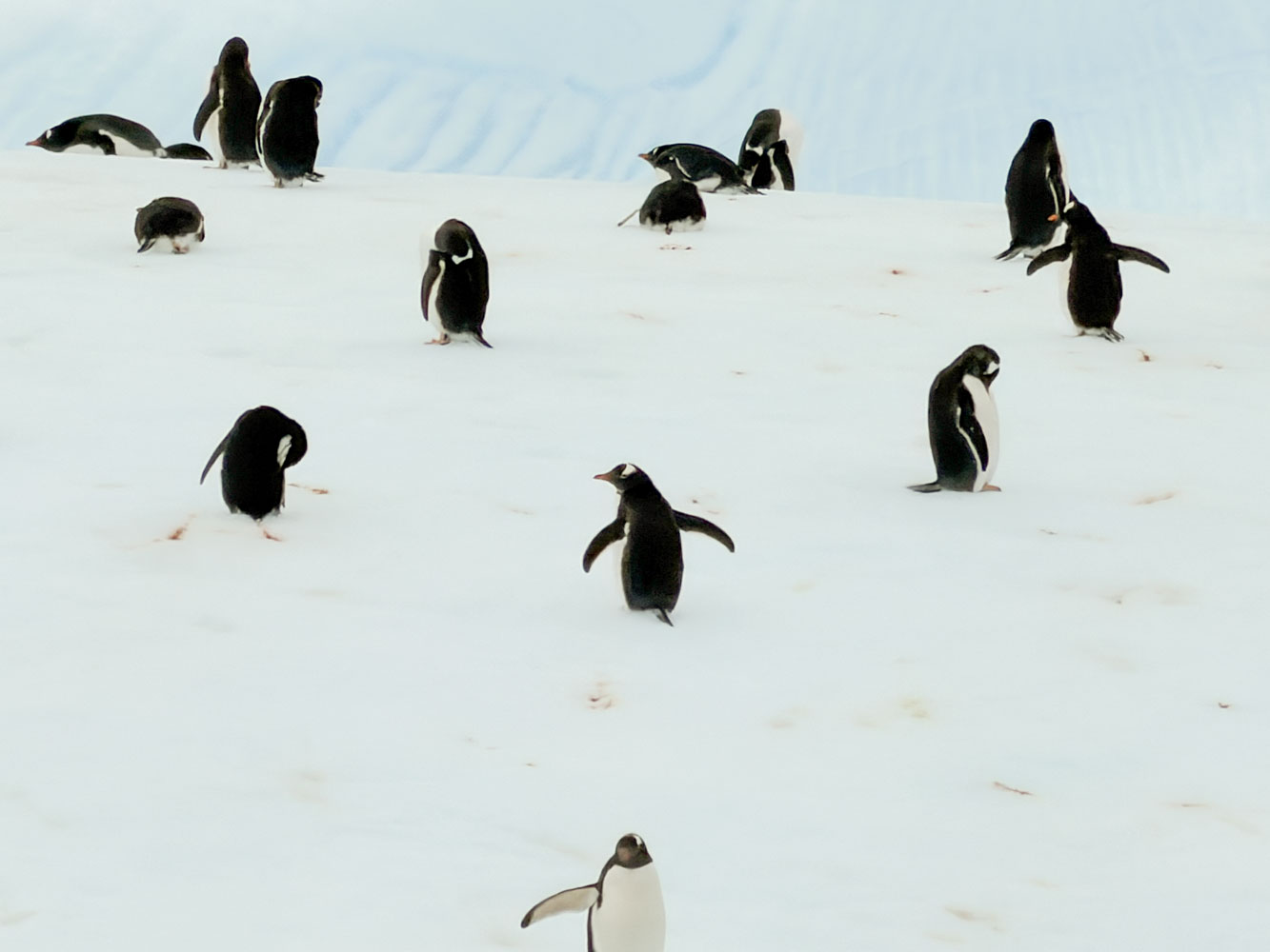
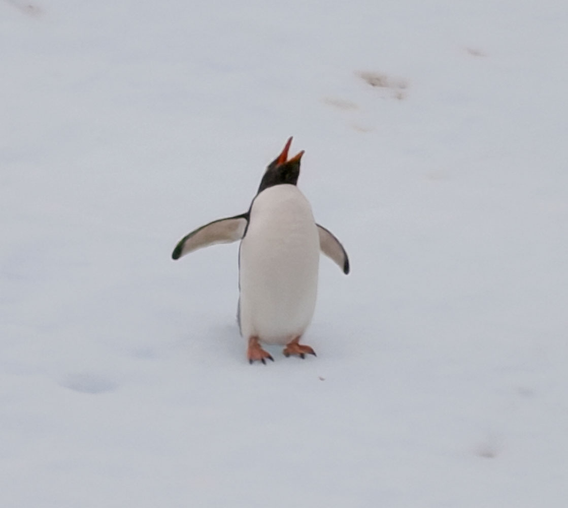
A penguin vocalizing. They throw their head back and open their beaks wide to make the sound.
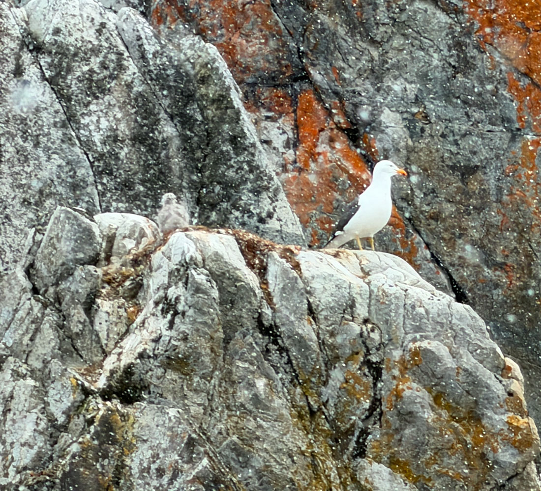
A petrel with a chick.
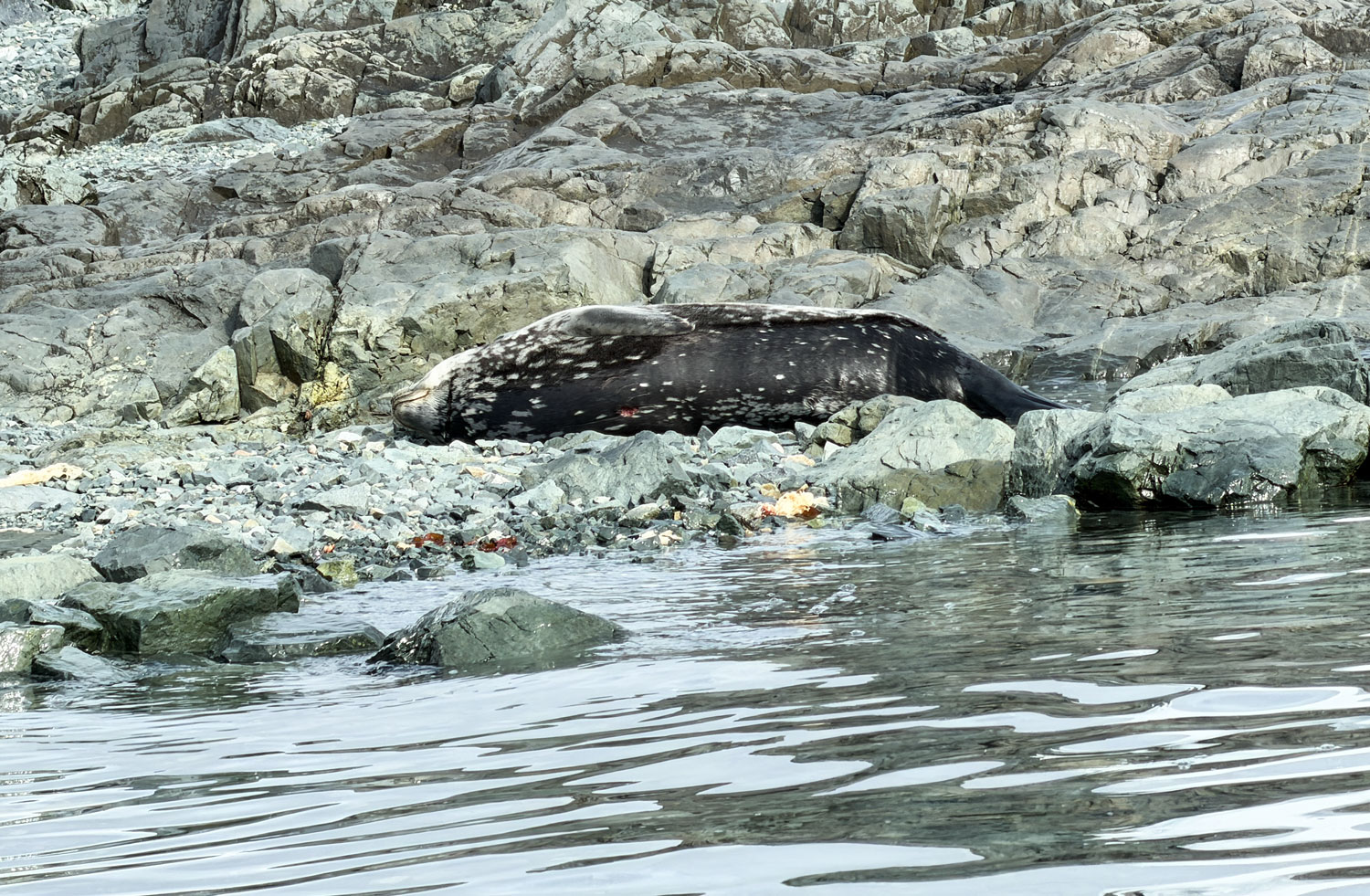
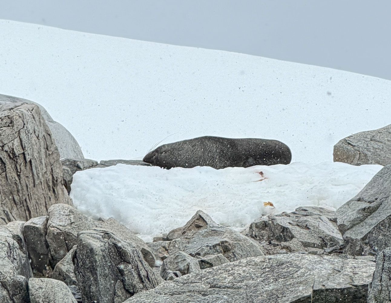
A Weddell seal asleep on the rocks, looking like a dark grey lump. As our Zodiac passed he turned, raised a flipper, and put his head down again. A little goodbye, as we ended our last Zodiac trip.
With that, we headed back to the ship through the channel between Gamma Island and Kappa Island (just northwest of Gamma Island). That evening, the ship weighed anchor and we headed north through the Drake Passage back to Puerto Williams and the end of this cruise.